Alan Godfrey Maps
@alangodfreymaps.bsky.social
140 followers 270 following 370 posts
Travel in time, witness the changes technology wrought upon Britain & beyond using our maps as a window into history, brought alive by our researchers & authors. Great Gifts! From £3.50 pp. https://www.alangodfreymaps.co.uk/acatalog/home.html
Posts Media Videos Starter Packs
alangodfreymaps.bsky.social
I love learning these wee tidbits from the map notes!

-Andrew.
alangodfreymaps.bsky.social
Here's a new map to Bolt on to your collection! 😆🤣
alangodfreymaps.bsky.social
By 1840, the country was being rapidly stitched together by iron rails & a patchwork of suburbs & industry rolled over the UK.
We’ve seen this recently with our new Stratford map, for eg.
Today though, we’re going back to a 19th.C Northern Giant – BOLTON.
www.alangodfreymaps.co.uk/bolton12.htm
1/
alangodfreymaps.bsky.social
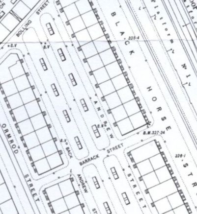
The huge numbers of our literal descendants who must have occupied these poorly built flats mean almost all of us are linked to homes & railways like these.
I (Andrew) am in Middlesbrough, but have family links from Bristol to Edinburgh; we’re often linked to more places & people that we think.
/5
alangodfreymaps.bsky.social
Alan notes that the houses to the south have tiny steps denoted outside, this means that there are basements flats here. Those few tiny lines suggest the cramped poverty of housing, the hopes of a better life of those moving into the expanding towns, the pace and greed of the industrial growth.
4/
alangodfreymaps.bsky.social
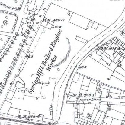
Hence today’s samples. Within a few decades, one early station has been totally rebuilt and expanded…and yet the railway line directly above it, closing off expansion in that direction, wasn’t connected to their new station!
The coal lines on the earlier image stop a few feet from its rival!
3/
1847. 1891.
alangodfreymaps.bsky.social
Bolton Great Moor Street 1847 (plus a bonus 1891 map on the rear with Alan Crosby’s map notes) is emblematic of the chaotic expansion the railways could bring.
Anyone familiar with Manchester, London & similar cities will recognise Alan’s discussion on the competing railway co’s of the 1820’s-50’s.
alangodfreymaps.bsky.social
By 1840, the country was being rapidly stitched together by iron rails & a patchwork of suburbs & industry rolled over the UK.
We’ve seen this recently with our new Stratford map, for eg.
Today though, we’re going back to a 19th.C Northern Giant – BOLTON.
www.alangodfreymaps.co.uk/bolton12.htm
1/
alangodfreymaps.bsky.social
A 120-year-old map might not seem to have much of a connection to someone alive today, but what it portrays may still be there, in a new purpose or as a solid monument to much older times.
The lines on the page can evoke lost family or friends.

www.alangodfreymaps.co.uk/yorks17411.htm
/4

-Andrew.
alangodfreymaps.bsky.social
So why is today’s sample a Cavalry & Infantry Barracks?
Look at the date on our map again– York (SE) & Heslington 1907.
In a few years soldiers here would be marching to France. In a generation they'd do so again. My grandfather did, in the early 1940s when he was old enough to lie about his age.
3/
alangodfreymaps.bsky.social
The lands around Heslington would go on to become parts of the University of York, and many of the large homes and institutions shown here are now student accommodations.
This little map would be a great gift for students old and new, a little memento of what was and what now is.
2/
alangodfreymaps.bsky.social
The fascinating thing about today’s new map is what can’t be seen.
That might not sound like a good start, but read Martin Handley’s great map notes and you’ll understand.
He takes us on a tour of the whole map, from Roman times to today, documenting the incredible changes the area's witnessed.
1/
alangodfreymaps.bsky.social
Here's the weekend!

Woohoo!

We have new maps from #York and #Bolton for you over the next four days!

Can you tell Andrew is excited? 🤣
alangodfreymaps.bsky.social
Also... Palmerstone Avenue? As in the Victoria British PM?!
alangodfreymaps.bsky.social
There's a bunch of jokes in there somewhere!

And is that "Charlemaine Street"?
Reposted by Alan Godfrey Maps
goodclimate.bsky.social
Here's my little part of the world in 1893, in great detail, half built up, house by house.
alangodfreymaps.bsky.social
That's a shame.

I feel that when you step back from a series of maps covering a city 100+ years ago it really gives you an insight into the past you can't quite get from history books.
I love seeing the streets etc unfold.

Sorry, I'm a bit of a map nerd 😂
-Andrew.
alangodfreymaps.bsky.social
Belgium? Must be knee deep in history there?!
alangodfreymaps.bsky.social
I understand.

It's incredible, how easy it is to fall into the detail of a map, isn't it? Even one you don't think you have a connection to.
alangodfreymaps.bsky.social
Alan is the boss, I'm a chap behind a map account 😀 - Andrew.

They're bloody brilliant though, yes!
alangodfreymaps.bsky.social
You've got more tongues than a discount butcher!

-Andrew
alangodfreymaps.bsky.social
Did anyone notice we just posted about #Birmingham and didn't mention blooming #PeakyBlinders once?!
alangodfreymaps.bsky.social
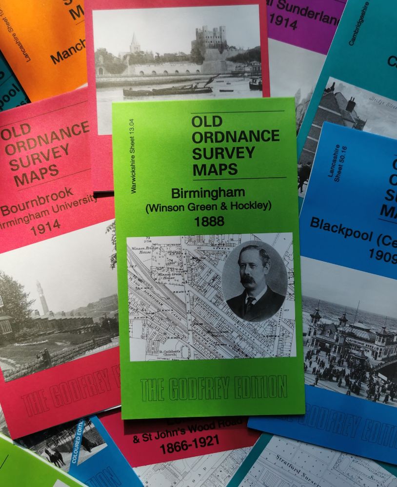
The bones of the area– rails, hospital, prison- are still there, but many of the back-to-backs seen elsewhere on this map are gone. Their descendants live further out of the city now, contributing to the great wealth & diversity of life the city still enjoys.
www.alangodfreymaps.co.uk/warks1304.htm
alangodfreymaps.bsky.social
The semi-skilled workforce, quick to learn through necessity, led to advancements in things like steam engines and motorcars. The population of the city and those around it ballooned, the space between population centres was ample for expanding business and industry, and the growth continued.
3/
alangodfreymaps.bsky.social
A staple trade for centuries was metal work. Nails gave way to chains, as technology developed items like coffin handles, coins & snuffboxes were made- mass produced & moved using canals.
Factories fed many specific demands= huge flexibility. If one trade declined, factories would adapt & change.
2/