


Dr Karen Joyce
@drkjoyce.bsky.social
🌏🛰️ #Earthobservation #remotesensing #geospatial #dronemapping | Co-founder She Maps and GeoNadir | Assoc/Prof JCU | she/her |🔗https://linktr.ee/drkjoyce
Send the robots to do the work! Blows my mind how small the propellors are on the Blueboat, but they are so effective!
February 1, 2025 at 2:26 AM
Send the robots to do the work! Blows my mind how small the propellors are on the Blueboat, but they are so effective!
Progress report. After three days:
53 km surface drone surveys
23 km underwater drone surveys
89 ha aerial drone surveys
All in the spirit of #seacukescience! @sawsharkman.bsky.social
53 km surface drone surveys
23 km underwater drone surveys
89 ha aerial drone surveys
All in the spirit of #seacukescience! @sawsharkman.bsky.social
January 30, 2025 at 10:11 AM
Progress report. After three days:
53 km surface drone surveys
23 km underwater drone surveys
89 ha aerial drone surveys
All in the spirit of #seacukescience! @sawsharkman.bsky.social
53 km surface drone surveys
23 km underwater drone surveys
89 ha aerial drone surveys
All in the spirit of #seacukescience! @sawsharkman.bsky.social
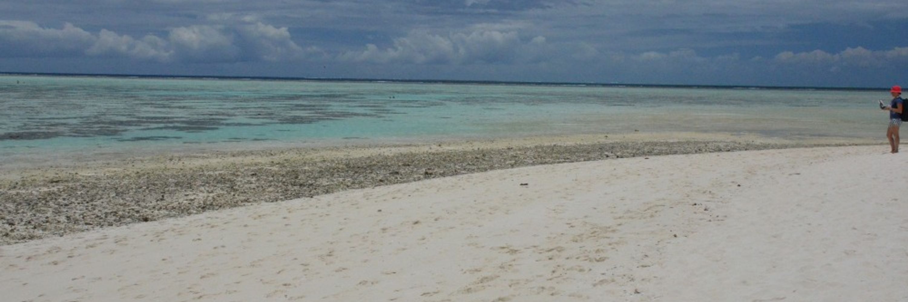
When the tide is too high for aerial drone mapping, here’s our alternative! It’s doing a great job helping us map sea cucumbers #seacukescience @bluerobotics.bsky.social
January 29, 2025 at 8:45 AM
When the tide is too high for aerial drone mapping, here’s our alternative! It’s doing a great job helping us map sea cucumbers #seacukescience @bluerobotics.bsky.social
First field trip job - set up the charging station! Aerial drones, under water ROVs, and surface drones! #seacukescience @sawsharkman.bsky.social
January 27, 2025 at 8:24 AM
First field trip job - set up the charging station! Aerial drones, under water ROVs, and surface drones! #seacukescience @sawsharkman.bsky.social
For 25 years I have been trying to map live coral on the GBR. Now and then I get a step closer. Today was one of those days as we continue to test our latest #GeoAI on @geonadir.bsky.social. No labeling required, working with a single word prompt. Not perfect, many caveats, but ultra cool.
December 9, 2024 at 7:00 AM
For 25 years I have been trying to map live coral on the GBR. Now and then I get a step closer. Today was one of those days as we continue to test our latest #GeoAI on @geonadir.bsky.social. No labeling required, working with a single word prompt. Not perfect, many caveats, but ultra cool.
Nine seconds to detect and map these palm trees with a single prompt. No labeling or other training required. This is the cool #geoAI we're building at @geonadir.bsky.social!
Real-time animation 👇🏼
Real-time animation 👇🏼
November 26, 2024 at 12:59 AM
Nine seconds to detect and map these palm trees with a single prompt. No labeling or other training required. This is the cool #geoAI we're building at @geonadir.bsky.social!
Real-time animation 👇🏼
Real-time animation 👇🏼