


🍉
@endlessstud.io
Exploring the overlap of science, art, data and randomness.
Building geospatial software · data narratives · creative coding
In my previous life I was an archaeologist · GZ
Building geospatial software · data narratives · creative coding
In my previous life I was an archaeologist · GZ
Is not a tool meant to do this, but on globalfishingwatch.org/map you can upload a shapefile with excavation data and explore it, filtering it by dataset property, and even by time (in case data is time bounded on the ranges the tool accepts). It could be used as an online GIS visor.
November 22, 2024 at 12:52 PM
Is not a tool meant to do this, but on globalfishingwatch.org/map you can upload a shapefile with excavation data and explore it, filtering it by dataset property, and even by time (in case data is time bounded on the ranges the tool accepts). It could be used as an online GIS visor.

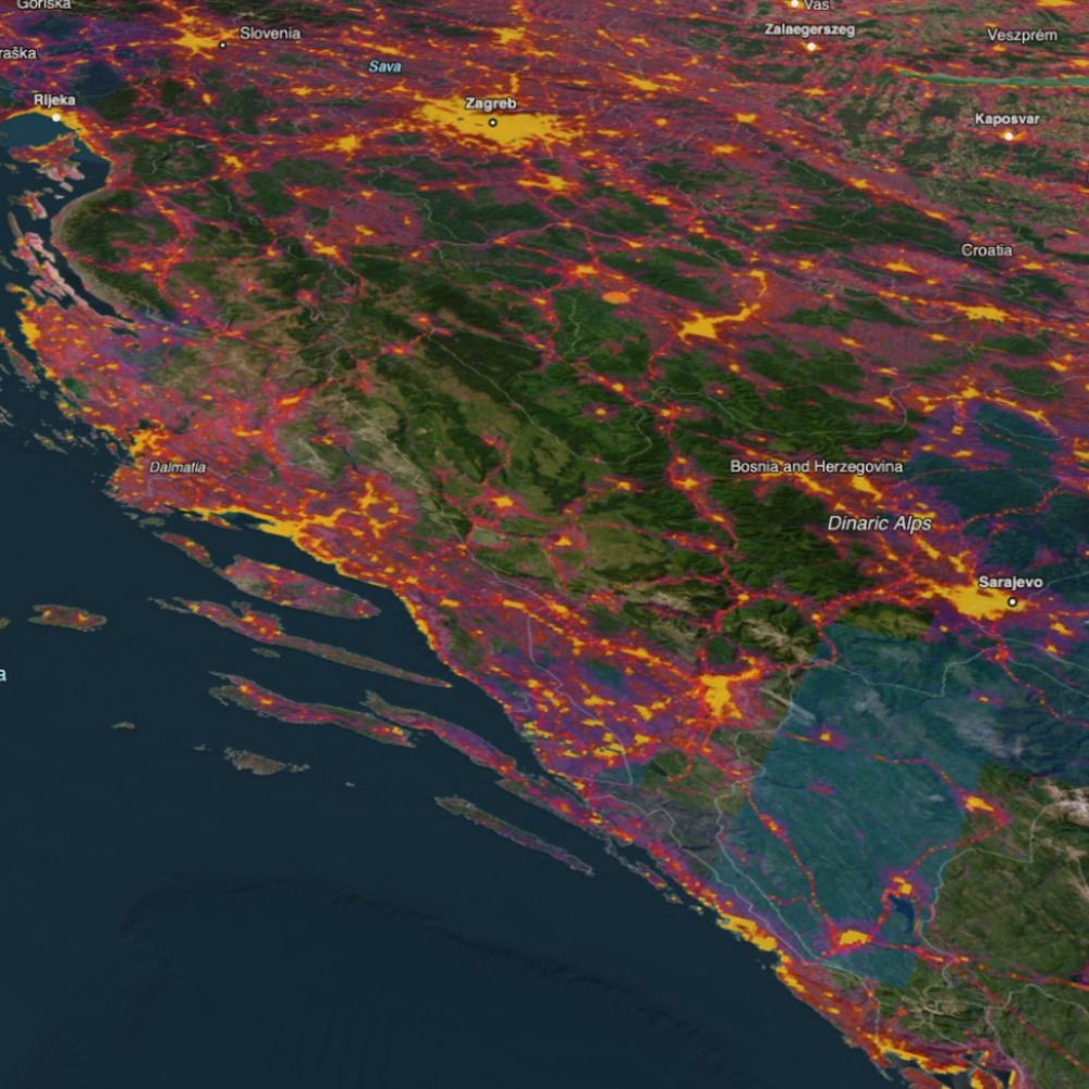
Hey there, follow up post of geospatial projects I've worked on (at Vizzuality). This one is the Half Earth Project Map; a tool to help contextualise global datasets of biodiversity, human encroachment, and protection 📊
Partnering with MoL, ESRI and E.O. Wilson foundation.
map.half-earthproject.org
Partnering with MoL, ESRI and E.O. Wilson foundation.
map.half-earthproject.org


September 24, 2024 at 10:38 AM
Hey there, follow up post of geospatial projects I've worked on (at Vizzuality). This one is the Half Earth Project Map; a tool to help contextualise global datasets of biodiversity, human encroachment, and protection 📊
Partnering with MoL, ESRI and E.O. Wilson foundation.
map.half-earthproject.org
Partnering with MoL, ESRI and E.O. Wilson foundation.
map.half-earthproject.org
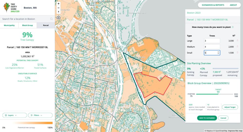
Another geospatial app I've been developing lately is Tree Equity Score analyzer. This tool helps raise awareness and plan urban tree-planting strategies while forecasting the numerous health, climate, and environmental benefits that can be achieved by improving Tree Equity Score
#americanforests 📊
#americanforests 📊


September 23, 2024 at 9:15 AM
Another geospatial app I've been developing lately is Tree Equity Score analyzer. This tool helps raise awareness and plan urban tree-planting strategies while forecasting the numerous health, climate, and environmental benefits that can be achieved by improving Tree Equity Score
#americanforests 📊
#americanforests 📊
Some beautiful reports could be derived from the data in the map (time based comparisons, vessels list with their gear type, fishing effort time series...)
#dataviz 📊
#dataviz 📊


September 19, 2024 at 2:17 PM
Some beautiful reports could be derived from the data in the map (time based comparisons, vessels list with their gear type, fishing effort time series...)
#dataviz 📊
#dataviz 📊
Fishing vessels activity 🎣
September 19, 2024 at 9:15 AM
Fishing vessels activity 🎣
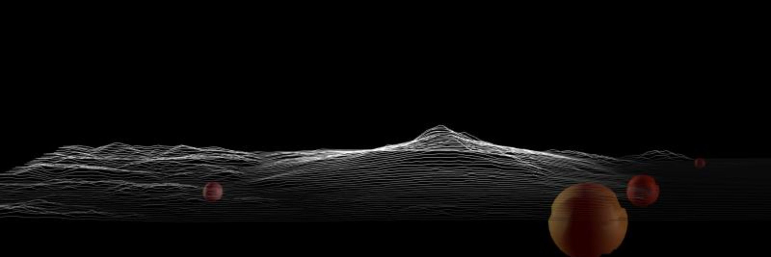
Gonna start posting some of the #geospatial apps development I've been involved with in the last years.
Last things first: a full migration from #maplibre to #deckGL of the Global Fishing Watch map.
Historical data of human activity at sea from 2012 to today.
Heatmap and individual positions 🐟🚢👇
Last things first: a full migration from #maplibre to #deckGL of the Global Fishing Watch map.
Historical data of human activity at sea from 2012 to today.
Heatmap and individual positions 🐟🚢👇
September 19, 2024 at 8:59 AM
Gonna start posting some of the #geospatial apps development I've been involved with in the last years.
Last things first: a full migration from #maplibre to #deckGL of the Global Fishing Watch map.
Historical data of human activity at sea from 2012 to today.
Heatmap and individual positions 🐟🚢👇
Last things first: a full migration from #maplibre to #deckGL of the Global Fishing Watch map.
Historical data of human activity at sea from 2012 to today.
Heatmap and individual positions 🐟🚢👇