


Anton van Tetering
@antonvantetering.bsky.social
Fysisch geograaf en natuurliefhebber.
Zelfstandig cartograaf onder de naam Studio Haverstraat in Utrecht.
GIS | illustrator | photoshop | landkaarten.
Ik hou van: bergen | wandelen | fietsen | lezen | schaken | muziek.
http://www.studio-haverstraat.nl
Zelfstandig cartograaf onder de naam Studio Haverstraat in Utrecht.
GIS | illustrator | photoshop | landkaarten.
Ik hou van: bergen | wandelen | fietsen | lezen | schaken | muziek.
http://www.studio-haverstraat.nl
Reposted by Anton van Tetering
Zonder handhaving blijft milieubeleid vooral papier.
www.volkskrant.nl/columns-opin...
www.volkskrant.nl/columns-opin...

Opinie: Handhaving van het milieurecht wordt steeds urgenter
Zonder onafhankelijke en consequente handhaving blijven klimaat- en milieudoelen een dode letter en blijft het land op het stikstofslot. Het nieuwe kabinet kan zich die vrijblijvendheid niet langer pe...
www.volkskrant.nl
January 30, 2026 at 10:48 AM
Zonder handhaving blijft milieubeleid vooral papier.
www.volkskrant.nl/columns-opin...
www.volkskrant.nl/columns-opin...
Reposted by Anton van Tetering
A genocide against Ukrainians is unfolding right now.
It already has a name: "Kholodomor" (exhaustion through cold)
This crime is being deliberately committed by Russia.
In legal terms, it has a clear definition - genocide
It already has a name: "Kholodomor" (exhaustion through cold)
This crime is being deliberately committed by Russia.
In legal terms, it has a clear definition - genocide
January 26, 2026 at 2:07 PM
A genocide against Ukrainians is unfolding right now.
It already has a name: "Kholodomor" (exhaustion through cold)
This crime is being deliberately committed by Russia.
In legal terms, it has a clear definition - genocide
It already has a name: "Kholodomor" (exhaustion through cold)
This crime is being deliberately committed by Russia.
In legal terms, it has a clear definition - genocide
Reposted by Anton van Tetering

omdat kleine kerncentrales er niet zijn, er misschien over een hele tijd gaan komen maar dan waarschijnlijk hele dure stroom leveren, maar als je er maar over blijft fantaseren je dus nu niets hoeft te beslissen over zon en wind in je gemeente...

January 18, 2026 at 4:26 PM
omdat kleine kerncentrales er niet zijn, er misschien over een hele tijd gaan komen maar dan waarschijnlijk hele dure stroom leveren, maar als je er maar over blijft fantaseren je dus nu niets hoeft te beslissen over zon en wind in je gemeente...
Reposted by Anton van Tetering
The Norwegian Nobel Prize committee has been forced to make a statement, declaring that the prize cannot be transferred.
It's hard even to comprehend how stupid this has become
It's hard even to comprehend how stupid this has become
January 10, 2026 at 9:15 AM
The Norwegian Nobel Prize committee has been forced to make a statement, declaring that the prize cannot be transferred.
It's hard even to comprehend how stupid this has become
It's hard even to comprehend how stupid this has become
Reposted by Anton van Tetering
"Het is een journalistieke taak om dat mechanisme te analyseren, niet om de boodschapper te psychologiseren.De vraag is dus niet waarom Klaver teleurgesteld is. De vraag is waarom zovelen zo veel moeite doen om te voorkomen dat zijn analyse gehoord wordt." www.bnnvara.nl/joop/artikel...

Waarom kritiek van Jesse Klaver wel zuur wordt genoemd, maar hetzelfde gedrag van rechts nooit - Joop - BNNVARA
Jaap Stalenburg over rechtse framing.
www.bnnvara.nl
December 13, 2025 at 11:06 AM
"Het is een journalistieke taak om dat mechanisme te analyseren, niet om de boodschapper te psychologiseren.De vraag is dus niet waarom Klaver teleurgesteld is. De vraag is waarom zovelen zo veel moeite doen om te voorkomen dat zijn analyse gehoord wordt." www.bnnvara.nl/joop/artikel...
Reposted by Anton van Tetering

Als er twee partijen aan de onderhandelingstafel zitten en de vvd komt er bij zitten en niemand doet iets. Dan zit er drie keer de vvd aan tafel. #ZegHetDoor
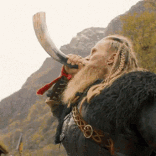
a man with dreadlocks and a beard is blowing a horn .
ALT: a man with dreadlocks and a beard is blowing a horn .
media.tenor.com
December 11, 2025 at 7:28 AM
Als er twee partijen aan de onderhandelingstafel zitten en de vvd komt er bij zitten en niemand doet iets. Dan zit er drie keer de vvd aan tafel. #ZegHetDoor
Reposted by Anton van Tetering
Meneer Jetten, iedereen in Nederland wil een stabiel kabinet, maar kan dat met de VVD? 🤷♀️
December 10, 2025 at 2:27 PM
Meneer Jetten, iedereen in Nederland wil een stabiel kabinet, maar kan dat met de VVD? 🤷♀️

Reposted by Anton van Tetering

Dit is echt een uitstekende phishingaanval, en weer een les om extra alert te zijn bij alle berichten waar "directe actie" is benodigd.
Voor de oplettende kijkers: het e-mailadres is rnicrosoft[.]com, niet microsoft[.]com.
Voor de oplettende kijkers: het e-mailadres is rnicrosoft[.]com, niet microsoft[.]com.

December 1, 2025 at 12:33 PM
Dit is echt een uitstekende phishingaanval, en weer een les om extra alert te zijn bij alle berichten waar "directe actie" is benodigd.
Voor de oplettende kijkers: het e-mailadres is rnicrosoft[.]com, niet microsoft[.]com.
Voor de oplettende kijkers: het e-mailadres is rnicrosoft[.]com, niet microsoft[.]com.
Map of the complicated border situation between the Netherlands and Belgium around the village Baarle-Nassau (NL)/Baarle-Hertog (B). Belgium has 22 exclaves in the Netherlands and the Netherlands have 8 exclaves in Belgium.
#30daymapchallenge day 27: borders #cartography #maps #belgium #netherlands
#30daymapchallenge day 27: borders #cartography #maps #belgium #netherlands

November 27, 2025 at 11:01 AM
Map of the complicated border situation between the Netherlands and Belgium around the village Baarle-Nassau (NL)/Baarle-Hertog (B). Belgium has 22 exclaves in the Netherlands and the Netherlands have 8 exclaves in Belgium.
#30daymapchallenge day 27: borders #cartography #maps #belgium #netherlands
#30daymapchallenge day 27: borders #cartography #maps #belgium #netherlands
Mean elevation of 10 km hexagons in the Alps (and surroundings). It is interesting that the highest hexagons are not near Mont Blanc (the highest summit) but in the Pennine Alps and the Bernese Oberland.
#30daymapchallenge day 25: hexagons #cartography #maps #alps
#30daymapchallenge day 25: hexagons #cartography #maps #alps

November 25, 2025 at 10:51 AM
Mean elevation of 10 km hexagons in the Alps (and surroundings). It is interesting that the highest hexagons are not near Mont Blanc (the highest summit) but in the Pennine Alps and the Bernese Oberland.
#30daymapchallenge day 25: hexagons #cartography #maps #alps
#30daymapchallenge day 25: hexagons #cartography #maps #alps
Map of all place names in the Netherlands containing the word 'dam' or 'dijk'.
Mapdata: top250NL, kadaster.
#30daymapchallenge day 24 places and their names #cartography #maps #netherlands
Mapdata: top250NL, kadaster.
#30daymapchallenge day 24 places and their names #cartography #maps #netherlands

November 24, 2025 at 12:34 PM
Map of all place names in the Netherlands containing the word 'dam' or 'dijk'.
Mapdata: top250NL, kadaster.
#30daymapchallenge day 24 places and their names #cartography #maps #netherlands
Mapdata: top250NL, kadaster.
#30daymapchallenge day 24 places and their names #cartography #maps #netherlands
Oblique map showing Central Europe seen from the south. I made this map with Natural Earth vector- and rasterdata (DEM NOAA: ETOPO1_Ice_g) in Natural Scene Designer.
#30daymapchallenge day 22: natural earth data #cartography #maps #italy #alps
#30daymapchallenge day 22: natural earth data #cartography #maps #italy #alps

November 22, 2025 at 12:53 PM
Oblique map showing Central Europe seen from the south. I made this map with Natural Earth vector- and rasterdata (DEM NOAA: ETOPO1_Ice_g) in Natural Scene Designer.
#30daymapchallenge day 22: natural earth data #cartography #maps #italy #alps
#30daymapchallenge day 22: natural earth data #cartography #maps #italy #alps
Map showing the strange phenomenon that in the Netherlands the water is often higher than the land.
#30daymapchallenge day 20: water #cartography #maps #netherlands #utrecht #water
#30daymapchallenge day 20: water #cartography #maps #netherlands #utrecht #water

November 20, 2025 at 8:54 AM
Map showing the strange phenomenon that in the Netherlands the water is often higher than the land.
#30daymapchallenge day 20: water #cartography #maps #netherlands #utrecht #water
#30daymapchallenge day 20: water #cartography #maps #netherlands #utrecht #water
World map in the Fuller projection, with which you can make your own, rather angular globe. More information about this map projection: en.wikipedia.org/wiki/Dymaxio...
Map data: natural earth data.
#30daymapchallenge day 19: projections #maps #cartography
Map data: natural earth data.
#30daymapchallenge day 19: projections #maps #cartography

November 19, 2025 at 10:39 AM
World map in the Fuller projection, with which you can make your own, rather angular globe. More information about this map projection: en.wikipedia.org/wiki/Dymaxio...
Map data: natural earth data.
#30daymapchallenge day 19: projections #maps #cartography
Map data: natural earth data.
#30daymapchallenge day 19: projections #maps #cartography
The far side of the Moon shown in exaggerated relief.
Mapdata: Nasa. Made in Natural Scene Designer.
#30daymapchallenge day 18 out of this world #cartography #maps #moon
Mapdata: Nasa. Made in Natural Scene Designer.
#30daymapchallenge day 18 out of this world #cartography #maps #moon

November 18, 2025 at 3:52 PM
The far side of the Moon shown in exaggerated relief.
Mapdata: Nasa. Made in Natural Scene Designer.
#30daymapchallenge day 18 out of this world #cartography #maps #moon
Mapdata: Nasa. Made in Natural Scene Designer.
#30daymapchallenge day 18 out of this world #cartography #maps #moon
Map of a walk to Knivskjelodden, the northernmost point of the North Cape peninsula on Magerøya, Norway. Knivskjelodden is approximately 1.5 kilometres further north than the North Cape.
I made this map for a Dutch guidebook.
#30daymapchallenge day 14: data: OpenStreetMap #norway #maps #cartography
I made this map for a Dutch guidebook.
#30daymapchallenge day 14: data: OpenStreetMap #norway #maps #cartography

November 14, 2025 at 8:54 AM
Map of a walk to Knivskjelodden, the northernmost point of the North Cape peninsula on Magerøya, Norway. Knivskjelodden is approximately 1.5 kilometres further north than the North Cape.
I made this map for a Dutch guidebook.
#30daymapchallenge day 14: data: OpenStreetMap #norway #maps #cartography
I made this map for a Dutch guidebook.
#30daymapchallenge day 14: data: OpenStreetMap #norway #maps #cartography
Reposted by Anton van Tetering

Boeiend: Koolmees’ verslag bevestigt dat de VVD GL-PvdA uitsluit - maar FVD niet. Een partij die het NAVO-lidmaatschap wil heroverwegen, de relatie met Rusland ‘normaliseren’ en de steun aan Oekraïne stoppen.
Heeft de chef van de NAVO al gereageerd?
www.kabinetsformatie2025.nl/documenten/2...
Heeft de chef van de NAVO al gereageerd?
www.kabinetsformatie2025.nl/documenten/2...

Eindverslag verkenner Koolmees | Kabinetsformatie
Verkenner Koolmees heeft zijn werkzaamheden afgerond en het eindverslag aangeboden aan de voorzitter van de Tweede Kamer.
www.kabinetsformatie2025.nl
November 12, 2025 at 11:23 AM
Boeiend: Koolmees’ verslag bevestigt dat de VVD GL-PvdA uitsluit - maar FVD niet. Een partij die het NAVO-lidmaatschap wil heroverwegen, de relatie met Rusland ‘normaliseren’ en de steun aan Oekraïne stoppen.
Heeft de chef van de NAVO al gereageerd?
www.kabinetsformatie2025.nl/documenten/2...
Heeft de chef van de NAVO al gereageerd?
www.kabinetsformatie2025.nl/documenten/2...
Oudste selfie op je telefoon
1996
1996

November 8, 2025 at 7:50 PM
Oudste selfie op je telefoon
1996
1996
Nooit gedacht: de ferry van Eemshaven naar het Duitse Waddeneiland Borkum vaart naar het noordwesten.
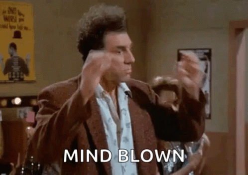
a man in a suit is making a funny face and says `` mind blown '' while standing in a bar .
ALT: a man in a suit is making a funny face and says `` mind blown '' while standing in a bar .
media.tenor.com
November 7, 2025 at 10:23 AM
Nooit gedacht: de ferry van Eemshaven naar het Duitse Waddeneiland Borkum vaart naar het noordwesten.
I took today's #30daymapchallenge literally and made a map of the Earth as a globe.
Software used: Natural Scene Designer, map data: naturalearthdata.
#30daymapchallenge day 5: earth #maps #cartography #earth #globe #shadedrelief
Software used: Natural Scene Designer, map data: naturalearthdata.
#30daymapchallenge day 5: earth #maps #cartography #earth #globe #shadedrelief

November 5, 2025 at 2:56 PM
I took today's #30daymapchallenge literally and made a map of the Earth as a globe.
Software used: Natural Scene Designer, map data: naturalearthdata.
#30daymapchallenge day 5: earth #maps #cartography #earth #globe #shadedrelief
Software used: Natural Scene Designer, map data: naturalearthdata.
#30daymapchallenge day 5: earth #maps #cartography #earth #globe #shadedrelief
Reposted by Anton van Tetering
Gek eigenlijk dat van alle kamerleden alleen één iemand van GL-PvdA het afgelopen jaar heeft gesolliciteerd voor een baan als burgemeester, en geen enkel kamerlid van VVD, D66 of CDA. Wonderlijk zeg!
Of zouden er heel misschien redenen zijn waarom hún sollicitaties gewoon niet worden gelekt?
Of zouden er heel misschien redenen zijn waarom hún sollicitaties gewoon niet worden gelekt?
November 3, 2025 at 4:39 PM
Gek eigenlijk dat van alle kamerleden alleen één iemand van GL-PvdA het afgelopen jaar heeft gesolliciteerd voor een baan als burgemeester, en geen enkel kamerlid van VVD, D66 of CDA. Wonderlijk zeg!
Of zouden er heel misschien redenen zijn waarom hún sollicitaties gewoon niet worden gelekt?
Of zouden er heel misschien redenen zijn waarom hún sollicitaties gewoon niet worden gelekt?
Map of the ratio between the total number of farm animals and the number of inhabitants per municipality in the Netherlands based on data of Statistics Netherlands (CBS).
#30daymapchallenge day 3: polygons #maps #thenetherlands #statistics #cartography
#30daymapchallenge day 3: polygons #maps #thenetherlands #statistics #cartography

November 3, 2025 at 9:51 AM
Map of the ratio between the total number of farm animals and the number of inhabitants per municipality in the Netherlands based on data of Statistics Netherlands (CBS).
#30daymapchallenge day 3: polygons #maps #thenetherlands #statistics #cartography
#30daymapchallenge day 3: polygons #maps #thenetherlands #statistics #cartography
Openstreetmap-data of river patterns north of the Pyrenees in southern France. #30daymapchallenge day 2 lines #france #maps #cartography

November 2, 2025 at 12:53 PM
Openstreetmap-data of river patterns north of the Pyrenees in southern France. #30daymapchallenge day 2 lines #france #maps #cartography
Population density map of France. Apart from the extreme density around Paris, more subtle patterns can also be observed, such as higher population density along the major rivers and very low density in the mountainous areas. #30daymapchallenge day 1: dots #cartography #maps #france

November 1, 2025 at 6:22 PM
Population density map of France. Apart from the extreme density around Paris, more subtle patterns can also be observed, such as higher population density along the major rivers and very low density in the mountainous areas. #30daymapchallenge day 1: dots #cartography #maps #france