


Ben Matheson
@benmatheson.bsky.social
web, data, radio, maps. running, biking, skiing. #rstats
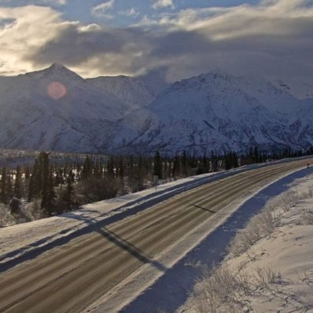
the weather seemed kind of like this all weekend.
The view from Badger Road @ Elvira Avenue, 📷 from 511.alaska.gov

November 24, 2025 at 6:30 PM
the weather seemed kind of like this all weekend.
Anchorage Winter Start race spectating yesterday


November 24, 2025 at 6:08 PM
Anchorage Winter Start race spectating yesterday
Reposted by Ben Matheson
The view from Seward Highway @ Turnagain Pass MP 69.9, 📷 from 511.alaska.gov

November 20, 2025 at 1:40 AM
The view from Seward Highway @ Turnagain Pass MP 69.9, 📷 from 511.alaska.gov
new 12 hour Ken Burns documentary (should be at least 24 hours)
November 17, 2025 at 7:53 PM
new 12 hour Ken Burns documentary (should be at least 24 hours)
very "mid-November" this weekend


November 17, 2025 at 5:59 PM
very "mid-November" this weekend
looks like some northern lights captured here
The view from Glenn Highway @ Gunsight Mountain MP 117, 📷 from 511.alaska.gov

November 12, 2025 at 5:18 PM
looks like some northern lights captured here
my phone was frozen solid so no photo evidence, but I skied tonight under a full arc red rainbow shape northern lights. very cool.
November 12, 2025 at 5:02 AM
my phone was frozen solid so no photo evidence, but I skied tonight under a full arc red rainbow shape northern lights. very cool.
i'm currently at five trips to Lowe's in the past week. I know all of the staff. I know where everything is. I have a favorite oversized cart. I know of secret parking spots. I have MyLowe’s Money™. (I am pretty sure five is nowhere near my record number of trips. )
November 10, 2025 at 5:47 PM
i'm currently at five trips to Lowe's in the past week. I know all of the staff. I know where everything is. I have a favorite oversized cart. I know of secret parking spots. I have MyLowe’s Money™. (I am pretty sure five is nowhere near my record number of trips. )
i'm pretty intrigued by the mulch yard

Parking was one of the more controversial aspects to Portland's Residential Infill Project.
This newly built triplex at SE 16th & Morrison is a good example of how eliminating parking requirements allowed a mature tree to be saved. www.redfin.com/OR/Portland/...
This newly built triplex at SE 16th & Morrison is a good example of how eliminating parking requirements allowed a mature tree to be saved. www.redfin.com/OR/Portland/...


November 10, 2025 at 5:40 PM
i'm pretty intrigued by the mulch yard
this weekend's views


November 10, 2025 at 5:30 PM
this weekend's views
I'm sure I have used their galvanized coatings many times.

November 7, 2025 at 10:04 PM
I'm sure I have used their galvanized coatings many times.
Reposted by Ben Matheson

Looks like the plows are busy in Anchorage this morning! experience.arcgis.com/experience/3... #akwx #Alaska

November 7, 2025 at 8:03 PM
Looks like the plows are busy in Anchorage this morning! experience.arcgis.com/experience/3... #akwx #Alaska
squirrelier than expected today : )


November 7, 2025 at 5:33 PM
squirrelier than expected today : )
Reposted by Ben Matheson
The view from Haines Highway @ Klehini MP 36.6, 📷 from 511.alaska.gov

November 5, 2025 at 5:22 PM
The view from Haines Highway @ Klehini MP 36.6, 📷 from 511.alaska.gov
yet another excellent view of the tunnel
The view from Camp Road @ Whittier Tunnel, 📷 from 511.alaska.gov

November 6, 2025 at 6:44 PM
yet another excellent view of the tunnel
Reposted by Ben Matheson
The view from Goldstream Road @ Old Steese Hwy, 📷 from 511.alaska.gov

November 5, 2025 at 9:21 PM
The view from Goldstream Road @ Old Steese Hwy, 📷 from 511.alaska.gov
Reposted by Ben Matheson
The view from Lathrop Street @ 21st Avenue Fairbanks, 📷 from 511.alaska.gov

November 4, 2025 at 9:25 AM
The view from Lathrop Street @ 21st Avenue Fairbanks, 📷 from 511.alaska.gov
Reposted by Ben Matheson
The view from Glenn Highway @ MP 176.6, 📷 from 511.alaska.gov

October 31, 2025 at 6:31 PM
The view from Glenn Highway @ MP 176.6, 📷 from 511.alaska.gov
very eager to see this one in person. As Anchorage works to make better streets, I like to point people to Minneapolis as another snowy, often dark and cold place that is a solid decade in front of us in terms of working out the kinks on these things (and that we should copy a bunch of things)
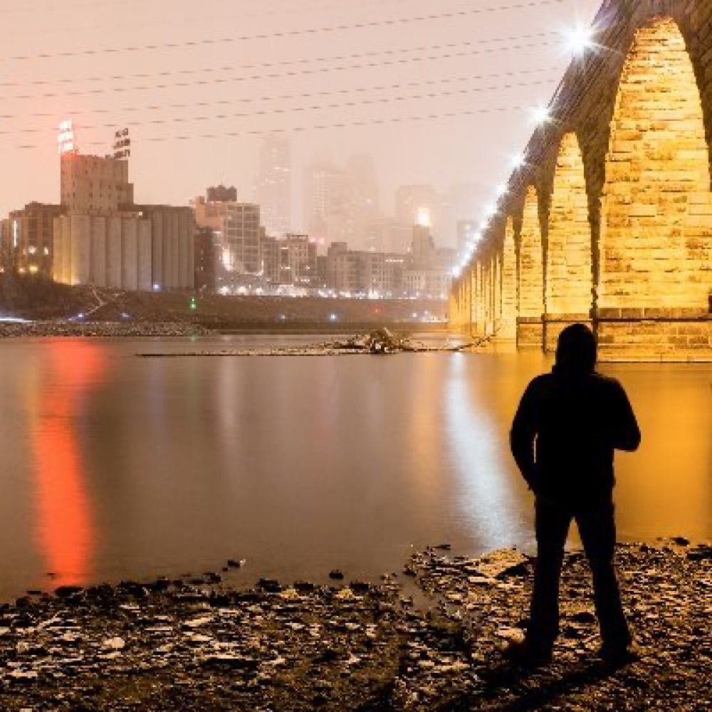
Hennepin Avenue ribbon cutting was today after being closed in some form since April 2024. In my opinion, this bike lane is up there at the top of or near the top of the list of the most important bike lanes the city has built in the last ten years...


October 31, 2025 at 11:48 PM
very eager to see this one in person. As Anchorage works to make better streets, I like to point people to Minneapolis as another snowy, often dark and cold place that is a solid decade in front of us in terms of working out the kinks on these things (and that we should copy a bunch of things)
based on my weekly shopping habits, it's shocking that Nvidia beat Lowe's to become the world's first $5 trillion company.
October 31, 2025 at 11:29 PM
based on my weekly shopping habits, it's shocking that Nvidia beat Lowe's to become the world's first $5 trillion company.
Alaskans’ stake in Nvidia amounts to an impressive $1,110 per PFD recipient. The Alaska Permanent Fund’s 3,416,878 shares (as of 9/30) indicate a holding worth $693,250,377 as of yesterday’s market close. #akleg
October 31, 2025 at 5:22 PM
Alaskans’ stake in Nvidia amounts to an impressive $1,110 per PFD recipient. The Alaska Permanent Fund’s 3,416,878 shares (as of 9/30) indicate a holding worth $693,250,377 as of yesterday’s market close. #akleg
Reposted by Ben Matheson
The view from Dalton Hwy @ Atigun Pass MP 244, 📷 from 511.alaska.gov

October 29, 2025 at 8:31 AM
The view from Dalton Hwy @ Atigun Pass MP 244, 📷 from 511.alaska.gov
🏔️ 🌄 🌲
The view from Glenn Highway @ Thunderbird Falls MP 24.5, 📷 from 511.alaska.gov

October 28, 2025 at 9:26 PM
🏔️ 🌄 🌲
Reposted by Ben Matheson
The view from Sterling Highway @ Tern Lake MP 37, 📷 from 511.alaska.gov

October 28, 2025 at 5:21 PM
The view from Sterling Highway @ Tern Lake MP 37, 📷 from 511.alaska.gov
I grew the world's smallest brussels sprouts this summer.


October 28, 2025 at 4:58 PM
I grew the world's smallest brussels sprouts this summer.