


ClimateEngine.org
@climateengineorg.bsky.social
On-demand insights from #Climate and #EarthObservations for non-commercial | ClimateEngine.org | App & API built on #EarthEngine | Initiative between @driscience.bsky.social and @ucmerced.bsky.social
Reposted by ClimateEngine.org

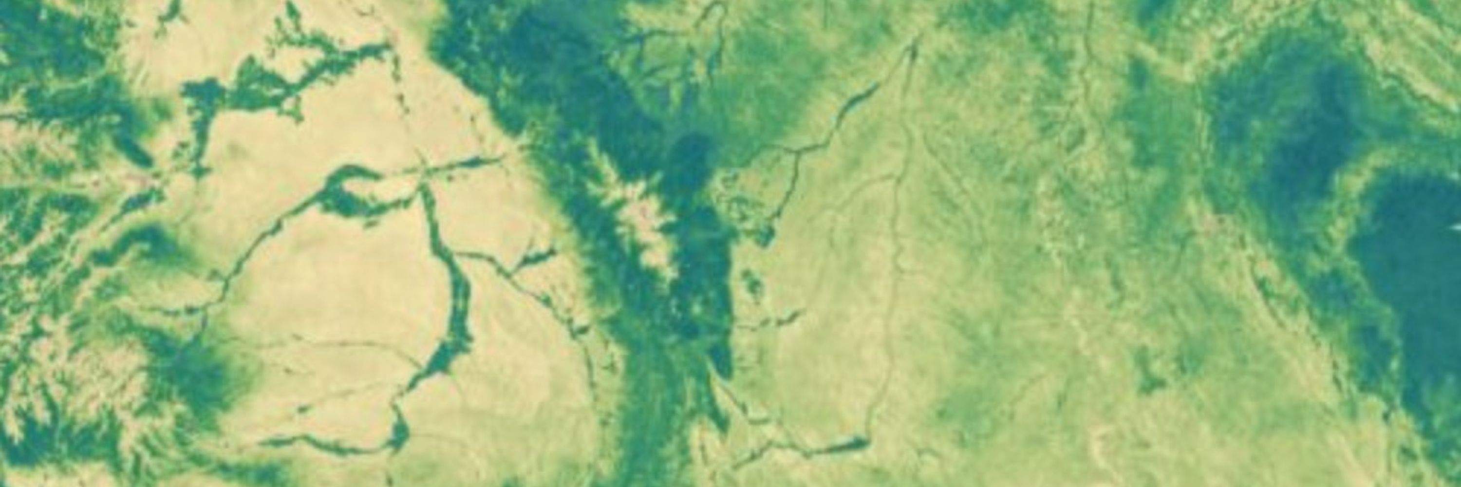
🗺️ New raster overlays in Climate Engine! 🗺️
You can now add contextual overlays to your CE maps:
🌍 Landcover (NLCD, ESA WorldCover),
🏛️ Land ownership (Surface Management Agency)
💧 Wetlands (NWI, VBET)
What layers do you want to see added to Climate Engine?
#EarthObservations #Climate #Geospatial
You can now add contextual overlays to your CE maps:
🌍 Landcover (NLCD, ESA WorldCover),
🏛️ Land ownership (Surface Management Agency)
💧 Wetlands (NWI, VBET)
What layers do you want to see added to Climate Engine?
#EarthObservations #Climate #Geospatial
November 10, 2025 at 2:22 PM
🗺️ New raster overlays in Climate Engine! 🗺️
You can now add contextual overlays to your CE maps:
🌍 Landcover (NLCD, ESA WorldCover),
🏛️ Land ownership (Surface Management Agency)
💧 Wetlands (NWI, VBET)
What layers do you want to see added to Climate Engine?
#EarthObservations #Climate #Geospatial
You can now add contextual overlays to your CE maps:
🌍 Landcover (NLCD, ESA WorldCover),
🏛️ Land ownership (Surface Management Agency)
💧 Wetlands (NWI, VBET)
What layers do you want to see added to Climate Engine?
#EarthObservations #Climate #Geospatial
Reposted by ClimateEngine.org
🗺️ Climate Engine is looking sharper than ever with new basemaps!
You can now add high-res aerial imagery and topographic layers beneath your computed maps to explore fine-scale landscape detail.
Check out the demo and try it at app.climateengine.org
🌎
#EarthEngine #RemoteSensing #Geospatial
You can now add high-res aerial imagery and topographic layers beneath your computed maps to explore fine-scale landscape detail.
Check out the demo and try it at app.climateengine.org
🌎
#EarthEngine #RemoteSensing #Geospatial
November 7, 2025 at 5:39 PM
🗺️ Climate Engine is looking sharper than ever with new basemaps!
You can now add high-res aerial imagery and topographic layers beneath your computed maps to explore fine-scale landscape detail.
Check out the demo and try it at app.climateengine.org
🌎
#EarthEngine #RemoteSensing #Geospatial
You can now add high-res aerial imagery and topographic layers beneath your computed maps to explore fine-scale landscape detail.
Check out the demo and try it at app.climateengine.org
🌎
#EarthEngine #RemoteSensing #Geospatial
Reposted by ClimateEngine.org
🧑💻 Check out my more extensive post on LinkedIn and stay tuned for more details — including how to call the tools through the @climateengineorg.bsky.social API — in the coming days
www.linkedin.com/feed/update/...
If you're using the tools, I'd love to hear from you!
www.linkedin.com/feed/update/...
If you're using the tools, I'd love to hear from you!

Eric Jensen on LinkedIn: Generating Climate Engine Reports for Custom Areas of Interest
🚨 New Climate Engine data tools! 🚨
This week we're excited to introduce new Climate Engine reports that can be produced for any location in CONUS! This tool…
www.linkedin.com
January 31, 2025 at 3:39 PM
🧑💻 Check out my more extensive post on LinkedIn and stay tuned for more details — including how to call the tools through the @climateengineorg.bsky.social API — in the coming days
www.linkedin.com/feed/update/...
If you're using the tools, I'd love to hear from you!
www.linkedin.com/feed/update/...
If you're using the tools, I'd love to hear from you!
Reposted by ClimateEngine.org
To help to support users, we've published a tutorial video that demonstrates using a 'Priority Region', 'Shapefile Upload', or 'Drawn Polygon' for your AOI for lands administered by BLM, NPS, USFS, USFWS, BIA, DOD, or all lands.
📺 See the video www.youtube.com/watch?v=b4yj...
📺 See the video www.youtube.com/watch?v=b4yj...

Generating Climate Engine Reports for Custom Areas of Interest
YouTube video by Climate Engine Org
www.youtube.com
January 31, 2025 at 3:39 PM
To help to support users, we've published a tutorial video that demonstrates using a 'Priority Region', 'Shapefile Upload', or 'Drawn Polygon' for your AOI for lands administered by BLM, NPS, USFS, USFWS, BIA, DOD, or all lands.
📺 See the video www.youtube.com/watch?v=b4yj...
📺 See the video www.youtube.com/watch?v=b4yj...
Reposted by ClimateEngine.org
🚨 New Climate Engine data tools! 🚨
This week we're excited to introduce @climateengineorg.bsky.social reports for anywhere in CONUS. Created for resource managers, policymakers, and others, the reports aid in reporting, monitoring, and adaptive management.
🛠️ Use the tools reports.climateengine.org
This week we're excited to introduce @climateengineorg.bsky.social reports for anywhere in CONUS. Created for resource managers, policymakers, and others, the reports aid in reporting, monitoring, and adaptive management.
🛠️ Use the tools reports.climateengine.org


January 31, 2025 at 3:39 PM
🚨 New Climate Engine data tools! 🚨
This week we're excited to introduce @climateengineorg.bsky.social reports for anywhere in CONUS. Created for resource managers, policymakers, and others, the reports aid in reporting, monitoring, and adaptive management.
🛠️ Use the tools reports.climateengine.org
This week we're excited to introduce @climateengineorg.bsky.social reports for anywhere in CONUS. Created for resource managers, policymakers, and others, the reports aid in reporting, monitoring, and adaptive management.
🛠️ Use the tools reports.climateengine.org
Our team at @DRIScience is honored to be recognized as one of the inaugural recipients of the #GeoForGood23 Impact Awards! 🛰️
Thank you to Google Earth Outreach for highlighting the work of the exemplary partners selected 🙏
medium.com/google-earth...
Thank you to Google Earth Outreach for highlighting the work of the exemplary partners selected 🙏
medium.com/google-earth...

Announcing Geo for Good Impact Awards: Recognizing our community
By Devaja Shah, Program Manager, Google Earth Outreach
medium.com
October 13, 2023 at 7:46 PM
Our team at @DRIScience is honored to be recognized as one of the inaugural recipients of the #GeoForGood23 Impact Awards! 🛰️
Thank you to Google Earth Outreach for highlighting the work of the exemplary partners selected 🙏
medium.com/google-earth...
Thank you to Google Earth Outreach for highlighting the work of the exemplary partners selected 🙏
medium.com/google-earth...
Reposted by ClimateEngine.org
Fantastic to see the USGS Historical Imagery mosaic produced by USDA-NRCS Working Lands for Wildlife in the #EarthEngine Community Catalog!
gee-community-catalog.org/projects/his...
I had the privilege of working on the project in 2020-2021 — tremendous opportunities in conservation and beyond.
gee-community-catalog.org/projects/his...
I had the privilege of working on the project in 2020-2021 — tremendous opportunities in conservation and beyond.

September 27, 2023 at 3:42 PM
Fantastic to see the USGS Historical Imagery mosaic produced by USDA-NRCS Working Lands for Wildlife in the #EarthEngine Community Catalog!
gee-community-catalog.org/projects/his...
I had the privilege of working on the project in 2020-2021 — tremendous opportunities in conservation and beyond.
gee-community-catalog.org/projects/his...
I had the privilege of working on the project in 2020-2021 — tremendous opportunities in conservation and beyond.
We're excited to share that we're adding dozens of our #EarthEngine assets to the EE Community Catalog!
The first batch includes USGS VIIRS and MODIS Evapotranspiration, CEMS Fire Danger Indices, the North American Drought Monitor, and more 🛰️
Catalog changelog: gee-community-catalog.org/changelog/
The first batch includes USGS VIIRS and MODIS Evapotranspiration, CEMS Fire Danger Indices, the North American Drought Monitor, and more 🛰️
Catalog changelog: gee-community-catalog.org/changelog/

September 27, 2023 at 3:25 PM
We're excited to share that we're adding dozens of our #EarthEngine assets to the EE Community Catalog!
The first batch includes USGS VIIRS and MODIS Evapotranspiration, CEMS Fire Danger Indices, the North American Drought Monitor, and more 🛰️
Catalog changelog: gee-community-catalog.org/changelog/
The first batch includes USGS VIIRS and MODIS Evapotranspiration, CEMS Fire Danger Indices, the North American Drought Monitor, and more 🛰️
Catalog changelog: gee-community-catalog.org/changelog/