


GPGRS
@gpgrs.bsky.social
GPGRS
› Earth Observation & Spatial Science
╔═════════════╗
║● GIS G #GIS
║● Photogrammetry P #Photogrammetry
║● Geodesy G #Geodesy
║● Remote Sensing RS #RemoteSensing
╚═════════════╝
› Earth Observation & Spatial Science
╔═════════════╗
║● GIS G #GIS
║● Photogrammetry P #Photogrammetry
║● Geodesy G #Geodesy
║● Remote Sensing RS #RemoteSensing
╚═════════════╝
Geodesy post👇
#LandSurveying #SurveyLife #Surveyor #Geodesy #GIS #ControlPoint #Benchmark #Geomatics #Mapping #EO #30DayMapChallenge #Earthquake
Many thanks to
@pythonmaps.bsky.social
#LandSurveying #SurveyLife #Surveyor #Geodesy #GIS #ControlPoint #Benchmark #Geomatics #Mapping #EO #30DayMapChallenge #Earthquake
Many thanks to
@pythonmaps.bsky.social

Day three of the #30DayMapChallenge - Polygons. This map shows the earths tectonic plates. I have overlayed all of the earthquakes with a magnitude greater than 4.0 over the last 20 years, coloured according to their magnitude (blue (smallest) - red (largest).

November 5, 2025 at 11:15 AM
Geodesy post👇
#LandSurveying #SurveyLife #Surveyor #Geodesy #GIS #ControlPoint #Benchmark #Geomatics #Mapping #EO #30DayMapChallenge #Earthquake
Many thanks to
@pythonmaps.bsky.social
#LandSurveying #SurveyLife #Surveyor #Geodesy #GIS #ControlPoint #Benchmark #Geomatics #Mapping #EO #30DayMapChallenge #Earthquake
Many thanks to
@pythonmaps.bsky.social
They are cute but necessary for forest health and ecosystems ...
🍄🦤🌐🍁
#RemoteSensing #EnvironmentalMonitoring #PlanetScope #EO #SatelliteImagery #Forestry #GIS #Ecosystem #Ecology
🍄🦤🌐🍁
#RemoteSensing #EnvironmentalMonitoring #PlanetScope #EO #SatelliteImagery #Forestry #GIS #Ecosystem #Ecology
A lone Chorus Frog was calling this morning… maybe the first this Squirrel youngster ever heard😄
November 4, 2025 at 5:43 PM
They are cute but necessary for forest health and ecosystems ...
🍄🦤🌐🍁
#RemoteSensing #EnvironmentalMonitoring #PlanetScope #EO #SatelliteImagery #Forestry #GIS #Ecosystem #Ecology
🍄🦤🌐🍁
#RemoteSensing #EnvironmentalMonitoring #PlanetScope #EO #SatelliteImagery #Forestry #GIS #Ecosystem #Ecology
Remote Sensing post👇
An interesting paper on optimizing the EVI (Enhanced Vegetation Index). 🌐🍁
#RemoteSensing #EnvironmentalMonitoring #PlanetScope #EO #SatelliteImagery #Forestry #GIS #EVI #VegetationIndex #NDVI #optimization
Many thanks to
@rvnfxri.bsky.social
and
@sajadsayadi.bsky.social
An interesting paper on optimizing the EVI (Enhanced Vegetation Index). 🌐🍁
#RemoteSensing #EnvironmentalMonitoring #PlanetScope #EO #SatelliteImagery #Forestry #GIS #EVI #VegetationIndex #NDVI #optimization
Many thanks to
@rvnfxri.bsky.social
and
@sajadsayadi.bsky.social

Sajad Sayadi
Classic NDVI can be fuzzy over bright soils and sparse canopies. We re-parameterized EVI with PSO for semi-arid mountains on Sentinel-2.
Have you tried scene-specific EVI tuning?
#RemoteSensing #EVI #Vegetation #Indexes #PSO #Sentinel2
See more details here👇 doi.org/10.1109/Metr...
Classic NDVI can be fuzzy over bright soils and sparse canopies. We re-parameterized EVI with PSO for semi-arid mountains on Sentinel-2.
Have you tried scene-specific EVI tuning?
#RemoteSensing #EVI #Vegetation #Indexes #PSO #Sentinel2
See more details here👇 doi.org/10.1109/Metr...

October 30, 2025 at 1:53 PM
Remote Sensing post👇
An interesting paper on optimizing the EVI (Enhanced Vegetation Index). 🌐🍁
#RemoteSensing #EnvironmentalMonitoring #PlanetScope #EO #SatelliteImagery #Forestry #GIS #EVI #VegetationIndex #NDVI #optimization
Many thanks to
@rvnfxri.bsky.social
and
@sajadsayadi.bsky.social
An interesting paper on optimizing the EVI (Enhanced Vegetation Index). 🌐🍁
#RemoteSensing #EnvironmentalMonitoring #PlanetScope #EO #SatelliteImagery #Forestry #GIS #EVI #VegetationIndex #NDVI #optimization
Many thanks to
@rvnfxri.bsky.social
and
@sajadsayadi.bsky.social
Remote Sensing post👇
This review shows how PlanetScope's 3m, near-daily data is revolutionizing forest monitoring.
#RemoteSensing #EnvironmentalMonitoring #PlanetScope #EOb #SatelliteImagery #ClimateChange #Forestry #GIS
Many thanks to
@alexisachim.bsky.social
and
@irssubc.bsky.social
This review shows how PlanetScope's 3m, near-daily data is revolutionizing forest monitoring.
#RemoteSensing #EnvironmentalMonitoring #PlanetScope #EOb #SatelliteImagery #ClimateChange #Forestry #GIS
Many thanks to
@alexisachim.bsky.social
and
@irssubc.bsky.social

📣NEW PAPER 📣A review of PlanetScope CubeSats for forest monitoring
✍️: Shields, Coops, Achim (@alexisachim.bsky.social), Hamelin, Mulverhill
📖: Science of Remote Sensing
doi.org/10.1016/j.sr...
#planetScope #forestry #highresolution #nearrealtime #multispectral #IRSSlab #UBCForestry
✍️: Shields, Coops, Achim (@alexisachim.bsky.social), Hamelin, Mulverhill
📖: Science of Remote Sensing
doi.org/10.1016/j.sr...
#planetScope #forestry #highresolution #nearrealtime #multispectral #IRSSlab #UBCForestry

October 29, 2025 at 10:37 AM
Remote Sensing post👇
This review shows how PlanetScope's 3m, near-daily data is revolutionizing forest monitoring.
#RemoteSensing #EnvironmentalMonitoring #PlanetScope #EOb #SatelliteImagery #ClimateChange #Forestry #GIS
Many thanks to
@alexisachim.bsky.social
and
@irssubc.bsky.social
This review shows how PlanetScope's 3m, near-daily data is revolutionizing forest monitoring.
#RemoteSensing #EnvironmentalMonitoring #PlanetScope #EOb #SatelliteImagery #ClimateChange #Forestry #GIS
Many thanks to
@alexisachim.bsky.social
and
@irssubc.bsky.social
Remote Sensing post👇
Seeing the unseen: This paper uses AI and satellite data to simulate some of the ocean's interior properties.
#OceanScience #DataDriven #RemoteSensing
#DeepLearning #AI #EnvironmentalMonitoring
@agarciaespriu.bsky.social
@cgonharo.bsky.social
@aguilarf.bsky.social
Seeing the unseen: This paper uses AI and satellite data to simulate some of the ocean's interior properties.
#OceanScience #DataDriven #RemoteSensing
#DeepLearning #AI #EnvironmentalMonitoring
@agarciaespriu.bsky.social
@cgonharo.bsky.social
@aguilarf.bsky.social
📢 New paper alert:
What started as a Master’s thesis has grown into a full research article — proof that great things can begin in small steps. 🌊🔬 #OceanScience #DataDriven #RemoteSensing
os.copernicus.org/articles/21/...
@agarciaespriu.bsky.social @aguilarf.bsky.social @icatmar.bsky.social
What started as a Master’s thesis has grown into a full research article — proof that great things can begin in small steps. 🌊🔬 #OceanScience #DataDriven #RemoteSensing
os.copernicus.org/articles/21/...
@agarciaespriu.bsky.social @aguilarf.bsky.social @icatmar.bsky.social

On the global reconstruction of ocean interior variables: a feasibility data-driven study with simulated surface and water column observations
Abstract. This work uses data-driven approaches to study the feasibility of reconstructing ocean interior variables (temperature and salinity) from surface observations provided by satellites and inte...
os.copernicus.org
October 28, 2025 at 7:24 AM
Remote Sensing post👇
Seeing the unseen: This paper uses AI and satellite data to simulate some of the ocean's interior properties.
#OceanScience #DataDriven #RemoteSensing
#DeepLearning #AI #EnvironmentalMonitoring
@agarciaespriu.bsky.social
@cgonharo.bsky.social
@aguilarf.bsky.social
Seeing the unseen: This paper uses AI and satellite data to simulate some of the ocean's interior properties.
#OceanScience #DataDriven #RemoteSensing
#DeepLearning #AI #EnvironmentalMonitoring
@agarciaespriu.bsky.social
@cgonharo.bsky.social
@aguilarf.bsky.social
Photogrammetry Post👇
A really nice 3D model.
#Photogrammetry
#UAVPhotogrammetry
#DronePhotogrammetry
#CloserangePhotogrammetry
#LiDAR #LaserScanner #MLS #TLS
A really nice 3D model.
#Photogrammetry
#UAVPhotogrammetry
#DronePhotogrammetry
#CloserangePhotogrammetry
#LiDAR #LaserScanner #MLS #TLS

A #3D scan of a church interior near me.
#gaussiansplats #3Dscan #architecture #photogrammetry #religiousbuilding #radiancefields #scannerian #langport #Somerset
#gaussiansplats #3Dscan #architecture #photogrammetry #religiousbuilding #radiancefields #scannerian #langport #Somerset
October 27, 2025 at 12:27 PM
Photogrammetry Post👇
A really nice 3D model.
#Photogrammetry
#UAVPhotogrammetry
#DronePhotogrammetry
#CloserangePhotogrammetry
#LiDAR #LaserScanner #MLS #TLS
A really nice 3D model.
#Photogrammetry
#UAVPhotogrammetry
#DronePhotogrammetry
#CloserangePhotogrammetry
#LiDAR #LaserScanner #MLS #TLS
Geodesy post👇
Check out these fascinating survey benchmarks! One of them is from 1941. Land surveying is always one of the coolest fields.
Thanks Julie.
#LandSurveying #SurveyLife
#Surveyor #Geodesy #GIS
#ControlPoint #Benchmark
#Geomatics #Mapping
Check out these fascinating survey benchmarks! One of them is from 1941. Land surveying is always one of the coolest fields.
Thanks Julie.
#LandSurveying #SurveyLife
#Surveyor #Geodesy #GIS
#ControlPoint #Benchmark
#Geomatics #Mapping
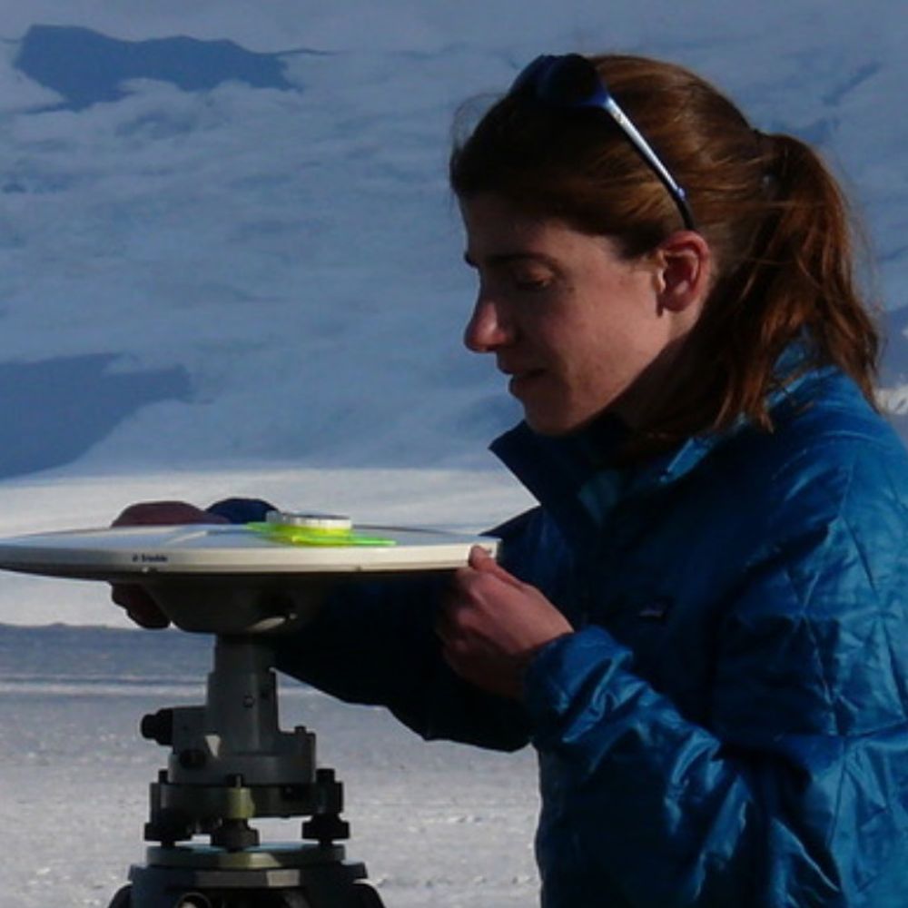
For #FieldworkFriday, some of the benchmarks I've surveyed over the past few weeks. Some are more challenging to use than others, but they're all interesting. #geodesy ⚒️🧪


October 16, 2025 at 1:37 PM
Geodesy post👇
Check out these fascinating survey benchmarks! One of them is from 1941. Land surveying is always one of the coolest fields.
Thanks Julie.
#LandSurveying #SurveyLife
#Surveyor #Geodesy #GIS
#ControlPoint #Benchmark
#Geomatics #Mapping
Check out these fascinating survey benchmarks! One of them is from 1941. Land surveying is always one of the coolest fields.
Thanks Julie.
#LandSurveying #SurveyLife
#Surveyor #Geodesy #GIS
#ControlPoint #Benchmark
#Geomatics #Mapping
Remote Sensing post & paper👇
This research explores the potential of using AI and mobile laser scanning data to automatically assess the productivity and growth potential of young forests.
#RemoteSensing
#DeepLearning
#LaserScanning
#MLS #Ecology
#AI #Forestry
#ForestEcology
#EnvironmentalMonitoring
This research explores the potential of using AI and mobile laser scanning data to automatically assess the productivity and growth potential of young forests.
#RemoteSensing
#DeepLearning
#LaserScanning
#MLS #Ecology
#AI #Forestry
#ForestEcology
#EnvironmentalMonitoring
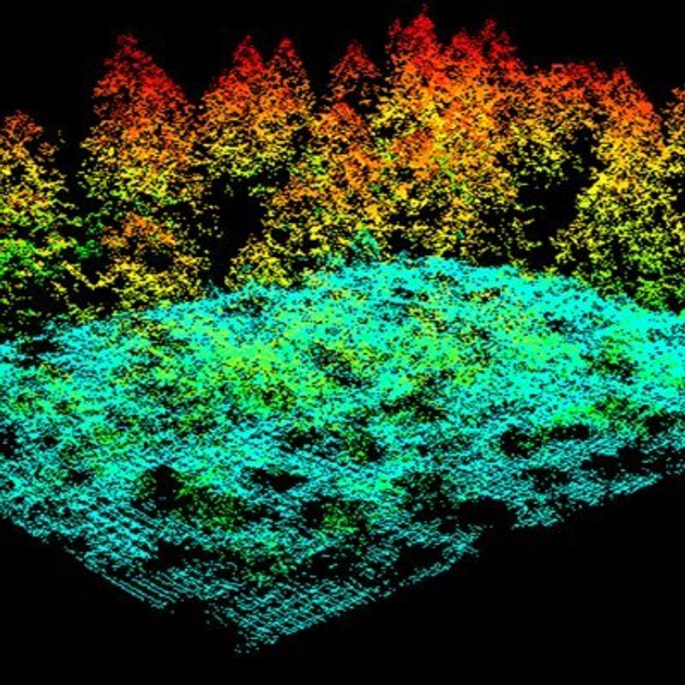
Can site index be determined using branch whorls detected by deep learning from very dense laser scanning data? 🌲
Check out our newly published paper to find out!
academic.oup.com/forestry/adv...
Check out our newly published paper to find out!
academic.oup.com/forestry/adv...

October 16, 2025 at 12:14 PM
Remote Sensing post & paper👇
This research explores the potential of using AI and mobile laser scanning data to automatically assess the productivity and growth potential of young forests.
#RemoteSensing
#DeepLearning
#LaserScanning
#MLS #Ecology
#AI #Forestry
#ForestEcology
#EnvironmentalMonitoring
This research explores the potential of using AI and mobile laser scanning data to automatically assess the productivity and growth potential of young forests.
#RemoteSensing
#DeepLearning
#LaserScanning
#MLS #Ecology
#AI #Forestry
#ForestEcology
#EnvironmentalMonitoring
Remote Sensing & GIS Post👇
A powerful, unsupervised approach for discovering any significant change in a satellite time-series.
#GIS
#remotesensing
#ChangeDetection
#EnvironmentalMonitoring
#Forestry
#ClimateChange
#vegetationdynamics #SatelliteImagery #EarthObservation
A powerful, unsupervised approach for discovering any significant change in a satellite time-series.
#GIS
#remotesensing
#ChangeDetection
#EnvironmentalMonitoring
#Forestry
#ClimateChange
#vegetationdynamics #SatelliteImagery #EarthObservation
🧪 oooh nice study #GIS #remotesensing
“The spectral anomaly algorithm identifies a broad spectrum of dynamics, including vegetation gain from a green-up event or agriculture intensification, changes in the built environment, lava flows, and vegetation cover loss”
www.nature.com/articles/s41...
“The spectral anomaly algorithm identifies a broad spectrum of dynamics, including vegetation gain from a green-up event or agriculture intensification, changes in the built environment, lava flows, and vegetation cover loss”
www.nature.com/articles/s41...

Rapid monitoring of global land change - Nature Communications
An operational satellite-based monitoring system using NASA/USGS and ESA imagery enables rapid tracking of global land change, with the area of conversion due to direct human action and fire equaling the size of California in 2023.
www.nature.com
October 13, 2025 at 1:43 PM
Remote Sensing & GIS Post👇
A powerful, unsupervised approach for discovering any significant change in a satellite time-series.
#GIS
#remotesensing
#ChangeDetection
#EnvironmentalMonitoring
#Forestry
#ClimateChange
#vegetationdynamics #SatelliteImagery #EarthObservation
A powerful, unsupervised approach for discovering any significant change in a satellite time-series.
#GIS
#remotesensing
#ChangeDetection
#EnvironmentalMonitoring
#Forestry
#ClimateChange
#vegetationdynamics #SatelliteImagery #EarthObservation
Photogrammetry Post👇
This is a fantastic visualization of the difference between a rolling and global shutter.
#Photogrammetry
#UAVPhotogrammetry
#DronePhotogrammetry
#CloserangePhotogrammetry
This is a fantastic visualization of the difference between a rolling and global shutter.
#Photogrammetry
#UAVPhotogrammetry
#DronePhotogrammetry
#CloserangePhotogrammetry
No matter what camera you use to capture images, you need to understand how rolling shutter and global shutter work and what sets them apart.
#Photogrammetry #Imaging #Shutter #UAVphotogrammetry
#3DModeling #RemoteSensing #CameraTech
#Photogrammetry #Imaging #Shutter #UAVphotogrammetry
#3DModeling #RemoteSensing #CameraTech
October 13, 2025 at 1:30 PM
Photogrammetry Post👇
This is a fantastic visualization of the difference between a rolling and global shutter.
#Photogrammetry
#UAVPhotogrammetry
#DronePhotogrammetry
#CloserangePhotogrammetry
This is a fantastic visualization of the difference between a rolling and global shutter.
#Photogrammetry
#UAVPhotogrammetry
#DronePhotogrammetry
#CloserangePhotogrammetry