


Jeffery Cannon, Landscape Ecology Lab
@jefferybcannon.bsky.social
Forest landscape ecologist in southeastern US. Follow for hurricane ecology, ecology jobs, forest restoration, remote sensing, and lidar eye-candy. #disturbance #ecology lab.jonesctr.org/cannon
Pinned
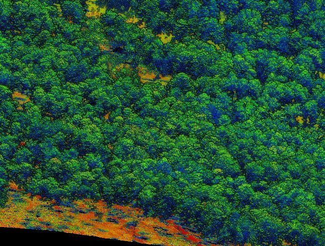
Ready to learn how to use LiDAR for research in #forestry and natural resources using #R? This week I am sharing our 7-part series on Bluesky to help you get started! Share with anyone you know who wants to get started. Part 1 covers acquiring, & viewing LiDAR data! bit.ly/lidR-module1
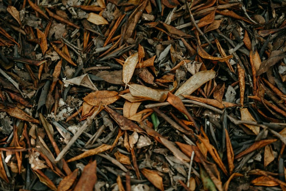
Excited to share our new Fire Ecology study! 🌲🔥 Terrestrial lidar can rapidly and accurately measure crown scorch 20x faster than traditional methods. Our R package, CrownScorchTLS, helps make this method accessible for large-scale forest monitoring.
doi.org/10.1186/s424...
doi.org/10.1186/s424...

November 14, 2025 at 2:11 AM
Excited to share our new Fire Ecology study! 🌲🔥 Terrestrial lidar can rapidly and accurately measure crown scorch 20x faster than traditional methods. Our R package, CrownScorchTLS, helps make this method accessible for large-scale forest monitoring.
doi.org/10.1186/s424...
doi.org/10.1186/s424...
Reposted by Jeffery Cannon, Landscape Ecology Lab
Enjoyed a wonderful visit to the longleaf pine ecosystem at The Jones Center at Ichauway.
Many thanks to David Mason for hosting me, @jefferybcannon.bsky.social for a tour of the Ichauway Forest Dynamics Plot & ForestGEO site, and The Jones Center community for a great seminar visit. 🔥 🌱 🌼
Many thanks to David Mason for hosting me, @jefferybcannon.bsky.social for a tour of the Ichauway Forest Dynamics Plot & ForestGEO site, and The Jones Center community for a great seminar visit. 🔥 🌱 🌼


October 11, 2025 at 2:42 PM
Enjoyed a wonderful visit to the longleaf pine ecosystem at The Jones Center at Ichauway.
Many thanks to David Mason for hosting me, @jefferybcannon.bsky.social for a tour of the Ichauway Forest Dynamics Plot & ForestGEO site, and The Jones Center community for a great seminar visit. 🔥 🌱 🌼
Many thanks to David Mason for hosting me, @jefferybcannon.bsky.social for a tour of the Ichauway Forest Dynamics Plot & ForestGEO site, and The Jones Center community for a great seminar visit. 🔥 🌱 🌼
Reposted by Jeffery Cannon, Landscape Ecology Lab

MS position for Fall 2026 available to study Hurricane Ecology w/ me at #UCF and with @jefferybcannon.bsky.social from @thejonesctr.bsky.social! Funded half time as a TA and half as an RA. See web for details: tinyurl.com/9pm33ttt
Please RT and share with your bright undergrads!!
Please RT and share with your bright undergrads!!

October 7, 2025 at 8:23 PM
MS position for Fall 2026 available to study Hurricane Ecology w/ me at #UCF and with @jefferybcannon.bsky.social from @thejonesctr.bsky.social! Funded half time as a TA and half as an RA. See web for details: tinyurl.com/9pm33ttt
Please RT and share with your bright undergrads!!
Please RT and share with your bright undergrads!!
Reposted by Jeffery Cannon, Landscape Ecology Lab
Interested in measuring trees and branches from Lidar data? Don't want to use Matlab? (who does).
Take a look at our new Python package for reconstructing trees from point cloud data using quantitative structure models (QSM's).
Fun with @jefferybcannon.bsky.social!
ecoevorxiv.org/repository/v...
Take a look at our new Python package for reconstructing trees from point cloud data using quantitative structure models (QSM's).
Fun with @jefferybcannon.bsky.social!
ecoevorxiv.org/repository/v...

September 17, 2025 at 12:51 PM
Interested in measuring trees and branches from Lidar data? Don't want to use Matlab? (who does).
Take a look at our new Python package for reconstructing trees from point cloud data using quantitative structure models (QSM's).
Fun with @jefferybcannon.bsky.social!
ecoevorxiv.org/repository/v...
Take a look at our new Python package for reconstructing trees from point cloud data using quantitative structure models (QSM's).
Fun with @jefferybcannon.bsky.social!
ecoevorxiv.org/repository/v...
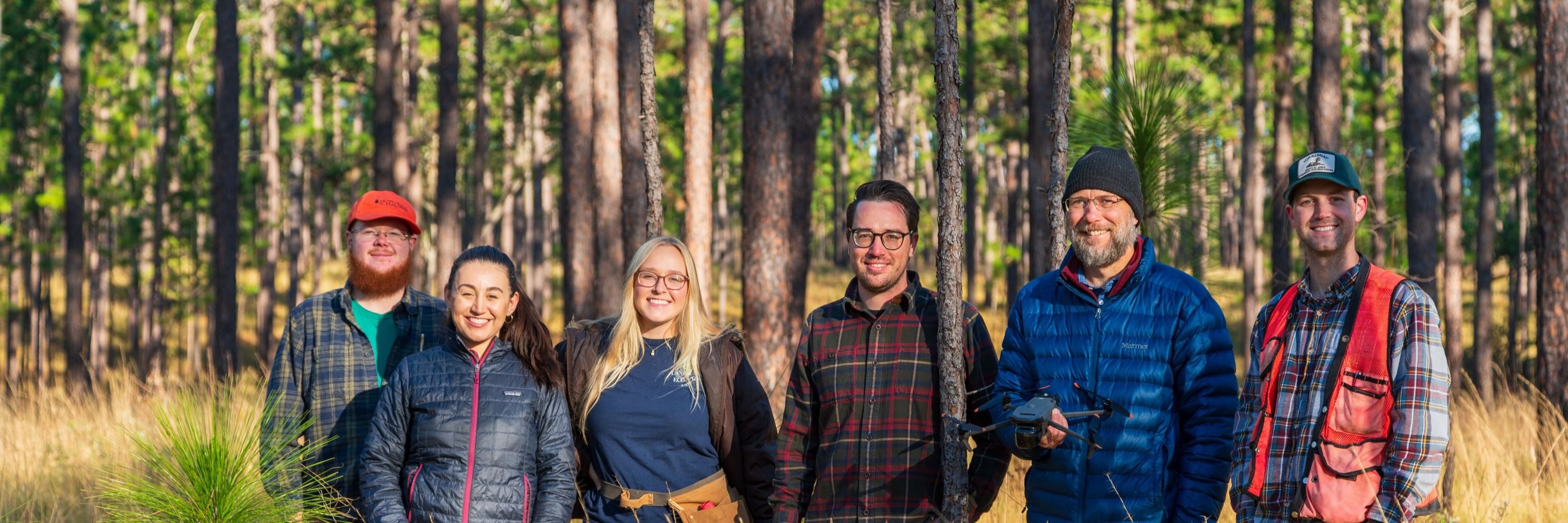
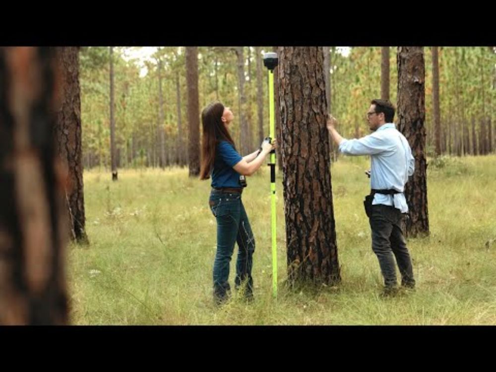
We’re excited to welcome Khanh Ton to the Landscape Ecology lab! 🌲 Khanh joins as Geospatial Analyst, bringing expertise in drones, lidar & satellite imagery to advance longleaf pine conservation. You can get to know Khanh and read more about her work 👉 lab.jonesctr.org/landscape-ec...

September 15, 2025 at 4:08 PM
We’re excited to welcome Khanh Ton to the Landscape Ecology lab! 🌲 Khanh joins as Geospatial Analyst, bringing expertise in drones, lidar & satellite imagery to advance longleaf pine conservation. You can get to know Khanh and read more about her work 👉 lab.jonesctr.org/landscape-ec...
Our study on helping pine forests endure hurricanes was featured in an issue of The Longleaf Alliance magazine. Originally publised in Forest Ecology and Management we show how managing density, promoting tree taper, and reducing fragmentation boosts wind resistance.
Read it here -> bit.ly/3UuDLEa
Read it here -> bit.ly/3UuDLEa

August 18, 2025 at 4:31 PM
Our study on helping pine forests endure hurricanes was featured in an issue of The Longleaf Alliance magazine. Originally publised in Forest Ecology and Management we show how managing density, promoting tree taper, and reducing fragmentation boosts wind resistance.
Read it here -> bit.ly/3UuDLEa
Read it here -> bit.ly/3UuDLEa
SCIENMAG featured our lab post-doc @nzampieri.bsky.social's work on how intensifying hurricanes threaten endangered longleaf pine ecosystems, and what strategies we can take to protect them #LongleafPine #ClimateChange #Ecology scienmag.com/new-research...

New Research Uncovers Key Vulnerabilities of Coastal Ecosystems to
A recent comprehensive analysis published in the journal BioScience throws into sharp relief the precarious future of longleaf pine ecosystems—some of the richest reservoirs of biodiversity in North A
scienmag.com
August 11, 2025 at 1:58 PM
SCIENMAG featured our lab post-doc @nzampieri.bsky.social's work on how intensifying hurricanes threaten endangered longleaf pine ecosystems, and what strategies we can take to protect them #LongleafPine #ClimateChange #Ecology scienmag.com/new-research...
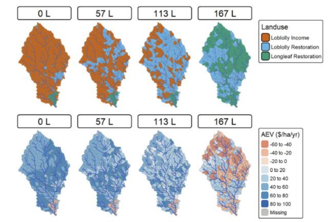
🌲💧 Check out this new work from our team, where we explore how forest restoration of open-pine systems, including loblolly and longleaf pine, can be strategically placed to boost streamflow. 📖 Read more in Scientific Reports: rdcu.be/eumhw
August 4, 2025 at 1:30 PM
🌲💧 Check out this new work from our team, where we explore how forest restoration of open-pine systems, including loblolly and longleaf pine, can be strategically placed to boost streamflow. 📖 Read more in Scientific Reports: rdcu.be/eumhw
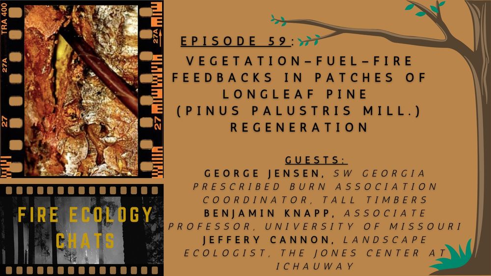
Our lab joined the Fire Ecology Chats podcast to talk about vegetation–fuel–fire feedbacks in longleaf pine. Hear how George Jensen’s new research is helping understand regeneration & fire. 🔥🌲
👉 fireecology.org/feco-podcast... #FireEcology #LongleafPine #PrescribedFire
👉 fireecology.org/feco-podcast... #FireEcology #LongleafPine #PrescribedFire
Episode 59: Vegetation–fuel–fire feedbacks in patches of longleaf pine (Pinus palustris Mill.) regeneration — Association for Fire Ecology
George Jensen, Benjamin Knapp, and Jeffery Cannon discuss how understanding structural complexity enhances understanding of the ecology and restoration of fire-maintained ecosystems.
fireecology.org
July 28, 2025 at 1:03 PM
Our lab joined the Fire Ecology Chats podcast to talk about vegetation–fuel–fire feedbacks in longleaf pine. Hear how George Jensen’s new research is helping understand regeneration & fire. 🔥🌲
👉 fireecology.org/feco-podcast... #FireEcology #LongleafPine #PrescribedFire
👉 fireecology.org/feco-podcast... #FireEcology #LongleafPine #PrescribedFire
Check out this article in Sierra Magazine on Hurricane Helene's impact on forests and wildfire risk which features insights from our reserach! Understanding these changes is vital for managing forest recovery. sierraclub.org/sierra/north... #HurricaneHelene #forest
North Carolina’s Forests Face a Long Road to Recovery
The impact of Hurricane Helene will linger for years, but the region’s woods are resilient
sierraclub.org
July 22, 2025 at 12:19 PM
Check out this article in Sierra Magazine on Hurricane Helene's impact on forests and wildfire risk which features insights from our reserach! Understanding these changes is vital for managing forest recovery. sierraclub.org/sierra/north... #HurricaneHelene #forest
Restoring longleaf pine woodlands boosts streamflow during drought. This new video covers our study on how climate-smart forestry can help conserve water across the Southeast. 🌲💧
Watch: youtube.com/watch?v=bPof...
#LongleafPine #Forestry #WaterConservation
Watch: youtube.com/watch?v=bPof...
#LongleafPine #Forestry #WaterConservation
Longleaf Pine Forests Contribute to Water Conservation
YouTube video by The Jones Center at Ichauway
youtube.com
July 15, 2025 at 5:19 PM
Restoring longleaf pine woodlands boosts streamflow during drought. This new video covers our study on how climate-smart forestry can help conserve water across the Southeast. 🌲💧
Watch: youtube.com/watch?v=bPof...
#LongleafPine #Forestry #WaterConservation
Watch: youtube.com/watch?v=bPof...
#LongleafPine #Forestry #WaterConservation
Reposted by Jeffery Cannon, Landscape Ecology Lab
NEW EPISODE of #FireEcology Chats! 🔥🎙️ Bob Keane joins George Jensen, Benjamin Knapp, and Jeffery Cannon @jefferybcannon.bsky.social to discuss structural complexity and fire-maintained ecosystems #SNFECO ⚡Listen here: fireecology.org/feco-podcast...
July 7, 2025 at 1:41 PM
NEW EPISODE of #FireEcology Chats! 🔥🎙️ Bob Keane joins George Jensen, Benjamin Knapp, and Jeffery Cannon @jefferybcannon.bsky.social to discuss structural complexity and fire-maintained ecosystems #SNFECO ⚡Listen here: fireecology.org/feco-podcast...
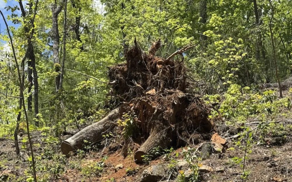
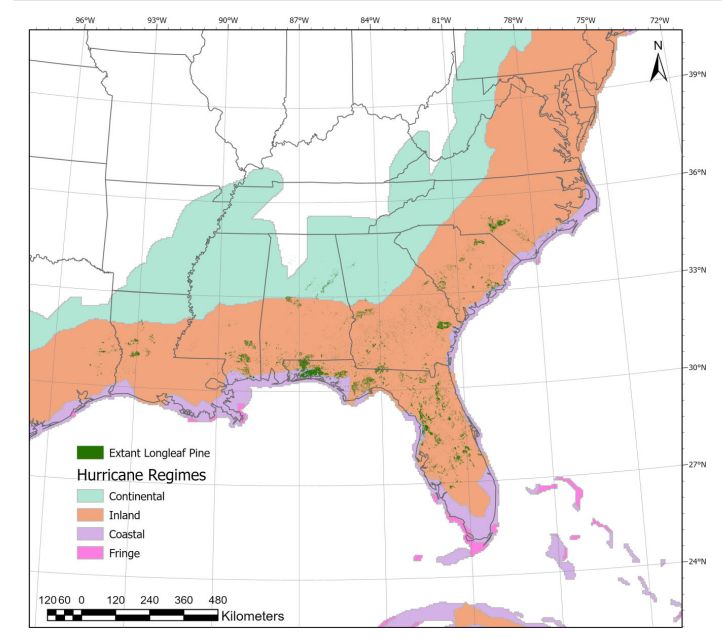
🔥 New study: 85% of remaining #LongleafPine habitat faces tropical storm-force winds every 6 years. We explore how #storms, #fire, insects, and salvage logging interact to shape resilience—and what managers can do about it. bit.ly/44QK3Uk Led by @nzampieri.bsky.social
July 7, 2025 at 1:20 PM
🔥 New study: 85% of remaining #LongleafPine habitat faces tropical storm-force winds every 6 years. We explore how #storms, #fire, insects, and salvage logging interact to shape resilience—and what managers can do about it. bit.ly/44QK3Uk Led by @nzampieri.bsky.social
How do we protect pecans from hurricane damage? Check out this new study with Lenny Wells on mitigating hurricane risk in pecan! A focus on pruning and orchard age diversity can provide meaningful mitigation. Thanks to the all the growers who helped us out with this fun study! bit.ly/3I9VjlR
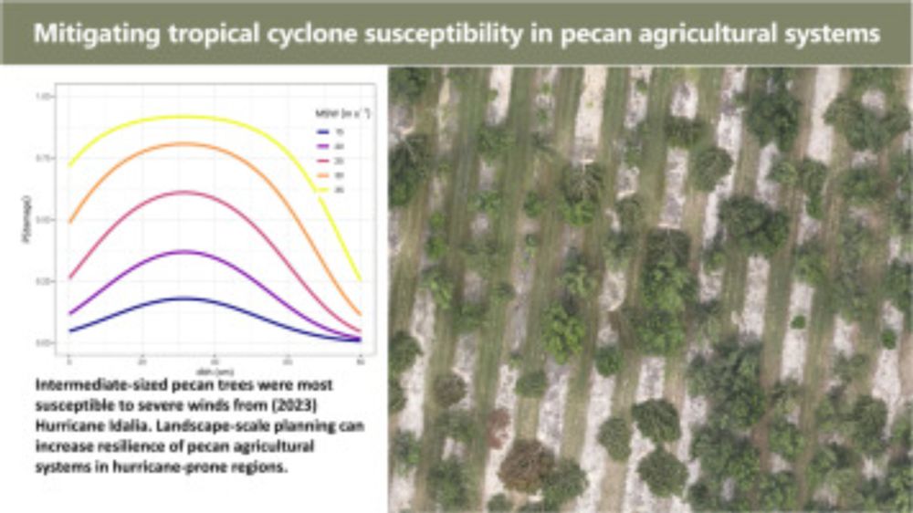
Mitigating tropical cyclone susceptibility in pecan (Carya illinoinensis) orchards
The production of tree nuts such as almonds, walnuts, pistachios, and pecans is a globally important agricultural industry. Climate risk posed to tree…
bit.ly
June 23, 2025 at 3:07 PM
How do we protect pecans from hurricane damage? Check out this new study with Lenny Wells on mitigating hurricane risk in pecan! A focus on pruning and orchard age diversity can provide meaningful mitigation. Thanks to the all the growers who helped us out with this fun study! bit.ly/3I9VjlR
Please share! JOIN THE LAB! We are looking to recruit a motivated reserach technician to assist with field research on restoration and lidar data collection in #longleaf pine at the beautiful @thejonesctr.bsky.social Apps due July 6 jonesctr.org/wp-content/u...
June 20, 2025 at 11:49 AM
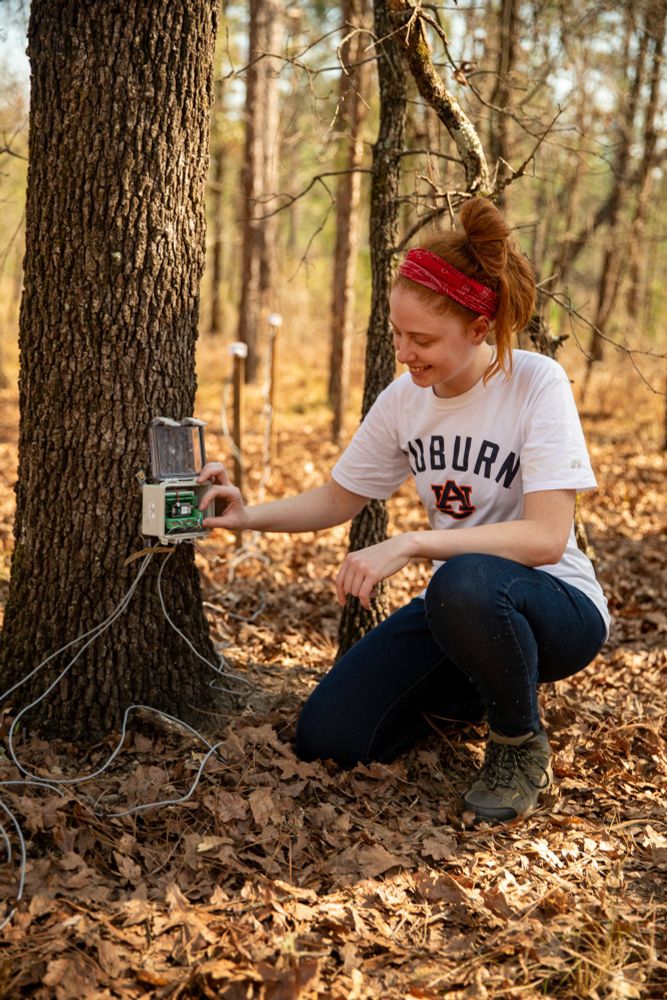
Please share! JOIN THE LAB! We are looking to recruit a motivated reserach technician to assist with field research on restoration and lidar data collection in #longleaf pine at the beautiful @thejonesctr.bsky.social Apps due July 6 jonesctr.org/wp-content/u...
I'm reposting my tutorials for learning #LiDAR in #R as I migrate to BlueSky! Here is Part 7of my 7-part series to help you get started! Module 7 puts everything together to learn parallel processing for large-scale analysis! t.co/VldnROjXm2
February 10, 2025 at 4:49 PM
I'm reposting my tutorials for learning #LiDAR in #R as I migrate to BlueSky! Here is Part 7of my 7-part series to help you get started! Module 7 puts everything together to learn parallel processing for large-scale analysis! t.co/VldnROjXm2
Please RT and share! JOIN THE LAB! We are looking to recruit a motivated PhD student to study how fire shapes forest dynamics in #longleaf pine at the beautiful @thejonesctr.bsky.social with Dr. Heather Alexander Auburn University. Apps due Feb 28, 2025. www.jonesctr.org/wp-content/u...
February 6, 2025 at 6:07 PM
Please RT and share! JOIN THE LAB! We are looking to recruit a motivated PhD student to study how fire shapes forest dynamics in #longleaf pine at the beautiful @thejonesctr.bsky.social with Dr. Heather Alexander Auburn University. Apps due Feb 28, 2025. www.jonesctr.org/wp-content/u...
I'm reposting my tutorials for learning #LiDAR in #R as I migrate to BlueSky! Here is Part 6 of a 7-part series to help you get started! Module 6 helps you scale-up to work with #big data# sets bit.ly/3VzGltW
February 6, 2025 at 2:06 PM
I'm reposting my tutorials for learning #LiDAR in #R as I migrate to BlueSky! Here is Part 6 of a 7-part series to help you get started! Module 6 helps you scale-up to work with #big data# sets bit.ly/3VzGltW
This week, I'm reposting my tutorials for learning
#LiDAR in #R as I migrate to BlueSky! Here is Part 5 of a 7-part series to help you get started! Module 5 teaches you how to speed up analyses with reduced LiDAR datasets! bit.ly/lidR-module5
#LiDAR in #R as I migrate to BlueSky! Here is Part 5 of a 7-part series to help you get started! Module 5 teaches you how to speed up analyses with reduced LiDAR datasets! bit.ly/lidR-module5
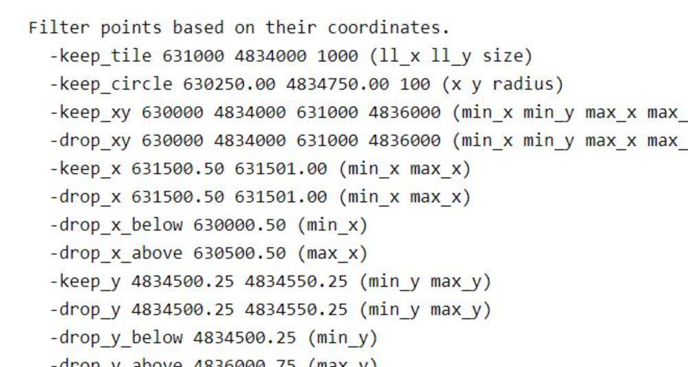
Module 5: Speeding up your analyses: Reduced datasets - The Jones Center at Ichauway Research Labs
If you are interested in learning to use LiDAR for forestry and natural resources, this tutorial can help you get started. You will learn ways to help speed up and super charge your LiDAR analyses. Th...
bit.ly
January 13, 2025 at 1:54 PM
This week, I'm reposting my tutorials for learning
#LiDAR in #R as I migrate to BlueSky! Here is Part 5 of a 7-part series to help you get started! Module 5 teaches you how to speed up analyses with reduced LiDAR datasets! bit.ly/lidR-module5
#LiDAR in #R as I migrate to BlueSky! Here is Part 5 of a 7-part series to help you get started! Module 5 teaches you how to speed up analyses with reduced LiDAR datasets! bit.ly/lidR-module5
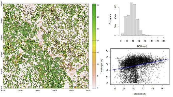
This week, I'm reposting my tutorials for learning #LiDAR in #R as I migrate to BlueSky! Here is Part 4 of a 7-part series to get started! Share with anyone you know who wants to get started. Module 4 covers answering ecological questions with LiDAR data! bit.ly/lidR-module4
January 9, 2025 at 12:29 PM
This week, I'm reposting my tutorials for learning #LiDAR in #R as I migrate to BlueSky! Here is Part 4 of a 7-part series to get started! Share with anyone you know who wants to get started. Module 4 covers answering ecological questions with LiDAR data! bit.ly/lidR-module4
Please repost and share! Come work and learn with us! We are hiring a motivated #geospatial #analyst to work with #UAV, #drones, and #Lidar in longleaf pine forests! Apps due Feb 21 and reviewed immediately. Remote arragements considered for applicants based in the region. t.co/Gv7UdVvt97

January 8, 2025 at 2:01 PM
Please repost and share! Come work and learn with us! We are hiring a motivated #geospatial #analyst to work with #UAV, #drones, and #Lidar in longleaf pine forests! Apps due Feb 21 and reviewed immediately. Remote arragements considered for applicants based in the region. t.co/Gv7UdVvt97
This week, I'm reposting my tutorials for learning #LiDAR
in #R as I migrate to BlueSky! Here is Part 3 of a 7-part series to help you get started! Share with anyone you know who wants to get started. Module 3 covers mapping trees from aerial LiDAR data! bit.ly/lidR-module3
in #R as I migrate to BlueSky! Here is Part 3 of a 7-part series to help you get started! Share with anyone you know who wants to get started. Module 3 covers mapping trees from aerial LiDAR data! bit.ly/lidR-module3
January 8, 2025 at 12:05 PM
This week, I'm reposting my tutorials for learning #LiDAR
in #R as I migrate to BlueSky! Here is Part 3 of a 7-part series to help you get started! Share with anyone you know who wants to get started. Module 3 covers mapping trees from aerial LiDAR data! bit.ly/lidR-module3
in #R as I migrate to BlueSky! Here is Part 3 of a 7-part series to help you get started! Share with anyone you know who wants to get started. Module 3 covers mapping trees from aerial LiDAR data! bit.ly/lidR-module3
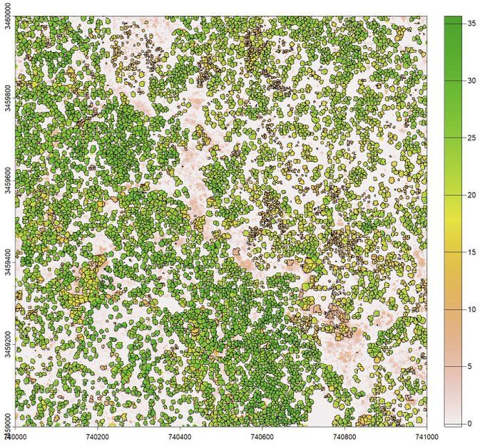
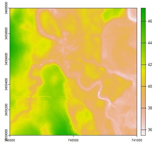
This week, I'm reposting my tutorials for learning #LiDAR in #R as I migrate to BlueSky! Here is Part 2 of a 7-part series to get started! Share with anyone you know who wants to get started. Module 2 covers creating raster products like elevation maps! bit.ly/lidR-module2
January 7, 2025 at 11:53 AM
This week, I'm reposting my tutorials for learning #LiDAR in #R as I migrate to BlueSky! Here is Part 2 of a 7-part series to get started! Share with anyone you know who wants to get started. Module 2 covers creating raster products like elevation maps! bit.ly/lidR-module2
Ready to learn how to use LiDAR for research in #forestry and natural resources using #R? This week I am sharing our 7-part series on Bluesky to help you get started! Share with anyone you know who wants to get started. Part 1 covers acquiring, & viewing LiDAR data! bit.ly/lidR-module1
January 6, 2025 at 3:33 PM
Ready to learn how to use LiDAR for research in #forestry and natural resources using #R? This week I am sharing our 7-part series on Bluesky to help you get started! Share with anyone you know who wants to get started. Part 1 covers acquiring, & viewing LiDAR data! bit.ly/lidR-module1
Check out a podcast episode that covers some of our recent work covered in #FireEcology on how individual trees can micro-engineer their enviornment and change how fire behaves. This podcast is also a fun way to catch up on current research in the field of fire ecology.
NEW EPISODE of #FireEcology Chats!🔥🎙️Bob Keane joins Heather Alexander and Jeffery Cannon @jefferybcannon.bsky.social to discuss reintroducing fire into mixed pine woodlands after fire exclusion. #SNFECO
Listen here: ow.ly/8hyy50UAkgK
Listen here: ow.ly/8hyy50UAkgK

January 6, 2025 at 3:27 PM
Check out a podcast episode that covers some of our recent work covered in #FireEcology on how individual trees can micro-engineer their enviornment and change how fire behaves. This podcast is also a fun way to catch up on current research in the field of fire ecology.