


LiDAR Pros
@thelidarpros.bsky.social
Scanning the world one point at a time. Imaging science meets lasers and precision.
We provide LiDAR and photogrammetry equipment sales, training, and services. 702-763-5001 covering UT, NV, SoCal, AZ, OR, WA, ID
We provide LiDAR and photogrammetry equipment sales, training, and services. 702-763-5001 covering UT, NV, SoCal, AZ, OR, WA, ID
Join our partners from @sundancemediagroup.bsky.social for their October #online workshops.
#BOGO pricing until EoD tomorrow. What are you waiting for?
#BOGO pricing until EoD tomorrow. What are you waiting for?

It's the last day of #BOGO pricing! YES - buy one seat get one free for our Oct 21 or Oct 28th online workshops.
Hope to see you there!
Getting the Best Image from UAS Cameras
smg_uaimagewebinar2025.eventbrite.com
Mastering UAS Flight in Urban Turbulence
smgurbanturbulanceoct2025.eventbrite.com
Hope to see you there!
Getting the Best Image from UAS Cameras
smg_uaimagewebinar2025.eventbrite.com
Mastering UAS Flight in Urban Turbulence
smgurbanturbulanceoct2025.eventbrite.com


September 29, 2025 at 8:35 PM
Join our partners from @sundancemediagroup.bsky.social for their October #online workshops.
#BOGO pricing until EoD tomorrow. What are you waiting for?
#BOGO pricing until EoD tomorrow. What are you waiting for?
Only 7 days until the show! #CUAV2025.
Will you be there? Join us and SAVE $100 on your FULL CONFERENCE badge or use the promo code for FREE Exhibit Hall access. Find us in booth #438!
Promo Code: SAVE100
Will you be there? Join us and SAVE $100 on your FULL CONFERENCE badge or use the promo code for FREE Exhibit Hall access. Find us in booth #438!
Promo Code: SAVE100

August 26, 2025 at 4:35 PM
Only 7 days until the show! #CUAV2025.
Will you be there? Join us and SAVE $100 on your FULL CONFERENCE badge or use the promo code for FREE Exhibit Hall access. Find us in booth #438!
Promo Code: SAVE100
Will you be there? Join us and SAVE $100 on your FULL CONFERENCE badge or use the promo code for FREE Exhibit Hall access. Find us in booth #438!
Promo Code: SAVE100
MORE #Training workshops from our partners
@sundancemediagroup.bsky.social the VERY popular #nightuavflight!
Join us for #practical #flight training...in the field..at #night.
Night UAV Flight Workshop (Theory + Field)
Thursday, September 4, 2025 - 2:30 PM – 10:30 PM PDT
bit.ly/CUAV25_SMGNi...
@sundancemediagroup.bsky.social the VERY popular #nightuavflight!
Join us for #practical #flight training...in the field..at #night.
Night UAV Flight Workshop (Theory + Field)
Thursday, September 4, 2025 - 2:30 PM – 10:30 PM PDT
bit.ly/CUAV25_SMGNi...

August 20, 2025 at 6:32 PM
MORE #Training workshops from our partners
@sundancemediagroup.bsky.social the VERY popular #nightuavflight!
Join us for #practical #flight training...in the field..at #night.
Night UAV Flight Workshop (Theory + Field)
Thursday, September 4, 2025 - 2:30 PM – 10:30 PM PDT
bit.ly/CUAV25_SMGNi...
@sundancemediagroup.bsky.social the VERY popular #nightuavflight!
Join us for #practical #flight training...in the field..at #night.
Night UAV Flight Workshop (Theory + Field)
Thursday, September 4, 2025 - 2:30 PM – 10:30 PM PDT
bit.ly/CUAV25_SMGNi...
Coming for #CUAV2025? Check out #Training workshops from our partners @sundancemediagroup.bsky.social
BRING YOUR LAPTOP and learn #Pix4D before the show opens!
Pix4D For Construction, Inspection, Survey, and Cinema
Tuesday, September 2, 2025
Read more and register here:
bit.ly/CUAV2025_Pix...
BRING YOUR LAPTOP and learn #Pix4D before the show opens!
Pix4D For Construction, Inspection, Survey, and Cinema
Tuesday, September 2, 2025
Read more and register here:
bit.ly/CUAV2025_Pix...

August 20, 2025 at 4:30 PM
Coming for #CUAV2025? Check out #Training workshops from our partners @sundancemediagroup.bsky.social
BRING YOUR LAPTOP and learn #Pix4D before the show opens!
Pix4D For Construction, Inspection, Survey, and Cinema
Tuesday, September 2, 2025
Read more and register here:
bit.ly/CUAV2025_Pix...
BRING YOUR LAPTOP and learn #Pix4D before the show opens!
Pix4D For Construction, Inspection, Survey, and Cinema
Tuesday, September 2, 2025
Read more and register here:
bit.ly/CUAV2025_Pix...
COUNTING DOWN to #CUAV2025!
There are SO many reasons to join @sundancemediagroup.bsky.social & our #TLP team at Commercial UAV Expo 2025!
ONE BIG REASON! FREE EXHIBIT HALL PASS with promo code SAVE100! Hope to see you there - we're in booth #438.
www.expouav.com
@commercialuavnews.bsky.social
There are SO many reasons to join @sundancemediagroup.bsky.social & our #TLP team at Commercial UAV Expo 2025!
ONE BIG REASON! FREE EXHIBIT HALL PASS with promo code SAVE100! Hope to see you there - we're in booth #438.
www.expouav.com
@commercialuavnews.bsky.social

August 19, 2025 at 5:12 PM
COUNTING DOWN to #CUAV2025!
There are SO many reasons to join @sundancemediagroup.bsky.social & our #TLP team at Commercial UAV Expo 2025!
ONE BIG REASON! FREE EXHIBIT HALL PASS with promo code SAVE100! Hope to see you there - we're in booth #438.
www.expouav.com
@commercialuavnews.bsky.social
There are SO many reasons to join @sundancemediagroup.bsky.social & our #TLP team at Commercial UAV Expo 2025!
ONE BIG REASON! FREE EXHIBIT HALL PASS with promo code SAVE100! Hope to see you there - we're in booth #438.
www.expouav.com
@commercialuavnews.bsky.social
Other sessions can be found at my speaker's page:
www.nabshow.com/speaker/doug...
www.nabshow.com/speaker/doug...

Douglas Spotted Eagle - NAB Show
Douglas Spotted Eagle is a giant in the video and audio industries, having received Grammy, Emmy, DuPont, Peabody, and many other awards. Douglas is the Director of Educational Programming for Sundanc...
www.nabshow.com
March 25, 2025 at 9:22 PM
Other sessions can be found at my speaker's page:
www.nabshow.com/speaker/doug...
www.nabshow.com/speaker/doug...
For those heading to NAB, I've got a couple of sessions that still have discounts available.
Budget Powered for Audio: registration.experientevent.com/ShowNAB251/F...
Budget Powered for Lighting: registration.experientevent.com/ShowNAB251/F...
Budget Powered for Audio: registration.experientevent.com/ShowNAB251/F...
Budget Powered for Lighting: registration.experientevent.com/ShowNAB251/F...

2025 NAB Show
registration.experientevent.com
March 25, 2025 at 9:21 PM
For those heading to NAB, I've got a couple of sessions that still have discounts available.
Budget Powered for Audio: registration.experientevent.com/ShowNAB251/F...
Budget Powered for Lighting: registration.experientevent.com/ShowNAB251/F...
Budget Powered for Audio: registration.experientevent.com/ShowNAB251/F...
Budget Powered for Lighting: registration.experientevent.com/ShowNAB251/F...
This is precisely why we don't hand-catch UAS. Especially not in high winds
#dronesafety
#safelanding
#AEC
#mapping
#survey
#dronesafety
#safelanding
#AEC
#mapping
#survey

February 27, 2025 at 11:13 PM
This is precisely why we don't hand-catch UAS. Especially not in high winds
#dronesafety
#safelanding
#AEC
#mapping
#survey
#dronesafety
#safelanding
#AEC
#mapping
#survey
From Southern Utah to Seattle in two days, we are here to speak on UAS in construction and survey. See you at the sessions!!

February 27, 2025 at 10:51 PM
From Southern Utah to Seattle in two days, we are here to speak on UAS in construction and survey. See you at the sessions!!


February 21, 2025 at 3:02 PM
Just processed this in #Pix4dMatic during the UCLS survey show in Southern Utah. Amazing how clean pointclouds can be with the right camera.
#theLiDARPROs
#LiDARScan
#HDS
#ConstructionEfficiency
#Mapping
#Photogrammetry
#pointcloud
#theLiDARPROs
#LiDARScan
#HDS
#ConstructionEfficiency
#Mapping
#Photogrammetry
#pointcloud

February 19, 2025 at 11:58 PM
Just processed this in #Pix4dMatic during the UCLS survey show in Southern Utah. Amazing how clean pointclouds can be with the right camera.
#theLiDARPROs
#LiDARScan
#HDS
#ConstructionEfficiency
#Mapping
#Photogrammetry
#pointcloud
#theLiDARPROs
#LiDARScan
#HDS
#ConstructionEfficiency
#Mapping
#Photogrammetry
#pointcloud
Happy to be at the Utah UCLS Conference in St. George, UT! bit.ly/4baCsSs
Our team is running the UAS track for the conference; come find us all day tomorrow in BallRooms A/B. Four sessions all day, plus live flight!
Our team is running the UAS track for the conference; come find us all day tomorrow in BallRooms A/B. Four sessions all day, plus live flight!
UCLS Annual Conference February 19-21, 2025 in St. George, Utah
bit.ly
February 19, 2025 at 9:47 PM
Happy to be at the Utah UCLS Conference in St. George, UT! bit.ly/4baCsSs
Our team is running the UAS track for the conference; come find us all day tomorrow in BallRooms A/B. Four sessions all day, plus live flight!
Our team is running the UAS track for the conference; come find us all day tomorrow in BallRooms A/B. Four sessions all day, plus live flight!
71-year-old Canadian tourist could face up to 3 years in prison for using drone to photograph Cape Canaveral military base
flip.it/6EGY9s
flip.it/6EGY9s

71-year-old Canadian tourist could face up to 3 years in prison for using drone to photograph Cape Canaveral military base
Xiao Guang Pan was originally born in China, and immigrated to Canada in 2001
flip.it
February 18, 2025 at 8:50 PM
71-year-old Canadian tourist could face up to 3 years in prison for using drone to photograph Cape Canaveral military base
flip.it/6EGY9s
flip.it/6EGY9s


Duffy Blames Midair Crash On DEI, Terminology
flip.it/GtAi.B
This simply cannot be accurate. He's obviously unfamiliar with aviation terminology.
flip.it/GtAi.B
This simply cannot be accurate. He's obviously unfamiliar with aviation terminology.

Duffy Blames Midair Crash On DEI, Terminology
Transportation Secretary Sean Duffy says using the phrase "flight deck" instead of "cockpit" caused the midair collision last week.
flip.it
February 4, 2025 at 11:08 PM
Duffy Blames Midair Crash On DEI, Terminology
flip.it/GtAi.B
This simply cannot be accurate. He's obviously unfamiliar with aviation terminology.
flip.it/GtAi.B
This simply cannot be accurate. He's obviously unfamiliar with aviation terminology.
Video Game Exec Pleads Guilty to Crashing Drone Into Firefighting Plane During LA Wildfires
flip.it/IsMzJV
flip.it/IsMzJV

Video Game Exec Pleads Guilty to Crashing Drone Into Firefighting Plane During LA Wildfires
He'll pay almost $70,000 to repair the plane and do 150 hours of community service.
flip.it
February 4, 2025 at 6:13 PM
Video Game Exec Pleads Guilty to Crashing Drone Into Firefighting Plane During LA Wildfires
flip.it/IsMzJV
flip.it/IsMzJV
if you haven't caught the story of the LA (canadian) fireplane/UA collision; here it is.
www.cnn.com/2025/01/10/u...
www.cnn.com/2025/01/10/u...

Canadian ‘Super Scooper’ plane grounded after hitting civilian drone over Los Angeles wildfires | CNN
A Canadian “Super Scooper” aircraft fighting the Palisades Fire in Los Angeles had to be grounded after it hit a drone flying in restricted airspace over the devastating blaze on Thursday, the local f...
www.cnn.com
January 18, 2025 at 1:52 AM
if you haven't caught the story of the LA (canadian) fireplane/UA collision; here it is.
www.cnn.com/2025/01/10/u...
www.cnn.com/2025/01/10/u...
Note that the most intact part of the UA is the battery. Batteries are harder than a softball. Softballs at speed will break windshields and do significant harm.
This is what Dick flew during a TFR.
Lives depend on you not being a Dick.
This is what Dick flew during a TFR.
Lives depend on you not being a Dick.

January 18, 2025 at 1:50 AM
Note that the most intact part of the UA is the battery. Batteries are harder than a softball. Softballs at speed will break windshields and do significant harm.
This is what Dick flew during a TFR.
Lives depend on you not being a Dick.
This is what Dick flew during a TFR.
Lives depend on you not being a Dick.
This is the drone found inside the wing of a firebombing plane. It punched through the leading edge of a wing.
As fire fighters say, "If you're flying, we can't be flying."
Keep your UA/drone on the ground, even if you believe "that little thing can't cause harm"
#drones4good
#dronesafety
#UAS
As fire fighters say, "If you're flying, we can't be flying."
Keep your UA/drone on the ground, even if you believe "that little thing can't cause harm"
#drones4good
#dronesafety
#UAS
January 18, 2025 at 1:48 AM
This is the drone found inside the wing of a firebombing plane. It punched through the leading edge of a wing.
As fire fighters say, "If you're flying, we can't be flying."
Keep your UA/drone on the ground, even if you believe "that little thing can't cause harm"
#drones4good
#dronesafety
#UAS
As fire fighters say, "If you're flying, we can't be flying."
Keep your UA/drone on the ground, even if you believe "that little thing can't cause harm"
#drones4good
#dronesafety
#UAS
youtu.be/oykkHwGKXk0
Engineering LiDAR at it's finest, yet very affordable.
#LiDAR
#Photogrammetry
#Pointcloud
#Stem
#UAS
#Geocue
#WomeninStem
#WomenandDrones
#CommUAV
Engineering LiDAR at it's finest, yet very affordable.
#LiDAR
#Photogrammetry
#Pointcloud
#Stem
#UAS
#Geocue
#WomeninStem
#WomenandDrones
#CommUAV

Which LiDAR Sensor is Right for Me?
YouTube video by The LiDAR Pros
youtu.be
January 16, 2025 at 10:07 PM
youtu.be/oykkHwGKXk0
Engineering LiDAR at it's finest, yet very affordable.
#LiDAR
#Photogrammetry
#Pointcloud
#Stem
#UAS
#Geocue
#WomeninStem
#WomenandDrones
#CommUAV
Engineering LiDAR at it's finest, yet very affordable.
#LiDAR
#Photogrammetry
#Pointcloud
#Stem
#UAS
#Geocue
#WomeninStem
#WomenandDrones
#CommUAV
check out this open pit manganese mine about to be reclaimed.
Captured with the Wingtra RGB61 camera, this map provides topography and fill data to the GC.
cloud.pix4d.com/site/276910/...
#womeninSTEM
#STEM
#WomenandDrones
#SundanceMediaGroup
#AEC
#Mining
#reclamation
#CostSavings
Captured with the Wingtra RGB61 camera, this map provides topography and fill data to the GC.
cloud.pix4d.com/site/276910/...
#womeninSTEM
#STEM
#WomenandDrones
#SundanceMediaGroup
#AEC
#Mining
#reclamation
#CostSavings
PIX4Dcloud
Advanced photogrammetry software that uses images to create professional orthomosaics, point clouds, models and more.
cloud.pix4d.com
January 16, 2025 at 9:27 PM
check out this open pit manganese mine about to be reclaimed.
Captured with the Wingtra RGB61 camera, this map provides topography and fill data to the GC.
cloud.pix4d.com/site/276910/...
#womeninSTEM
#STEM
#WomenandDrones
#SundanceMediaGroup
#AEC
#Mining
#reclamation
#CostSavings
Captured with the Wingtra RGB61 camera, this map provides topography and fill data to the GC.
cloud.pix4d.com/site/276910/...
#womeninSTEM
#STEM
#WomenandDrones
#SundanceMediaGroup
#AEC
#Mining
#reclamation
#CostSavings
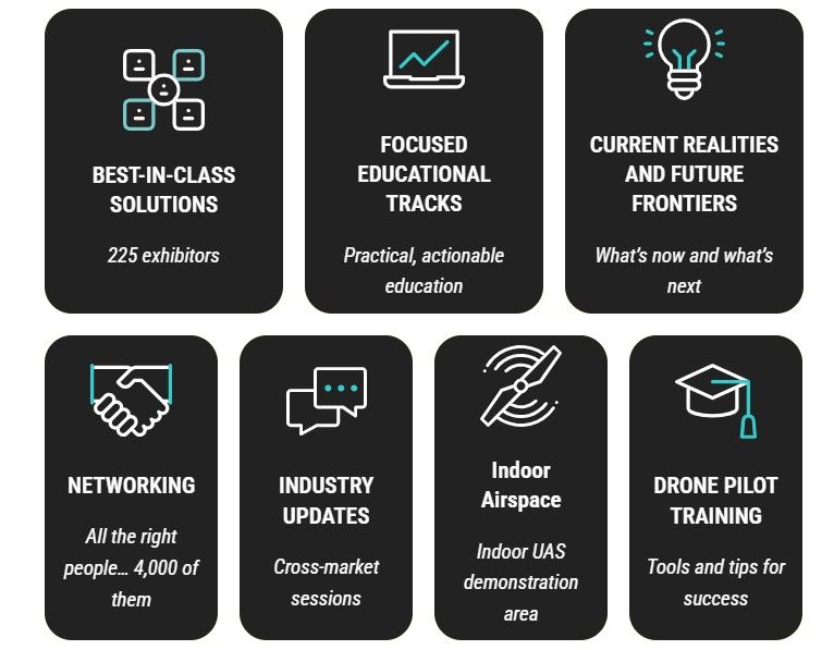
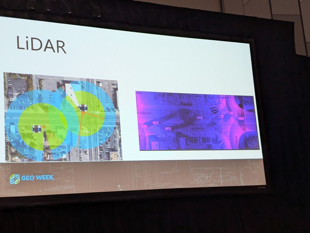
Catch up with us at Geoweek!
www.geo-week.com?gad_source=1...
www.geo-week.com?gad_source=1...

January 15, 2025 at 1:42 AM
Catch up with us at Geoweek!
www.geo-week.com?gad_source=1...
www.geo-week.com?gad_source=1...
This is the new Sony ILX camera. Zoom in deep to see the detail a high-quality sensor provides. Accurate to a centimeter on ground
cloud.pix4d.com/dataset/1917...
#STEM
#WomeninSTEM
#WomenandDrones
#Photogrammetry
#AerialMapping
#Sony
#SundanceMediaGroup
#PointCloud
#Surveygrade
cloud.pix4d.com/dataset/1917...
#STEM
#WomeninSTEM
#WomenandDrones
#Photogrammetry
#AerialMapping
#Sony
#SundanceMediaGroup
#PointCloud
#Surveygrade
PIX4Dcloud
Advanced photogrammetry software that uses images to create professional orthomosaics, point clouds, models and more.
cloud.pix4d.com
January 15, 2025 at 1:40 AM
This is the new Sony ILX camera. Zoom in deep to see the detail a high-quality sensor provides. Accurate to a centimeter on ground
cloud.pix4d.com/dataset/1917...
#STEM
#WomeninSTEM
#WomenandDrones
#Photogrammetry
#AerialMapping
#Sony
#SundanceMediaGroup
#PointCloud
#Surveygrade
cloud.pix4d.com/dataset/1917...
#STEM
#WomeninSTEM
#WomenandDrones
#Photogrammetry
#AerialMapping
#Sony
#SundanceMediaGroup
#PointCloud
#Surveygrade
This egg farm scan shows why small sensors aren't ideal for aerial mapping. .5 sensors aren't made for any kind of serious mapping or accuracy. We ended up "fixing" this for the client. Tho not perfect, it's not bad.
cloud.pix4d.com/dataset/1016...
#DronesforGood
#STEM
cloud.pix4d.com/dataset/1016...
#DronesforGood
#STEM
PIX4Dcloud
Advanced photogrammetry software that uses images to create professional orthomosaics, point clouds, models and more.
cloud.pix4d.com
January 15, 2025 at 1:36 AM
This egg farm scan shows why small sensors aren't ideal for aerial mapping. .5 sensors aren't made for any kind of serious mapping or accuracy. We ended up "fixing" this for the client. Tho not perfect, it's not bad.
cloud.pix4d.com/dataset/1016...
#DronesforGood
#STEM
cloud.pix4d.com/dataset/1016...
#DronesforGood
#STEM