


Thijs van der Plas
@vdplasthijs.bsky.social
Post-doc (AI for monitoring ecosystems) @ AI group, WUR. Previously Oxford DPhil, The Alan Turing Institute & Peak District NP. vdplasthijs.github.io
Our perspective on deployment-centric, multimodal AI beyond vision and language is now out in Nature Machine Intelligence!
www.nature.com/articles/s42...
www.nature.com/articles/s42...

Towards deployment-centric multimodal AI beyond vision and language - Nature Machine Intelligence
Multimodal AI combines different types of data to improve decision-making in fields such as healthcare and engineering, but work so far has focused on vision and language models. To make these systems...
www.nature.com
October 22, 2025 at 12:46 PM
Our perspective on deployment-centric, multimodal AI beyond vision and language is now out in Nature Machine Intelligence!
www.nature.com/articles/s42...
www.nature.com/articles/s42...
Can LLMs do our 'digital dishes'? Or in other words, what are tedious, small tasks that researchers often face and could be automated by LLMs? We've worked on one such task: extracting dataset metadata and converting these to a single format to build a dataset knowledge base. [1/5]
October 7, 2025 at 11:47 AM
Can LLMs do our 'digital dishes'? Or in other words, what are tedious, small tasks that researchers often face and could be automated by LLMs? We've worked on one such task: extracting dataset metadata and converting these to a single format to build a dataset knowledge base. [1/5]
Great read from Michael Pocock: Linking remote sensing, citizen science data and AI could transform environmental monitoring | UK Centre for Ecology & Hydrology www.ceh.ac.uk/news-and-med...
Linking remote sensing, citizen science data and AI could transform environmental monitoring
In our new paper, published in Ecological Solutions and Evidence, we provided a perspective on how three areas of science – remote sensing, citizen science, and machine learning (a form of AI) – could...
www.ceh.ac.uk
July 15, 2025 at 9:04 AM
Great read from Michael Pocock: Linking remote sensing, citizen science data and AI could transform environmental monitoring | UK Centre for Ecology & Hydrology www.ceh.ac.uk/news-and-med...
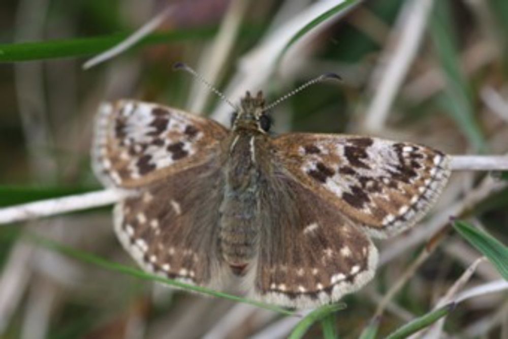
Published last week at the CVPR FGVC Workshop; our paper on "Predicting butterfly species presence from satellite imagery using soft contrastive regularisation".
PDF (with links to data/code) available here:
openaccess.thecvf.com/content/CVPR...
PDF (with links to data/code) available here:
openaccess.thecvf.com/content/CVPR...
CVPR 2025 Open Access Repository
openaccess.thecvf.com
June 17, 2025 at 9:57 AM
Published last week at the CVPR FGVC Workshop; our paper on "Predicting butterfly species presence from satellite imagery using soft contrastive regularisation".
PDF (with links to data/code) available here:
openaccess.thecvf.com/content/CVPR...
PDF (with links to data/code) available here:
openaccess.thecvf.com/content/CVPR...
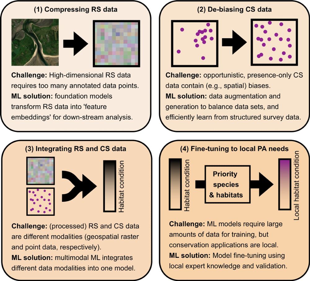
In our latest perspective article, we outline how ML can overcome 4 current obstacles for large-scale, high-resolution monitoring of protected areas.
doi.org/10.1002/2688...
Hope this stimulates the conversation and provides a pathway of how ML research can be applied for monitoring PAs at scale.
doi.org/10.1002/2688...
Hope this stimulates the conversation and provides a pathway of how ML research can be applied for monitoring PAs at scale.
May 20, 2025 at 8:41 AM
In our latest perspective article, we outline how ML can overcome 4 current obstacles for large-scale, high-resolution monitoring of protected areas.
doi.org/10.1002/2688...
Hope this stimulates the conversation and provides a pathway of how ML research can be applied for monitoring PAs at scale.
doi.org/10.1002/2688...
Hope this stimulates the conversation and provides a pathway of how ML research can be applied for monitoring PAs at scale.
Reposted by Thijs van der Plas

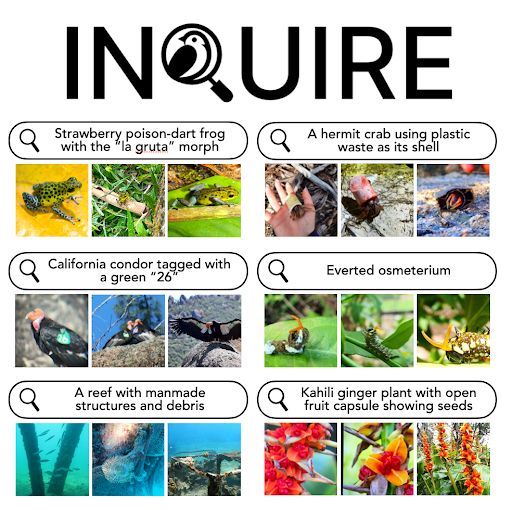
🎯 How can we empower scientific discovery in millions of nature photos?
Introducing INQUIRE: A benchmark testing if AI vision-language models can help scientists find biodiversity patterns- from disease symptoms to rare behaviors- hidden in vast image collections.
Thread👇🧵
Introducing INQUIRE: A benchmark testing if AI vision-language models can help scientists find biodiversity patterns- from disease symptoms to rare behaviors- hidden in vast image collections.
Thread👇🧵
December 6, 2024 at 8:28 PM
🎯 How can we empower scientific discovery in millions of nature photos?
Introducing INQUIRE: A benchmark testing if AI vision-language models can help scientists find biodiversity patterns- from disease symptoms to rare behaviors- hidden in vast image collections.
Thread👇🧵
Introducing INQUIRE: A benchmark testing if AI vision-language models can help scientists find biodiversity patterns- from disease symptoms to rare behaviors- hidden in vast image collections.
Thread👇🧵
Reposted by Thijs van der Plas
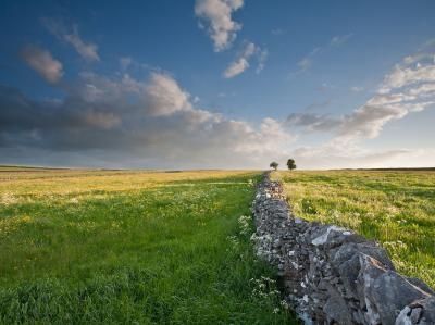
Using computer vision and #MapReader software, we analysed the loss of field boundaries across the #PeakDistrict Since the 1950s, the White Peak has seen a 12% reduction-551 km lost from an original 4,814 km. A stark reminder of landscape change 📊🌿 storymaps.arcgis.com/stories/5c89... #maps #GIS
Mapping the Past Against the Present
Past Landscapes, Present Discoveries: A Data Science Approach to Rediscovering Field Systems from Historic Ordnance Survey Maps
storymaps.arcgis.com
November 21, 2024 at 7:52 PM
Using computer vision and #MapReader software, we analysed the loss of field boundaries across the #PeakDistrict Since the 1950s, the White Peak has seen a 12% reduction-551 km lost from an original 4,814 km. A stark reminder of landscape change 📊🌿 storymaps.arcgis.com/stories/5c89... #maps #GIS