


Weathernet
@wxnet.bsky.social
Serving as the weather operations arm of The Narwhal Group, Weathernet provides 24/7 weather forecast services to hundreds of public and private sector clients across the United States and Canada.
https://linktr.ee/WxNet
https://linktr.ee/WxNet

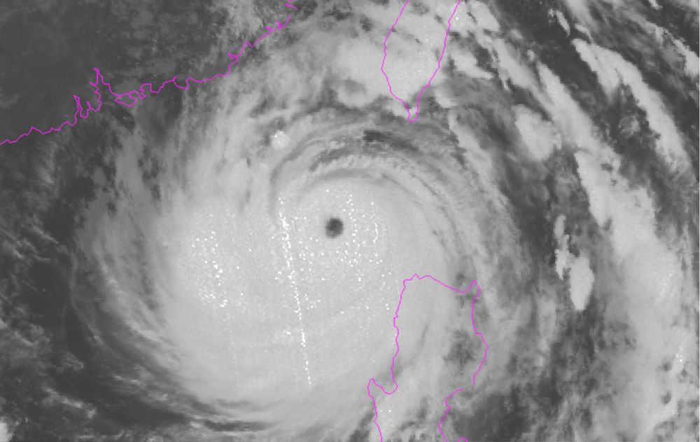
#Melissa has strengthened into a dangerous Category 5 hurricane with catastrophic impacts likely for Jamaica in the next couple of days! 🌀💨🌧️
It is currently moving slowly westward, but is expected to make a sharp turn north heading directly for the western portion of the island.
It is currently moving slowly westward, but is expected to make a sharp turn north heading directly for the western portion of the island.
October 27, 2025 at 3:58 PM
#Melissa has strengthened into a dangerous Category 5 hurricane with catastrophic impacts likely for Jamaica in the next couple of days! 🌀💨🌧️
It is currently moving slowly westward, but is expected to make a sharp turn north heading directly for the western portion of the island.
It is currently moving slowly westward, but is expected to make a sharp turn north heading directly for the western portion of the island.
A windstorm came through western Washington last night, impacting portions of the south Puget Sound region and the Olympic coastline. 💨
Areas by the North Bay recorded several gusts in the 70 mph range! #wawx
Areas by the North Bay recorded several gusts in the 70 mph range! #wawx

October 26, 2025 at 5:01 PM
A windstorm came through western Washington last night, impacting portions of the south Puget Sound region and the Olympic coastline. 💨
Areas by the North Bay recorded several gusts in the 70 mph range! #wawx
Areas by the North Bay recorded several gusts in the 70 mph range! #wawx
Many of the Cascade Passes have seen their first snow of the season over the past couple of days! This image was taken this morning over Blewett Pass where heavy snowfall rates have forced closures for both directions of travel.

October 13, 2025 at 3:50 PM
Many of the Cascade Passes have seen their first snow of the season over the past couple of days! This image was taken this morning over Blewett Pass where heavy snowfall rates have forced closures for both directions of travel.
For the first time in 12 years, a tornado has been rated an EF-5! 🌪️
A wedge tornado dropped near Enderlin, North Dakota on June 20th 2025 that tipped several fully-loaded train cars leading NWS experts to the conclusion that wind speeds exceeded 210 mph from this tornado #ndwx
A wedge tornado dropped near Enderlin, North Dakota on June 20th 2025 that tipped several fully-loaded train cars leading NWS experts to the conclusion that wind speeds exceeded 210 mph from this tornado #ndwx


October 6, 2025 at 6:38 PM
For the first time in 12 years, a tornado has been rated an EF-5! 🌪️
A wedge tornado dropped near Enderlin, North Dakota on June 20th 2025 that tipped several fully-loaded train cars leading NWS experts to the conclusion that wind speeds exceeded 210 mph from this tornado #ndwx
A wedge tornado dropped near Enderlin, North Dakota on June 20th 2025 that tipped several fully-loaded train cars leading NWS experts to the conclusion that wind speeds exceeded 210 mph from this tornado #ndwx
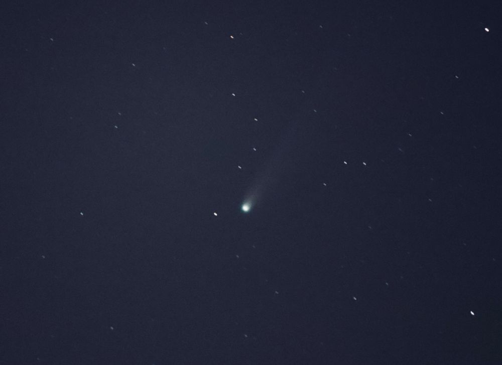
#Aurora Borealis was spotted across the northern U.S. states last night, as G3 storm conditions were reached! #spaceweather

October 2, 2025 at 4:34 PM
#Aurora Borealis was spotted across the northern U.S. states last night, as G3 storm conditions were reached! #spaceweather
A volcanic eruption is currently in progress at the Kilauea Volcano on the big island of Hawaii! 🌋
Large lava fountaining can be seen as the 34th eruptive episode since late December of 2024 is underway. #hiwx
Large lava fountaining can be seen as the 34th eruptive episode since late December of 2024 is underway. #hiwx

October 1, 2025 at 3:47 PM
A volcanic eruption is currently in progress at the Kilauea Volcano on the big island of Hawaii! 🌋
Large lava fountaining can be seen as the 34th eruptive episode since late December of 2024 is underway. #hiwx
Large lava fountaining can be seen as the 34th eruptive episode since late December of 2024 is underway. #hiwx
A current look from Tacoma right now as lenticular and asperitas clouds fill the sky as a new system approaches Western Washington! ☁️
Periods of rain and windy conditions are likely through Wednesday, especially near the Pacific coastline 🌧️ 💨 #wawx
Periods of rain and windy conditions are likely through Wednesday, especially near the Pacific coastline 🌧️ 💨 #wawx

September 30, 2025 at 10:44 PM
A current look from Tacoma right now as lenticular and asperitas clouds fill the sky as a new system approaches Western Washington! ☁️
Periods of rain and windy conditions are likely through Wednesday, especially near the Pacific coastline 🌧️ 💨 #wawx
Periods of rain and windy conditions are likely through Wednesday, especially near the Pacific coastline 🌧️ 💨 #wawx
Strong westerly winds due to a frontal passage intensified the #LaborMountainFire in Eastern Washington last night, as now it has burned over 25,000 acres! 💨🔥 #wawx

September 26, 2025 at 4:06 PM
Strong westerly winds due to a frontal passage intensified the #LaborMountainFire in Eastern Washington last night, as now it has burned over 25,000 acres! 💨🔥 #wawx
All eyes have been focused on the Atlantic off the Southeast U.S. coastline, as a couple tropical systems look to continue developing. 🌀
While Tropical Storm #Humberto does not pose a concern to the U.S. at this time, Invest #94L has a greater chance of landfall as it looks to form closer to shore
While Tropical Storm #Humberto does not pose a concern to the U.S. at this time, Invest #94L has a greater chance of landfall as it looks to form closer to shore


September 25, 2025 at 3:33 PM
Thursday will be a huge concern for #fire weather as a mid-level jet will bring strong westerly winds to Eastern WA/OR under low RH values during the afternoon and evening. 🔥
Active fires (particularly the #LaborMountainFire and #LowerSugarloafFire) will likely spread east #wawx #orwx
Active fires (particularly the #LaborMountainFire and #LowerSugarloafFire) will likely spread east #wawx #orwx


September 24, 2025 at 4:33 PM
Thursday will be a huge concern for #fire weather as a mid-level jet will bring strong westerly winds to Eastern WA/OR under low RH values during the afternoon and evening. 🔥
Active fires (particularly the #LaborMountainFire and #LowerSugarloafFire) will likely spread east #wawx #orwx
Active fires (particularly the #LaborMountainFire and #LowerSugarloafFire) will likely spread east #wawx #orwx
It is a beautiful fall morning across Western Washington today!
High temperatures will get up to the low to mid 70s with sunny skies ☀️ #wawx
High temperatures will get up to the low to mid 70s with sunny skies ☀️ #wawx

September 23, 2025 at 4:51 PM
It is a beautiful fall morning across Western Washington today!
High temperatures will get up to the low to mid 70s with sunny skies ☀️ #wawx
High temperatures will get up to the low to mid 70s with sunny skies ☀️ #wawx
A look at two tropical cyclones that are making the headlines recently - Hurricane #Gabrielle in the Atlantic and Super Typhoon #Ragasa in the Pacific! 🌀

September 22, 2025 at 9:36 PM
A look at two tropical cyclones that are making the headlines recently - Hurricane #Gabrielle in the Atlantic and Super Typhoon #Ragasa in the Pacific! 🌀

Sights of fall will be here before you know it, as peak fall color season is only a couple weeks away in the high country of Colorado! 🍁 #cowx

September 16, 2025 at 5:10 PM
Sights of fall will be here before you know it, as peak fall color season is only a couple weeks away in the high country of Colorado! 🍁 #cowx
Although the Seattle area is seeing some much needed rainfall today, breezy winds and reduced relative humidity have prompted the NWS to issue a fire weather watch on Sunday. These conditions allow for new fires to spark across the region or even cause existing fires to spread. #wawx #firewx

September 14, 2025 at 8:40 PM
Fire season rolls on across Washington as the WA department of natural resources is currently monitoring 19 separate wildfires. A pattern change over the next few weeks should bring some much needed rainfall across western Washington and begin to improve fire conditions across the region. #wawx

September 11, 2025 at 7:23 PM
Fire season rolls on across Washington as the WA department of natural resources is currently monitoring 19 separate wildfires. A pattern change over the next few weeks should bring some much needed rainfall across western Washington and begin to improve fire conditions across the region. #wawx
It was a chilly morning across the West Virginia high country, as the valley floor of Canaan Valley dropped down to 22 degrees! 🥶
This valley is a textbook cold sink with combining its bathtub topography, allows air to drain from the slopes and pool at the bottom on cool, calm, and clear nights.
This valley is a textbook cold sink with combining its bathtub topography, allows air to drain from the slopes and pool at the bottom on cool, calm, and clear nights.

September 9, 2025 at 4:17 PM
It was a chilly morning across the West Virginia high country, as the valley floor of Canaan Valley dropped down to 22 degrees! 🥶
This valley is a textbook cold sink with combining its bathtub topography, allows air to drain from the slopes and pool at the bottom on cool, calm, and clear nights.
This valley is a textbook cold sink with combining its bathtub topography, allows air to drain from the slopes and pool at the bottom on cool, calm, and clear nights.
Isolated severe #thunderstorms will be possible this afternoon and evening over portions of the Texas and Oklahoma panhandles as well as southwest Kansas! ⚡
The main concerns will be large hail and damaging winds. #okwx #kswx #txwx
The main concerns will be large hail and damaging winds. #okwx #kswx #txwx

September 8, 2025 at 5:51 PM
Isolated severe #thunderstorms will be possible this afternoon and evening over portions of the Texas and Oklahoma panhandles as well as southwest Kansas! ⚡
The main concerns will be large hail and damaging winds. #okwx #kswx #txwx
The main concerns will be large hail and damaging winds. #okwx #kswx #txwx
Hurricane #Kiko continues to churn out in the open Pacific, though thankfully will weaken with time and move just north of Hawaii out of harms way. However, portions of the islands will still receive rainfall and rough surf from the tropical system. 🌀


September 7, 2025 at 5:01 PM
Hurricane #Kiko continues to churn out in the open Pacific, though thankfully will weaken with time and move just north of Hawaii out of harms way. However, portions of the islands will still receive rainfall and rough surf from the tropical system. 🌀

Big changes are coming across the CONUS in the extended forecast, as a preview of fall is likely for the Eastern U.S as a cold front moves in beginning this weekend! 💨🍁
On the western side, monsoon season will make a comeback as well as a prolonged heat wave particularly in the Pacific Northwest ⛈️🔥
On the western side, monsoon season will make a comeback as well as a prolonged heat wave particularly in the Pacific Northwest ⛈️🔥


August 21, 2025 at 3:07 PM
Big changes are coming across the CONUS in the extended forecast, as a preview of fall is likely for the Eastern U.S as a cold front moves in beginning this weekend! 💨🍁
On the western side, monsoon season will make a comeback as well as a prolonged heat wave particularly in the Pacific Northwest ⛈️🔥
On the western side, monsoon season will make a comeback as well as a prolonged heat wave particularly in the Pacific Northwest ⛈️🔥
Hurricane #Erin has grown to a substantial size off the Eastern U.S. coastline as it begins to turn NE and become a major hurricane once again!
Despite not making landfall, storm surge and tropical storm conditions will be felt especially along the NC coast, where 2-4 feet of storm surge is likely.
Despite not making landfall, storm surge and tropical storm conditions will be felt especially along the NC coast, where 2-4 feet of storm surge is likely.


August 20, 2025 at 8:22 PM
Hurricane #Erin has grown to a substantial size off the Eastern U.S. coastline as it begins to turn NE and become a major hurricane once again!
Despite not making landfall, storm surge and tropical storm conditions will be felt especially along the NC coast, where 2-4 feet of storm surge is likely.
Despite not making landfall, storm surge and tropical storm conditions will be felt especially along the NC coast, where 2-4 feet of storm surge is likely.
