


wxornotBG
@wxornotbg.com
Community supported hyperlocal weather for the WABBLES™️ region of Kentucky.
We’re a real-time, weather monitoring prediction service for weather hazard emergency preparedness & awareness.
We’re a real-time, weather monitoring prediction service for weather hazard emergency preparedness & awareness.
Pinned
wxornotBG
@wxornotbg.com
· Nov 19
x.com
x.com
Thank you to our followers already joining us here on Bluesky!
A reminder that we are still trying to optimize our workflow with our existing social media accounts, so we graciously ask for your patience.
Of note, we’re not leaving X! Active weather coverage will be best there: x.com/wxornotbg
A reminder that we are still trying to optimize our workflow with our existing social media accounts, so we graciously ask for your patience.
Of note, we’re not leaving X! Active weather coverage will be best there: x.com/wxornotbg
Hovering near freezing for 2026's first night.

January 2, 2026 at 12:47 AM
Hovering near freezing for 2026's first night.
🎉 HAPPY 2026 Y’ALL 🎊
Partly to mostly sunny. Tranquil & cool.
Now 26° / High 50°
Partly to mostly sunny. Tranquil & cool.
Now 26° / High 50°
January 1, 2026 at 1:15 PM
🎉 HAPPY 2026 Y’ALL 🎊
Partly to mostly sunny. Tranquil & cool.
Now 26° / High 50°
Partly to mostly sunny. Tranquil & cool.
Now 26° / High 50°
Not a bad night to ring in the new year for WABBLES

December 31, 2025 at 9:24 PM
Not a bad night to ring in the new year for WABBLES

Sunny this morning with more clouds as the day progresses.
Cold start will be followed by warmer temperatures.
Now 25˚ / High 46˚
Cold start will be followed by warmer temperatures.
Now 25˚ / High 46˚
December 31, 2025 at 1:23 PM
Sunny this morning with more clouds as the day progresses.
Cold start will be followed by warmer temperatures.
Now 25˚ / High 46˚
Cold start will be followed by warmer temperatures.
Now 25˚ / High 46˚

Weather 12.31.2025
YouTube video by Weather or Not Bowling Green
www.youtube.com
December 31, 2025 at 12:02 PM
A distinct chill in the air this evening.

December 30, 2025 at 11:11 PM
A distinct chill in the air this evening.
Clouds on the decrease as the day progresses. Staying cold & windy, with gusts of 15-25 mph.
Now 25˚ / High 36˚
Now 25˚ / High 36˚
December 30, 2025 at 12:45 PM
Clouds on the decrease as the day progresses. Staying cold & windy, with gusts of 15-25 mph.
Now 25˚ / High 36˚
Now 25˚ / High 36˚

Weather 12.30.2025
YouTube video by Weather or Not Bowling Green
www.youtube.com
December 30, 2025 at 12:37 PM
Temperatures have taken a plunge as winter makes an appearance once again.

December 29, 2025 at 5:07 PM
Temperatures have taken a plunge as winter makes an appearance once again.
A colder feel to end 2025 with rain chances returning as we flip the calendar to 2026. Full breakdown on the blog:
wxornotbg.com/2025/12/29/a...
wxornotbg.com/2025/12/29/a...

A Cooler End to the Year in WABBLES - WXorNOT
Good Monday morning, WABBLES! If you were outside in shorts a few days ago, you may question this upcoming forecast. After an abnormally warm holiday week,
wxornotbg.com
December 29, 2025 at 5:02 PM
A colder feel to end 2025 with rain chances returning as we flip the calendar to 2026. Full breakdown on the blog:
wxornotbg.com/2025/12/29/a...
wxornotbg.com/2025/12/29/a...
🥶 Waking up to the realization we've teleported back to the ice age.
🌬️ Few flying flakes possible early, then becoming sunny. Wind Advisory thru noon, with gusts of 30-40+ mph possible.
🌡️ Wind chills will likely not escape the mid to upper teens today.
🌬️ Few flying flakes possible early, then becoming sunny. Wind Advisory thru noon, with gusts of 30-40+ mph possible.
🌡️ Wind chills will likely not escape the mid to upper teens today.
December 29, 2025 at 1:22 PM
🥶 Waking up to the realization we've teleported back to the ice age.
🌬️ Few flying flakes possible early, then becoming sunny. Wind Advisory thru noon, with gusts of 30-40+ mph possible.
🌡️ Wind chills will likely not escape the mid to upper teens today.
🌬️ Few flying flakes possible early, then becoming sunny. Wind Advisory thru noon, with gusts of 30-40+ mph possible.
🌡️ Wind chills will likely not escape the mid to upper teens today.

Weather 12.29.2025
YouTube video by Weather or Not Bowling Green
www.youtube.com
December 29, 2025 at 12:01 PM
11:02p - While it will be gusty overnight, the threat of damaging winds and spin-ups is over for the night. Much colder air is already filtering in behind this front.

December 29, 2025 at 5:04 AM
11:02p - While it will be gusty overnight, the threat of damaging winds and spin-ups is over for the night. Much colder air is already filtering in behind this front.
KY Mesonet site off 403 in Butler County registered a 47 mph gust as the line moved through.
December 29, 2025 at 3:55 AM
KY Mesonet site off 403 in Butler County registered a 47 mph gust as the line moved through.
obligatory .gif
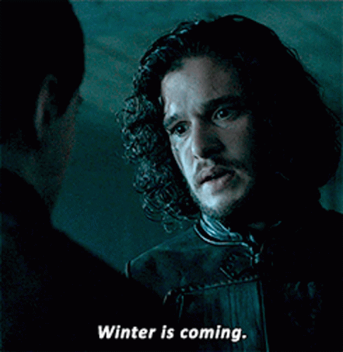
a man talking to another man with the words winter is coming
ALT: a man talking to another man with the words winter is coming
media.tenor.com
December 29, 2025 at 3:30 AM
obligatory .gif
Our Morgantown cyclonePORT just dropped 13° in about 8 minutes. Was 71°, now 58°.
December 29, 2025 at 3:14 AM
Our Morgantown cyclonePORT just dropped 13° in about 8 minutes. Was 71°, now 58°.
8:43p - Strong storms arriving from the west, crossing the Butler & Logan Co line momentarily. These winds are going to be intense, y'all. Sharp drop in temps will occur quickly behind the line as it surges through.

December 29, 2025 at 2:48 AM
8:43p - Strong storms arriving from the west, crossing the Butler & Logan Co line momentarily. These winds are going to be intense, y'all. Sharp drop in temps will occur quickly behind the line as it surges through.
7:57p - Showers/storms continue to close in from the west. No active warnings along the line at the moment. Hopefully this trend continues.

December 29, 2025 at 2:01 AM
7:57p - Showers/storms continue to close in from the west. No active warnings along the line at the moment. Hopefully this trend continues.
Set an alarm to close the windows before you go to bed.
You’ll thank yourself in the morning.
You’ll thank yourself in the morning.

Tkt Smart GIF
ALT: Tkt Smart GIF
media.tenor.com
December 29, 2025 at 1:05 AM
Set an alarm to close the windows before you go to bed.
You’ll thank yourself in the morning.
You’ll thank yourself in the morning.
5:02p - Line of strong/severe storms approaching from the northwest. Still a few hours before arrival. Will update accordingly.

December 28, 2025 at 11:07 PM
5:02p - Line of strong/severe storms approaching from the northwest. Still a few hours before arrival. Will update accordingly.
Well, once we get shed of the warmth and storms...something wintry this way comes.

December 28, 2025 at 7:30 PM
Well, once we get shed of the warmth and storms...something wintry this way comes.
🌬️ Brisk southerly winds of 25-35+ mph will take highs to the mid/upper 70s today. Wind Advisory in effect.
December 28, 2025 at 2:45 PM
🌬️ Brisk southerly winds of 25-35+ mph will take highs to the mid/upper 70s today. Wind Advisory in effect.
Yet another warm one for this post-Christmas...wait, what day is it again? Saturday, I think?

December 27, 2025 at 5:36 PM
Yet another warm one for this post-Christmas...wait, what day is it again? Saturday, I think?
Dawn is here, WABBLES! Visibility outside is currently somewhere between "Where'd the dog go?" and "Did I accidentally walk into Narnia?" thanks to a dense fog advisory.
December 27, 2025 at 1:35 PM
Dawn is here, WABBLES! Visibility outside is currently somewhere between "Where'd the dog go?" and "Did I accidentally walk into Narnia?" thanks to a dense fog advisory.