Antonio
@aasmith.bsky.social
520 followers 210 following 140 posts
Mostly making maps about the United States. AAS in GIS at RSCC BSc in Geo at Marshall MSc in GIS at JHU
Posts Media Videos Starter Packs
Reposted by Antonio
ourworldindata.org
Does the news reflect what we die from?
The image presents a comparison of the leading causes of death in the United States for 2023 and the media coverage these causes receive from three news outlets: The New York Times, The Washington Post, and Fox News. 

In the footer, it notes the data sources, indicating that the information is based on media mentions from Media Cloud (2025) and death data from the US CDC (2025) and the Global Terrorism Index, with a clarification that values are normalized to sum to 100%.
aasmith.bsky.social
I should have thought about this one a little bit longer. I was in the correct region though.

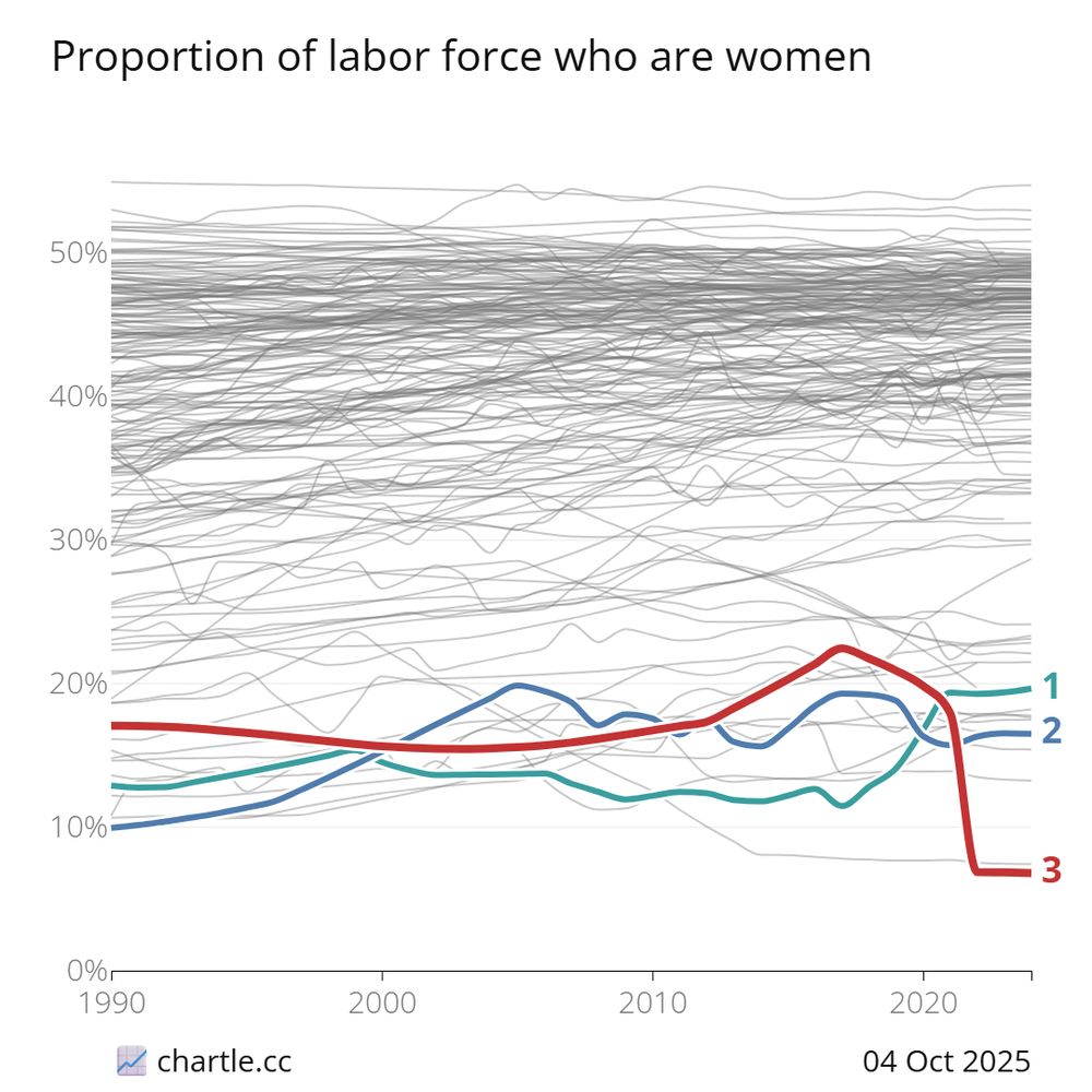
chartle.cc
aasmith.bsky.social
I thought resizing an existing map would be faster than creating a new one from scratch. I was very wrong.
aasmith.bsky.social
Sorry, I am just now seeing this! In ArcPro, there are tools for creating very smooth contours. I think they are under the Cartographic toolbox/extension. Smoother contours are less accurate but more visually appealing to most people. Here is a screenshot of some contours I made in ArcPro.
aasmith.bsky.social
Oh god, I didn't know it was that time of year again!

Looks like he already posted the list on his website.

30daymapchallenge.com

#gischat
aasmith.bsky.social
I seem to get these on the first guess or not at all. 😂

chartle.cc
aasmith.bsky.social
That's not bad at all. The response time is less so.
aasmith.bsky.social
Jesus.

BTW, do you happen to know how much time it takes to raise the levee?
aasmith.bsky.social
I don't know that I was thinking with some of these guesses. 😂

chartle.cc
Reposted by Antonio
davelevitan.bsky.social
Anyway seems not great that so many people with large platforms or in actual positions of power appear to have entirely lost their minds
aasmith.bsky.social
Very interesting, and just in time for bookmarks! 😀
aasmith.bsky.social
And here is the final version. I am pretty happy with how this map turned out, and I got a lot of great feedback at the conference.
aasmith.bsky.social
This is surprising. I would have expected single parents to be one of the dominant groups based on the media. Married, no kids are basically flat. Single, no kids seems to be the big change in households. Overall, married households went from 74% to 47%.
infobeautiful.bsky.social
How the makeup of US households have changed 1960 vs today

(by @VisualCapitalist)
A stacked bar chart showing the evolution of U.S. household composition from 1960 to 2023. The chart illustrates the changing proportions of married parents, single parents, married couples without children, and single adults without children. Key takeaways include a significant increase in households without children and a decrease in households with married parents.
aasmith.bsky.social
Literally every other small business in Huntsville was "Rocket City" something when I grew up there. This man will take credit for anything.
Reposted by Antonio
kevinmkruse.bsky.social
Trump says that because he’s moving Space Command to “a locale called Huntsville, Alabama” which will *now* be forever known as “Rocket City.”

He’s so powerful with these names, the bib from the marathon my dad ran there in the early 1980s has had this brand new nickname magically appear on it.
Humana Rocket City Marathon
aasmith.bsky.social
At Hopkins, they kept our data for about 6 months. The deletion policy is more or less tied to when you lose access to your school account.
aasmith.bsky.social
Also, ol boy Neville Chamberlain had a meeting around this time. I'm pretty sure they called him "Briton" due to space limitations, but I like to think of it as a slight.
aasmith.bsky.social
I was doing research on a RI hurricane in 1938 (unnamed) for one of my maps and came across this article. The eye of the storm landed in New Haven, CT, but RI was on the dirty side and got hit with a the storm surge. The photos help put it in perspective.

www.providencejournal.com/picture-gall...
The Evening Bulletin newspaper article from September 1938. Headline: HURRICANE KILLS AT LEAST 125 IN STATE; 29 DEAD, 52 MISSING IN WESTERLY; LOSS PUT IN MILLIONS. A smaller headline reads: BRITON, HITLER CONFER; CZECH
aasmith.bsky.social
Cool find. I was thinking about making something similar.
aasmith.bsky.social
I just registered for my first Nacis conference. Now, I need to finish my map. 🗺️
aasmith.bsky.social
Oh dang! I may have to grab a pair. Maybe that will keep my wife and kids from stealing (and losing) my scissors. 😂
aasmith.bsky.social
Today I learned there are left-handed scissors. 🤯 I am so used to cutting with my right hand that I don't know if I could even them. lol
aasmith.bsky.social
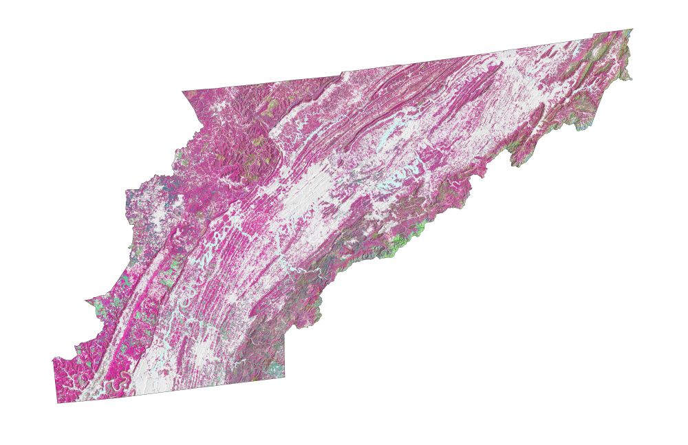
It is still a WIP, but I am happy with the overall direction. I have wanted to use this TreeMap data for some time now. It took some time, but I changed the color scheme to match the Fall leaf colors. Here is the original version.
A map showing the original tree cover data over a light hillshade layer of East Tennessee.
aasmith.bsky.social
For some reason, I thought it would be a good idea to start two more maps, as if the first one wasn't kicking my ass. This East TN tree cover map is for a GIS conference in a few weeks! #gis #gischat #cartography
A work-in-progress map showing tree cover data over a light hillshade layer of East Tennessee.
aasmith.bsky.social
Nvm, I see Oakland and Wayne. I dumb.