Andy Woodruff
@awoodruff.bsky.social
2.5K followers 220 following 180 posts
cartographer of things https://andywoodruff.com/
Posts Media Videos Starter Packs
Pinned
awoodruff.bsky.social
If we all live on this site now, are (re)introductions in order?

I make all sorts of maps. Web maps, faux-antique maps, trail maps, feathery terrain maps, typographic maps, time zone maps, Boston maps, eclipse maps, a basketball...

Highlights here from the past 20(!) or so years: andywoodruff.com
Collage of 15 images of maps made by Andy Woodruff: a flowing terrain map, a basketball globe, web map basemap for FlightAware, hand-drawn antique style map, map of the 2024 solar eclipse, map of the White Mountains in National Parks style, map of sea level rise flood risk in 19th/20th century "urban atlas" style, maps from the 2023 30 day map challenge, more flowing terrain maps, maps about daylight saving time, an interactive public health dashboard, typographic city map, neighborhoods map of Boston, map showing what's across the ocean from coastal points, and an interactive map of the same
awoodruff.bsky.social
Yeah I guess they’ve gotten meaner since I lived in the neighborhood. Worst I ever experienced was a turkey walking too slowly in front of me on the sidewalk when snow was piled like 3 feet on both sides and I couldn’t go around. Not violent, but certainly inconsiderate!
awoodruff.bsky.social
I’m sorry to say this one is toned down quite a bit from the last time I mapped it.
Map of turkey sightings in the Boston area. “Boston beware! The turkey menace is all around you!”
awoodruff.bsky.social
Me 363 days of the year: heck yeah, no dentist appointment today!

Me 2 days of the year: ugh
awoodruff.bsky.social
Aw nuts, this sounds great and would be quite convenient if I weren’t heading out of town that weekend! Wish I could send it to the old maptime list, but I lost it. 😖

(In lieu of seeing you close to home or still pretty close to home in RI, see you in Kentucky not long after, right?)
Reposted by Andy Woodruff
pinakographos.bsky.social
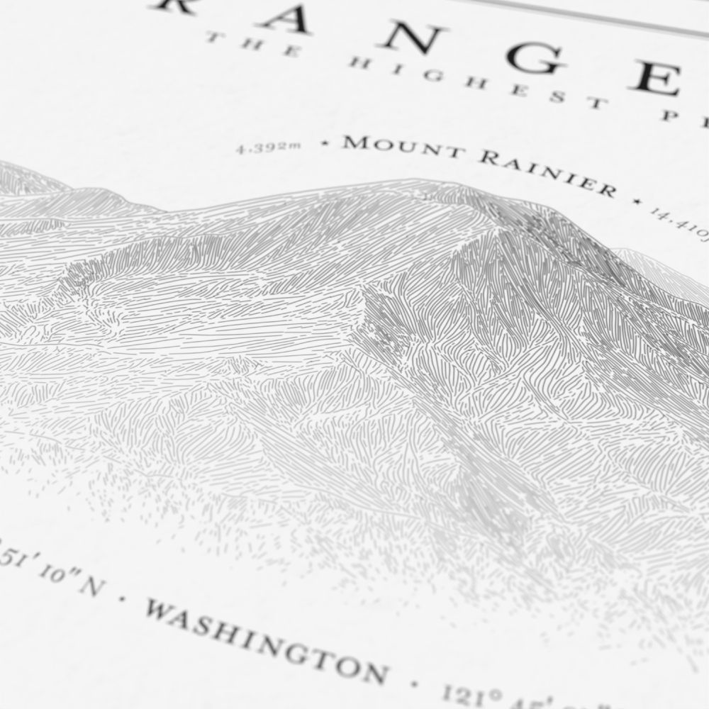
New poster! Hachure illustrations of the highest Cascade Range volcanoes. This one took a lot of experimentation to get the layout right. If you or someone you know loves this area, check it out. www.etsy.com/listing/4373...
A black and white illustration titled "Cascade Range Volcanoes," showing a 3 by 3 layout of the nine tallest peaks in the range. The art is done in a hachure sketch style. A detail image of the illustration of Mount Rainier A detail image from the poster of Mounts Hood and Jefferson.
awoodruff.bsky.social
(Mostly because I'm publishing a map related to this soon, and want to make sure I've got it right!)
awoodruff.bsky.social
This is pretty inconsequential, but what page are you looking at, out of curiosity? It sounds like an incomplete count; these from the city and state agree on a 588-587 total, for example.
www.boston.gov/departments/...
electionstats.state.ma.us/elections/vi...
awoodruff.bsky.social
It was, and is one of only two in the city carried by Trump, the other being neighboring precinct 9—which he won by a single vote.
awoodruff.bsky.social
If you have a London person in your life, this looks very nice! (Unsurprisingly, coming from one of the best cartographers out there!)
thisismikehall.com
🚨 One month to go till THE BOROUGHS OF LONDON by me and @mattfromlondon.bsky.social hits the shops!

Packed with maps and illustrations, learn about London's 32 boroughs, how they came to be, the fascinating places in each, and much more history and trivia besides. Preorder today!

ℹ️ bit.ly/BorosLdn
Cover art for The Boroughs of London by Mike Hall and Matt Brown A detail of a page from The Boroughs of London by Mike Hall and Matt Brown, showing a map of the County of London in 1901 and the former Metropolitan Boroughs A detail of a page from The Boroughs of London by Mike Hall and Matt Brown, showing text and illustrations including an illustration of a dog A detail of a page from The Boroughs of London by Mike Hall and Matt Brown, showing various colourful statistical maps of Greater London
awoodruff.bsky.social
Cincinnati in 50 Maps, by Nick Swartsell and me, is off to the printer, so you can get your pre-orders in now for the December launch! beltpublishing.com/products/cin...

Get this, folks: I counted and there are 125 individual maps. That's 75 extra maps for free!
Cincinnati in 50 Maps
Edited by Nick Swartsell with cartography by Andy Woodruff Publication date: December 2, 2025   There are as many versions of Greater Cincinnati as there are residents of the region. That’s roughly tw...
beltpublishing.com
awoodruff.bsky.social
In the years I looked at, there simply weren’t many crashes at all during any narrow date range—so no discernible pattern by bridge. But decent point above that many (most?) incidents see someone stopping before crashing. @universalhub.com twitter archives might hold the best data on that!
awoodruff.bsky.social
Since Boston is sounding the “don’t drive a truck on Storrow” sirens this week, time to post this map again, now with a timeline.

As far as I can tell, either the messaging works or the idea of students smashing U-Hauls into overpasses is largely a myth. I couldn’t find any real spike in September.
Map showing number and locations of crashes involving vehicles striking overhead bridges or signs on Storrow Drive and Memorial Drive in Boston and Cambridge, Massachusetts.
awoodruff.bsky.social
Me at 7pm: wow, I made a vegan dinner that was actually pretty satisfying!

Me at 11pm:
Homer Simpson in his underwear at night about to eat a whole Thing of sliced cheese, saying “mmm, sixty-four slices of American cheese.”
awoodruff.bsky.social
Thanks! So far I’ve also just got some different patterns, not entirely unlike your first example… which, by the way, I also need to bug you about just to know/see more of the Boston maps you’re doing!
awoodruff.bsky.social
I’m pretty far down the path by now, but it would have been wise to seek wisdom from a monochrome master like you!

Still, I’d be interested in any brilliant examples you have of, essentially, categorical line symbols. (I can be more specific; this may be more of an email question.)
awoodruff.bsky.social
Not so different from my data-driven web mapping days, really. We’d always produce these mock-ups of lovely maps and nice lil charts you could fiddle with, and then the real data would come in with like 95% of counties or whatever having a value of 0.002 and the rest being 4,000,000,000.
awoodruff.bsky.social
Making what might be my first real, work-for-hire grayscale maps after all these years. Monochrome is a fun challenge for a pet project, but when it’s “distinctly symbolize these 7 routes and 90 points that are all on top of each other if you want your money” it’s just kind of… hard?
Reposted by Andy Woodruff
thetransitguy.com
The rail map of Columbus, OH, a city of nearly one million people:
awoodruff.bsky.social
Nice! I really love the ability to randomize everything in QGIS patterns.
awoodruff.bsky.social
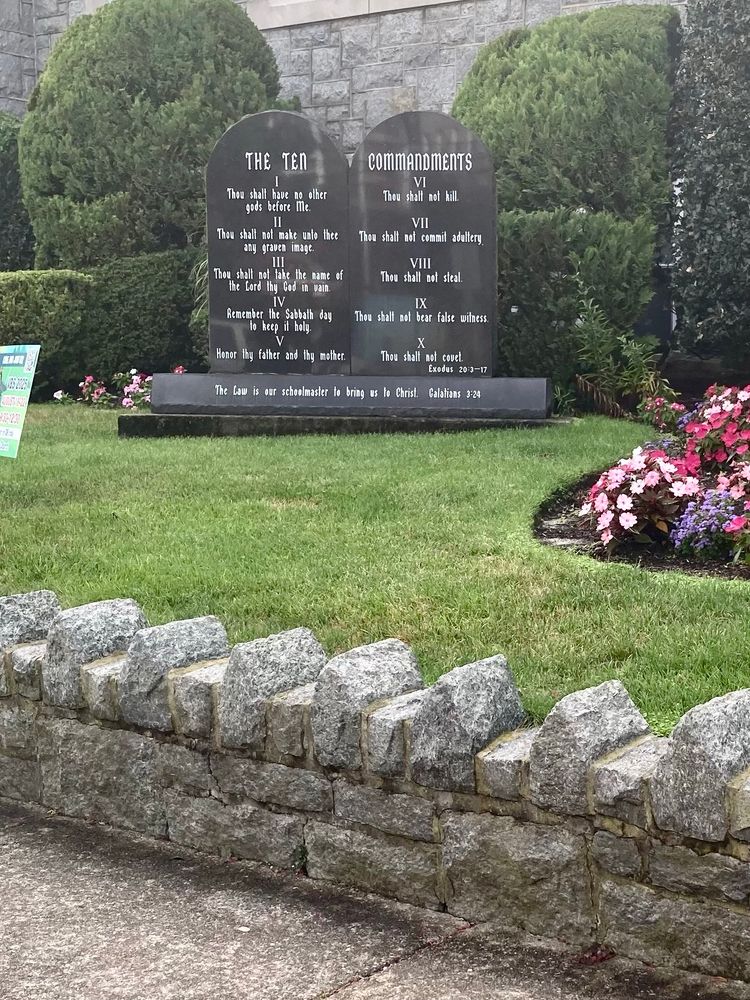
XI. Thou shall not rest thy legs on the LORD’s landscaping
Photo of the ten commandments in front of a church, behind a low rock wall with pointed stones to prevent people from sitting.
awoodruff.bsky.social
True indeed. I continue to be im/depressed by how well the whole bit has aged over the years.