


Geoff Thornton
@geoffthornton.bsky.social
Now is the time of returning
love, respect, and service | Enviro planner. Risk and hazard mitigation | Family | Music and dance | Skier
love, respect, and service | Enviro planner. Risk and hazard mitigation | Family | Music and dance | Skier
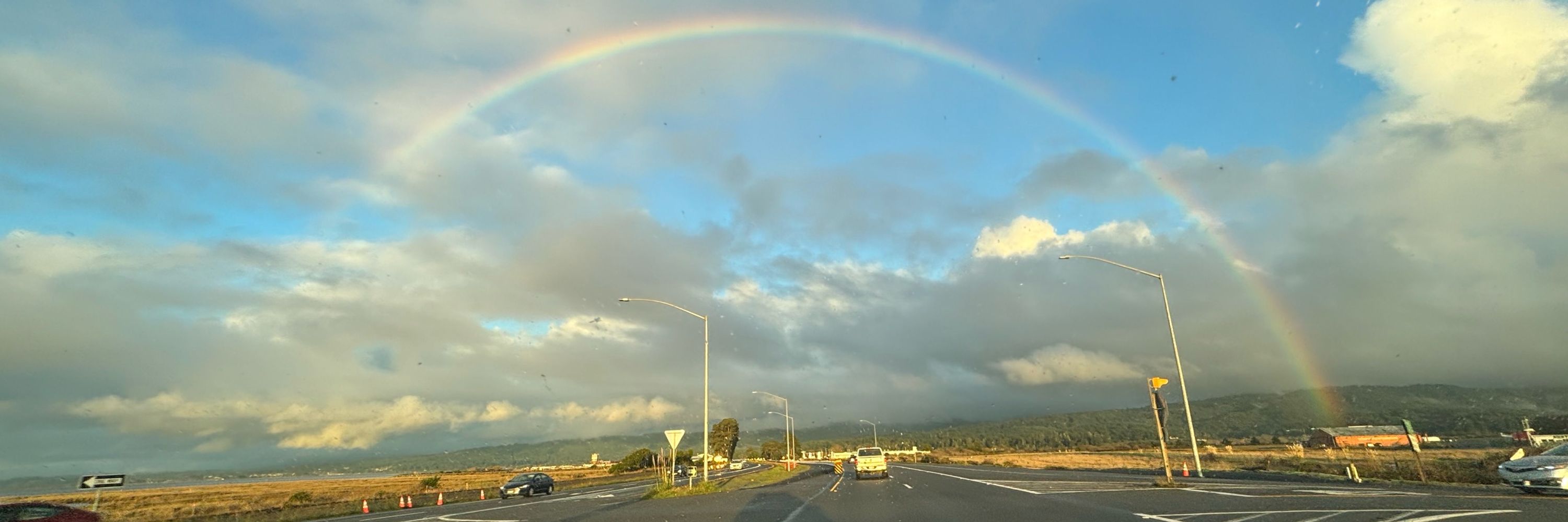
Yes. We feel really lucky!
December 27, 2025 at 4:15 AM
Yes. We feel really lucky!
The tree felling on other properties is super crazy. At that time, the City’s permitting process was very challenging. Most staff were still WFH, and timely communication was very difficult. That could make it easier to consider that you could get away with this type of thing w/o repercussion.
December 22, 2025 at 7:45 PM
The tree felling on other properties is super crazy. At that time, the City’s permitting process was very challenging. Most staff were still WFH, and timely communication was very difficult. That could make it easier to consider that you could get away with this type of thing w/o repercussion.
The PEIR explains the discretionary land use approvals of Fresno County on private property and approvals of CPUC (I think it’s in ch 1).
December 20, 2025 at 7:19 AM
The PEIR explains the discretionary land use approvals of Fresno County on private property and approvals of CPUC (I think it’s in ch 1).
… to support a project-specific tiered EIR related to their specific discretionary approvals. My understanding is that those agencies would also need to certify the PEIR in order to tier from it.
December 20, 2025 at 5:03 AM
… to support a project-specific tiered EIR related to their specific discretionary approvals. My understanding is that those agencies would also need to certify the PEIR in order to tier from it.
… If I’m reading the PEIR correctly, Westlands may be able to use the PEIR for its sole CEQA compliance for activities on the 72k acre westlands-owned lands in the project area, and the PEIR can be used by the county, CPUC, etc.,…
December 20, 2025 at 5:03 AM
… If I’m reading the PEIR correctly, Westlands may be able to use the PEIR for its sole CEQA compliance for activities on the 72k acre westlands-owned lands in the project area, and the PEIR can be used by the county, CPUC, etc.,…
Are there standalone projects that only require this current discretionary approval from Westlands or are “we” just getting started with the process of getting the land use discretionary approvals for moving this forward?…
December 20, 2025 at 5:03 AM
Are there standalone projects that only require this current discretionary approval from Westlands or are “we” just getting started with the process of getting the land use discretionary approvals for moving this forward?…
Thanks for taking the time to do this!
December 19, 2025 at 7:52 AM
Thanks for taking the time to do this!
Fingers crossed!
December 19, 2025 at 12:28 AM
Fingers crossed!
The nuance here is that, apparently, an engineered and USACE-certified levee failed. Why did it fail?
Looking at the FIRM (on my phone), I see a levee structure that was predicted to not provide full 100-yr protection for its entire length. But some reaches receive(d) 100-yr protection.
Looking at the FIRM (on my phone), I see a levee structure that was predicted to not provide full 100-yr protection for its entire length. But some reaches receive(d) 100-yr protection.
December 17, 2025 at 8:00 AM
The nuance here is that, apparently, an engineered and USACE-certified levee failed. Why did it fail?
Looking at the FIRM (on my phone), I see a levee structure that was predicted to not provide full 100-yr protection for its entire length. But some reaches receive(d) 100-yr protection.
Looking at the FIRM (on my phone), I see a levee structure that was predicted to not provide full 100-yr protection for its entire length. But some reaches receive(d) 100-yr protection.
Apparently, I needed to drink more coffee before posting and typing with my thumbs…. Story: a reported 100+yr flood turned out to be, based on a detailed study, a 5-yr riverine flood and a bunch of poorly designed urban street drainage system and poor maintenance of that urban system.
December 16, 2025 at 2:22 AM
Apparently, I needed to drink more coffee before posting and typing with my thumbs…. Story: a reported 100+yr flood turned out to be, based on a detailed study, a 5-yr riverine flood and a bunch of poorly designed urban street drainage system and poor maintenance of that urban system.
I’ve witnessed (and tried to help mitigate) riverine flood hazard where, originally, an event was estimated at 100+yr event was experienced because of the severity/elevation of urban flooding. They revised their estimate to a 5 yr riverine event and extremely poor urban drainage/maintenance.
December 15, 2025 at 6:22 PM
I’ve witnessed (and tried to help mitigate) riverine flood hazard where, originally, an event was estimated at 100+yr event was experienced because of the severity/elevation of urban flooding. They revised their estimate to a 5 yr riverine event and extremely poor urban drainage/maintenance.
I haven’t noticed (or looked too hard) for that sticker.
December 12, 2025 at 6:56 PM
I haven’t noticed (or looked too hard) for that sticker.
I live in a purple area. I witnessed what I would consider grieving by his followers. Vigils held at the high schools and in town.
December 12, 2025 at 6:17 PM
I live in a purple area. I witnessed what I would consider grieving by his followers. Vigils held at the high schools and in town.
If the measurement is correct, it looks like the highest of record at that gage.
December 11, 2025 at 11:04 PM
If the measurement is correct, it looks like the highest of record at that gage.
Not that I agree with the waiver, but, if I remember correctly, the waiver goes back to the Clinton administration through an act of Congress. And the Congress majority has continued to support the waiver or they would have removed it through one of their multiple amendments.
December 4, 2025 at 5:41 PM
Not that I agree with the waiver, but, if I remember correctly, the waiver goes back to the Clinton administration through an act of Congress. And the Congress majority has continued to support the waiver or they would have removed it through one of their multiple amendments.
Thx for sharing. Statute/reg change seems difficult in this arena or it would have occurred long ago. For flood, EO 13690 seemed to try to push this forward in a good way. NOAAs CISA seemed like a good start.
Knowing a little on the inside, it was alarming to watch FS stuff get broader use.
Knowing a little on the inside, it was alarming to watch FS stuff get broader use.
December 3, 2025 at 6:02 PM
Thx for sharing. Statute/reg change seems difficult in this arena or it would have occurred long ago. For flood, EO 13690 seemed to try to push this forward in a good way. NOAAs CISA seemed like a good start.
Knowing a little on the inside, it was alarming to watch FS stuff get broader use.
Knowing a little on the inside, it was alarming to watch FS stuff get broader use.
It’s interesting to see, based on that Bloomberg article, that the accuracy and validity of the First Street assessments are still questionable by peer groups (not realtors). I know several years ago that this was an issue and large concern related to the flood and wildfire assessments.
December 3, 2025 at 3:48 AM
It’s interesting to see, based on that Bloomberg article, that the accuracy and validity of the First Street assessments are still questionable by peer groups (not realtors). I know several years ago that this was an issue and large concern related to the flood and wildfire assessments.
Has the older issue of validity of the First St Foundation data been resolved?
The CO state WF map issue is interesting. I wonder how it’d evaluate the front range foothills risk post Marshal fire.
The process of updating these maps in a timely manner based on changed baseline seems challenging.
The CO state WF map issue is interesting. I wonder how it’d evaluate the front range foothills risk post Marshal fire.
The process of updating these maps in a timely manner based on changed baseline seems challenging.
December 2, 2025 at 8:05 AM
Has the older issue of validity of the First St Foundation data been resolved?
The CO state WF map issue is interesting. I wonder how it’d evaluate the front range foothills risk post Marshal fire.
The process of updating these maps in a timely manner based on changed baseline seems challenging.
The CO state WF map issue is interesting. I wonder how it’d evaluate the front range foothills risk post Marshal fire.
The process of updating these maps in a timely manner based on changed baseline seems challenging.