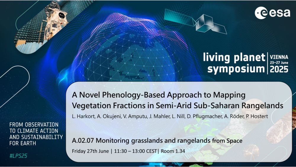
@lasseharkort.bsky.social
170 followers
450 following
3 posts
🌍 Geographer | 🛰️ Earth Observation
Studying vegetation change in semiarid rangelands.
Interested in how we observe landscapes & use environmental data.
🎓 PhD @humboldteolab.bsky.social
Posts
Media
Videos
Starter Packs
Reposted
Reposted
Reposted
Reposted
Reposted
Reposted
Reposted
Simone M. Stuenzi
@smstuenzi.bsky.social
· Mar 30
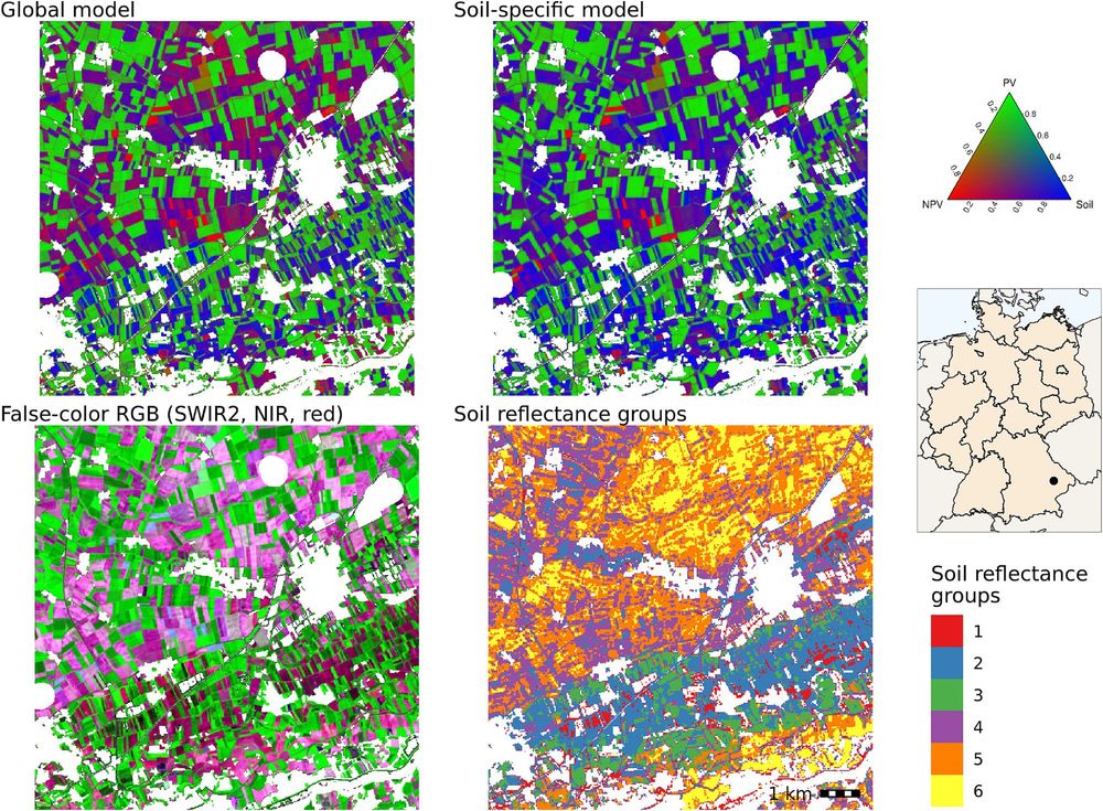
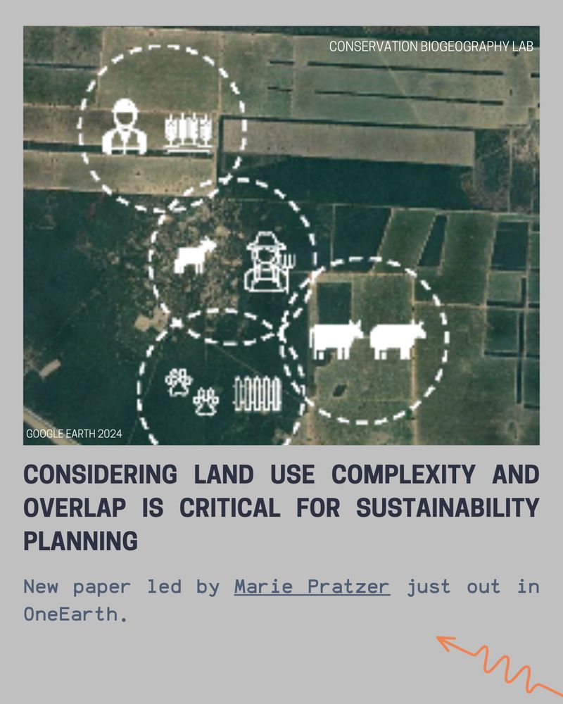
Boreal Forest Cover Delays Thermokarst Onset in Central Siberia's Yedoma Deposits
Forests delay thermokarst and excess ice melt by 3–18 years, depending on excess ice depth, climate scenarios, and site conditions Canopies buffer fast initial thermokarst formation during climat...
doi.org
Reposted
Reposted
Reposted
Reposted

Reposted

Reposted

Reposted

Reposted
Reposted
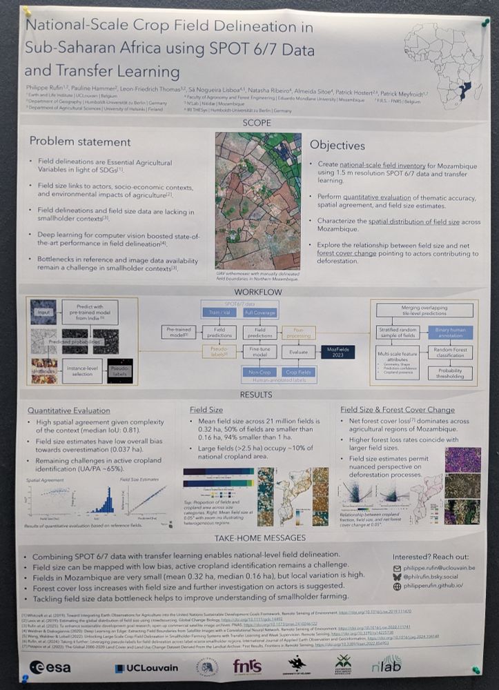
Philippe Rufin
@philrufin.bsky.social
· Feb 12

Reposted

Reposted
Reposted