MetJam
@metjam.co.uk
1.2K followers 240 following 1.8K posts
Jamie. BSc Environmental Science Student at University of Reading. 
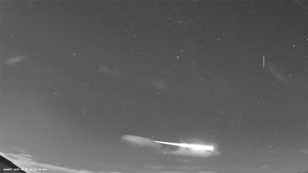
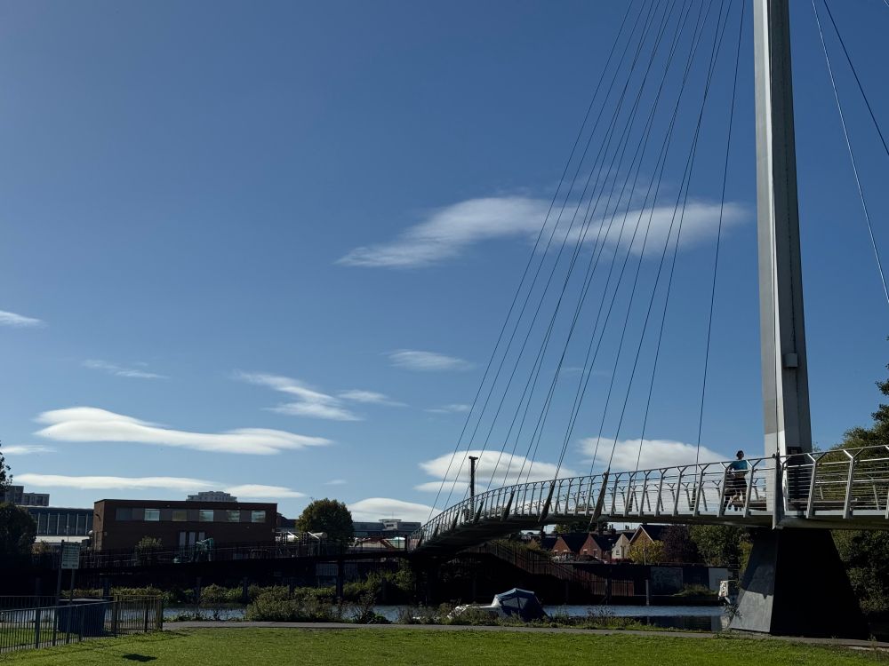
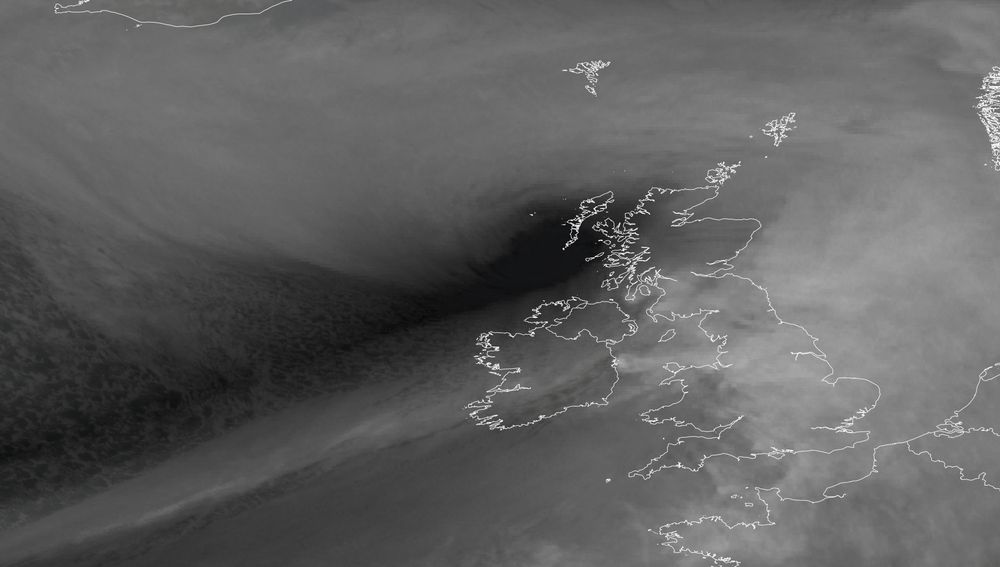
Avid weather nut from coastal Kent doing weather updates for the SE. Space weather & astronomy thrown in whenever that looks interesting too! metjam.co.uk
Posts Media Videos Starter Packs
Pinned
metjam.co.uk
MetJam @metjam.co.uk · Nov 13
Hello Bluesky - I suppose I had better put somewhat of an introduction together considering the flurry of followers I’ve had! I’m an avid weather nut and will post anything that interests in me that regard so feel free to follow if that’s what you want to see 😂
metjam.co.uk
bsky.app/profile/metj...
May be the same one?
metjam.co.uk
Fireball overhead in Herne Bay at 19:10 UTC - brightest one I’ve captured.
metjam.co.uk
Fireball overhead in Herne Bay at 19:10 UTC - brightest one I’ve captured.
metjam.co.uk
Aye I won’t let that die in the time I’m here 🤣
metjam.co.uk
A few reports of a fireball over Margate this evening - inclined to think it’s this one in the meteor cameras at 19:19 UTC. Does anyone have any further reports?
metjam.co.uk
Thanks - certainly am! I am getting very ingrained in the Met society 😂
metjam.co.uk
Stunning sunset here in Reading.
metjam.co.uk
A little difference to yesterday 😂
metjam.co.uk
There’s a happy chappie 😄
metjam.co.uk
ECM AI deciding to go for 2010 at the end of the run in mid October - more fantastic cold rain for us all.
metjam.co.uk
A nice show of lenticular clouds around Reading this afternoon - no doubt the Chilterns are aiding them.
Reposted by MetJam
edhawkins.org
The @metoffice.gov.uk use weather station observations to reconstruct changes in UK average temperature since 1884.

@copernicusecmwf.bsky.social produce the ERA5 reanalysis which reconstructs global weather every hour back to 1950 using a weather forecast model.

Their estimates agree. Just sayin'.
metjam.co.uk
Sunny and warm today across the south - up to 20/21ºC.
metjam.co.uk
That's certainly a strong indicator for drier and calmer conditions over the UK in the coming week - likely to be calmer and perhaps foggier (cloud cover will really depend on where the high pressure decides to orientate itself). The dryness of 2025 seems to continue..
metjam.co.uk
#StormAmy from NASA Worldview today.
Reposted by MetJam
edhawkins.org
Well done to the Warming Stripes La Rochelle team!

Starting climate conversations in France! 👏
Warming Stripes painted in the harbour area of La Rochelle, France
metjam.co.uk
‘Hit harder than expected’ seems to be the colloquial term for “we didn’t prepare adequately enough so we must blame it on the forecasters instead” 👍🏻
www.bbc.co.uk/news/article...
Widespread damage as Storm Amy 'hit harder' than expected
More than 60,000 homes were left without power as wind and rain swept across Scotland overnight.
www.bbc.co.uk
metjam.co.uk
A nice show of the mature stage of the Shapiro-Keyser cyclone lifecycle with #StormAmy.
metjam.co.uk
947.9 hPa at 05 UTC this morning at Baltasound is provisionally the lowest October pressure ever recorded at a UK station - substantially beating the previous record of 950.9 hPa by 3 hPa!
metjam.co.uk
Tiree's data did go out, although the Met Office website has 102 mph - would be the joint strongest wind gust at Tiree on record. #StormAmy
metjam.co.uk
154 km/h (96 mph) at Tiree, WOW! #StormAmy
metjam.co.uk
Malin Head up to 92 mph at 16 UTC - likely gusting well over 100 mph offshore. #StormAmy
metjam.co.uk
This correlates well with nowcast models with the strongest wind gusts just offshore but still very powerful wind gusts inland
metjam.co.uk
Very impressive dry slot with #StormAmy - seems to perhaps be some evaporation ongoing to the NW of Northern Ireland, which is likely where the strongest wind gusts are likely to be and will move onshore in the next 5 - 6 hours. Eglington in Northern Ireland is up to 90 mph.
metjam.co.uk
#StormAmy is starting to look like it means business - lots of dry air rushing into it with a nice cloud head beginning to wrap around it as its central pressure rapidly drops.
metjam.co.uk
The raw UKV output does show the risk of some very strong wind gusts across the Western Isles in Scotland this evening, although suffers from poor wind gust ratios, so taking roughly 90% of the top output still shows the risk of 100 mph gusts occurring. #StormAmy