MyRadar
@myradar.bsky.social
11K followers 70 following 510 posts
Keeping you ahead of the storm since 2008. Download for FREE! myradar.com
Posts Media Videos Starter Packs
Pinned
myradar.bsky.social
Hurricane season is here. 🌀
Stay ahead with real-time tracks, expert updates, and custom alerts from MyRadar’s best-in-class hurricane tools.
📲 Download now: go.onelink.me/ebEx/a3553bd0
myradar.bsky.social
🌀Hurricanes Imelda and Humberto are less than 500 miles apart — and they’re about to combine into one potentially stronger storm.

MyRadar meteorologist Matthew Cappucci breaks down their rare “Fujiwhara” dance — and what happens next.

myradar.com/videos/6181
Two Hurricanes Are Combining Right Now!
Hurricanes Imelda and Humberto are less than 500 miles apart — and they’re about to combine into one potentially stronger storm. MyRadar meteorologist Matthew Cappucci breaks down their rare “Fujiwhar...
myradar.com
myradar.bsky.social
🍂Autumn is here; the days are getting shorter, the air is cooling, and the leaves are changing. Soon, forests will transform into a patchwork of colorful fall hues.

MyRadar meteorologist @matthewcappucci.bsky.social discusses the sights — and scents — of the season.

myradar.com/videos/6180
Fall Foliage Building
Autumn is here; the days are getting shorter, the air is cooling, and the leaves are beginning to change. Soon, forests will transform into a patchwork of colorful fall hues. MyRadar meteorologist Mat...
myradar.com
myradar.bsky.social
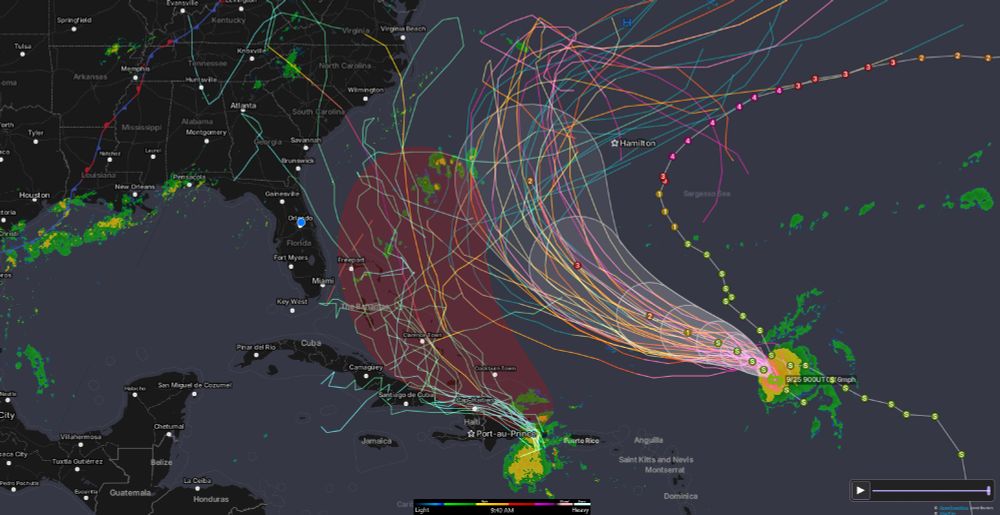
Tracking Tropical Storm Humberto (right) and Invest 94L (left, likely Imelda).

Humberto may reach Major Hurricane strength by Monday, while 94L has a 90% chance to develop.

If Humberto curves out quickly, 94L may push west. If it lingers, 94L could head out to sea.

Small shifts = big differences.
myradar.bsky.social
Hurricane Gabrielle is closing in on the Azores.

Hurricane warnings are up, with impacts expected Thursday into Friday.

Remnants could even reach the Iberian Peninsula.

Meteorologist @matthewcappucci.bsky.social has the latest update.
Gabrielle to hit Portugal
Hurricane warnings have been issued in the Azores ahead of Hurricane Gabrielle, which is expected to hit the archipelago at hurricane strength Thursday into Friday. The remnants could even affect the I...
myradar.com
myradar.bsky.social
A few severe thunderstorms, including the risk for a couple of tornadoes, are possible in eastern Oklahoma or Arkansas today. Damaging gusts, hail, and heavy rains are possible too.

MyRadar meteorologist @matthewcappucci.bsky.social has an update.
Oklahoma/Arkansas Tornado Risk
A few severe thunderstorms, including the risk for a couple of tornadoes, are possible in eastern Oklahoma or Arkansas today. Damaging gusts, hail, and heavy rains are possible too. MyRadar meteorolog...
myradar.com
myradar.bsky.social
A few strong to locally severe thunderstorms are possible Monday afternoon in parts of the Ohio Valley.

The main hazard will be damaging straight-line wind gusts.

MyRadar meteorologist @matthewcappucci.bsky.social has a quick update.
Ohio and Kentucky storms
A few strong to locally severe thunderstorms are possible Monday afternoon in parts of the Ohio Valley. The main hazard will be damaging straight-line wind gusts. MyRadar meteorologist Matthew Cappucc...
myradar.com
myradar.bsky.social
Charleston, SC is among the most vulnerable cities on the East Coast for hurricanes.

@willcanowx.bsky.social explains why storm surge, history, and geography put it at the top of the danger list.
youtube.com/shorts/Py5p7...
This City Faces the Greatest Hurricane Risk on the East Coast
YouTube video by MyRadar Weather News
youtube.com
myradar.bsky.social
The remnants of Tropical Storm Mario will bring scattered heavy downpours, isolated strong to severe thunderstorms, and the potential for flooding to southern California.

MyRadar meteorologist @matthewcappucci.bsky.social has an update.
Southern California Storms
This is "Southern California Storms" by MyRadar on Vimeo, the home for high quality videos and the people who love them.
vimeo.com
myradar.bsky.social
A sneaky system – and borderline subtropical storm – is drenching parts of eastern North Carolina and Virginia.

Tropical storm-force winds are battering the coastline and causing coastal flooding.

MyRadar meteorologist @matthewcappucci.bsky.social has an update.
Mid-Atlantic Soaker
A sneaky system – and borderline subtropical storm – is drenching parts of eastern North Carolina and Virginia. Tropical storm-force winds are battering the coastline and causing coastal flooding. MyR...
myradar.com
myradar.bsky.social
A borderline subtropical disturbance is forming near the Outer Banks and will move into the Carolinas with heavy rains that could cause localized flooding.

A few 4 to 8-inch amounts are possible. So is an isolated tornado.

Meteorologist @matthewcappucci.bsky.social has an update.
Sneaky Subtropical Soaker
A borderline subtropical disturbance is forming near the Outer Banks and will move into the Carolinas with heavy rains that could cause localized flooding. A few…
vimeo.com
myradar.bsky.social
North Dakota saw a rare tornado outbreak on Sunday, September 14, 2025, with more than 20 tornadoes reported — nearly two-thirds of the state’s yearly average in a single day.

MyRadar storm chaser @jordanhallwx.bsky.social was there.
20+ Tornadoes Hit North Dakota in One Day!
YouTube video by MyRadar Weather News
youtube.com
myradar.bsky.social
Hurricane season has been weirdly quiet lately, but it won’t stay that way for long.

MyRadar meteorologist @matthewcappucci.bsky.social spoke with experts to discuss the season to date – as well as when the Gulf and Caribbean could suddenly awaken.
Why the Gulf and Caribbean Could Explode Soon
YouTube video by MyRadar Weather News
youtu.be
myradar.bsky.social
One of the most haunting satellite images: Sept 11, 2001.

Smoke rose from the World Trade Center the sky. Just 200 miles offshore, Hurricane Erin churned in the Atlantic Ocean.

The calm above New York belied the tragedy that claimed nearly 3,000 lives and changed the world.
myradar.bsky.social
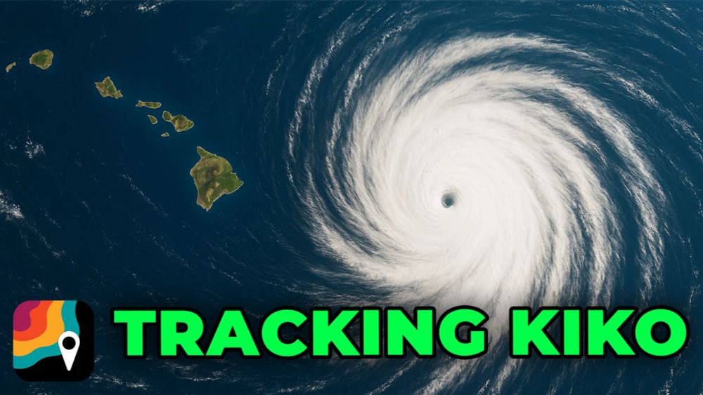
Hurricane Kiko is a Category 3 over the central tropical Pacific. It will gradually weaken into a tropical storm as it approaches Hawaii toward the middle of next week.

The Hawaiian archipelago could experience impacts.

Meteorologist @matthewcappucci.bsky.social has an early forecast.
Kiko to affect Hawaii?
Hurricane Kiko is a Category 3 over the central tropical Pacific. It will gradually weaken into a tropical storm as it approaches Hawaii toward the middle of next…
vimeo.com
myradar.bsky.social
A Level 2 out of 5 slight risk of severe weather covers much of the Appalachians on Friday. Damaging gusts are the main concern, with a low-end risk for hail or a very isolated tornado.

Meteorologist @matthewcappucci.bsky.social has an update.
Appalachian Storms Friday
A Level 2 out of 5 slight risk of severe weather covers much of the Appalachians on Friday. Damaging gusts are the main concern, with a low-end risk for hail or…
vimeo.com
myradar.bsky.social
Invest 99L is primed to organize into Tropical Storm Gabrielle, and could threaten Puerto Rico, the Virgin Islands and the Leeward Islands in the next 7-10 days.

MyRadar meteorologist @matthewcappucci.bsky.social breaks down the latest.
Invest 99L Could Become Gabrielle — Here’s the Latest
YouTube video by MyRadar Weather News
youtu.be
myradar.bsky.social
A Level 2 out of 5 Slight risk of severe weather has been drawn by the Storm Prediction Center for parts of Kansas and Missouri.

Damaging gusts, large hail and an isolated tornado will be possible.

MyRadar meteorologist @matthewcappucci.bsky.social has a midday update.
Severe weather risk Wednesday
A Level 2 out of 5 Slight risk of severe weather has been drawn by the Storm Prediction Center for parts of Kansas and Missouri. Damaging gusts, large hail and an…
vimeo.com
myradar.bsky.social
A tropical disturbance in the Atlantic may become Gabrielle by late week. A new Pacific storm, Lorena, will impact western Mexico; its remnants could bring heavy rains to the Southwest and southern Plains.

Meteorologist @matthewcappucci.bsky.social has an update.
Tropical Update
A tropical disturbance in the Atlantic may become Gabrielle by late week. A new Pacific storm, Lorena, will impact western Mexico; its remnants could bring heavy…
vimeo.com
myradar.bsky.social
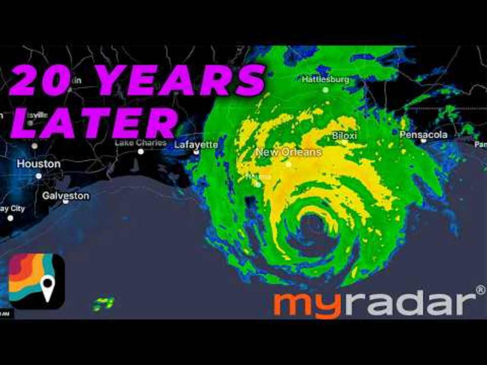
At 10:11 a.m. Central time on Sunday, August 28, 2005, the National Weather Service in New Orleans disseminated the most chilling weather alert ever issued.

MyRadar meteorologist @matthewcappucci.bsky.social looks back on the infamous “doomsday statement.”
The Most Terrifying Weather Alert Ever Issued
YouTube video by MyRadar Weather News
youtu.be
myradar.bsky.social
🌀We’re curious... what’s the one hurricane you’ll never forget?

We’re trying to see which storms stand out most in people’s memories.
myradar.bsky.social
Haboobs — or dust storms — are common across the Desert Southwest. They can bring blinding reductions in visibility, destructive straight-line winds and a muddy grime that coats any exposed surface.

MyRadar senior meteorologist @matthewcappucci.bsky.social explains.
What's a Haboob? The Desert's Most Extreme Dust Storm
YouTube video by MyRadar Weather News
youtu.be