New England Storm Center
@nestormcenter.bsky.social
830 followers 1.2K following 810 posts
Complete New England Storm and weather coverage. Owner of NewEnglandStormCenter.com
Posts Media Videos Starter Packs
nestormcenter.bsky.social
A couple of cold nights are ahead for New England. Frost advisories and freeze warnings below are for tonight while freeze watches are in effect for Thursday night to Friday morning, which will be much colder than tonight. #MAwx #CTwx #RIwx #NHwx #MEwx #VTwx
nestormcenter.bsky.social
A nice slug of rain is on the way from a rather strong cold front moving through. A slower trend does mean showers may last later into the day Wednesday across eastern New England. Widespread half inch of rain is still expected. #MAwx #CTwx #RIwx #NHwx #MEwx #VTwx
nestormcenter.bsky.social
The widespread high temperatures in the 80s weren't quite enough to break daily records in southern New England, but the widespread 80s in northern New England certainly were. #NHwx #MEwx #VTwx #MAwx
nestormcenter.bsky.social
Another chilly night tonight under high pressure. Now that it's October, frost and freeze alerts will no longer be posted for northernmost New Hampshire and the Maine mountains. Surf remains rough from Humberto as well. #MAwx #CTwx #RIwx #NHwx #MEwx #VTwx
nestormcenter.bsky.social
A quick burst of fall begins tonight. A couple cool days and crisp nights will be followed by a sharp warm-up, which will likely sustain into early next week. Frosts and freezes will be coming and expanding south for the next couple nights. #MAwx #CTwx #RIwx #NHwx #MEwx #VTwx
nestormcenter.bsky.social
Fall chill makes a brief return to New England midweek before warmth invades once again late this week. Hugh pressure keeps the region bone-dry, acting as a shield against tropical activity. This is a Rex-Block like setup. #MAwx #CTwx #RIwx #NHwx #MEwx #VTwx
nestormcenter.bsky.social
As we quickly dig deeper into fall, here's a look at the hottest temperature recorded this year in major New England cities. #MAwx #CTwx #RIwx #NHwx #MEwx #VTwx
nestormcenter.bsky.social
Similar to last year, a ridge of high pressure looks to keep tropical activity south of New England in the coming week. There's still a ton of uncertainty with Invest 94 (has a 90% chance of becoming Imelda) and how it may interact with Humberto & affect the south. #Hurricane #MAwx #CTwx #RIwx
nestormcenter.bsky.social
Flash Flood warnings remain in effect across the Providence/south shore areas through early this afternoon. Up to 3 inches of rain has fallen with more on the way. This system is a good example of a system creating short-term issues with long-term benefits. #MAwx #RIwx
nestormcenter.bsky.social
The flash flood warning has expanded eastward into southeast Massachusetts. Rainfall rates of up to 3 inches an hour will be possible. #RIwx #MAwx
nestormcenter.bsky.social
A flash flood warning is in effect for the Providence area through 10:45 this morning as a slow-moving downpour has dropped up to 2 inches of rain. #RIwx
nestormcenter.bsky.social
A couple rounds of rain for New England Thursday will make for inconsistent rainfall rates throughout the day, but washout potential is there. A widespread 1-2 inches of much needed rain is on the way. #MAwx #CTwx #RIwx #NHwx #MEwx #VTwx
nestormcenter.bsky.social
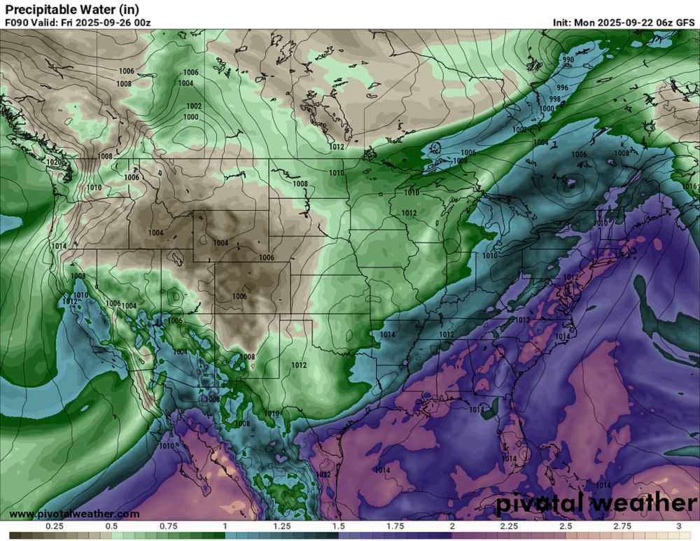
It's been a while, but there's good signals for a decent rainfall across New England over the next few days. A widespread inch or so of rain is likely thru Thursday. Thursday itself has some washout potential with 2 potential rounds of rain. #MAwx #CTwx #RIwx #NHwx #MEwx #VTwx
nestormcenter.bsky.social
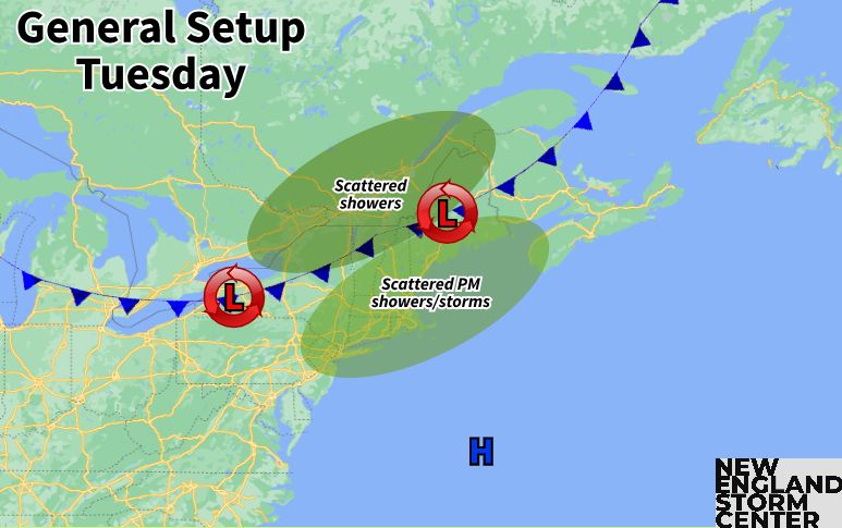
Wetter weather finally makes a return to New England starting tomorrow. Scattered showers and a few storms fire up tomorrow, increasing in coverage heading toward the evening (and dropping southward). Another system brings more rain Thursday to Friday. #MAwx #CTwx #RIwx #NHwx #MEwx #VTwx