
Daniel Plauba
@palubad.bsky.social
1.1K followers
390 following
58 posts
Postdoctoral researcher in Earth Observation @ Charles University, Prague, Czechia | SAR | Time Series | 🌳🌲Forests | Machine Learning | 🎓 Capacity Building | 🚴🏼🏐
Posts
Media
Videos
Starter Packs
Pinned


Daniel Plauba
@palubad.bsky.social
· Aug 17
Daniel Plauba
@palubad.bsky.social
· Aug 17


Daniel Plauba
@palubad.bsky.social
· Jun 27
Daniel Plauba
@palubad.bsky.social
· Jun 16

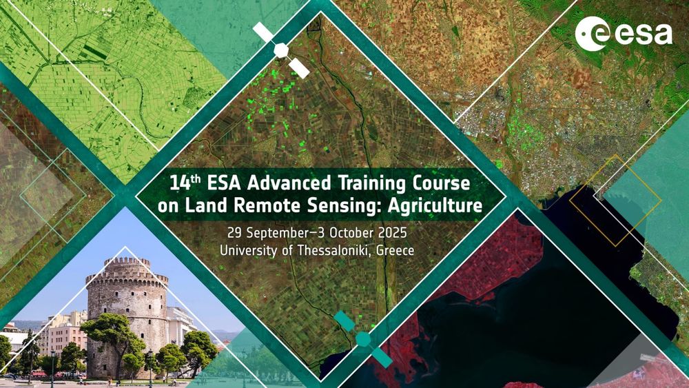
ESA Advanced Land Training Course 2025
The European Space Agency (ESA) is organising an Advanced Training Course on Land Remote Sensing with the focus on Agriculture in collaboration with the University of Thessaloniki. This course is dedi...
landtraining2025.esa.int


Daniel Plauba
@palubad.bsky.social
· Apr 6


Daniel Plauba
@palubad.bsky.social
· Apr 2

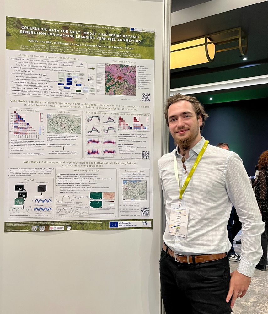
GitHub - palubad/SAR-based-VIs: Supplementary material [data & codes] for the article "Estimating vegetation indices and biophysical parameters for Central European temperate forests with Sentinel-1 S...
Supplementary material [data & codes] for the article "Estimating vegetation indices and biophysical parameters for Central European temperate forests with Sentinel-1 SAR data and machine ...
github.com
Daniel Plauba
@palubad.bsky.social
· Apr 2
Daniel Plauba
@palubad.bsky.social
· Apr 2
Daniel Plauba
@palubad.bsky.social
· Mar 29
Daniel Plauba
@palubad.bsky.social
· Mar 23
Daniel Plauba
@palubad.bsky.social
· Mar 23
Daniel Plauba
@palubad.bsky.social
· Mar 23
