Marco Petagna
@petagna.bsky.social
1.3K followers 150 following 1.7K posts
BSc MSc Media Advisor & Senior Operational Meteorologist UK Met Office Parent to 2 mini daxies Love running Views & opinions my own @Petagna on X
Posts Media Videos Starter Packs
petagna.bsky.social
The jet stream heading N by the weekend

Higher pressure taking hold

=drier/more settled weather
petagna.bsky.social
The harvest supermoon 🌚 is now rising in the ENE sky..more info here...

www.metoffice.gov.uk/blog/2025/ho...
petagna.bsky.social
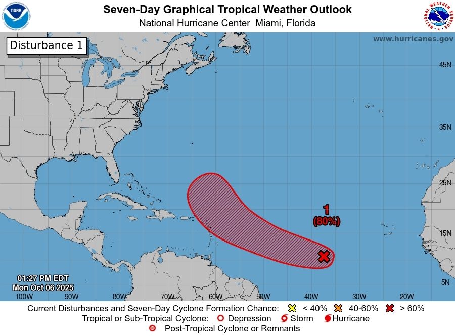
The 10th named storm of the tropical Atlantic season forms
#Jerry
petagna.bsky.social
If at first you don't succeed

High pressure is trying to settle the weather down and has had a good attempt across the S of the UK

As expected though it's through the second half of the week and into the weekend that a more successful wider spread effort takes place for the UK
metoffice.gov.uk
High pressure will build across the UK this week, eventually providing many of us with calm conditions

But calm doesn't automatically mean sunny, as there could often be large amounts of cloud around ☁️
petagna.bsky.social
Contrails are a naturally occurring phenomena of course, and have been since the invention of aircraft

During wartime military aircraft pilots have even used them to mask their bombing attacks..as in 1944 below..

go.gale.com/ps/i.do?p=AO...
petagna.bsky.social
The #spv stratospheric polar vortex is incredibly weak at the moment

EQBO known to slow 🐌 its W'ly spin up during the Autumn
petagna.bsky.social
Seems to be a thing with tropical storms interacting with one another at the moment

Humberto and Imelda last week in the N Atlantic

Now perhaps Octave and Priscilla in the E N Pacific
petagna.bsky.social
In the wake of #StormAmy (stage right), a build in pressure from the southwest

However, further weather fronts gathering to the N/NW, so still some rain to come next few days before a more notable rise in pressure later this coming week..
petagna.bsky.social
Will pass this on to our record monitoring team
petagna.bsky.social
'Up up and away'

A gradual build in pressure on the way...
petagna.bsky.social
At one point earlier today there were 102,000 power outages across Scotland and 22,000 across Northern Ireland
#StormAmy
petagna.bsky.social
Changes afoot next 7 days

Low pressure➡️high pressure

Wet and very windy➡️mostly dry, settled with light winds and a fog risk
petagna.bsky.social
Appears #StormAmy bottomed out at 944hpa

96mph Tiree equalled station record wind gust speed

92mph Magilligan a new October wind gust record for N Ireland
petagna.bsky.social
A whopping 96mph gust at Tiree this evening..higher over high ground..
petagna.bsky.social
#StormAmy accompanied by warm humid (high dew point) air, now being replaced by fresher conditions as the cold front sweeps east across England and Wales

As expected line convection on front

Vigorous wrap around occlusion maintaining squally, showery conditions in the north
petagna.bsky.social
Big wind gusts being recorded in the N now..here in km/h..
petagna.bsky.social
Just for reference, the lowest mean sea level pressure on record for the UK in October is 950.9hpa recorded at Muckle Flugga, Shetland on 6.10.1988
petagna.bsky.social
#StormAmy developing rapidly now
Dry air getting wrapped into the system in the cold air and hints of a cloud hook tip T..notice the squeeze in the isobars associated with it 🌬