r⁵py
@r5py.bsky.social
29 followers 8 following 3 posts
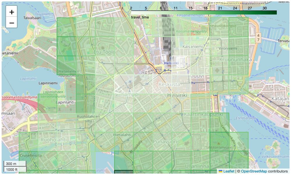
r⁵py is an open-source Python package (wrapping R5) to compute multi-modal 🚲 🚃 🚗 🛼 travel time matrices, isochrones and other accessibility measures By @christophfink.com, @htenkanen.bsky.social, @wklumpen.bsky.social, @urbandemog.bsky.social
Posts Media Videos Starter Packs
Reposted by r⁵py
urbandemog.bsky.social
New paper alert! In a massive collaborative effort, we surveyed 1300 transport & planning practitioners from 22 countries to ask their understanding and normative views of proximity-centred accessibility. doi.org/10.1016/j.ci... To me, the most amazing results that emerged from this paper are that:
r5py.bsky.social
Ready to get started with r5py? Installation is simple via pip: pip install r5py. Check out the quickstart guide in our docs: r5py.readthedocs.io/stable/user-... #r5py #Python #GIS #GeoPython
Quickstart
r5py.readthedocs.io
r5py.bsky.social
Hello world! 👋 We're excited to launch social channels for #r5py, the Python package for super-fast multimodal #travelTime and #accessibility calculations using #OSM & #GTFS data. Follow us for tips, updates, and examples! #r5py #GeoSpatial #Python #UrbanPlanning #GIS
r5py.bsky.social
Computing travel time matrices in r⁵py from #geopandas #DataFrame is two lines of code:

(1) create an r5py.TransportNetwork from @openstreetmap.bsky.social and #GTFS data

(2) turn it into an r5py.TravelTimeMatrix()

Try it out in #binder: r5py.readthedocs.io/stable/user-...
A map of central Helsinki. A transparent overlay shows a grid of cells that are coloured according to the time needed to travel to their centre point from the railway station