Stephen Hicks
@seismo-steve.bsky.social
2.6K followers
230 following
49 posts
Seismologist.
NERC Independent Research Fellow and Lecturer at University College London (UCL).
https://profiles.ucl.ac.uk/89579-stephen-hicks
Posts
Media
Videos
Starter Packs
Pinned


Reposted by Stephen Hicks


Reposted by Stephen Hicks
Reposted by Stephen Hicks


Reposted by Stephen Hicks


Stephen Hicks
@seismo-steve.bsky.social
· Apr 23

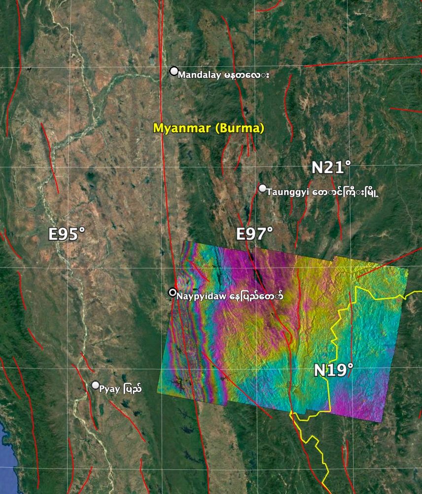
Fin whale song recordings by onshore seismometers open new horizons for cetacean coastal monitoring - Scientific Reports
Scientific Reports - Fin whale song recordings by onshore seismometers open new horizons for cetacean coastal monitoring
www.nature.com
Stephen Hicks
@seismo-steve.bsky.social
· Apr 11


Reposted by Stephen Hicks


Reposted by Stephen Hicks