


Seraphine Hauser
@seraphinehauser.bsky.social
Postdoctoral research scientist working in Atmospheric Sciences at ETH Zurich, Switzerland 🇨🇭| Former Postdoc at OU and UW-Madison 🇺🇸| PhD at Karlsruhe Insitute of Technology 🇩🇪| Views are my own! (she/her)
Reposted by Seraphine Hauser

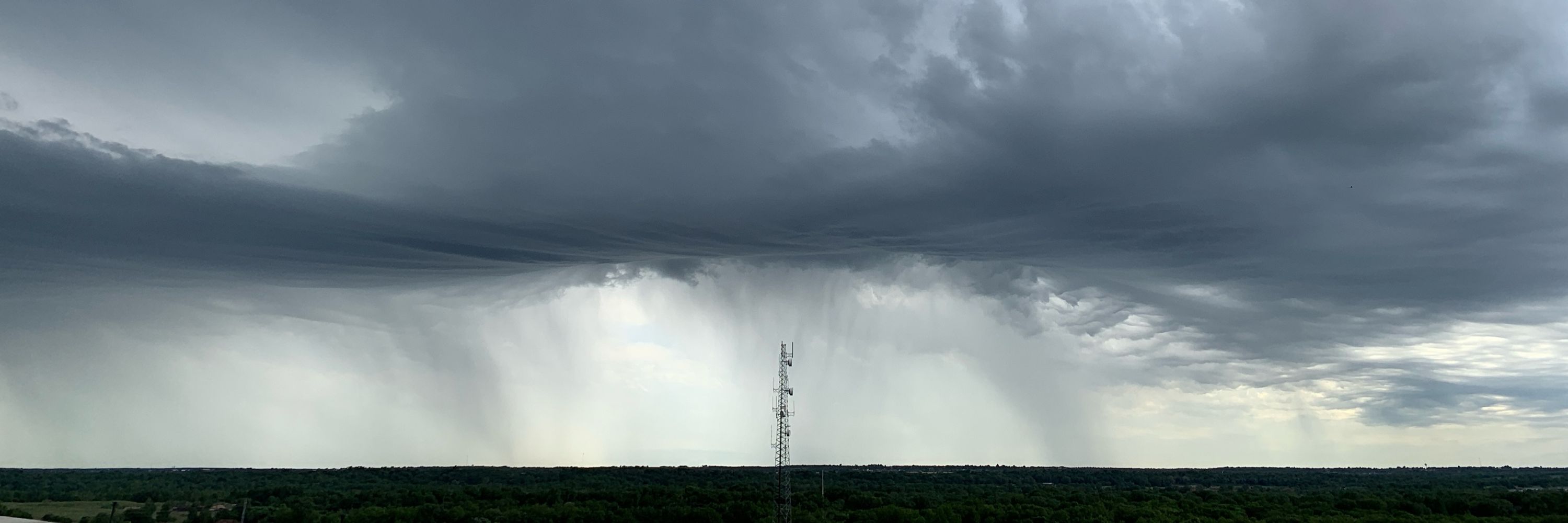
It is caused by stalled circulation. The currently prevailing Eastern European blockade is turning into a high-over-low blockade. The affected region is on the leading edge of a persistent trough, which is cut off due to ridging over northern Europe and nestles in.
July 8, 2025 at 4:03 PM
It is caused by stalled circulation. The currently prevailing Eastern European blockade is turning into a high-over-low blockade. The affected region is on the leading edge of a persistent trough, which is cut off due to ridging over northern Europe and nestles in.
🧵 (7/7)
📅 What’s next?
Forecasts suggest more cyclonic regime activity in the coming two weeks, with a potential return to blocked regimes by mid-July (panel e). ECMWF's control forecast even points to a build-up of Scandinavian blocking later in July—but it’s far out and uncertain.
📅 What’s next?
Forecasts suggest more cyclonic regime activity in the coming two weeks, with a potential return to blocked regimes by mid-July (panel e). ECMWF's control forecast even points to a build-up of Scandinavian blocking later in July—but it’s far out and uncertain.
June 25, 2025 at 6:05 PM
🧵 (7/7)
📅 What’s next?
Forecasts suggest more cyclonic regime activity in the coming two weeks, with a potential return to blocked regimes by mid-July (panel e). ECMWF's control forecast even points to a build-up of Scandinavian blocking later in July—but it’s far out and uncertain.
📅 What’s next?
Forecasts suggest more cyclonic regime activity in the coming two weeks, with a potential return to blocked regimes by mid-July (panel e). ECMWF's control forecast even points to a build-up of Scandinavian blocking later in July—but it’s far out and uncertain.
🧵 (6/7)
🌀 And what about forecasts?
The IFS control forecast from 13 June hinted at a possible transition (with large ensemble spread, panel d). By 17 June, the ensemble mean captured the regime change—but the timing was off.
🌀 And what about forecasts?
The IFS control forecast from 13 June hinted at a possible transition (with large ensemble spread, panel d). By 17 June, the ensemble mean captured the regime change—but the timing was off.
June 25, 2025 at 6:05 PM
🧵 (6/7)
🌀 And what about forecasts?
The IFS control forecast from 13 June hinted at a possible transition (with large ensemble spread, panel d). By 17 June, the ensemble mean captured the regime change—but the timing was off.
🌀 And what about forecasts?
The IFS control forecast from 13 June hinted at a possible transition (with large ensemble spread, panel d). By 17 June, the ensemble mean captured the regime change—but the timing was off.
🧵 (5/7)
📊 How rare is this?
Since 1979, we’ve seen only two other summer transitions from European blocking to Zonal: August 1983 and June 2021. On average, the Zonal regime occurs on just 3.8 summer days per year.
📊 How rare is this?
Since 1979, we’ve seen only two other summer transitions from European blocking to Zonal: August 1983 and June 2021. On average, the Zonal regime occurs on just 3.8 summer days per year.
June 25, 2025 at 6:05 PM
🧵 (5/7)
📊 How rare is this?
Since 1979, we’ve seen only two other summer transitions from European blocking to Zonal: August 1983 and June 2021. On average, the Zonal regime occurs on just 3.8 summer days per year.
📊 How rare is this?
Since 1979, we’ve seen only two other summer transitions from European blocking to Zonal: August 1983 and June 2021. On average, the Zonal regime occurs on just 3.8 summer days per year.
🧵 (4/7)
🔹 Just recently, we transitioned into a Zonal regime—a rare move for summer. Despite the shift in atmospheric circulation, the heat persists because the Zonal regime’s summer footprint still favors above-average temperatures in Central Europe (panel c).
🔹 Just recently, we transitioned into a Zonal regime—a rare move for summer. Despite the shift in atmospheric circulation, the heat persists because the Zonal regime’s summer footprint still favors above-average temperatures in Central Europe (panel c).
June 25, 2025 at 6:05 PM
🧵 (4/7)
🔹 Just recently, we transitioned into a Zonal regime—a rare move for summer. Despite the shift in atmospheric circulation, the heat persists because the Zonal regime’s summer footprint still favors above-average temperatures in Central Europe (panel c).
🔹 Just recently, we transitioned into a Zonal regime—a rare move for summer. Despite the shift in atmospheric circulation, the heat persists because the Zonal regime’s summer footprint still favors above-average temperatures in Central Europe (panel c).
🧵 (3/7)
Here’s what’s happening right now:
🔹 A European blocking pattern set in around 12 June (panel a), fueling the recent heatwave across Central Europe. This regime often brings above-average 2m temperatures in summer, particularly in northeastern Europe (panel b).
Here’s what’s happening right now:
🔹 A European blocking pattern set in around 12 June (panel a), fueling the recent heatwave across Central Europe. This regime often brings above-average 2m temperatures in summer, particularly in northeastern Europe (panel b).
June 25, 2025 at 6:05 PM
🧵 (3/7)
Here’s what’s happening right now:
🔹 A European blocking pattern set in around 12 June (panel a), fueling the recent heatwave across Central Europe. This regime often brings above-average 2m temperatures in summer, particularly in northeastern Europe (panel b).
Here’s what’s happening right now:
🔹 A European blocking pattern set in around 12 June (panel a), fueling the recent heatwave across Central Europe. This regime often brings above-average 2m temperatures in summer, particularly in northeastern Europe (panel b).
🧵 (2/7)
🔍 In fact, a recent study currently under review digs deep into this variability and how surface impacts can differ—even under the same regime type. Stay tuned! (arxiv.org/abs/2408.04302)
🔍 In fact, a recent study currently under review digs deep into this variability and how surface impacts can differ—even under the same regime type. Stay tuned! (arxiv.org/abs/2408.04302)

Quantifying intra-regime weather variability for energy applications
Weather regimes describe the large-scale atmospheric circulation in the mid-latitudes in terms of a few circulation states that modulate regional surface weather. Subseasonal forecasts of prevailing w...
arxiv.org
June 25, 2025 at 6:05 PM
🧵 (2/7)
🔍 In fact, a recent study currently under review digs deep into this variability and how surface impacts can differ—even under the same regime type. Stay tuned! (arxiv.org/abs/2408.04302)
🔍 In fact, a recent study currently under review digs deep into this variability and how surface impacts can differ—even under the same regime type. Stay tuned! (arxiv.org/abs/2408.04302)
🧵 (1/7)
We did just have a regime change over the North Atlantic–European region two days ago—but it didn’t bring much relief at the surface. Why? Because not every regime change leads to a noticeable shift in weather. There’s substantial variability within each regime, especially across seasons.
We did just have a regime change over the North Atlantic–European region two days ago—but it didn’t bring much relief at the surface. Why? Because not every regime change leads to a noticeable shift in weather. There’s substantial variability within each regime, especially across seasons.
June 25, 2025 at 6:05 PM
🧵 (1/7)
We did just have a regime change over the North Atlantic–European region two days ago—but it didn’t bring much relief at the surface. Why? Because not every regime change leads to a noticeable shift in weather. There’s substantial variability within each regime, especially across seasons.
We did just have a regime change over the North Atlantic–European region two days ago—but it didn’t bring much relief at the surface. Why? Because not every regime change leads to a noticeable shift in weather. There’s substantial variability within each regime, especially across seasons.
This is so nice! 🥹
August 28, 2024 at 2:28 PM
This is so nice! 🥹