


Stance Hurst
@stanceh.bsky.social
Assistant Professor of Geoheritage | Heritage and Museum sciences
@texastech
Interested in lithics, photogrammetry, pXRF. Cycling
@texastech
Interested in lithics, photogrammetry, pXRF. Cycling
Pinned
Stance Hurst
@stanceh.bsky.social
· Feb 17
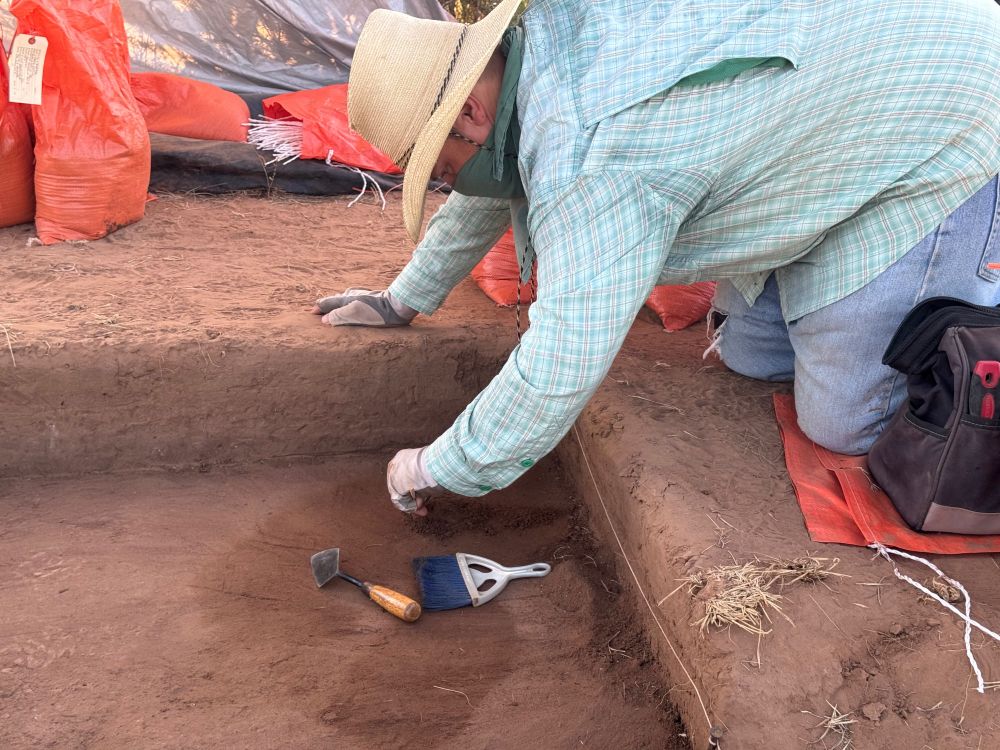
🔎 Join the Lubbock Lake Landmark Field Research Program! ⛏️
Get hands-on experience in archaeology & Quaternary research! Work on active excavations, learn field techniques, and contribute to heritage science
📍 Lubbock, TX | 📅 Summer 2025
🔗 www.depts.ttu.edu/museumttu/ll...
#Archaeology #Fieldwork
Get hands-on experience in archaeology & Quaternary research! Work on active excavations, learn field techniques, and contribute to heritage science
📍 Lubbock, TX | 📅 Summer 2025
🔗 www.depts.ttu.edu/museumttu/ll...
#Archaeology #Fieldwork
StrataWrite Beta update. Join Testflight here: testflight.apple.com/join/k7CDMrQ2
• Export manuscripts and mind maps directly to .md and .txt formats for seamless integration with other tools.
• Enhanced daily word count tracking in manuscripts, making progress more transparent and motivating.
• Export manuscripts and mind maps directly to .md and .txt formats for seamless integration with other tools.
• Enhanced daily word count tracking in manuscripts, making progress more transparent and motivating.

Join the StrataWrite beta
Using TestFlight is a great way to help developers test beta versions of their apps.
testflight.apple.com
August 18, 2025 at 2:29 PM
StrataWrite Beta update. Join Testflight here: testflight.apple.com/join/k7CDMrQ2
• Export manuscripts and mind maps directly to .md and .txt formats for seamless integration with other tools.
• Enhanced daily word count tracking in manuscripts, making progress more transparent and motivating.
• Export manuscripts and mind maps directly to .md and .txt formats for seamless integration with other tools.
• Enhanced daily word count tracking in manuscripts, making progress more transparent and motivating.
I am working on a new research and writing app, that I am calling StrataWrite medium.com/@stancehurst.... If you are running MacOs 26 Tahoe (Beta) and are interested in testing. Here is the link to join the test flight: testflight.apple.com/join/k7CDMrQ2
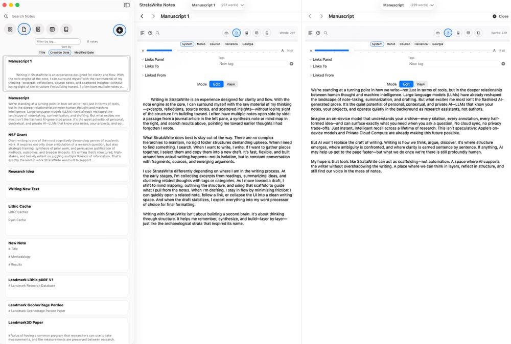
StrataWrite: A Writing App Built by an Archaeologist for Thinking in Layers
StrataWrite is a macOS note-taking and writing application I’ve been building as a side project — equal parts note-taking, research…
medium.com
July 30, 2025 at 1:09 AM
I am working on a new research and writing app, that I am calling StrataWrite medium.com/@stancehurst.... If you are running MacOs 26 Tahoe (Beta) and are interested in testing. Here is the link to join the test flight: testflight.apple.com/join/k7CDMrQ2
Reposted by Stance Hurst
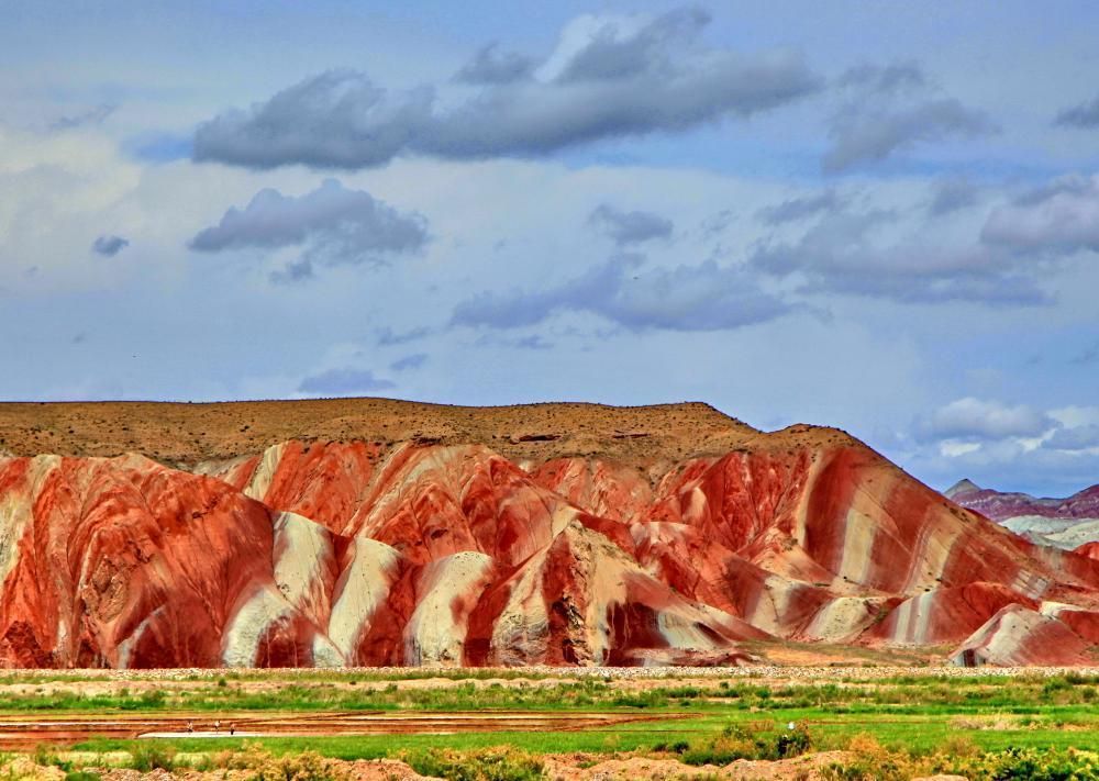
🟥 Geological Wonder from Iran! 🟥
📍 Upper Red Formation, Hesar area, Zanjan Province
📸 Photo by Alireza Amrikazemi
Say hello to one of Iran’s most striking geological landscapes! These vibrant red and white layers belong to the Upper Red Formation
#geoheritage #iran
📍 Upper Red Formation, Hesar area, Zanjan Province
📸 Photo by Alireza Amrikazemi
Say hello to one of Iran’s most striking geological landscapes! These vibrant red and white layers belong to the Upper Red Formation
#geoheritage #iran
May 9, 2025 at 7:58 AM
🟥 Geological Wonder from Iran! 🟥
📍 Upper Red Formation, Hesar area, Zanjan Province
📸 Photo by Alireza Amrikazemi
Say hello to one of Iran’s most striking geological landscapes! These vibrant red and white layers belong to the Upper Red Formation
#geoheritage #iran
📍 Upper Red Formation, Hesar area, Zanjan Province
📸 Photo by Alireza Amrikazemi
Say hello to one of Iran’s most striking geological landscapes! These vibrant red and white layers belong to the Upper Red Formation
#geoheritage #iran
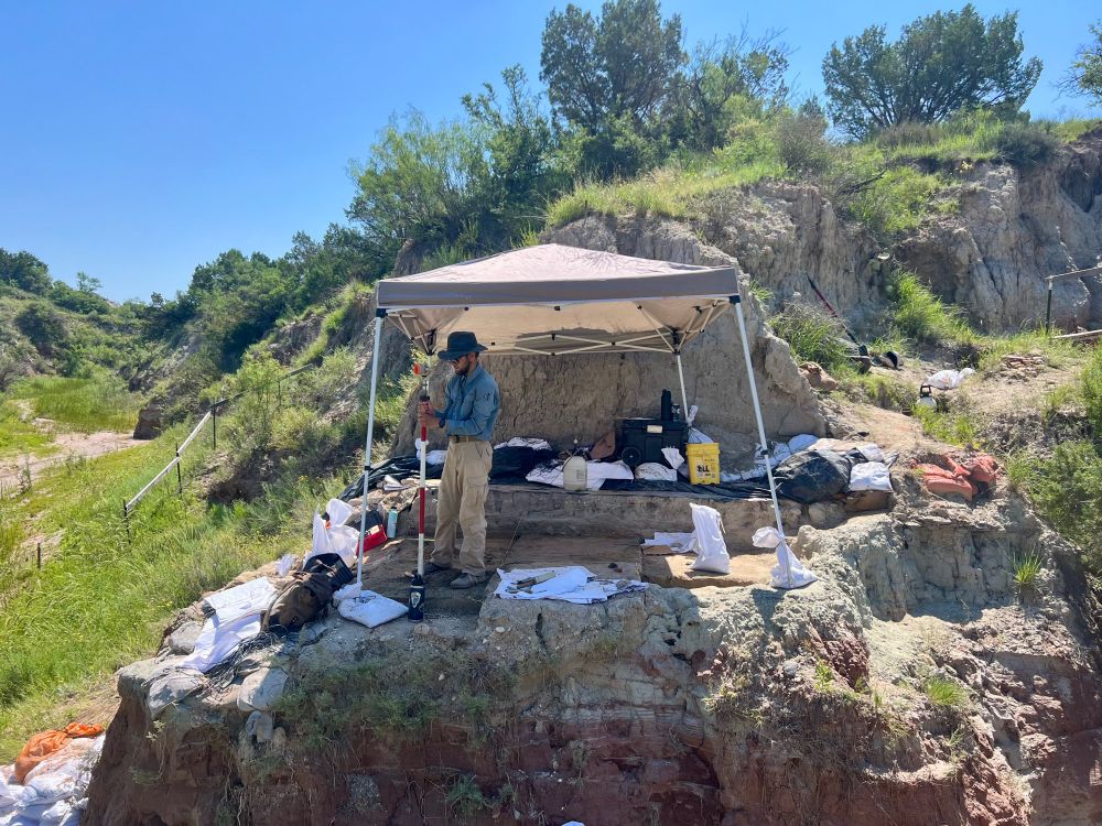
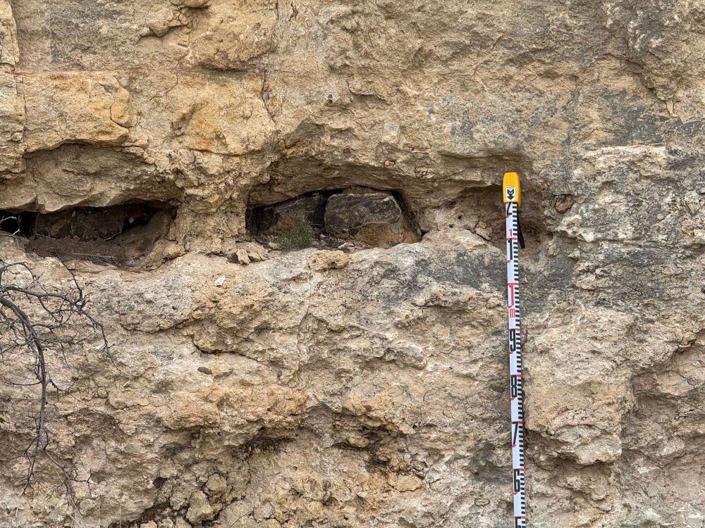
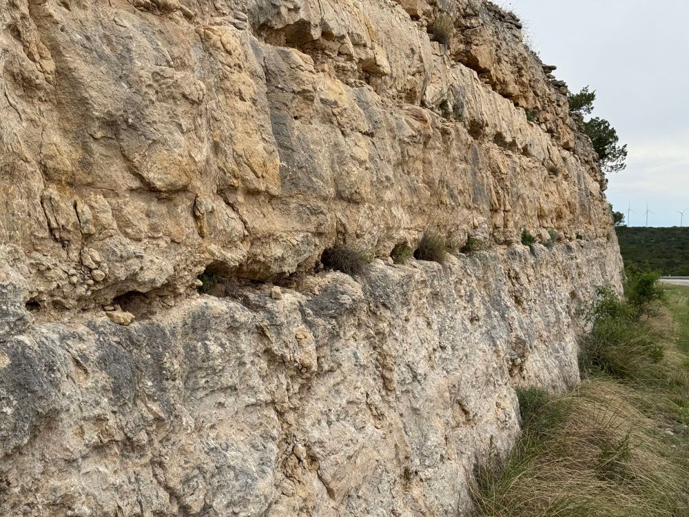
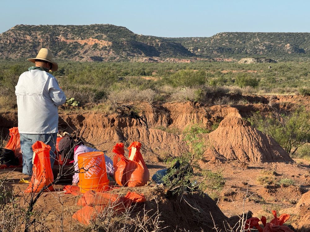
Spent the day looking for chert outcrops in limestone across west Texas. Adding to the database of landscape lithic geodiversity across the Southern Plains of Texas. #Geoheritage
May 8, 2025 at 10:32 PM
Spent the day looking for chert outcrops in limestone across west Texas. Adding to the database of landscape lithic geodiversity across the Southern Plains of Texas. #Geoheritage
Driving today to the SAA conference in Denver.
April 23, 2025 at 12:22 PM
Driving today to the SAA conference in Denver.
Reposted by Stance Hurst
🔎 Join the Lubbock Lake Landmark Field Research Program! ⛏️
Get hands-on experience in archaeology & Quaternary research! Work on active excavations, learn field techniques, and contribute to heritage science
📍 Lubbock, TX | 📅 Summer 2025
🔗 www.depts.ttu.edu/museumttu/ll...
#Archaeology #Fieldwork
Get hands-on experience in archaeology & Quaternary research! Work on active excavations, learn field techniques, and contribute to heritage science
📍 Lubbock, TX | 📅 Summer 2025
🔗 www.depts.ttu.edu/museumttu/ll...
#Archaeology #Fieldwork
February 17, 2025 at 11:56 AM
🔎 Join the Lubbock Lake Landmark Field Research Program! ⛏️
Get hands-on experience in archaeology & Quaternary research! Work on active excavations, learn field techniques, and contribute to heritage science
📍 Lubbock, TX | 📅 Summer 2025
🔗 www.depts.ttu.edu/museumttu/ll...
#Archaeology #Fieldwork
Get hands-on experience in archaeology & Quaternary research! Work on active excavations, learn field techniques, and contribute to heritage science
📍 Lubbock, TX | 📅 Summer 2025
🔗 www.depts.ttu.edu/museumttu/ll...
#Archaeology #Fieldwork
I was genuinely impressed by the latest Mr. Beast video featuring the exploration of the Giza Pyramids — @flintdibble.bsky.social.
"If the Egyptians can build the pyramids, they can build anything."
"If the Egyptians can build the pyramids, they can build anything."
February 14, 2025 at 3:50 PM
I was genuinely impressed by the latest Mr. Beast video featuring the exploration of the Giza Pyramids — @flintdibble.bsky.social.
"If the Egyptians can build the pyramids, they can build anything."
"If the Egyptians can build the pyramids, they can build anything."
Reposted by Stance Hurst
🌍 Geodiversity Assessment: Unlocking Earth's Hidden Value 🏔️
Geodiversity widely recognized in geoscience, its assessment and mapping remain a challenge involving: 📊
📌 Classification & Indexing
📌 GIS Mapping
📌 Integrated Approaches
#Geodiversity #Geoheritage #Geoconservation
Geodiversity widely recognized in geoscience, its assessment and mapping remain a challenge involving: 📊
📌 Classification & Indexing
📌 GIS Mapping
📌 Integrated Approaches
#Geodiversity #Geoheritage #Geoconservation
February 14, 2025 at 3:44 PM
🌍 Geodiversity Assessment: Unlocking Earth's Hidden Value 🏔️
Geodiversity widely recognized in geoscience, its assessment and mapping remain a challenge involving: 📊
📌 Classification & Indexing
📌 GIS Mapping
📌 Integrated Approaches
#Geodiversity #Geoheritage #Geoconservation
Geodiversity widely recognized in geoscience, its assessment and mapping remain a challenge involving: 📊
📌 Classification & Indexing
📌 GIS Mapping
📌 Integrated Approaches
#Geodiversity #Geoheritage #Geoconservation
Apply for our summer #archaeology field research program. www.depts.ttu.edu/museumttu/ll...
Field Research Program
www.depts.ttu.edu
February 13, 2025 at 3:40 AM
Apply for our summer #archaeology field research program. www.depts.ttu.edu/museumttu/ll...
Reposted by Stance Hurst
Published a new paper on 3D modeling using Apple’s photogrammetry Object capture. We use it for 3D modeling everything. Projectile points, landscapes, etc. journals.plos.org/plosone/arti...
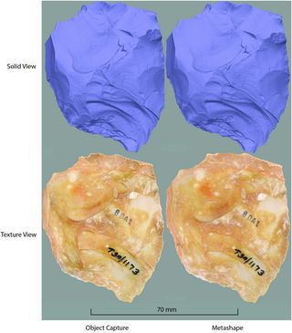
Assessment of Apple’s object capture photogrammetry API for rapidly creating research quality cultural heritage 3D models
Photogrammetry is a significant tool museums utilize to produce high-quality 3D models for research and exhibit content. As advancements in computer hardware and software continue, it is crucial to as...
journals.plos.org
February 8, 2025 at 11:41 AM
Published a new paper on 3D modeling using Apple’s photogrammetry Object capture. We use it for 3D modeling everything. Projectile points, landscapes, etc. journals.plos.org/plosone/arti...
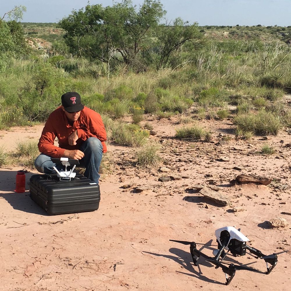
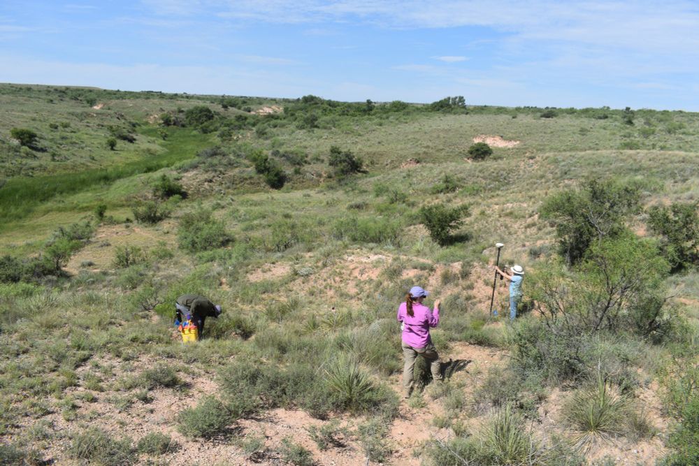
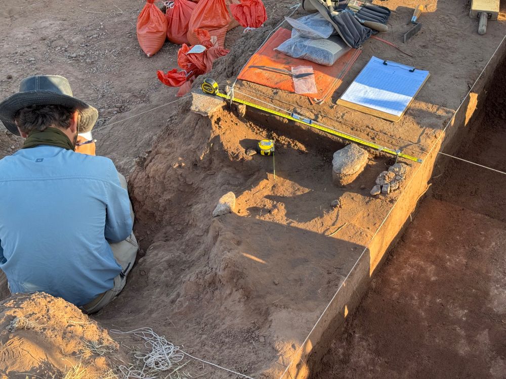
Published new research on the use of drones to map archaeology, sediments and soils in West Texas.
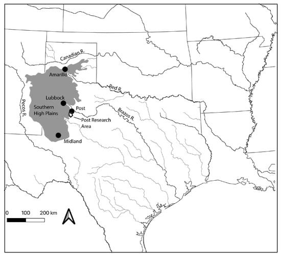
Mapping Stratigraphy and Artifact Distribution with Unmanned Aerial Vehicle-Based Three-Dimensional Models—A Case Study from the Post Research Area in Northwestern Texas, USA
This study applies UAV-based photogrammetry to map and examine the stratigraphy and archaeological artifact distribution in two localities within the Post research area in northwest Texas. A DJI Inspi...
www.mdpi.com
November 21, 2024 at 1:20 AM
Published new research on the use of drones to map archaeology, sediments and soils in West Texas.
October 19, 2024 at 3:56 PM