


Grant Huang
@yanchen00.bsky.social
TW | Cartography, GIS, Transportation, Urban planning, Dataviz | In ㄎㄧㄤ we trust | DM open | Wanderlust |
Twitter => https://twitter.com/yanchen00
Mastodon => http://mastodon.social/@yanchen00
Twitter => https://twitter.com/yanchen00
Mastodon => http://mastodon.social/@yanchen00
#30DayMapChallenge Day 5: Earth
Hong Kong International Airport added 650 ha of newly reclamed land in recent years for new terminal and 3rd runway. The change can easily be seen from satellite images.
#maps
Hong Kong International Airport added 650 ha of newly reclamed land in recent years for new terminal and 3rd runway. The change can easily be seen from satellite images.
#maps


November 8, 2025 at 4:30 PM
#30DayMapChallenge Day 5: Earth
Hong Kong International Airport added 650 ha of newly reclamed land in recent years for new terminal and 3rd runway. The change can easily be seen from satellite images.
#maps
Hong Kong International Airport added 650 ha of newly reclamed land in recent years for new terminal and 3rd runway. The change can easily be seen from satellite images.
#maps
#30DayMapChallenge Day 4: My Data
I completed a single, full ride on the Kaohsiung Circular Light Rail. It took me around 90 min to finish the whole circle. What a pointless journey🫠
#map
I completed a single, full ride on the Kaohsiung Circular Light Rail. It took me around 90 min to finish the whole circle. What a pointless journey🫠
#map

November 5, 2025 at 12:57 PM
#30DayMapChallenge Day 4: My Data
I completed a single, full ride on the Kaohsiung Circular Light Rail. It took me around 90 min to finish the whole circle. What a pointless journey🫠
#map
I completed a single, full ride on the Kaohsiung Circular Light Rail. It took me around 90 min to finish the whole circle. What a pointless journey🫠
#map
#30DayMapChallenge Day 3: Polygons
I arranged the Japanese prefectures to look like a sight test! The largest polygon at the top is Hokkaido. It's roughly the size of Austria.
#map #Japan
I arranged the Japanese prefectures to look like a sight test! The largest polygon at the top is Hokkaido. It's roughly the size of Austria.
#map #Japan

November 4, 2025 at 1:03 PM
#30DayMapChallenge Day 3: Polygons
I arranged the Japanese prefectures to look like a sight test! The largest polygon at the top is Hokkaido. It's roughly the size of Austria.
#map #Japan
I arranged the Japanese prefectures to look like a sight test! The largest polygon at the top is Hokkaido. It's roughly the size of Austria.
#map #Japan
#30DayMapChallenge Day 2 - Lines
The route of Kaohsiung garbage truckes🚚. after collection, they head to the incineration plants, making the lines around them thicker.
#map
The route of Kaohsiung garbage truckes🚚. after collection, they head to the incineration plants, making the lines around them thicker.
#map

November 3, 2025 at 9:59 AM
#30DayMapChallenge Day 2 - Lines
The route of Kaohsiung garbage truckes🚚. after collection, they head to the incineration plants, making the lines around them thicker.
#map
The route of Kaohsiung garbage truckes🚚. after collection, they head to the incineration plants, making the lines around them thicker.
#map
#30DaysMapChallenge Day1: Points
Destinations of Taoyuan International Airport have changed a lot compared with 2015. More than 2/3 Chinese destinations have terminated during covid pandemic. Yet, number of Japanese, Korean and European destinations have significantly increased.
Destinations of Taoyuan International Airport have changed a lot compared with 2015. More than 2/3 Chinese destinations have terminated during covid pandemic. Yet, number of Japanese, Korean and European destinations have significantly increased.

November 2, 2025 at 7:09 AM
#30DaysMapChallenge Day1: Points
Destinations of Taoyuan International Airport have changed a lot compared with 2015. More than 2/3 Chinese destinations have terminated during covid pandemic. Yet, number of Japanese, Korean and European destinations have significantly increased.
Destinations of Taoyuan International Airport have changed a lot compared with 2015. More than 2/3 Chinese destinations have terminated during covid pandemic. Yet, number of Japanese, Korean and European destinations have significantly increased.
Taiwan is going to lunch its first FORMOSAT-8 satellite in November!
www.youtube.com/watch?v=veU3...
www.youtube.com/watch?v=veU3...


October 3, 2025 at 3:07 PM
Taiwan is going to lunch its first FORMOSAT-8 satellite in November!
www.youtube.com/watch?v=veU3...
www.youtube.com/watch?v=veU3...

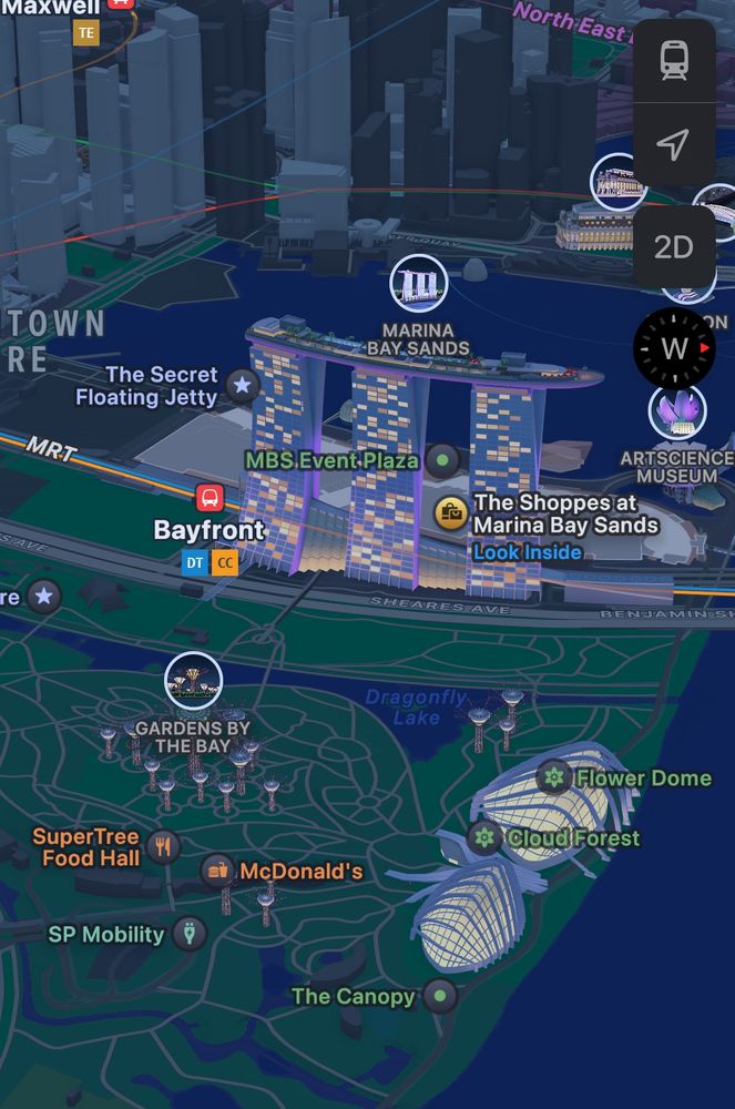
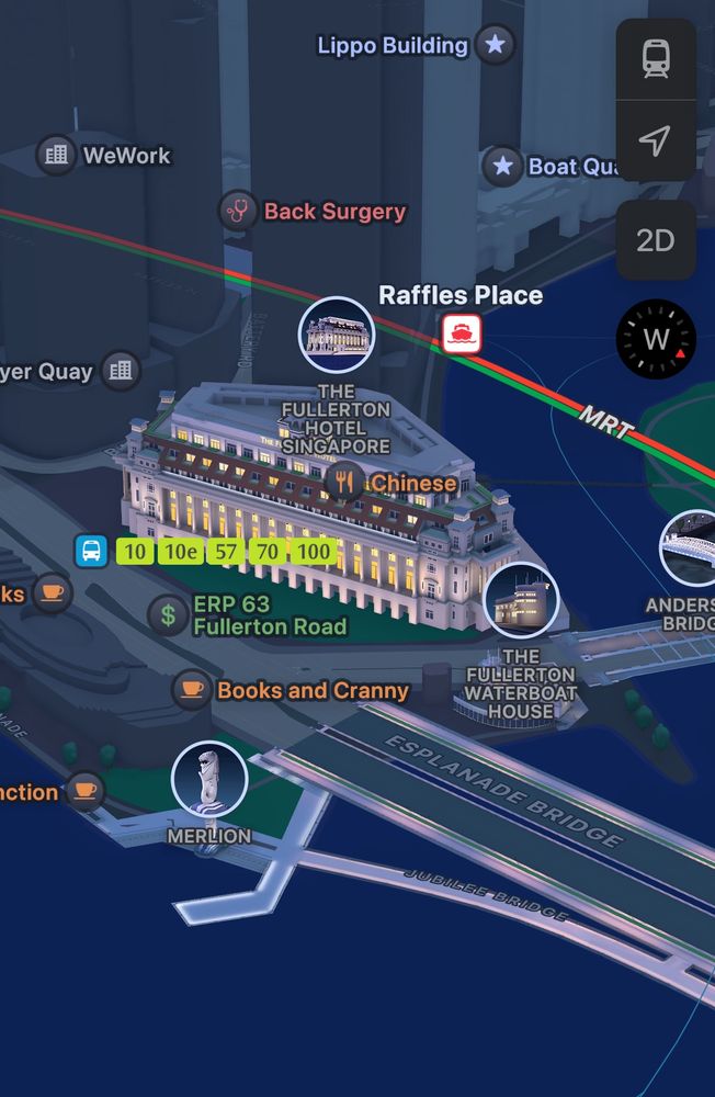
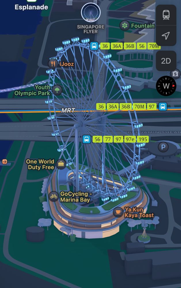
Did Apple Maps update these building models in Singapore 🇸🇬?
I don’t remember models in Singapore have such decorations.
I don’t remember models in Singapore have such decorations.
August 7, 2025 at 7:39 AM
Did Apple Maps update these building models in Singapore 🇸🇬?
I don’t remember models in Singapore have such decorations.
I don’t remember models in Singapore have such decorations.
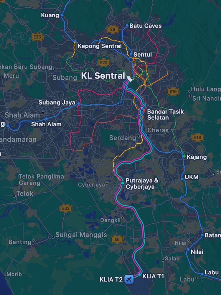
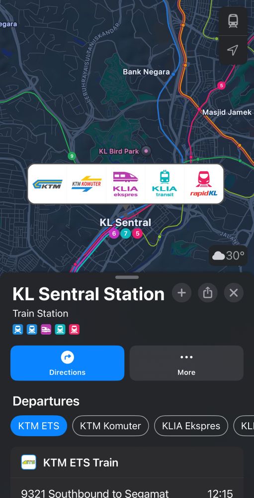
Public transportation lines in Kuala Lumpur 🇲🇾are now available on Apple Maps.🥳 #KualaLumpur
May 23, 2025 at 3:01 AM
Public transportation lines in Kuala Lumpur 🇲🇾are now available on Apple Maps.🥳 #KualaLumpur
Creating animation using #Blender and Python. Garbage truck 🗑️ movement animation for Kaohsiung City from Tue, 4/15 to Thu, 4/17. Garbage collection in the city is mainly in the afternoons and evenings.
#b3d #MovingPandas
#b3d #MovingPandas
May 17, 2025 at 4:52 PM
Creating animation using #Blender and Python. Garbage truck 🗑️ movement animation for Kaohsiung City from Tue, 4/15 to Thu, 4/17. Garbage collection in the city is mainly in the afternoons and evenings.
#b3d #MovingPandas
#b3d #MovingPandas
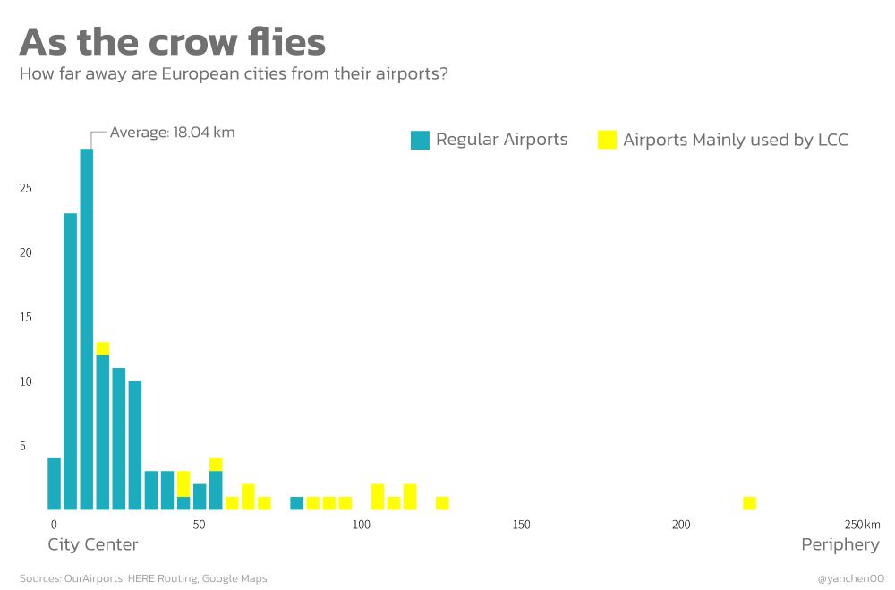
Transforming map data to chart. The distribution chart indicates that, on average, European cities are around 15~20km away from their airports.
April 6, 2025 at 4:02 PM
Transforming map data to chart. The distribution chart indicates that, on average, European cities are around 15~20km away from their airports.
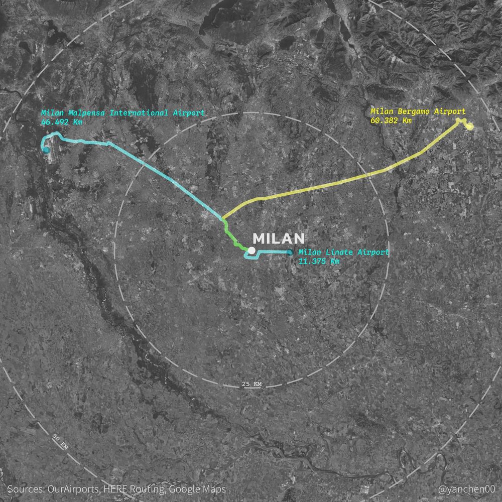
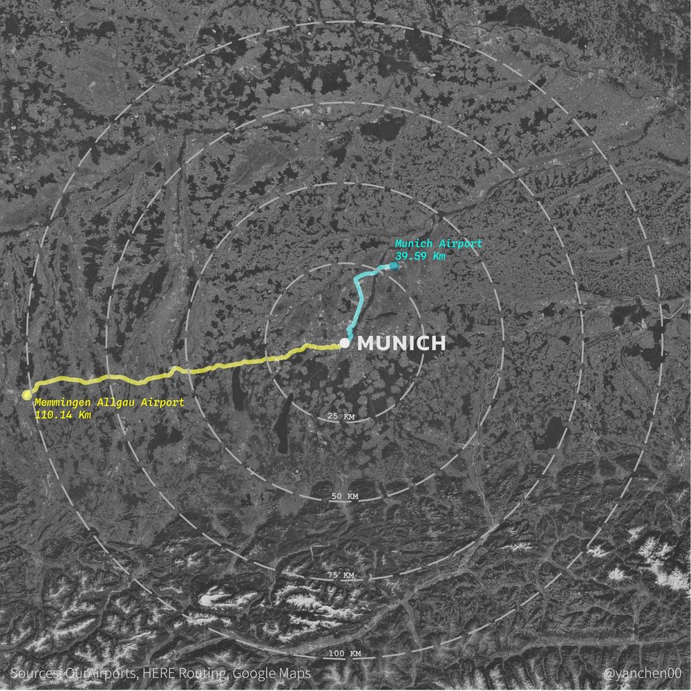
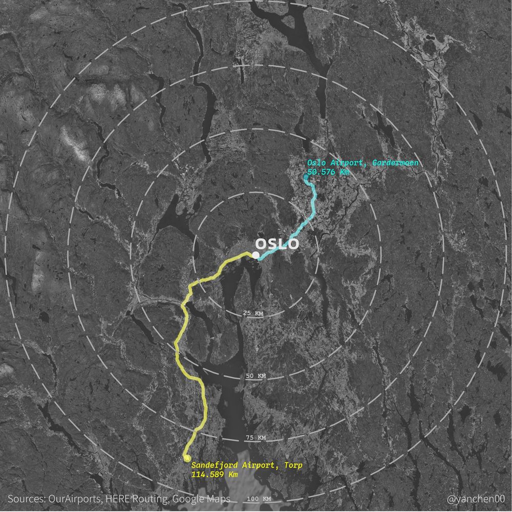
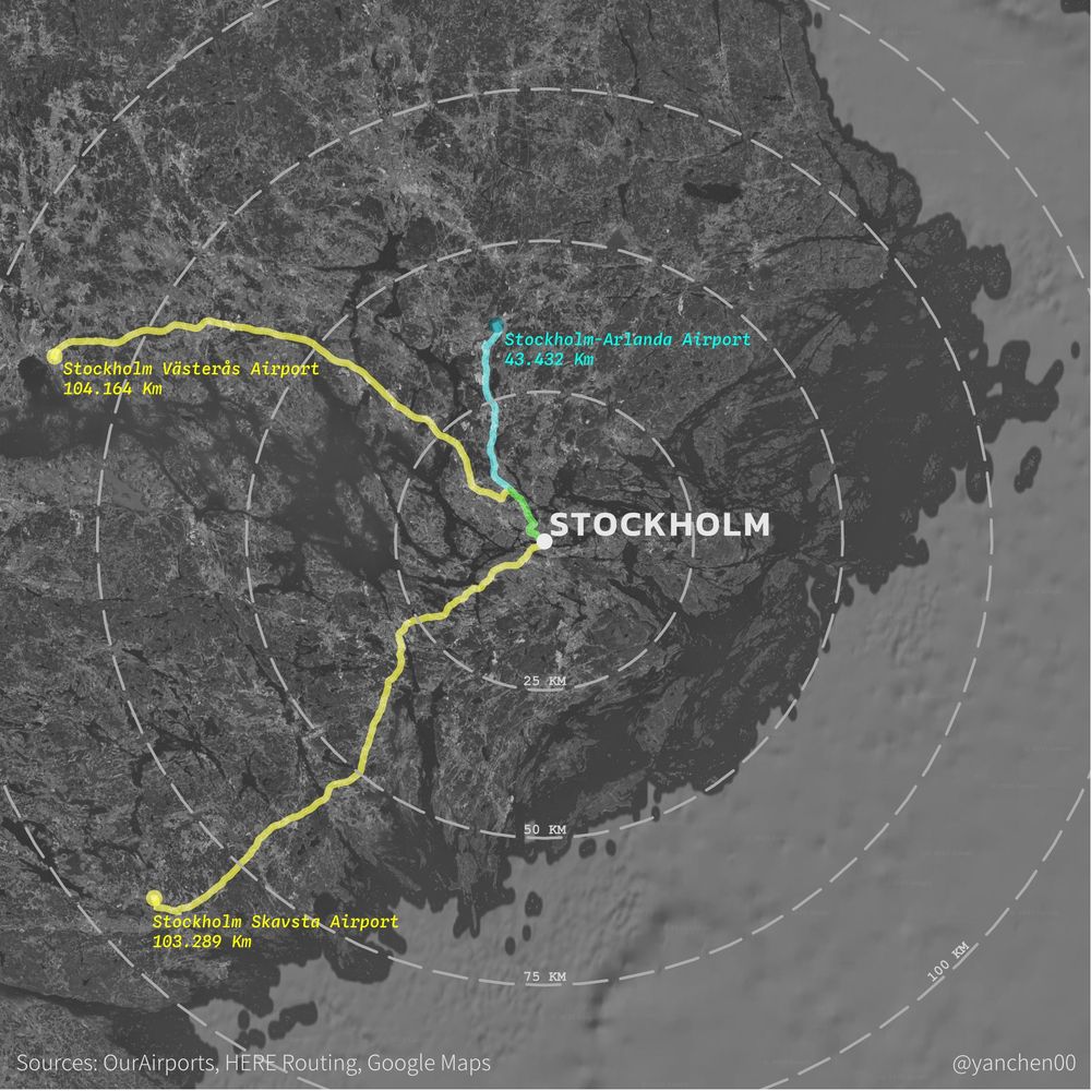
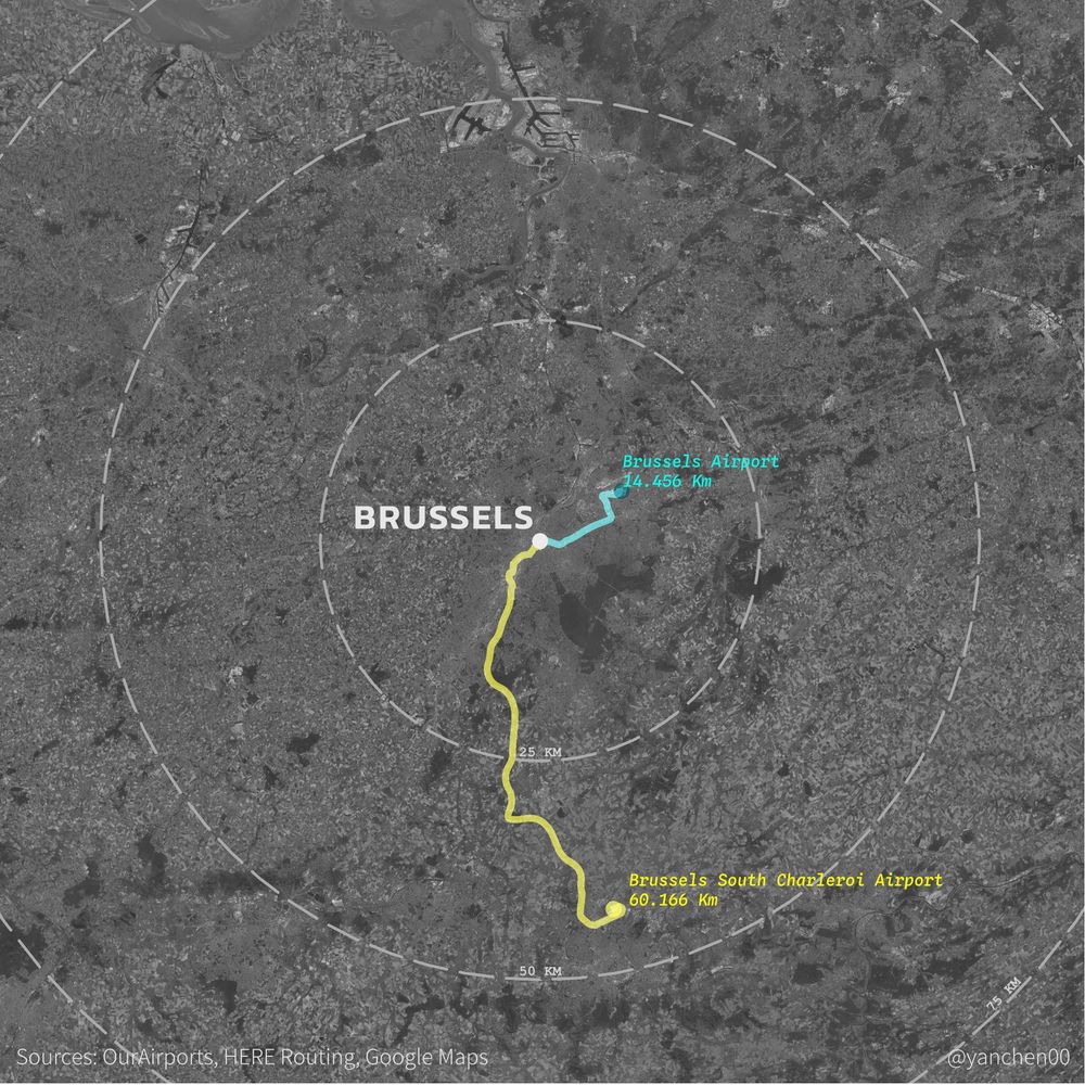
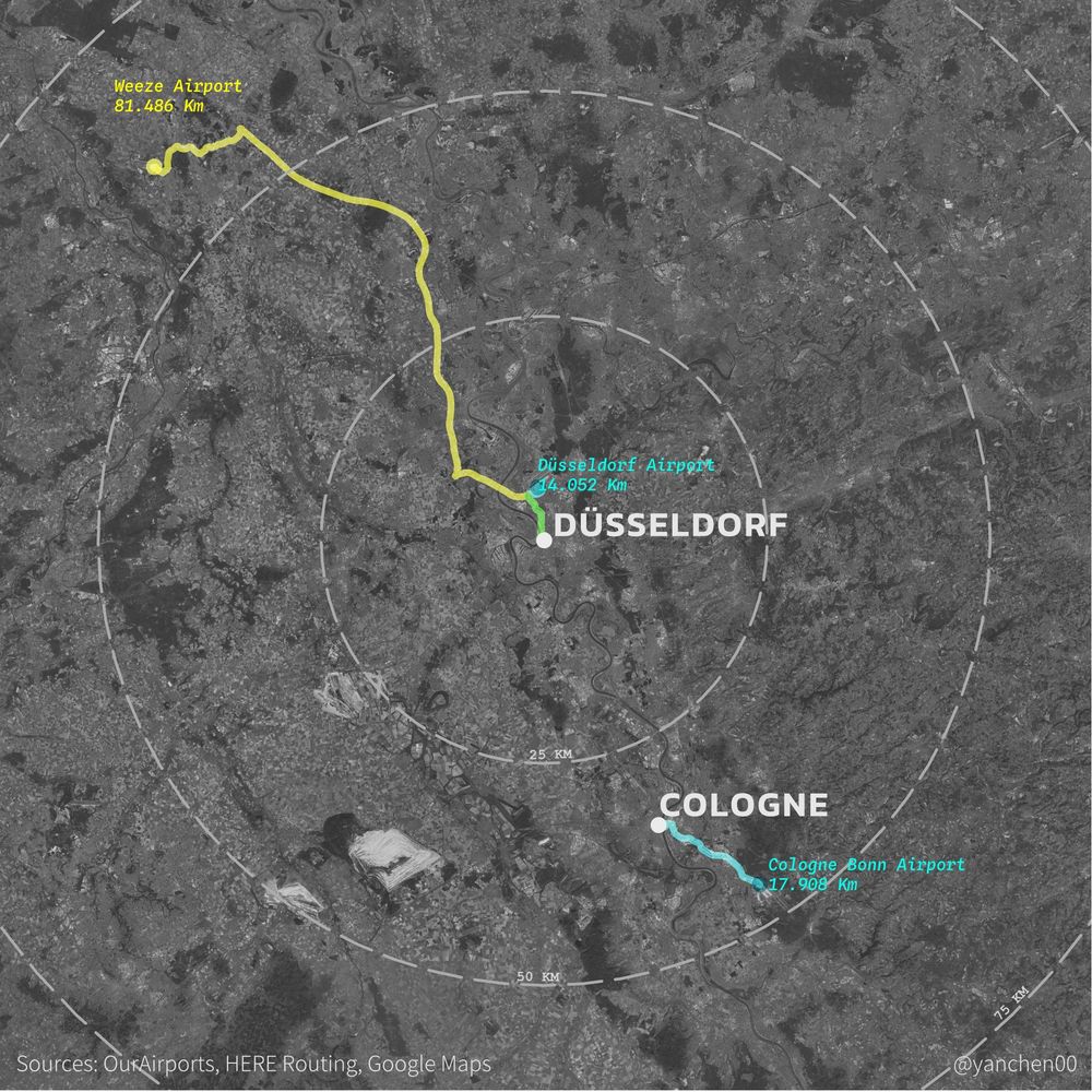
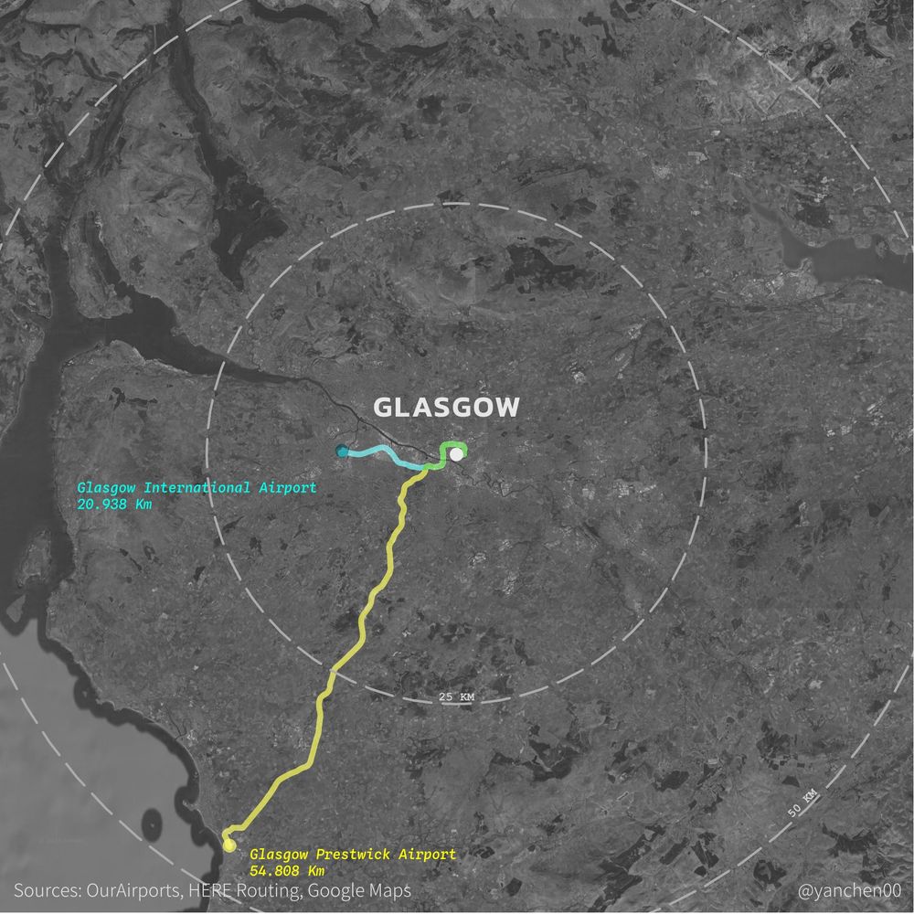
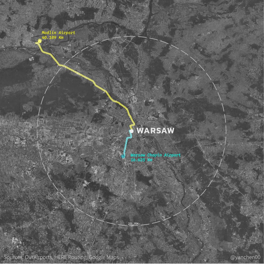
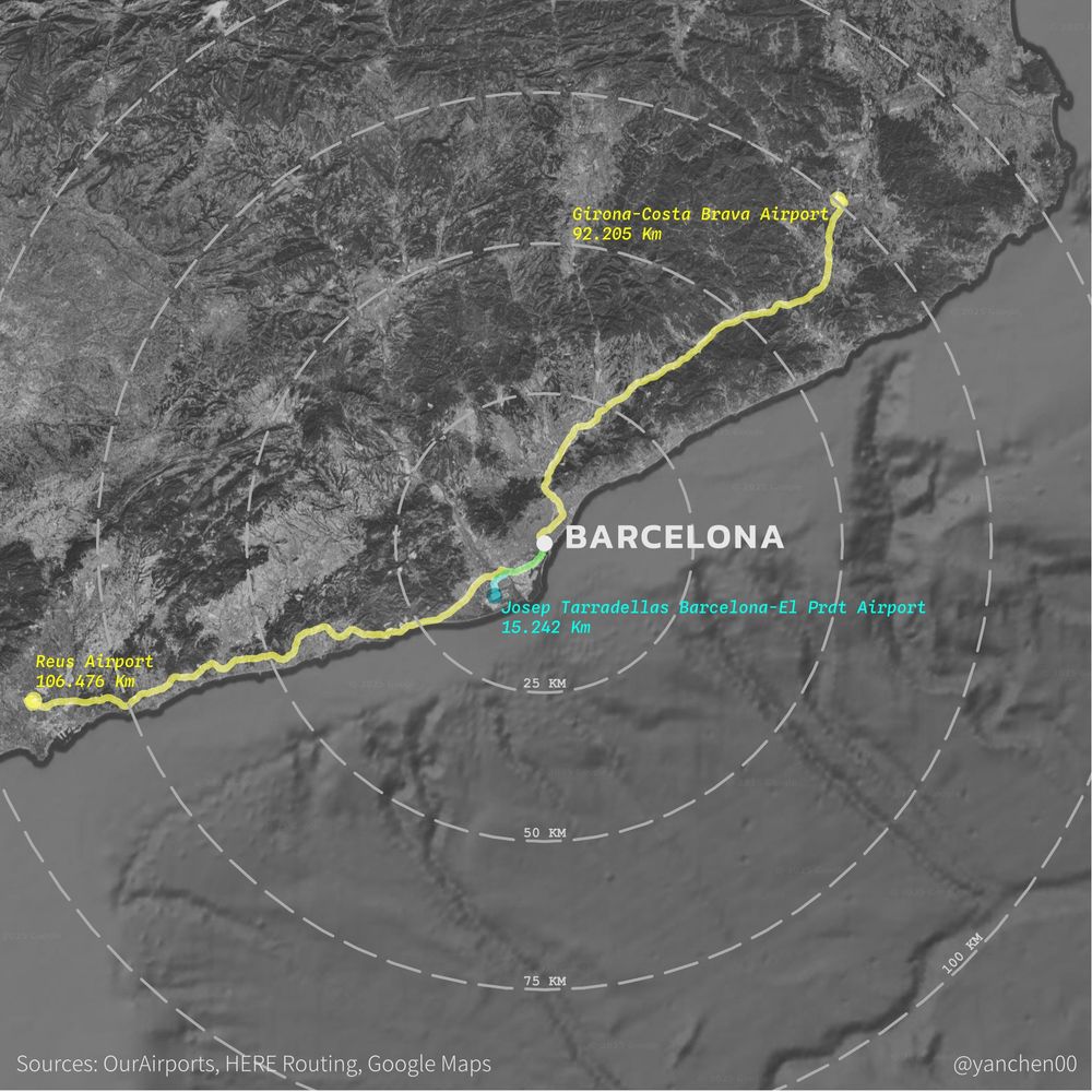
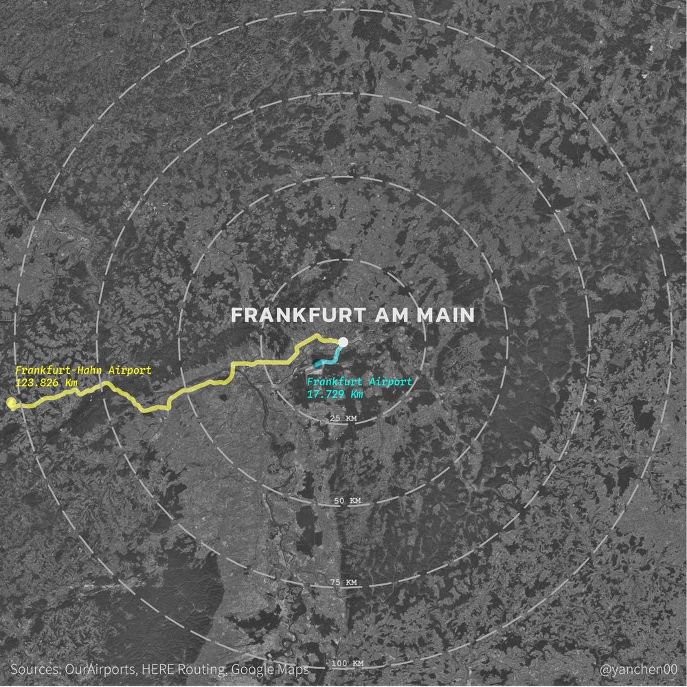
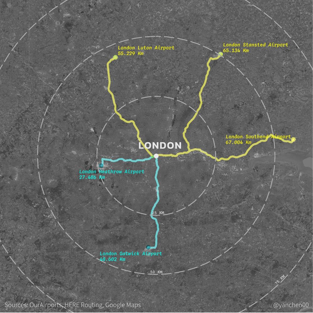
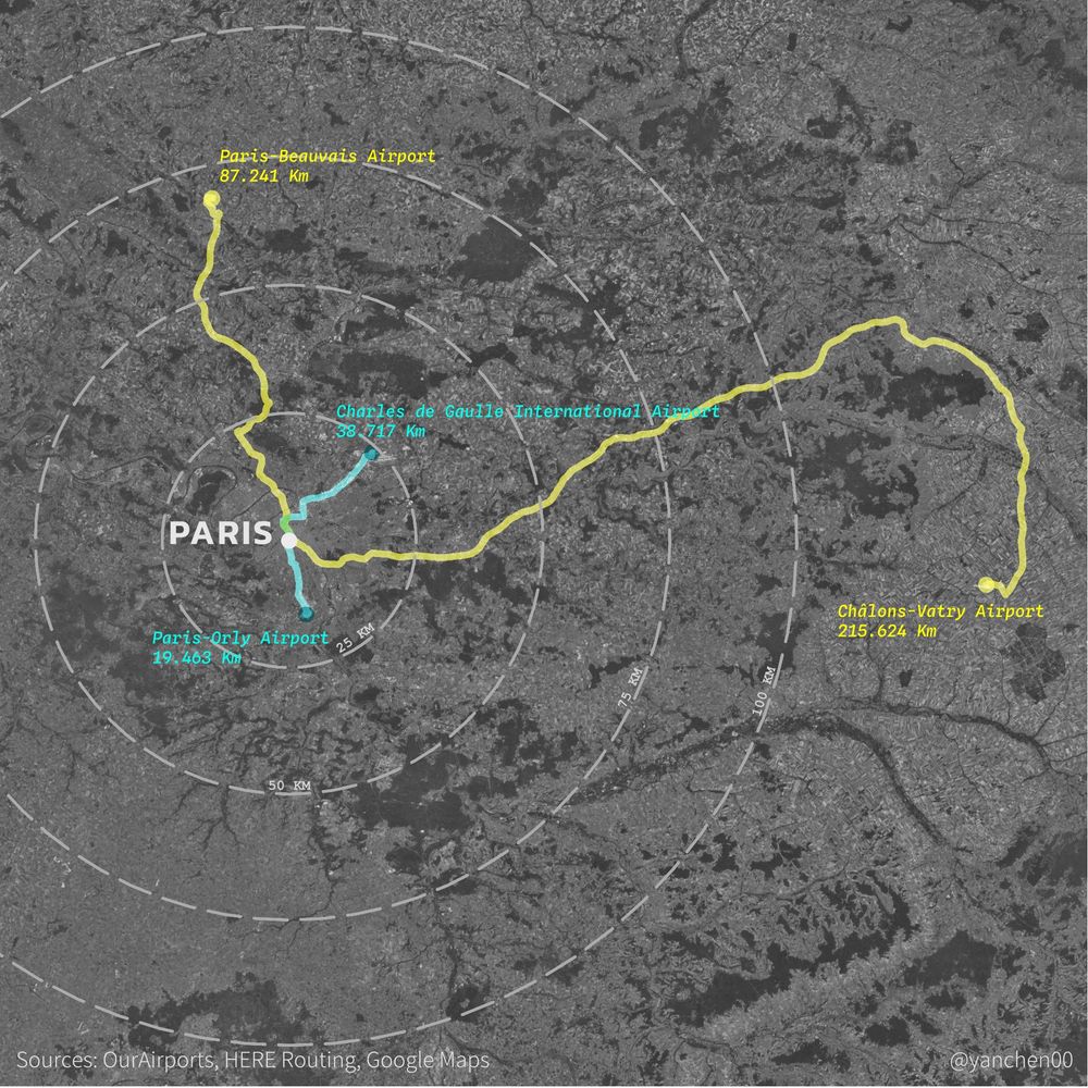
Low-cost carriers sometimes mislead customers by using airports far from actual destinations. The maps below are examples. The lines are driving routes from airports to city centre. Yellow one means airports used mainly by lcc, and blue ones used by regular airlines.
#maps
#maps
April 3, 2025 at 11:57 AM
Low-cost carriers sometimes mislead customers by using airports far from actual destinations. The maps below are examples. The lines are driving routes from airports to city centre. Yellow one means airports used mainly by lcc, and blue ones used by regular airlines.
#maps
#maps
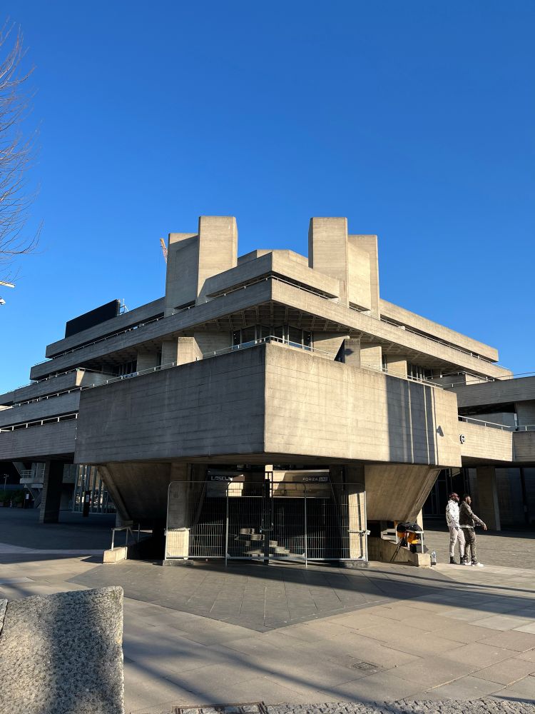
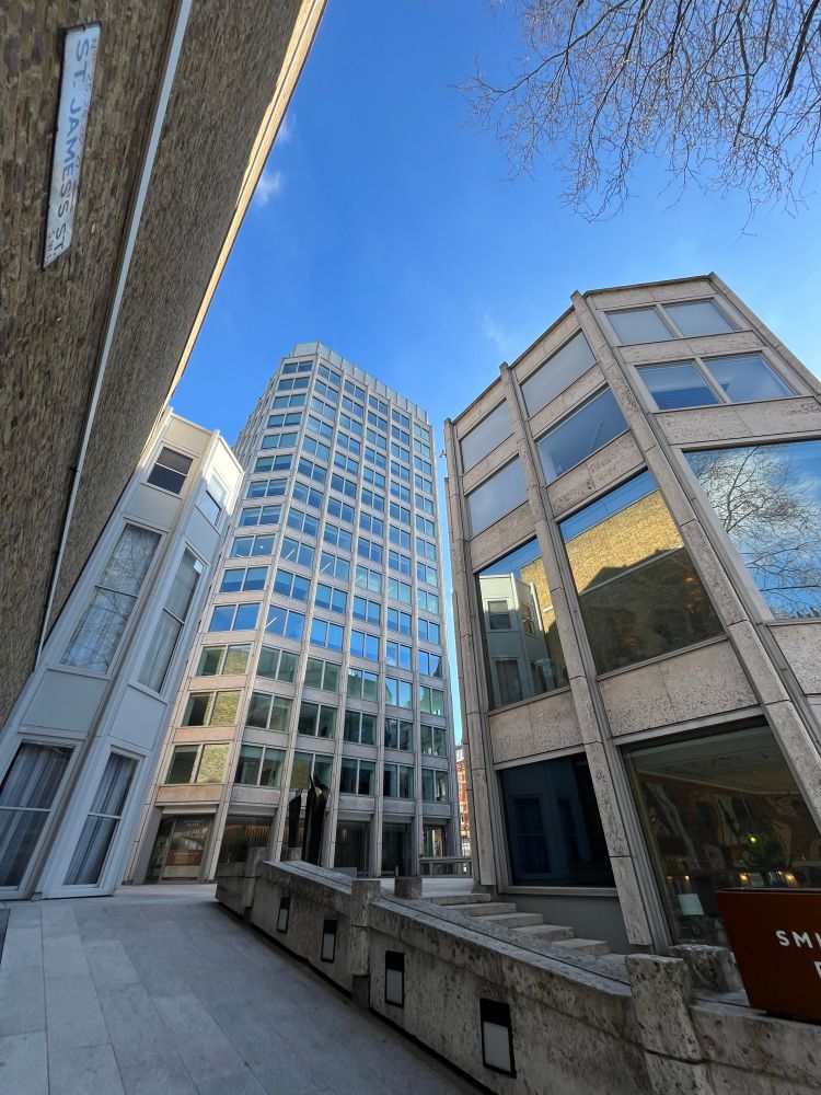
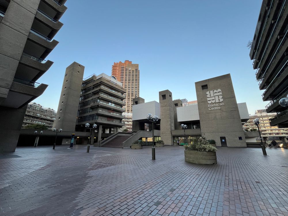
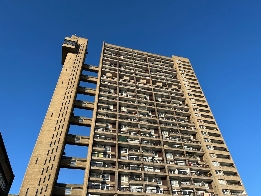
London is a paradise of brutalist architecture. These buildings are still futuristic 50 years after. It’s quite sad that almost no one builds in this style anymore.
March 5, 2025 at 11:22 PM
London is a paradise of brutalist architecture. These buildings are still futuristic 50 years after. It’s quite sad that almost no one builds in this style anymore.
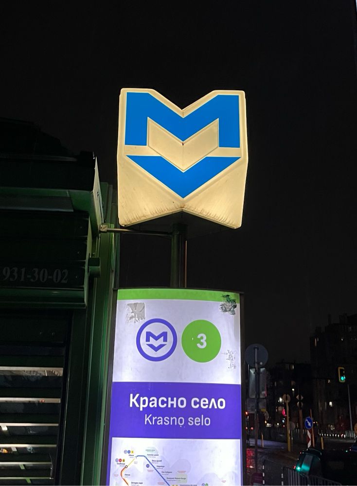
The most interesting aspect of the Budapest metro 🇭🇺 is that each line was built in different eras. M1 is the 2nd oldest metro in the world. M2 & M3 were built in the 1970s. M4 was built in the 2010s. M3 has been recently reconstructed. It feels like time traveling when changing lines in the system.


January 5, 2025 at 12:59 AM
The most interesting aspect of the Budapest metro 🇭🇺 is that each line was built in different eras. M1 is the 2nd oldest metro in the world. M2 & M3 were built in the 1970s. M4 was built in the 2010s. M3 has been recently reconstructed. It feels like time traveling when changing lines in the system.
Sea cable sabotage in the waters northeast of Taiwan
www.cna.com.tw/news/asoc/20...
www.cna.com.tw/news/asoc/20...

January 4, 2025 at 7:49 PM
Sea cable sabotage in the waters northeast of Taiwan
www.cna.com.tw/news/asoc/20...
www.cna.com.tw/news/asoc/20...
Apple map just recently added Thai 🇹🇭 trains and MRTs routes into the map!!!
I hope Malaysia 🇲🇾 and Turkey🇹🇷 can be available soon.
I hope Malaysia 🇲🇾 and Turkey🇹🇷 can be available soon.


October 28, 2024 at 8:03 PM
Apple map just recently added Thai 🇹🇭 trains and MRTs routes into the map!!!
I hope Malaysia 🇲🇾 and Turkey🇹🇷 can be available soon.
I hope Malaysia 🇲🇾 and Turkey🇹🇷 can be available soon.
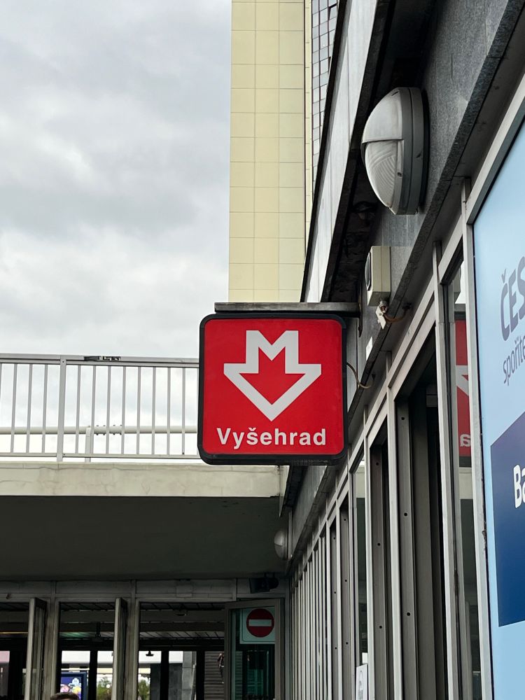
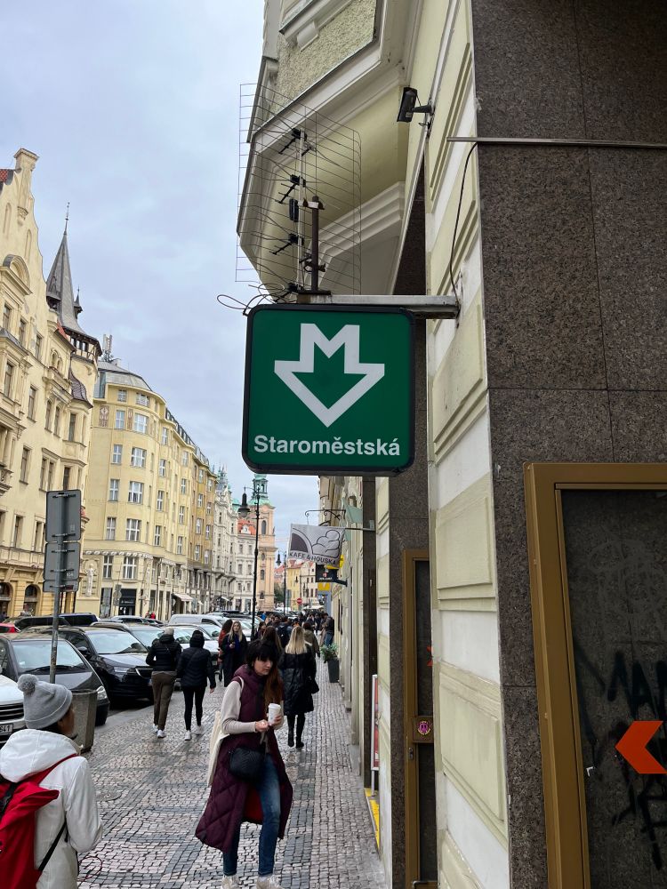
These Prague metro station designs are amazing! Jaroslav Otruba should deserve more recognition.


October 25, 2024 at 7:11 PM
These Prague metro station designs are amazing! Jaroslav Otruba should deserve more recognition.
Bluesky now has over 10 million users, and I was #1,572,066!

September 20, 2024 at 10:35 PM
Bluesky now has over 10 million users, and I was #1,572,066!
將9組標租的單元進行整理回顧再加上各站捷運的進出量資料可以看到,一直到2020年前捷運站廣告由四間廠商經營。東森(東森新媒體、東森新聞雲)於2020年後逐步獲得北捷廣告的經營權,自2021年後就拿下9組中的7組一直到今天。使用捷運站進出人次來看東森長年保持著7成的市占率。這就難怪為何這麼常看到東森的相關廣告了。😗

August 23, 2024 at 1:30 PM
將9組標租的單元進行整理回顧再加上各站捷運的進出量資料可以看到,一直到2020年前捷運站廣告由四間廠商經營。東森(東森新媒體、東森新聞雲)於2020年後逐步獲得北捷廣告的經營權,自2021年後就拿下9組中的7組一直到今天。使用捷運站進出人次來看東森長年保持著7成的市占率。這就難怪為何這麼常看到東森的相關廣告了。😗
雖然四間公司分別經營北捷廣告,但當中東森新媒體控股與森岳傳播同屬於東森新聞雲(ET Today)所擁有。也就是說9組捷運廣告中有7間由同集團經營,若使用廣告面積計算東森新聞雲所經營的廣告佔了78%的面積。使用站內的廣告看板數看,捷運站廣告總數為1851幅,東森新聞雲經營的部分共有1400幅廣告,代表75%的廣告由東森新聞雲經營。


August 23, 2024 at 1:29 PM
雖然四間公司分別經營北捷廣告,但當中東森新媒體控股與森岳傳播同屬於東森新聞雲(ET Today)所擁有。也就是說9組捷運廣告中有7間由同集團經營,若使用廣告面積計算東森新聞雲所經營的廣告佔了78%的面積。使用站內的廣告看板數看,捷運站廣告總數為1851幅,東森新聞雲經營的部分共有1400幅廣告,代表75%的廣告由東森新聞雲經營。
臺北捷運站廣告的營運方式是將其下109個捷運站分組,並以這些車站分組為單位標租出去。廣告廠商得標後取得組內車站廣告數年的經營權。
目前北捷的車站廣告分組共有9個,分別為:AA、AB、AC、AD、BA、BB、BC、BD、BE。分組方式考量了各站的流量、路線等等。這9個分組由四間廣告公司負責經營,由多至少依序為:東森新媒體控股股份有限公司(5)、森岳傳播股份有限公司(2)、漁歌展業股份有限公司(1)、台灣摩菲爾國際股份有限公司(1)。
目前北捷的車站廣告分組共有9個,分別為:AA、AB、AC、AD、BA、BB、BC、BD、BE。分組方式考量了各站的流量、路線等等。這9個分組由四間廣告公司負責經營,由多至少依序為:東森新媒體控股股份有限公司(5)、森岳傳播股份有限公司(2)、漁歌展業股份有限公司(1)、台灣摩菲爾國際股份有限公司(1)。

August 23, 2024 at 1:29 PM
臺北捷運站廣告的營運方式是將其下109個捷運站分組,並以這些車站分組為單位標租出去。廣告廠商得標後取得組內車站廣告數年的經營權。
目前北捷的車站廣告分組共有9個,分別為:AA、AB、AC、AD、BA、BB、BC、BD、BE。分組方式考量了各站的流量、路線等等。這9個分組由四間廣告公司負責經營,由多至少依序為:東森新媒體控股股份有限公司(5)、森岳傳播股份有限公司(2)、漁歌展業股份有限公司(1)、台灣摩菲爾國際股份有限公司(1)。
目前北捷的車站廣告分組共有9個,分別為:AA、AB、AC、AD、BA、BB、BC、BD、BE。分組方式考量了各站的流量、路線等等。這9個分組由四間廣告公司負責經營,由多至少依序為:東森新媒體控股股份有限公司(5)、森岳傳播股份有限公司(2)、漁歌展業股份有限公司(1)、台灣摩菲爾國際股份有限公司(1)。