


Dante Grasso
@yellowevan.bsky.social
Tropical Meteorologist. Lakers/Rams/UNLV fan. BS Oklahoma 2021. MS Hawaii 2023.
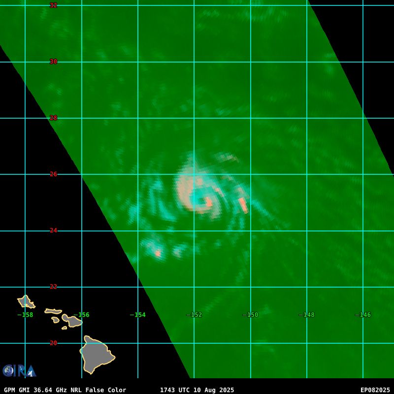
A pair of microwave passes suggest that Hurricane #Henriette completed an eyewall replacement cycle yesterday. A window of further intensification exists today at an unusually high latitude for a Pacific hurricane.


August 11, 2025 at 1:55 PM
A pair of microwave passes suggest that Hurricane #Henriette completed an eyewall replacement cycle yesterday. A window of further intensification exists today at an unusually high latitude for a Pacific hurricane.

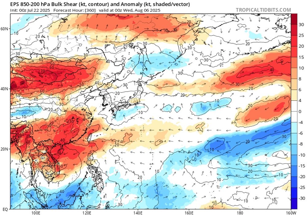
Upper environment for Invest #97L is quite favorable for the next 4 to 5 days, with dual outflow channels and a potent upper level anticyclone. Given how convectively active it looks, odds are increasing for a significant hurricane before encountering increased shear from an upper trough.


August 11, 2025 at 1:33 PM
Upper environment for Invest #97L is quite favorable for the next 4 to 5 days, with dual outflow channels and a potent upper level anticyclone. Given how convectively active it looks, odds are increasing for a significant hurricane before encountering increased shear from an upper trough.
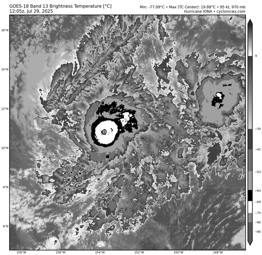
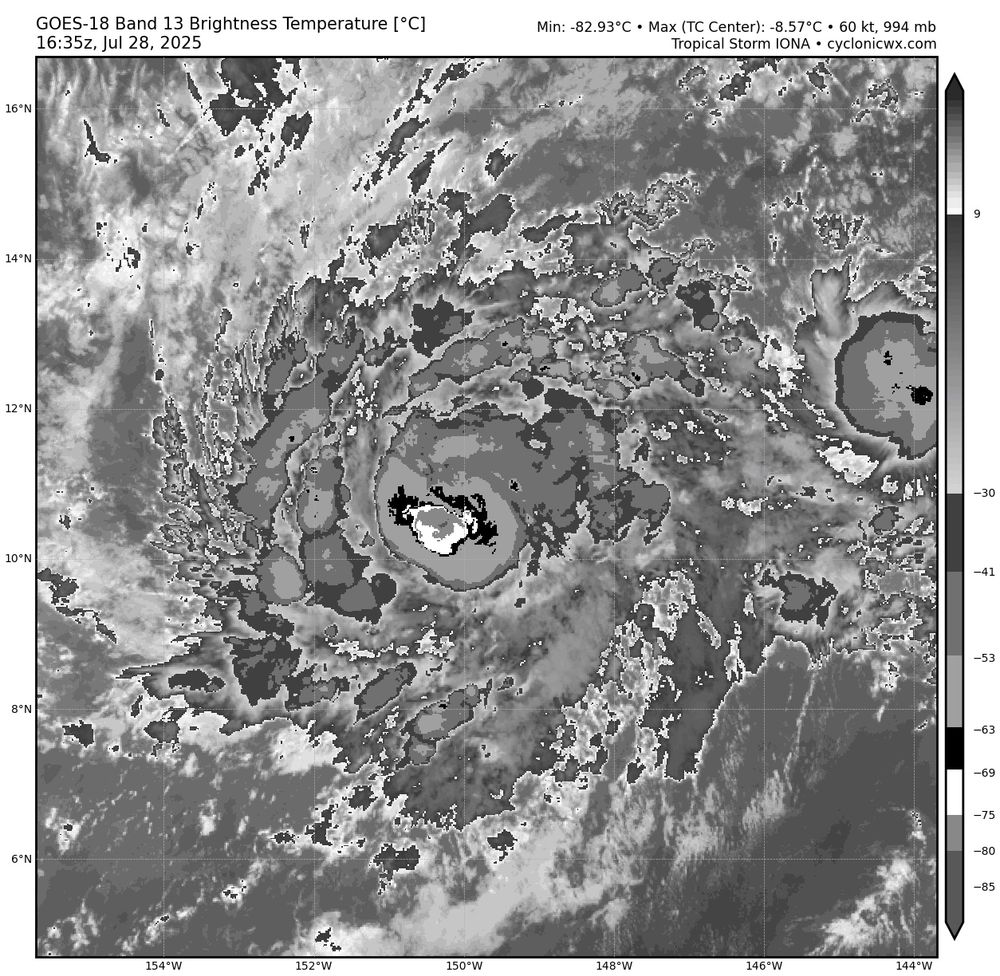
Hurricane #Iona has continued its rapid intensification episode overnight. Although the eye has not fully cleared, the CDO has become quite circular and upper level outflow remains well established. Satellite classifications from SAB and JTWC support T6.0/115 kts.
July 29, 2025 at 1:17 PM
Hurricane #Iona has continued its rapid intensification episode overnight. Although the eye has not fully cleared, the CDO has become quite circular and upper level outflow remains well established. Satellite classifications from SAB and JTWC support T6.0/115 kts.
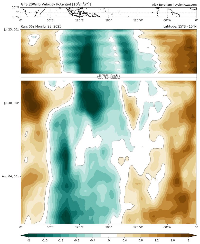
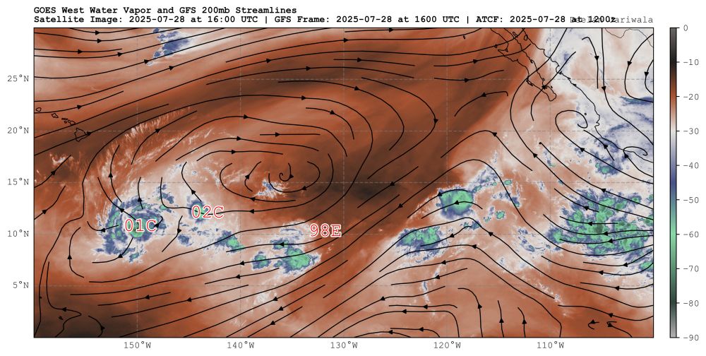
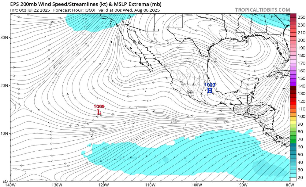
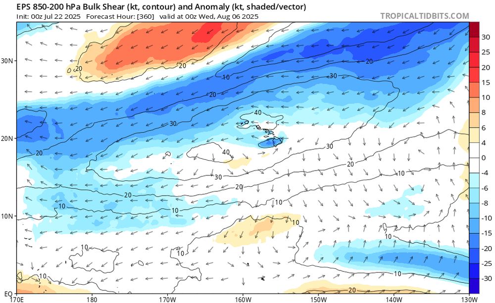
A passing Kelvin Wave has resulted in monsoon trough penetration past 140W and the development of an upper anticyclone until around 150W. This is in contrast to the La Niña and -PDO/PMM dominant conditions that have shut down this region of the world since 2019.
July 28, 2025 at 5:13 PM
A passing Kelvin Wave has resulted in monsoon trough penetration past 140W and the development of an upper anticyclone until around 150W. This is in contrast to the La Niña and -PDO/PMM dominant conditions that have shut down this region of the world since 2019.
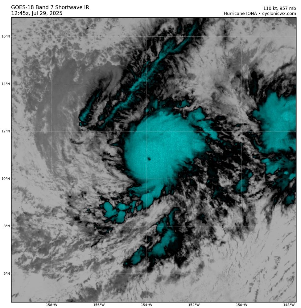
First visible and IR imagery shows hot towers lingering in the southwest quadrant of Hurricane #Iona, which has rapidly intensified since yesterday. This episode is likely to continue until westerly shear picks up overnight. To the left, Tropical Depression #02C has also formed.
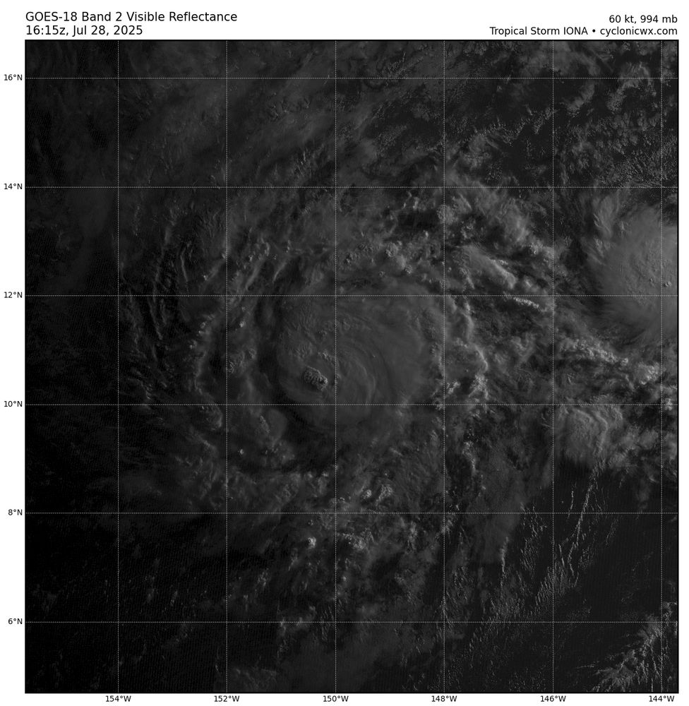
July 28, 2025 at 5:13 PM
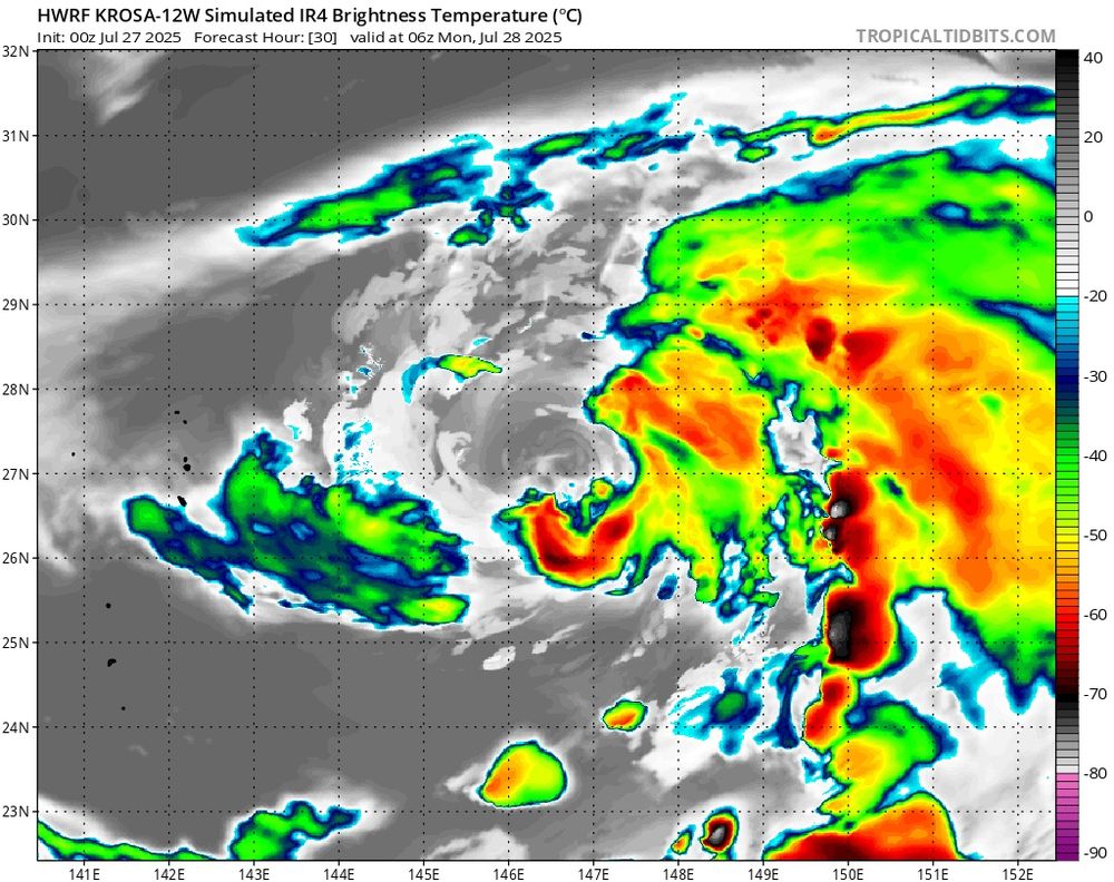
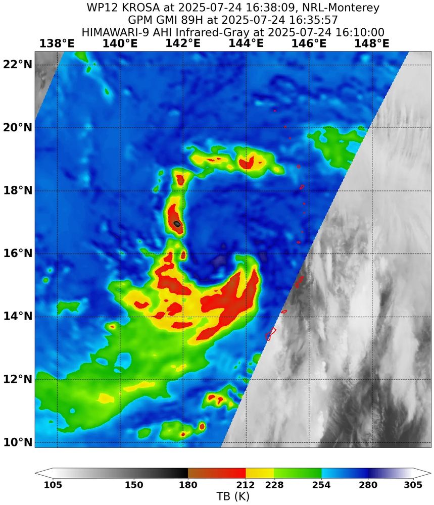
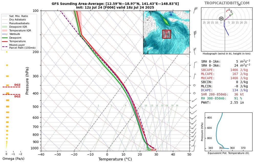
Hurricane and global models agree that #Krosa will suffer from a significant dry air intrusion in about 18-24 hours, likely as a result of persistent northerly flow. Whether the peak tomorrow will be the final peak is still to be determined.
July 27, 2025 at 5:22 AM
Hurricane and global models agree that #Krosa will suffer from a significant dry air intrusion in about 18-24 hours, likely as a result of persistent northerly flow. Whether the peak tomorrow will be the final peak is still to be determined.
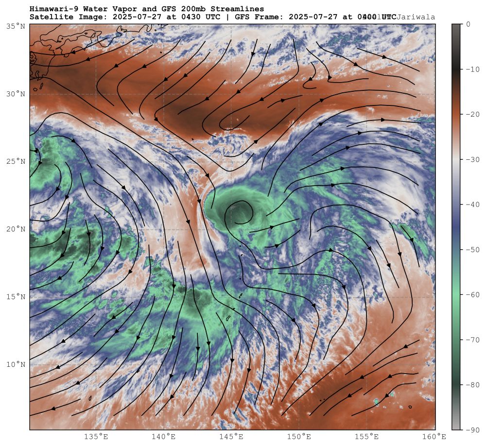
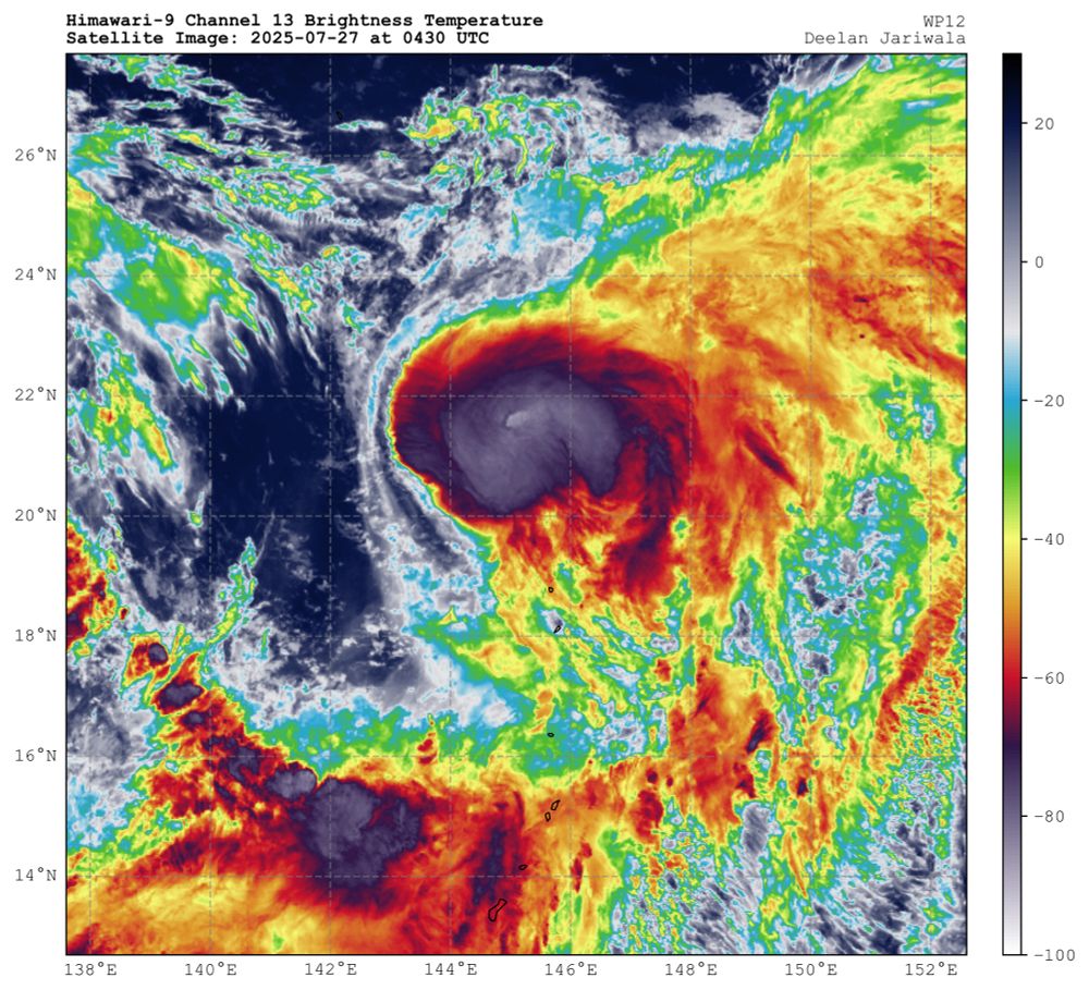
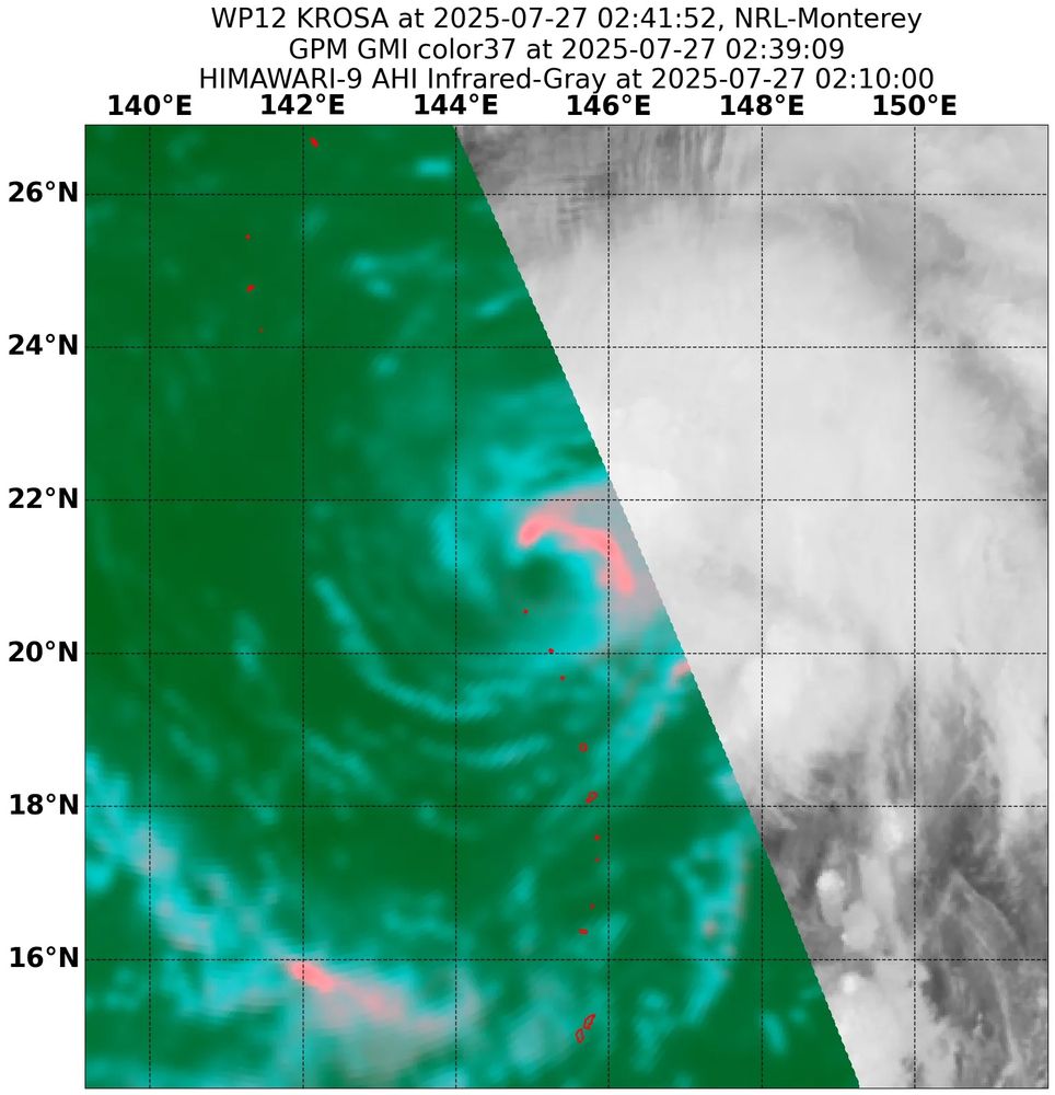
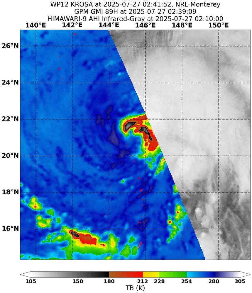
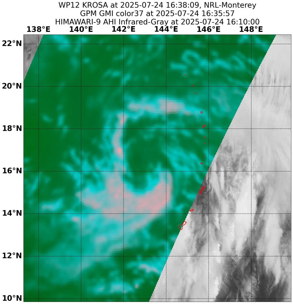
After eroding an upper level low, Typhoon #Krosa has managed to find a favorable environment that has yielded intensification. Microwave imagery suggests an inner core is forming and deep convection has recently wrapped into the northwest quadrant.
July 27, 2025 at 5:22 AM
After eroding an upper level low, Typhoon #Krosa has managed to find a favorable environment that has yielded intensification. Microwave imagery suggests an inner core is forming and deep convection has recently wrapped into the northwest quadrant.
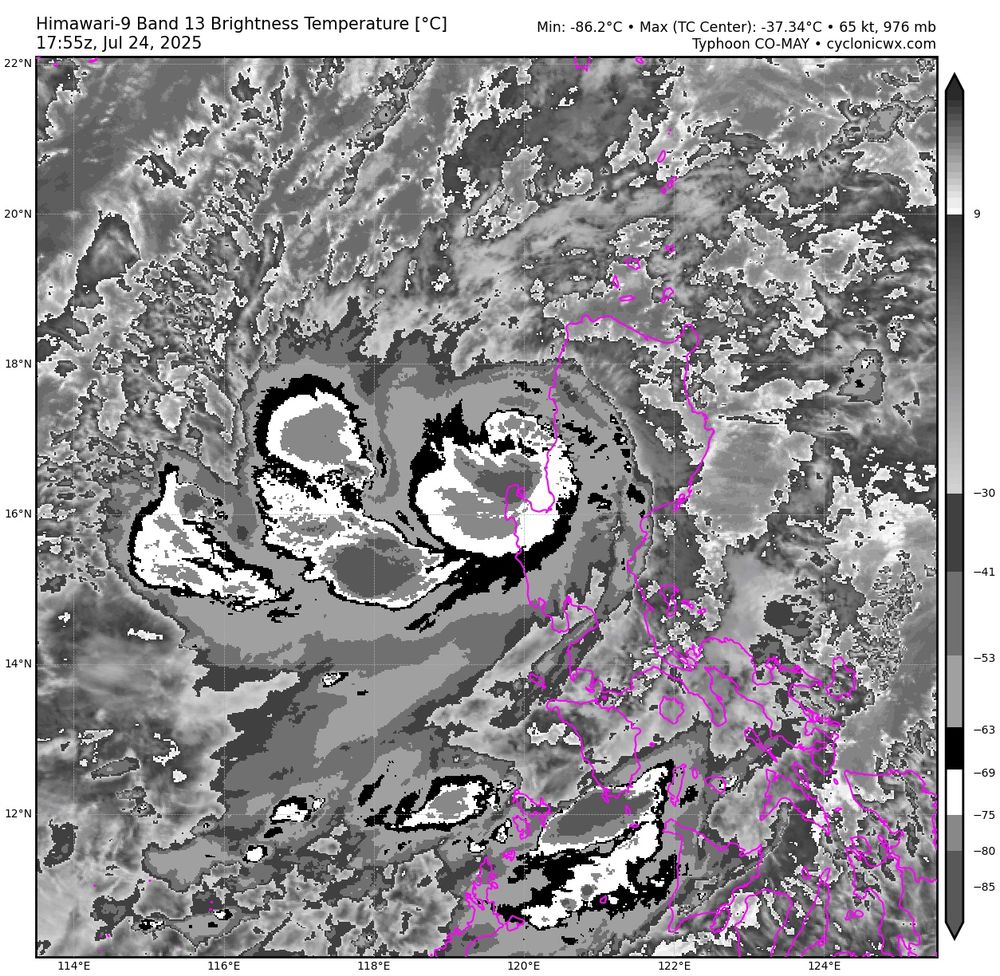
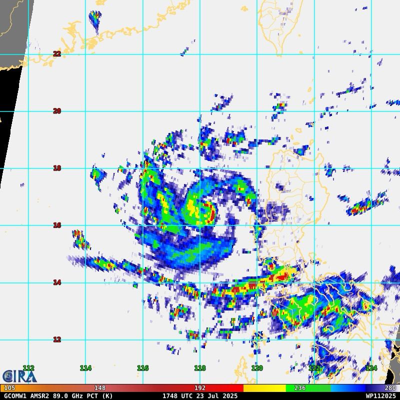
With deep convection wrapping around, a ragged warm spot has become apparent. However, time is running out as #Co-May is likely only a couple hours from making landfall in Luzon.
July 24, 2025 at 6:18 PM
With deep convection wrapping around, a ragged warm spot has become apparent. However, time is running out as #Co-May is likely only a couple hours from making landfall in Luzon.
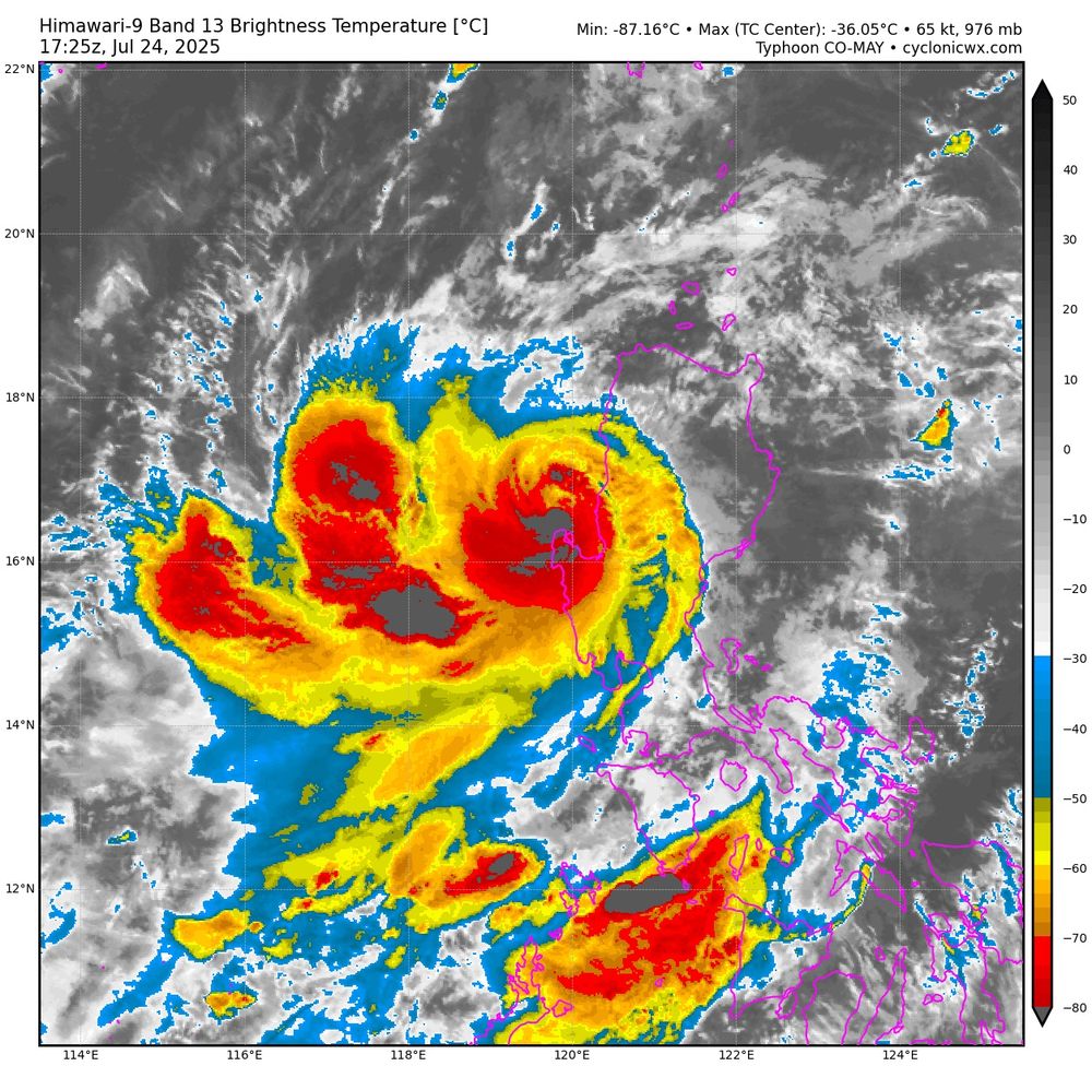
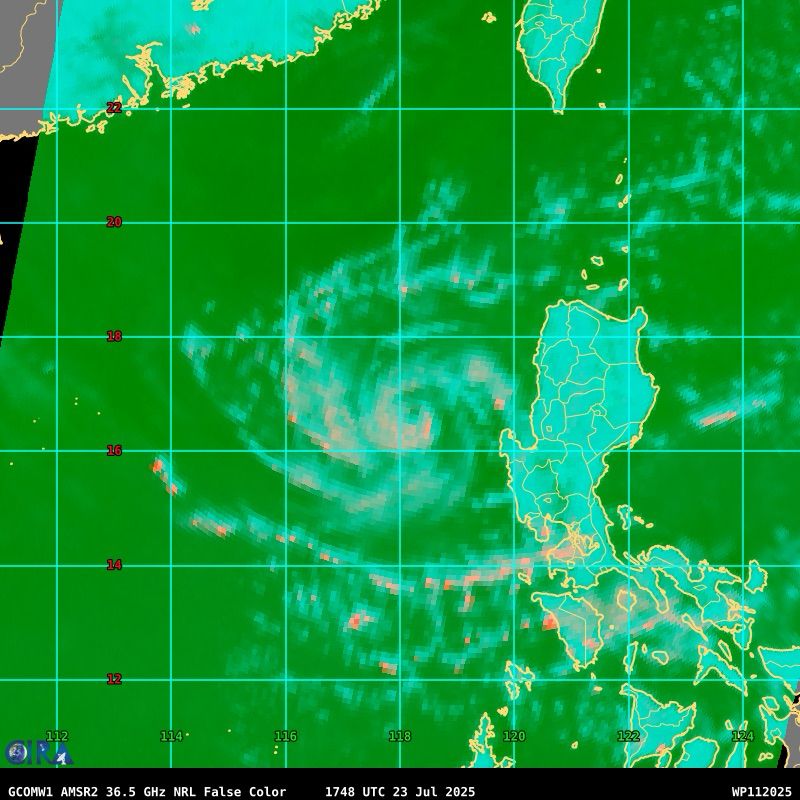
After forming yesterday, Tropical Storm #Co-may has been quickly intensifying, with an expansive CDO, well established anticyclonic outflow, and a small but not yet fully closed core. With moderate easterly shear, additional intensification is likely in the short term.

July 23, 2025 at 9:12 PM
After forming yesterday, Tropical Storm #Co-may has been quickly intensifying, with an expansive CDO, well established anticyclonic outflow, and a small but not yet fully closed core. With moderate easterly shear, additional intensification is likely in the short term.
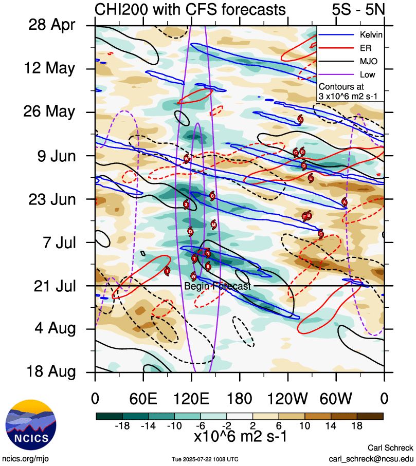
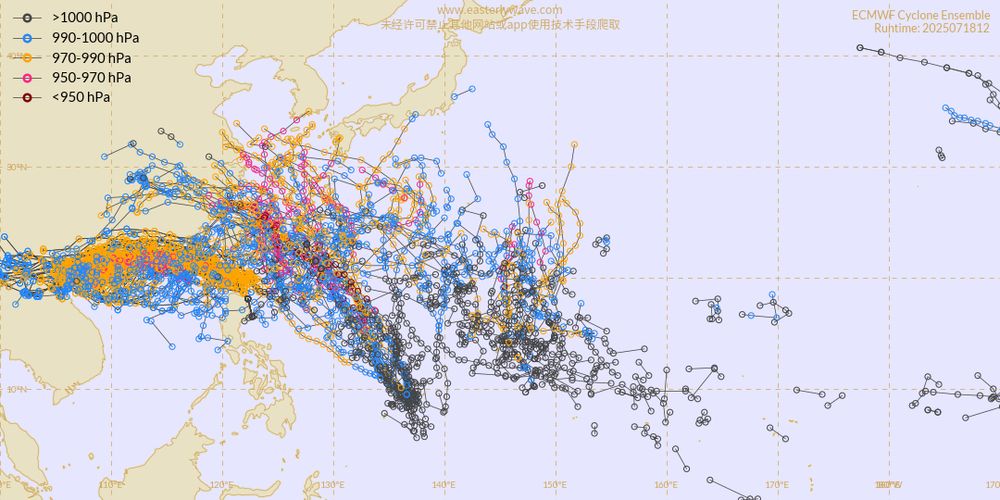
With low frequency forcing still centered near the Philippines and the passage of multiple Convectively Coupled Kelvin Waves across the Pacific, upper level conditions will be quite favorable for tropical cyclone activity across both the eastern and western Pacific over the next few weeks.
July 22, 2025 at 5:43 PM
With low frequency forcing still centered near the Philippines and the passage of multiple Convectively Coupled Kelvin Waves across the Pacific, upper level conditions will be quite favorable for tropical cyclone activity across both the eastern and western Pacific over the next few weeks.
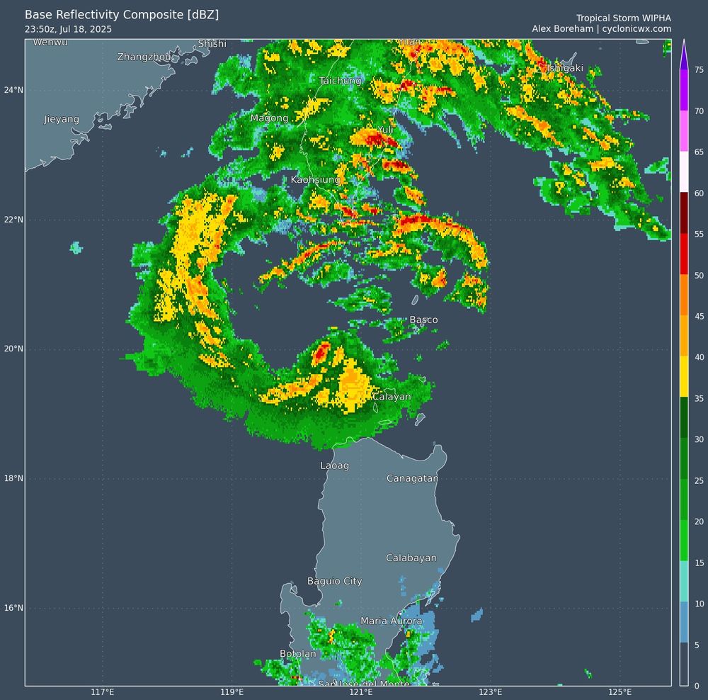
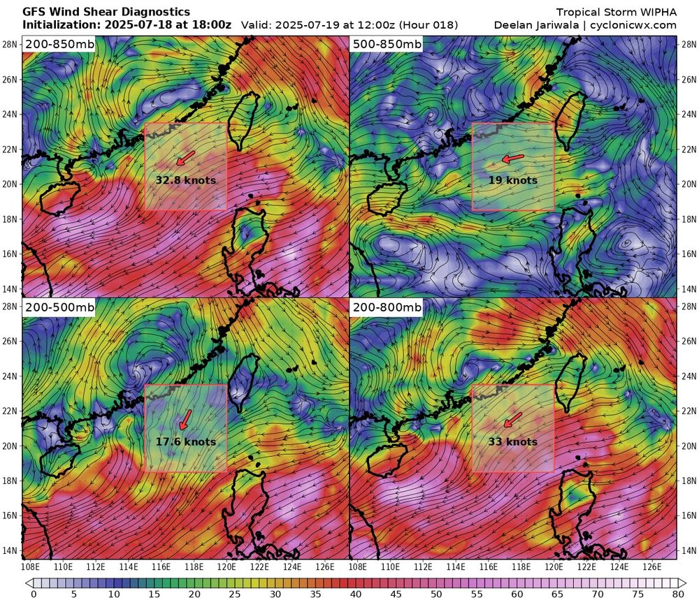
Although IR remains lackluster, #Wipha has become much better organized on radar, likely in response to friction with the coastline, with a well defined eye now apparent.
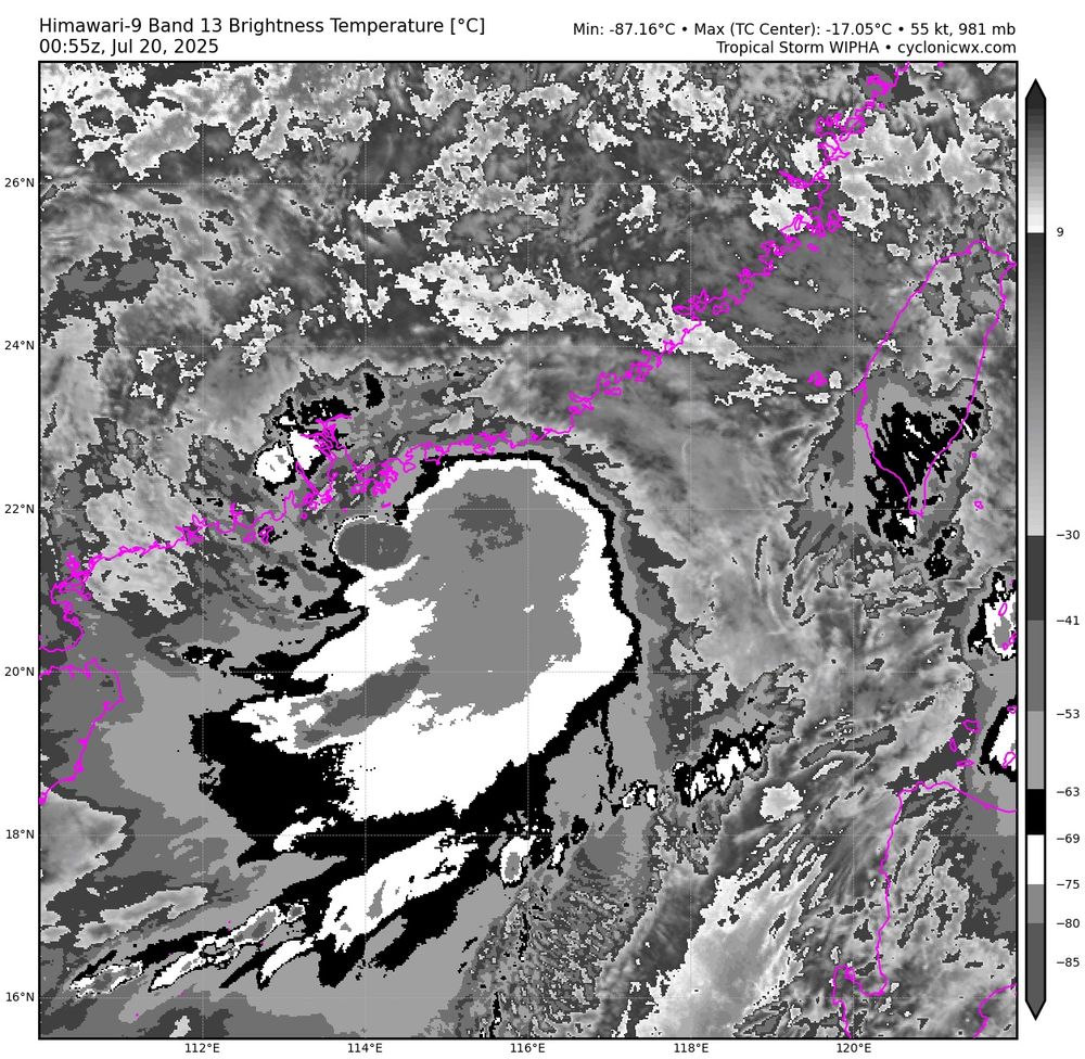
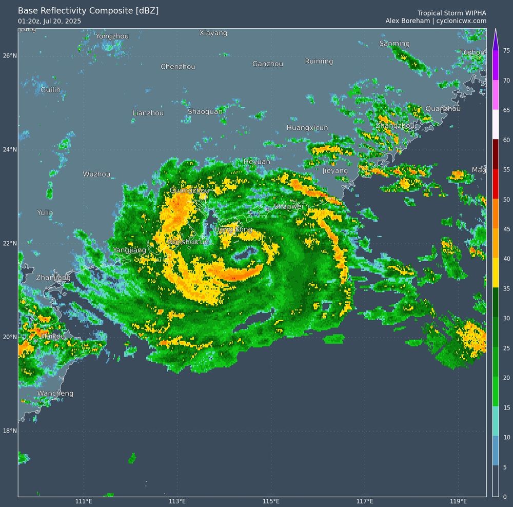
July 20, 2025 at 1:31 AM
Although IR remains lackluster, #Wipha has become much better organized on radar, likely in response to friction with the coastline, with a well defined eye now apparent.
A Convectively Coupled Kelvin Wave is passing through the tropical Pacific, increasing convection near 125W. As it progresses through, low level westerlies and anticyclonic flow aloft may aid in the development of an unusually far west northeastern Pacific tropical cyclone for late July.
July 19, 2025 at 12:42 AM
A Convectively Coupled Kelvin Wave is passing through the tropical Pacific, increasing convection near 125W. As it progresses through, low level westerlies and anticyclonic flow aloft may aid in the development of an unusually far west northeastern Pacific tropical cyclone for late July.
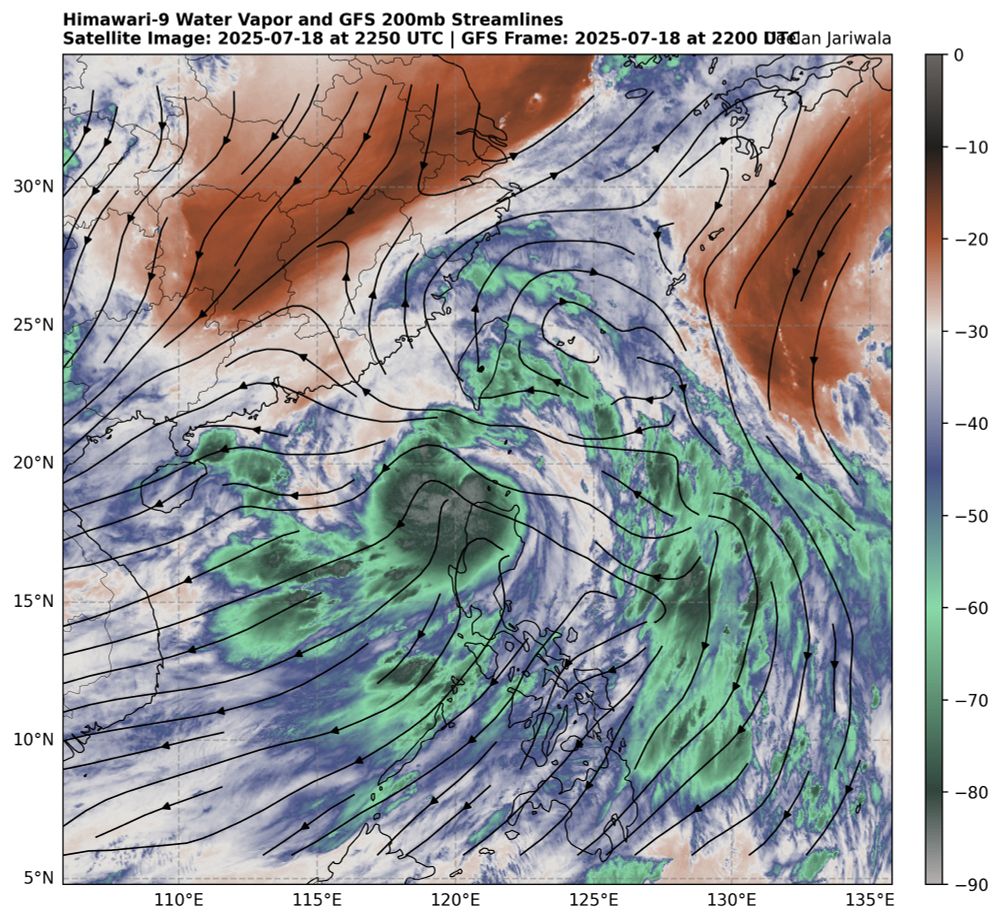
The passage of the Madden Julian Oscillation has increased convection over the western Pacific, but upper toughing initially prevented any consolidated tropical cyclones from forming. As upper troughing has lifted out, European ensemble members have begun to show an increase in TC activity.
July 19, 2025 at 12:16 AM
The passage of the Madden Julian Oscillation has increased convection over the western Pacific, but upper toughing initially prevented any consolidated tropical cyclones from forming. As upper troughing has lifted out, European ensemble members have begun to show an increase in TC activity.
The passage of the Madden Julian Oscillation has increased convection over the western Pacific, but upper toughing initially prevented any consolidated tropical cyclones from forming. As upper troughing has lifted out, European ensemble members have begun to show an increase in TC activity.
July 19, 2025 at 12:16 AM
The passage of the Madden Julian Oscillation has increased convection over the western Pacific, but upper toughing initially prevented any consolidated tropical cyclones from forming. As upper troughing has lifted out, European ensemble members have begun to show an increase in TC activity.
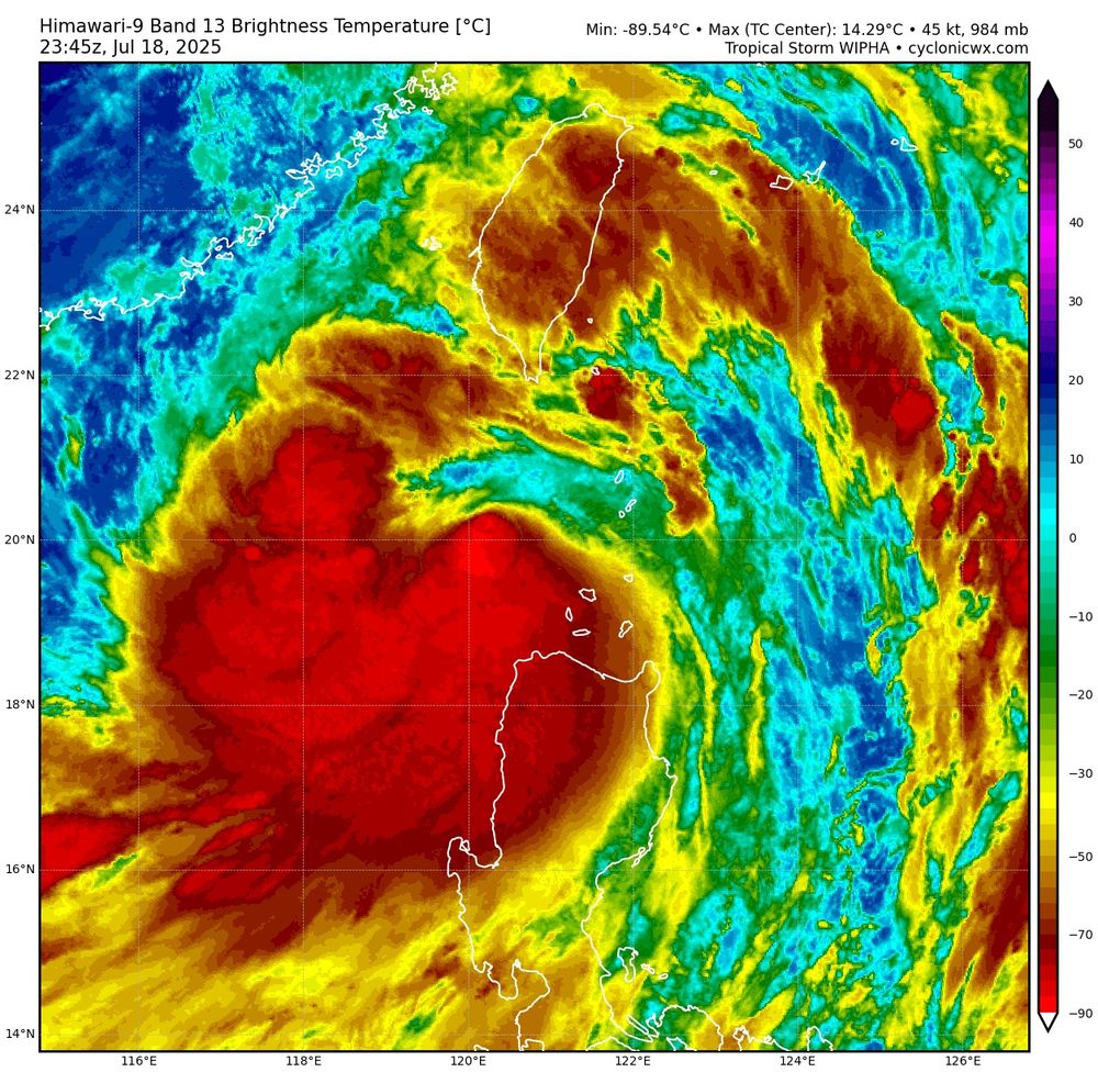
Tropical Storm #Wipha is intensifying this evening, with IR showing a shrimp look as convection attempts to wrap around. Radar shows a partial eyewall. Easterly shear will likely prevent significant intensification prior to reaching southern China in a little over 24 hours, however.
July 19, 2025 at 12:07 AM
Tropical Storm #Wipha is intensifying this evening, with IR showing a shrimp look as convection attempts to wrap around. Radar shows a partial eyewall. Easterly shear will likely prevent significant intensification prior to reaching southern China in a little over 24 hours, however.
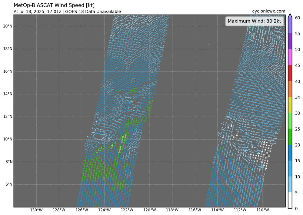
Latest ASCAT from Tropical Storm #01S shows gale force winds. With undersampling, that supports around 45 kts. Strong wind shear is displacing the convection from the center, although this shear could relax tomorrow as it aligns more favorably with an approaching trough.
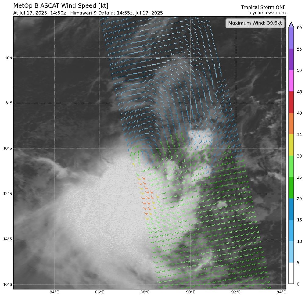
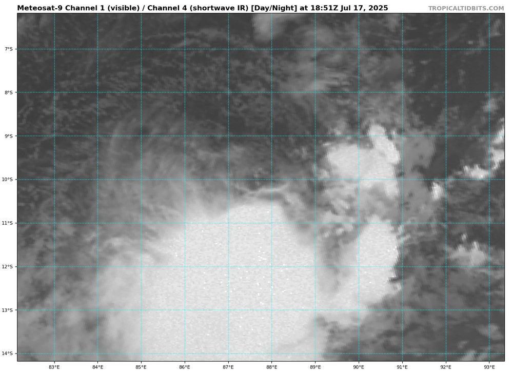
July 17, 2025 at 7:28 PM
Latest ASCAT from Tropical Storm #01S shows gale force winds. With undersampling, that supports around 45 kts. Strong wind shear is displacing the convection from the center, although this shear could relax tomorrow as it aligns more favorably with an approaching trough.
Tropical Storm #Nari has roared convection into the upshear semicircle this morning, aiding in the erosion of a nearby upper level low. Upper level outflow is well defined and typical of a north moving system. Latest ASCAT supports an intensity of around 60 knots.
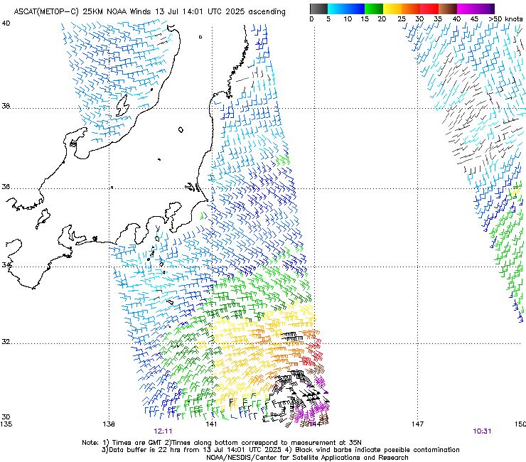
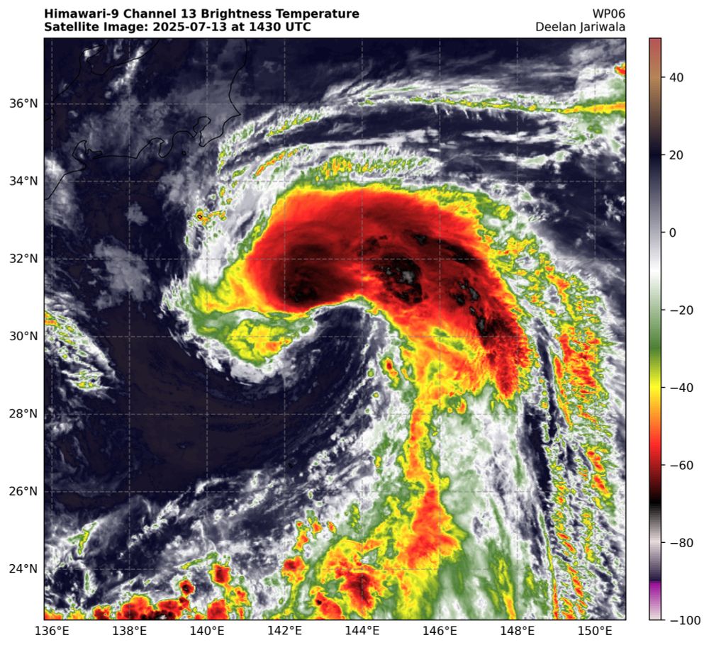
July 13, 2025 at 2:52 PM
Tropical Storm #Nari has roared convection into the upshear semicircle this morning, aiding in the erosion of a nearby upper level low. Upper level outflow is well defined and typical of a north moving system. Latest ASCAT supports an intensity of around 60 knots.
Although starting to interact with Taiwan now, Typhoon. #Danas likely briefly reached major equivalent intensity overnight as its eye briefly cleared significantly.
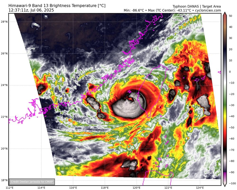


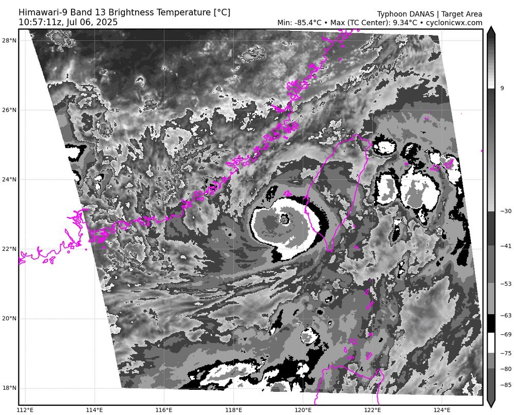
July 6, 2025 at 12:57 PM
Although starting to interact with Taiwan now, Typhoon. #Danas likely briefly reached major equivalent intensity overnight as its eye briefly cleared significantly.
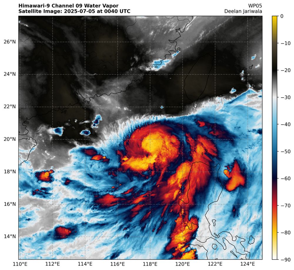
Vortical hot towers of soon to be Typhoon #Danas are quickly wrapping around, outlining an eyewall. A rapid intensification episode is likely underway.

July 5, 2025 at 3:22 PM
Vortical hot towers of soon to be Typhoon #Danas are quickly wrapping around, outlining an eyewall. A rapid intensification episode is likely underway.
Vortical hot towers of soon to be Typhoon #Danas are quickly wrapping around, outlining an eyewall. A rapid intensification episode is likely underway.
July 5, 2025 at 3:17 PM
Vortical hot towers of soon to be Typhoon #Danas are quickly wrapping around, outlining an eyewall. A rapid intensification episode is likely underway.
After days of beating back an upper-level outflow and several dry air intrusions, #Mun has become better organized today, with a distinct eye appear on visible along with a warm spot on IR. Its structure resembles several compact Atlantic hurricanes in the subtropics in recent years.


July 5, 2025 at 1:49 AM
After days of beating back an upper-level outflow and several dry air intrusions, #Mun has become better organized today, with a distinct eye appear on visible along with a warm spot on IR. Its structure resembles several compact Atlantic hurricanes in the subtropics in recent years.
Tropical Storm #Danas has wrapped convection alongside the western semicircle. Curved banding features and equatorial outflow are well established. Northwesterly shear is expected to reduce and an intensifying ULAC is forecast to amplify poleward outflow tomorrow, which will aid strengthening.


July 5, 2025 at 1:42 AM
Tropical Storm #Danas has wrapped convection alongside the western semicircle. Curved banding features and equatorial outflow are well established. Northwesterly shear is expected to reduce and an intensifying ULAC is forecast to amplify poleward outflow tomorrow, which will aid strengthening.
After an earlier dry air intrusion, Hurricane #Flossie has recovered, with the eye rapidly warming over the last hour, although some convection remains stuck on the eastern semicircle. About 15 hours left for Flossie before thermodynamic support collapses.
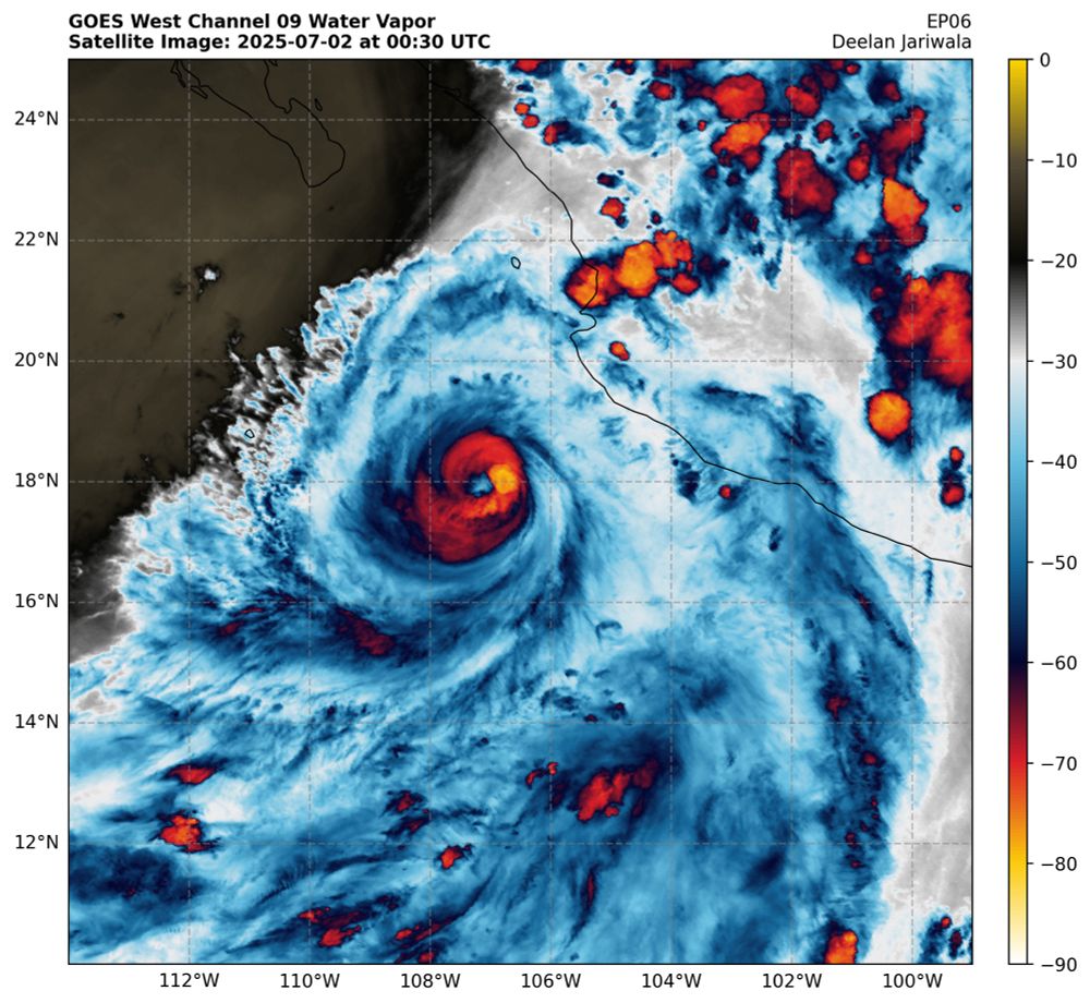

July 2, 2025 at 12:57 AM
After an earlier dry air intrusion, Hurricane #Flossie has recovered, with the eye rapidly warming over the last hour, although some convection remains stuck on the eastern semicircle. About 15 hours left for Flossie before thermodynamic support collapses.