Brad Storm Chaser
@bradstorm19.bsky.social
380 followers 57 following 81 posts
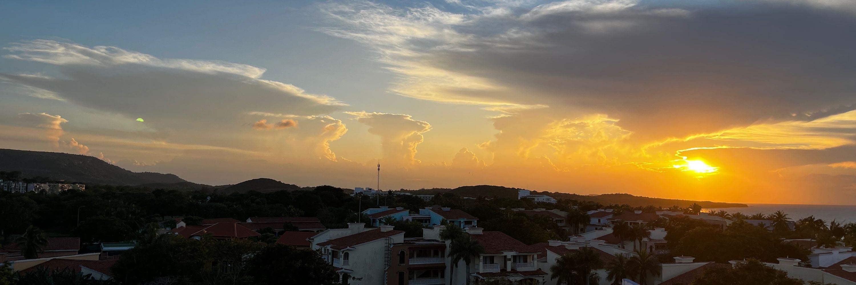
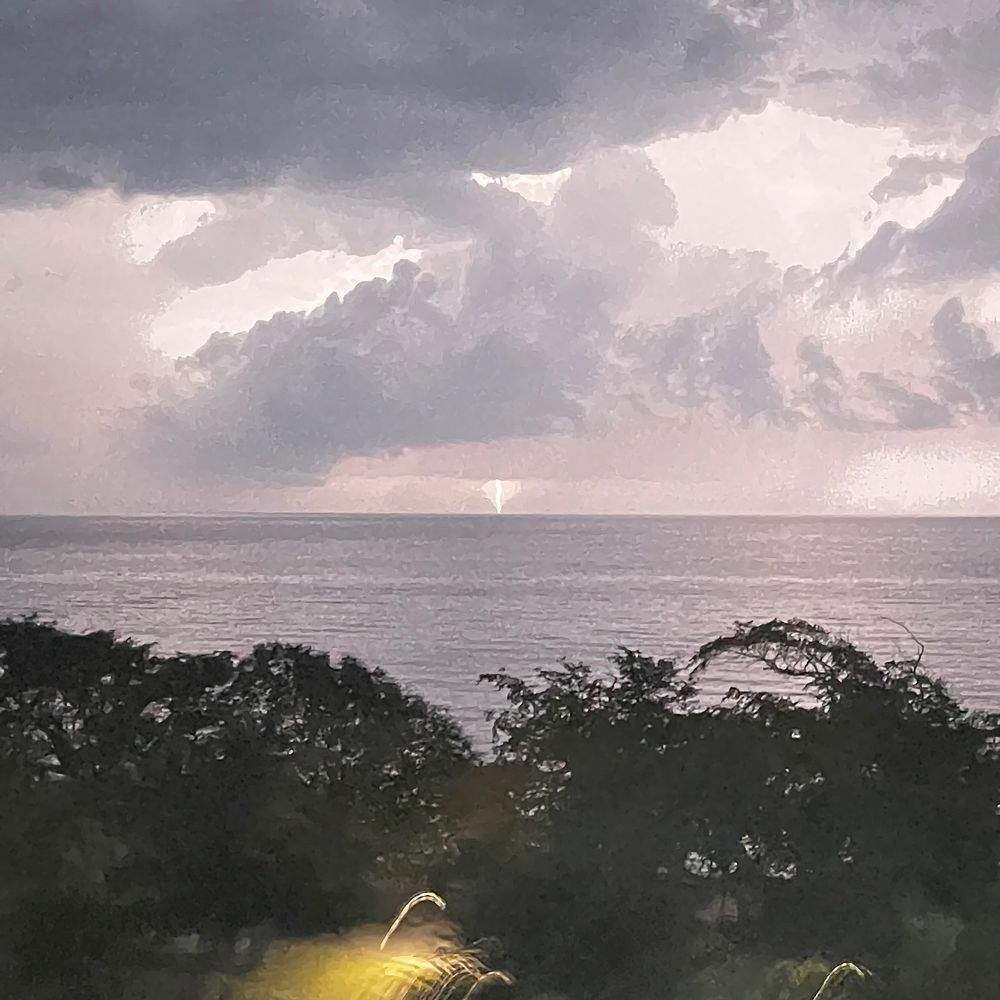
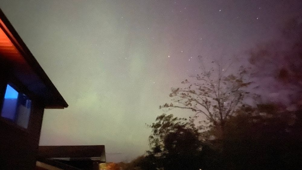
I love weather and storms.
Posts Media Videos Starter Packs
Reposted by Brad Storm Chaser
allisteraalders.bsky.social
Not surprising to now see exceptional drought observed in parts of Nova Scotia and New Brunswick in the latest AAFC drought update. Almost all of Atlantic Canada remains in some form of drought, worst in the Maritimes and Avalon Peninsula. The full report: agriculture.canada.ca/en/agricultu...
Reposted by Brad Storm Chaser
yhzweatherguy.bsky.social
A nice weekend; some high teens today, a bit cooler Sunday.
Clouds move in from the SW on Monday; chance of showers over extreme SW NS. Some models , but not all. bring the showers into Halifax Tuesday. The EU model keeps showers away til Thursday. Next weekend likely more unsettled.
Reposted by Brad Storm Chaser
allisteraalders.bsky.social
High pressure dominates through the upcoming long weekend, but a cold front will bring a few showers late Saturday to Newfoundland, and a coastal low to our south builds cloud cover later this weekend. A few showers could reach SW N.S. on Thanksgiving. #NSwx #NBwx #PEwx #NLwx
Reposted by Brad Storm Chaser
yhzweatherguy.bsky.social
The multi-model outlook into late October predicting a fine weekend. Rain chances develop late next week, heavier amounts from the Canadian model.
Afternoon temperatures forecast to be seasonably in the teens throughout the next 2 weeks.
Reposted by Brad Storm Chaser
allisteraalders.bsky.social
A cool and, for some, frosty night ahead. Brighter skies Friday for much of the Maritimes but still a chance of showers in the east. Cool for Newfoundland with some lingering showers, and possibly flurries in the morning at high elevations farther west 🥶 #NSwx #NBwx #PEwx #NLwx
Reposted by Brad Storm Chaser
yhzweatherguy.bsky.social
Highest rainfalls (25-50mm) on either side of the Bay of Fundy & NE into PEI (20mm). Only 2mm in my HFX location.
A chilly NW wind today with more cloud and a few showers developing in E areas (see pic).
Frosty tonight; even downtown Halifax.
Lots of sun and warming into the teens on the weekend.
Reposted by Brad Storm Chaser
yhzweatherguy.bsky.social
At 6pm, the rain on the cold front has dropped 25-50+mm so far over parts of the Annapolis Valley into Northern NS. The rain will be in Halifax near 7pm... but doubt we'll see those heavy amounts. Meanwhile some tropical downpours moving onshore Guysborough county.
Reposted by Brad Storm Chaser
yhzweatherguy.bsky.social
A cold front with rain over NB this morning moves to PEI & W NS this aftn then E NS this evening. Mild temps, gusty SW winds, sunny breaks & a few showers precede the front.
Cold air with a few showers, single digits & gusty NW winds in the wake of the front on Thursday.
Fine Thanksgiving weekend.
Reposted by Brad Storm Chaser
yhzweatherguy.bsky.social
Another summer day today: a few degrees cooler but some record highs will be broken.
A cold front with rain moves into N NB tonight then S NB Wed am. Rain reaches PEI-Mainland NS Wed aftn and CB Wed eve. 15-25mm most likely across middle of Maritimes.
Clearing and down to low teens behind front.
Reposted by Brad Storm Chaser
ryansnoddon.bsky.social
One of the warmest October days on record in the Maritimes.
New October provincial record set in PEI, where Stanhope hit 28.7° & tied in NB, where Kouchibouguac hit 31.1°.
A few official stations just shy of 31.1° Oct record for NS, however some unofficial spots did exceed that mark!
#nswx #nbwx
Reposted by Brad Storm Chaser
allisteraalders.bsky.social
Still much warmer than normal across the Maritimes on Tuesday with some warmer temperatures also pushing into Newfoundland. Aside from some patchy morning fog, sunshine is in the forecast. A mid-week cold front will bring rain then cooler air. #NSwx #NBwx #PEwx #NLwx
Reposted by Brad Storm Chaser
yhzweatherguy.bsky.social
A couple of summer-like days to start the week. Expect some record high temps in the high 20's or perhaps 30C.
Nice breezy start to day on Wednesday in the south; a cold front with rain moves into N NB Tues night then S NB Wed am and finally PEI and NS Wed aftn & evening.
Then chilly Thurs-Friday.
Reposted by Brad Storm Chaser
yhzweatherguy.bsky.social
Clouds more prominent in the north & east today. A few light showers move from N NB this am to CB this eve.
Warmer (thin clouds) in western Maritimes.
Record breaking temperatures in the mid-high 20's on Monday; some spots may touch 30C!
A cold front with rain slides through the Maritimes Wed.
Reposted by Brad Storm Chaser
yhzweatherguy.bsky.social
Mostly fine weekend. Low to mid 20's in the west; mostly teens in the east (northerly winds today; southerly Sunday).
Spotty pm showers NB later this aftn; few late aftn showers PEI-E NS Sunday.
A couple more nice days & above normal temps early next week; then a cold front & rain Wed or Wed night.
Reposted by Brad Storm Chaser
yhzweatherguy.bsky.social
Enjoy quite a bit of sunshine and warmer than normal aftn temps next 5 days. Just spotty showers and cooler at times around the Gulf.
Rain on a cold front Wednesday then a more normal October pattern with higher chances of precipitation.
Reposted by Brad Storm Chaser
yhzweatherguy.bsky.social
A few spotty showers in the est clear up then lots of sunshine today: low to mid teens.
Frosty night tonight under ckear skies and light winds.
Then mostly fine weather thru the middle of next week; warming to low-mid 20's.
A more organized rain event next Thursday?
Reposted by Brad Storm Chaser
yhzweatherguy.bsky.social
Scattered showers in eastern areas this am become more widespread this aftn over central sections (including HFX). Skies clear overnight or early Thursday (widespread frost NB); then a fine stretch into middle of next week. Low-mid teens next couple of days, but gradually returning to low-mid 20's.
Reposted by Brad Storm Chaser
yhzweatherguy.bsky.social
A sun cloud mix today; spotty showers in the east. With a northerly flow, 20C most likely Fundy & Atlantic coasts.
More cloud and higher chances of showers Wednesday to start October. Cooler north winds: lucky to reach the teens.
Clears up and gradually back into the low-mid 20's thru the weekend.
Reposted by Brad Storm Chaser
allisteraalders.bsky.social
Visible satellite shows an increase in smoke from a wildfire near Lake George. An evacuation ALERT has been issued for the area of North River Road and Aylesford Road intersection to G2 Road at Lake George, Nova Scotia due to this wildfire. #NSwx
Reposted by Brad Storm Chaser
yhzweatherguy.bsky.social
Nice and sunny today; a few mid 20's.
A band of showers develops this eve over N NB; moves SE overnight thru PEI to CB.
Cooler Tuesday with just lingering showers & a sun-cloud mix.
A few showers possible Wednesday; cooler again.
Fine late week and warming up thru the weekend.
Reposted by Brad Storm Chaser
yhzweatherguy.bsky.social
Fine late September day; some mid 20's. A band of showers (risk thunder)develops this aftn over N Nb then slides to S NB-PEI early eve; finally weakening over CB late eve.
Slim channce SW areas.
A NW flow on Monday; lots of sunshine and cooler esply north and east.
Cool start to Oct then warms up.
Reposted by Brad Storm Chaser
yhzweatherguy.bsky.social
The rainfall totals from Thursday night into Friday. Unfortunately, the Annapolis Valley and Northern NS again had the least amount of rain. I was at 21mm for my doentown HFX gauge.