


Alex Leith
@ausp.io
Father, Open Geospatial Technologist, Digital Earth Architect. Auspatious: https://ausp.io
This is coming up this Friday, 1.30 pm in Australia time!
Join the Google Group or DM me for a direct invite :-)
Join the Google Group or DM me for a direct invite :-)
The STAC Project SC is hosting a community meeting specifically timed for folks in the Asia/Oceania region – that means no more 2 a.m. wake-up calls to join
🗓️Fri, Oct 10th at 1:30 pm AEST
Get invite from @ausp.io or join the Google Group via groups.google.com/a/cloudnativ...
🗓️Fri, Oct 10th at 1:30 pm AEST
Get invite from @ausp.io or join the Google Group via groups.google.com/a/cloudnativ...

October 8, 2025 at 6:17 AM
This is coming up this Friday, 1.30 pm in Australia time!
Join the Google Group or DM me for a direct invite :-)
Join the Google Group or DM me for a direct invite :-)
Reposted by Alex Leith

🌟Welcome to Auspatious, a sponsor of FOSS4G 2025!
Supporting open #geospatial technologies!
- #data wrangling
- #infrastructure
- #software dev
- #cloud infrastructure
- technical #leadership
> projects of all sizes
> champion of open source geospatial
https://auspatious.com/
Supporting open #geospatial technologies!
- #data wrangling
- #infrastructure
- #software dev
- #cloud infrastructure
- technical #leadership
> projects of all sizes
> champion of open source geospatial
https://auspatious.com/

September 17, 2025 at 12:12 AM
🌟Welcome to Auspatious, a sponsor of FOSS4G 2025!
Supporting open #geospatial technologies!
- #data wrangling
- #infrastructure
- #software dev
- #cloud infrastructure
- technical #leadership
> projects of all sizes
> champion of open source geospatial
https://auspatious.com/
Supporting open #geospatial technologies!
- #data wrangling
- #infrastructure
- #software dev
- #cloud infrastructure
- technical #leadership
> projects of all sizes
> champion of open source geospatial
https://auspatious.com/
Reposted by Alex Leith
📢Announcing our keynote speakers!
4 superb speakers; seriously, they rock
Introducing you across this week
Meet Amy Rose
Currently = CTO @overturemaps.bsky.social
Responsible = technical roadmap, infrastructure design, data interoperability strategy
30 years #geospatial domain = myriad solutions
4 superb speakers; seriously, they rock
Introducing you across this week
Meet Amy Rose
Currently = CTO @overturemaps.bsky.social
Responsible = technical roadmap, infrastructure design, data interoperability strategy
30 years #geospatial domain = myriad solutions

September 10, 2025 at 12:14 AM
📢Announcing our keynote speakers!
4 superb speakers; seriously, they rock
Introducing you across this week
Meet Amy Rose
Currently = CTO @overturemaps.bsky.social
Responsible = technical roadmap, infrastructure design, data interoperability strategy
30 years #geospatial domain = myriad solutions
4 superb speakers; seriously, they rock
Introducing you across this week
Meet Amy Rose
Currently = CTO @overturemaps.bsky.social
Responsible = technical roadmap, infrastructure design, data interoperability strategy
30 years #geospatial domain = myriad solutions
Reposted by Alex Leith
📢Announcing our keynote speakers!
Meet Ana Belgun
Co-leader of Terria
Committed --> making #spatial data & digital twin tech more accessible &impactful for both tech & non-tech users
Dedicated to driving open source initiatives
Empowers orgs to harness full potential of spatial data
Meet Ana Belgun
Co-leader of Terria
Committed --> making #spatial data & digital twin tech more accessible &impactful for both tech & non-tech users
Dedicated to driving open source initiatives
Empowers orgs to harness full potential of spatial data

September 11, 2025 at 12:40 AM
📢Announcing our keynote speakers!
Meet Ana Belgun
Co-leader of Terria
Committed --> making #spatial data & digital twin tech more accessible &impactful for both tech & non-tech users
Dedicated to driving open source initiatives
Empowers orgs to harness full potential of spatial data
Meet Ana Belgun
Co-leader of Terria
Committed --> making #spatial data & digital twin tech more accessible &impactful for both tech & non-tech users
Dedicated to driving open source initiatives
Empowers orgs to harness full potential of spatial data
Reposted by Alex Leith
📢Announcing our keynote speakers!
Meet Hirini Tane
Co-founder Takarangi Research
Māori Strategic Capability Lead, Te Whare Wānaka o Aoraki (Lincoln University)
Involved = Te Potiki National Trust & Māori Maps
Research = understand relationship b/n people, land & water
❤️'s listening to stories
Meet Hirini Tane
Co-founder Takarangi Research
Māori Strategic Capability Lead, Te Whare Wānaka o Aoraki (Lincoln University)
Involved = Te Potiki National Trust & Māori Maps
Research = understand relationship b/n people, land & water
❤️'s listening to stories

September 11, 2025 at 4:47 AM
📢Announcing our keynote speakers!
Meet Hirini Tane
Co-founder Takarangi Research
Māori Strategic Capability Lead, Te Whare Wānaka o Aoraki (Lincoln University)
Involved = Te Potiki National Trust & Māori Maps
Research = understand relationship b/n people, land & water
❤️'s listening to stories
Meet Hirini Tane
Co-founder Takarangi Research
Māori Strategic Capability Lead, Te Whare Wānaka o Aoraki (Lincoln University)
Involved = Te Potiki National Trust & Māori Maps
Research = understand relationship b/n people, land & water
❤️'s listening to stories
Reposted by Alex Leith
📢Announcing our keynote speakers
Meet Selene Yang
Latin Am queer fem, community organiser, mapmaker
Co-Fndr @geochicas.bsky.social
🔎 geospatial data @openstreetmap.bsky.social --> feminist perspective
📍@wikimediafoundation.org Senior Sp, DEI
Res Fellow, @digcivsoc.bsky.social , @stanford.edu
➕
Meet Selene Yang
Latin Am queer fem, community organiser, mapmaker
Co-Fndr @geochicas.bsky.social
🔎 geospatial data @openstreetmap.bsky.social --> feminist perspective
📍@wikimediafoundation.org Senior Sp, DEI
Res Fellow, @digcivsoc.bsky.social , @stanford.edu
➕

September 11, 2025 at 11:30 PM
📢Announcing our keynote speakers
Meet Selene Yang
Latin Am queer fem, community organiser, mapmaker
Co-Fndr @geochicas.bsky.social
🔎 geospatial data @openstreetmap.bsky.social --> feminist perspective
📍@wikimediafoundation.org Senior Sp, DEI
Res Fellow, @digcivsoc.bsky.social , @stanford.edu
➕
Meet Selene Yang
Latin Am queer fem, community organiser, mapmaker
Co-Fndr @geochicas.bsky.social
🔎 geospatial data @openstreetmap.bsky.social --> feminist perspective
📍@wikimediafoundation.org Senior Sp, DEI
Res Fellow, @digcivsoc.bsky.social , @stanford.edu
➕
Reposted by Alex Leith

Results so stunningly clear they inspired this classic xkcd (xkcd.com/2400/):

September 1, 2025 at 7:32 PM
Results so stunningly clear they inspired this classic xkcd (xkcd.com/2400/):
I want to find a reggae band for a conference in Auckland in November. We don't have a lot of money, and we want to dance! Does anyone know anyone? #auckland #music #livemusic
August 21, 2025 at 11:21 PM
I want to find a reggae band for a conference in Auckland in November. We don't have a lot of money, and we want to dance! Does anyone know anyone? #auckland #music #livemusic
The community vote is open for @foss4g.org and there are some amazing talks in there!
Get voting, and start getting excited 😃
talks.osgeo.org/foss4g-2025/...
Get voting, and start getting excited 😃
talks.osgeo.org/foss4g-2025/...

FOSS4G 2025
Schedule, talks and talk submissions for FOSS4G 2025
talks.osgeo.org
July 29, 2025 at 3:22 AM
The community vote is open for @foss4g.org and there are some amazing talks in there!
Get voting, and start getting excited 😃
talks.osgeo.org/foss4g-2025/...
Get voting, and start getting excited 😃
talks.osgeo.org/foss4g-2025/...
It’s your last chance to register at early bird prices for @foss4g.org
2025.foss4g.org/attend/regis...
2025.foss4g.org/attend/regis...

FOSS4G Auckland 2025
FOSS4G stands for Free and Open Source Software for Geospatial, a conference hosted in partnership with OSGeo.
2025.foss4g.org
July 17, 2025 at 10:17 AM
It’s your last chance to register at early bird prices for @foss4g.org
2025.foss4g.org/attend/regis...
2025.foss4g.org/attend/regis...
There's 2 weeks left of early bird registrations for @foss4g.org and no more extensions.
We've got good registrations already and some great sponsors. And we have a great volunteer team (pic related).
So, register now as you'll regret missing out on a bargain later!
2025.foss4g.org
We've got good registrations already and some great sponsors. And we have a great volunteer team (pic related).
So, register now as you'll regret missing out on a bargain later!
2025.foss4g.org

July 4, 2025 at 2:12 AM
There's 2 weeks left of early bird registrations for @foss4g.org and no more extensions.
We've got good registrations already and some great sponsors. And we have a great volunteer team (pic related).
So, register now as you'll regret missing out on a bargain later!
2025.foss4g.org
We've got good registrations already and some great sponsors. And we have a great volunteer team (pic related).
So, register now as you'll regret missing out on a bargain later!
2025.foss4g.org
Reposted by Alex Leith

#CNG2025 Lightning Talk
Remember the days of costly satellite imagery stored on tapes? @ausp.io's presentation shows how far we've come with accessing EO data from a tedious, expensive process into a more efficient and globally accessible resource.
▶️ youtu.be/WleNwMhNWfk
Remember the days of costly satellite imagery stored on tapes? @ausp.io's presentation shows how far we've come with accessing EO data from a tedious, expensive process into a more efficient and globally accessible resource.
▶️ youtu.be/WleNwMhNWfk

[CNG 2025] Open Data Cube is Dead. Long Live Open Data Cube – Alex Leith (Lightning Talk)
YouTube video by Cloud-Native Geospatial Forum
youtu.be
June 30, 2025 at 8:48 PM
#CNG2025 Lightning Talk
Remember the days of costly satellite imagery stored on tapes? @ausp.io's presentation shows how far we've come with accessing EO data from a tedious, expensive process into a more efficient and globally accessible resource.
▶️ youtu.be/WleNwMhNWfk
Remember the days of costly satellite imagery stored on tapes? @ausp.io's presentation shows how far we've come with accessing EO data from a tedious, expensive process into a more efficient and globally accessible resource.
▶️ youtu.be/WleNwMhNWfk
This little checkbox should be checked by default on all Git repositories on @github.com
Super useful not to need to clean up dead branches after a merge!
Super useful not to need to clean up dead branches after a merge!

June 26, 2025 at 12:43 AM
This little checkbox should be checked by default on all Git repositories on @github.com
Super useful not to need to clean up dead branches after a merge!
Super useful not to need to clean up dead branches after a merge!
Reposted by Alex Leith
4.5 DAYS until early bird registration closes.
https://2025.foss4g.org
#earlybird #tickets #registration #osgeo #foss4g #auckland
https://2025.foss4g.org
#earlybird #tickets #registration #osgeo #foss4g #auckland

June 24, 2025 at 1:38 AM
4.5 DAYS until early bird registration closes.
https://2025.foss4g.org
#earlybird #tickets #registration #osgeo #foss4g #auckland
https://2025.foss4g.org
#earlybird #tickets #registration #osgeo #foss4g #auckland
Are we allowed to drink 0% alcohol beer before midday 🤔
June 18, 2025 at 1:40 AM
Are we allowed to drink 0% alcohol beer before midday 🤔
Who wants to sponsor @foss4g.org in Auckland in November?
No better time than now to commit!
drive.google.com/file/d/1eD39...
No better time than now to commit!
drive.google.com/file/d/1eD39...

June 17, 2025 at 2:14 AM
Who wants to sponsor @foss4g.org in Auckland in November?
No better time than now to commit!
drive.google.com/file/d/1eD39...
No better time than now to commit!
drive.google.com/file/d/1eD39...
I want to complain about maps...
Exhibit 1, rare earth elements. Because the OBJECTID_1 and SHAPE__Length are very important indicators of the availability of rare earth elements.
Exhibit 1, rare earth elements. Because the OBJECTID_1 and SHAPE__Length are very important indicators of the availability of rare earth elements.

June 16, 2025 at 1:09 AM
I want to complain about maps...
Exhibit 1, rare earth elements. Because the OBJECTID_1 and SHAPE__Length are very important indicators of the availability of rare earth elements.
Exhibit 1, rare earth elements. Because the OBJECTID_1 and SHAPE__Length are very important indicators of the availability of rare earth elements.
Reposted by Alex Leith
This week we begin rolling out recordings from #CNG2025. First up: @opencholmes.bsky.social on "Towards a Global Spatial Data Ecosystem." As Chris states: "We have the tools and people we need to make a huge impact...as long as we do it together"
▶️ youtu.be/IA9ZvXOnPZ0
New videos dropping weekly!
▶️ youtu.be/IA9ZvXOnPZ0
New videos dropping weekly!
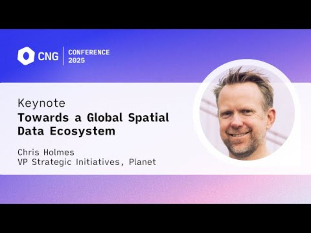
[CNG 2025] Towards a Global Spatial Data Ecosystem – Chris Holmes (Keynote)
YouTube video by Cloud-Native Geospatial Forum
youtu.be
May 28, 2025 at 5:43 PM
This week we begin rolling out recordings from #CNG2025. First up: @opencholmes.bsky.social on "Towards a Global Spatial Data Ecosystem." As Chris states: "We have the tools and people we need to make a huge impact...as long as we do it together"
▶️ youtu.be/IA9ZvXOnPZ0
New videos dropping weekly!
▶️ youtu.be/IA9ZvXOnPZ0
New videos dropping weekly!
Reposted by Alex Leith
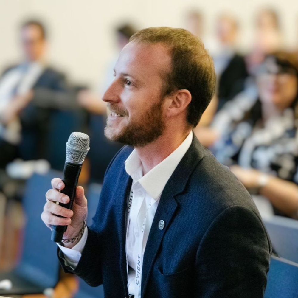
Intro: Committee Members 😎
Co-Chair Alex Leith!
- geospatial tech
- global leader = Earth observation
- delivers ops data infrastructure
- expertise = software dev, cloud infrastructure, program gov
- founding director OSGeo Oceania
+ more
Runs @ausp.io
#committee #foss4g #osgeo
Co-Chair Alex Leith!
- geospatial tech
- global leader = Earth observation
- delivers ops data infrastructure
- expertise = software dev, cloud infrastructure, program gov
- founding director OSGeo Oceania
+ more
Runs @ausp.io
#committee #foss4g #osgeo
May 20, 2025 at 1:01 AM
Intro: Committee Members 😎
Co-Chair Alex Leith!
- geospatial tech
- global leader = Earth observation
- delivers ops data infrastructure
- expertise = software dev, cloud infrastructure, program gov
- founding director OSGeo Oceania
+ more
Runs @ausp.io
#committee #foss4g #osgeo
Co-Chair Alex Leith!
- geospatial tech
- global leader = Earth observation
- delivers ops data infrastructure
- expertise = software dev, cloud infrastructure, program gov
- founding director OSGeo Oceania
+ more
Runs @ausp.io
#committee #foss4g #osgeo
Reposted by Alex Leith
A big thank you to our sponsor LINZ! 🤩
LINZ, or Toitū Te Whenua Land Information New Zealand, is the NZ Government's lead agency for geospatial info. The agency is an open data leader & frequent contributor to geospatial open-source software. Our kinda agency ✨
See: https://f.mtr.cool/rrxeforvoe
LINZ, or Toitū Te Whenua Land Information New Zealand, is the NZ Government's lead agency for geospatial info. The agency is an open data leader & frequent contributor to geospatial open-source software. Our kinda agency ✨
See: https://f.mtr.cool/rrxeforvoe

May 14, 2025 at 12:00 AM
A big thank you to our sponsor LINZ! 🤩
LINZ, or Toitū Te Whenua Land Information New Zealand, is the NZ Government's lead agency for geospatial info. The agency is an open data leader & frequent contributor to geospatial open-source software. Our kinda agency ✨
See: https://f.mtr.cool/rrxeforvoe
LINZ, or Toitū Te Whenua Land Information New Zealand, is the NZ Government's lead agency for geospatial info. The agency is an open data leader & frequent contributor to geospatial open-source software. Our kinda agency ✨
See: https://f.mtr.cool/rrxeforvoe
Reposted by Alex Leith

On our way to @cloudnativegeo.org conf, @ausp.io and I met up in Vegas, hiked Zion, now swinging through Bryce canyon before heading up to Snowbird! Looking forward to a few days of #geonerding


April 29, 2025 at 3:32 PM
On our way to @cloudnativegeo.org conf, @ausp.io and I met up in Vegas, hiked Zion, now swinging through Bryce canyon before heading up to Snowbird! Looking forward to a few days of #geonerding
Holy crap Zion National Park!


April 29, 2025 at 12:26 AM
Holy crap Zion National Park!
I’m on my way to the @cloudnativegeo.org conference, sporting my OG cloud native geospatial hoodie from 2020!
Looking forward to meeting new people and being absolutely humbled by what people are doing.
Also running a workshop Thursday morning, teaching some CNG for EO.
Looking forward to meeting new people and being absolutely humbled by what people are doing.
Also running a workshop Thursday morning, teaching some CNG for EO.

April 23, 2025 at 11:08 PM
I’m on my way to the @cloudnativegeo.org conference, sporting my OG cloud native geospatial hoodie from 2020!
Looking forward to meeting new people and being absolutely humbled by what people are doing.
Also running a workshop Thursday morning, teaching some CNG for EO.
Looking forward to meeting new people and being absolutely humbled by what people are doing.
Also running a workshop Thursday morning, teaching some CNG for EO.
Image generation is so easy. I'm a prompt engineer. Vibe rendering.

April 20, 2025 at 6:06 AM
Image generation is so easy. I'm a prompt engineer. Vibe rendering.
Pretty chill kind of watercolour map of some coastal stuff

April 17, 2025 at 1:22 PM
Pretty chill kind of watercolour map of some coastal stuff