


Benjamin Strick
@bendobrown.bsky.social
Investigator | Human Rights | Hybrid Wars
- Makes videos on maps, data & #OSINT
- Director of Investigations at @cen4infores.bsky.social
- Prev at BBC Africa Eye. Bellingcat contributor.
- Makes videos on maps, data & #OSINT
- Director of Investigations at @cen4infores.bsky.social
- Prev at BBC Africa Eye. Bellingcat contributor.
Pinned
Satellite imagery helps you understand what’s happening on the ground, from above.
There are loads of free tools out there. Here are 6 I actually use (and what each is best for).
Thread 👇🛰️
There are loads of free tools out there. Here are 6 I actually use (and what each is best for).
Thread 👇🛰️
OSINT Field Notes #5 is out: satellites, sanctions-evasion, and stacking evidence.
This month: newbuild identity theft in the shadow fleet, satellite methodologies stacked and how Ubiquiti networking gear ended up powering Russia's drone war.
🧵
This month: newbuild identity theft in the shadow fleet, satellite methodologies stacked and how Ubiquiti networking gear ended up powering Russia's drone war.
🧵
February 11, 2026 at 12:07 PM
OSINT Field Notes #5 is out: satellites, sanctions-evasion, and stacking evidence.
This month: newbuild identity theft in the shadow fleet, satellite methodologies stacked and how Ubiquiti networking gear ended up powering Russia's drone war.
🧵
This month: newbuild identity theft in the shadow fleet, satellite methodologies stacked and how Ubiquiti networking gear ended up powering Russia's drone war.
🧵
Wow. 100,000 subs on YouTube. For maps, metadata and the occasional weaponised Hilux.
Since Feb 2021, my channel has been about breaking down imagery, tools, tracking world events and sharing methods to democratise OSINT.
Thanks for watching, sharing and nerding out with me 🤓
Since Feb 2021, my channel has been about breaking down imagery, tools, tracking world events and sharing methods to democratise OSINT.
Thanks for watching, sharing and nerding out with me 🤓

January 30, 2026 at 2:25 PM
Wow. 100,000 subs on YouTube. For maps, metadata and the occasional weaponised Hilux.
Since Feb 2021, my channel has been about breaking down imagery, tools, tracking world events and sharing methods to democratise OSINT.
Thanks for watching, sharing and nerding out with me 🤓
Since Feb 2021, my channel has been about breaking down imagery, tools, tracking world events and sharing methods to democratise OSINT.
Thanks for watching, sharing and nerding out with me 🤓
Satellite imagery helps you understand what’s happening on the ground, from above.
There are loads of free tools out there. Here are 6 I actually use (and what each is best for).
Thread 👇🛰️
There are loads of free tools out there. Here are 6 I actually use (and what each is best for).
Thread 👇🛰️
January 28, 2026 at 10:11 AM
Satellite imagery helps you understand what’s happening on the ground, from above.
There are loads of free tools out there. Here are 6 I actually use (and what each is best for).
Thread 👇🛰️
There are loads of free tools out there. Here are 6 I actually use (and what each is best for).
Thread 👇🛰️
Excited to share the first edition of OSINT Field Notes for 2026. There's a lot here, from film geolocations, hybrid war maps, laptop farms, broken redactions and surveillance map sources.
Read here: tinyurl.com/osintfieldno...
Here's some nuggets from the dispatches section 👇🧵
Read here: tinyurl.com/osintfieldno...
Here's some nuggets from the dispatches section 👇🧵

OSINT Field Notes #4
Film geolocation, hybrid warfare, laptop farms, broken redactions, and the camera map that did not come from Brown.
tinyurl.com
January 14, 2026 at 1:25 PM
Excited to share the first edition of OSINT Field Notes for 2026. There's a lot here, from film geolocations, hybrid war maps, laptop farms, broken redactions and surveillance map sources.
Read here: tinyurl.com/osintfieldno...
Here's some nuggets from the dispatches section 👇🧵
Read here: tinyurl.com/osintfieldno...
Here's some nuggets from the dispatches section 👇🧵
Google Earth has updated imagery of Southern Lebanon, showing the scale of destruction of towns and communities, in detail, after the IDF's operation in the region between Oct 2024 and Jan 2025.
The imagery of this area is from 6 June, 2025.
The imagery of this area is from 6 June, 2025.
January 12, 2026 at 9:04 AM
Google Earth has updated imagery of Southern Lebanon, showing the scale of destruction of towns and communities, in detail, after the IDF's operation in the region between Oct 2024 and Jan 2025.
The imagery of this area is from 6 June, 2025.
The imagery of this area is from 6 June, 2025.
Reposted by Benjamin Strick

It's amazing how much knowledge we all have at our fingertips (all of us with internet, toilets etc so no more than half of us, but still.)
Great responsibility.
Great responsibility.
For those looking for geolocated footage from recent events in Venezuela, @geoconfirmed.org has mapped the community's crowdsourced geolocations here: geoconfirmed.org/ven
Use it and give credit where it is due. pic.x.com/i5jESLxm6T
Use it and give credit where it is due. pic.x.com/i5jESLxm6T

January 4, 2026 at 11:02 AM
It's amazing how much knowledge we all have at our fingertips (all of us with internet, toilets etc so no more than half of us, but still.)
Great responsibility.
Great responsibility.
For those looking for geolocated footage from recent events in Venezuela, @geoconfirmed.org has mapped the community's crowdsourced geolocations here: geoconfirmed.org/ven
Use it and give credit where it is due. pic.x.com/i5jESLxm6T
Use it and give credit where it is due. pic.x.com/i5jESLxm6T
January 4, 2026 at 9:27 AM
For those looking for geolocated footage from recent events in Venezuela, @geoconfirmed.org has mapped the community's crowdsourced geolocations here: geoconfirmed.org/ven
Use it and give credit where it is due. pic.x.com/i5jESLxm6T
Use it and give credit where it is due. pic.x.com/i5jESLxm6T
This footage from Brno (برنو) in Sudan's South Kordofan region, shows the sheer number of RSF affiliated fighters that descend upon these small towns when they are attacked, looted and burned.
The location is: 11.27240, 29.4757. It was filmed during the attack and takeover of the town last week.
The location is: 11.27240, 29.4757. It was filmed during the attack and takeover of the town last week.
December 24, 2025 at 2:07 PM
This footage from Brno (برنو) in Sudan's South Kordofan region, shows the sheer number of RSF affiliated fighters that descend upon these small towns when they are attacked, looted and burned.
The location is: 11.27240, 29.4757. It was filmed during the attack and takeover of the town last week.
The location is: 11.27240, 29.4757. It was filmed during the attack and takeover of the town last week.
Reposted by Benjamin Strick

okay!!!

The First National Website Dedicated To Documenting ICE License Plates Is Here ~ L.A. TACO
“Something like the plate tracker helps to encourage and promote legal transparency and legal accountability, especially when they're going around, switching plates, trying to hide, trying to be undet...
lataco.com
December 24, 2025 at 3:45 AM
okay!!!
Sometimes political figures and influential accounts delete posts that could cause headlines. But some archives store those posts forever.
In this video, we dig into five tools to look up deleted tweets and search through political posts.
youtu.be/QZi4iRN_Uj8?...
In this video, we dig into five tools to look up deleted tweets and search through political posts.
youtu.be/QZi4iRN_Uj8?...

OSINT At Home #28 - How to find deleted political posts (5 tools)
YouTube video by Bendobrown
youtu.be
December 23, 2025 at 12:32 PM
Sometimes political figures and influential accounts delete posts that could cause headlines. But some archives store those posts forever.
In this video, we dig into five tools to look up deleted tweets and search through political posts.
youtu.be/QZi4iRN_Uj8?...
In this video, we dig into five tools to look up deleted tweets and search through political posts.
youtu.be/QZi4iRN_Uj8?...
Since February 2022, the Eyes on Russia project by CIR and the #OSINT community has verified and mapped footage of Russia's invasion of Ukraine. The data is searchable by location, date and description.
For example, you can search "drone" and see areas they are largely present in.
For example, you can search "drone" and see areas they are largely present in.
December 18, 2025 at 3:32 PM
Since February 2022, the Eyes on Russia project by CIR and the #OSINT community has verified and mapped footage of Russia's invasion of Ukraine. The data is searchable by location, date and description.
For example, you can search "drone" and see areas they are largely present in.
For example, you can search "drone" and see areas they are largely present in.
Investigation finds evidence that a Sudanese Armed Forces operation carried out in Wad Madani was marked by ethnically motivated violence, mass killing of civilians, dumping of bodies into canals and mass graves.
Impactful work by @cnn.com & @lighthousereports.com
edition.cnn.com/interactive/...
Impactful work by @cnn.com & @lighthousereports.com
edition.cnn.com/interactive/...

Bodies in the canals
Dumped in canals and buried in mass graves: CNN investigates how Sudan’s army carried out ethnically targeted killings
edition.cnn.com
December 17, 2025 at 11:15 AM
Investigation finds evidence that a Sudanese Armed Forces operation carried out in Wad Madani was marked by ethnically motivated violence, mass killing of civilians, dumping of bodies into canals and mass graves.
Impactful work by @cnn.com & @lighthousereports.com
edition.cnn.com/interactive/...
Impactful work by @cnn.com & @lighthousereports.com
edition.cnn.com/interactive/...
This is the third edition of OSINT Field Notes, a monthly newsletter on digital investigations, techniques and tools.
This issue covers X location data, Nano Banana, 3D flight paths, and a sanctions data diving.
Thank you for the support on these 🙏
tinyurl.com/osintfieldno...
This issue covers X location data, Nano Banana, 3D flight paths, and a sanctions data diving.
Thank you for the support on these 🙏
tinyurl.com/osintfieldno...

OSINT Field Notes #3
3D scenes from scraps of imagery, X’s hidden location signal, how to follow sanctions paper trails and the global MAGA grifters exposed.
tinyurl.com
December 10, 2025 at 7:09 AM
This is the third edition of OSINT Field Notes, a monthly newsletter on digital investigations, techniques and tools.
This issue covers X location data, Nano Banana, 3D flight paths, and a sanctions data diving.
Thank you for the support on these 🙏
tinyurl.com/osintfieldno...
This issue covers X location data, Nano Banana, 3D flight paths, and a sanctions data diving.
Thank you for the support on these 🙏
tinyurl.com/osintfieldno...
Sudan air force bombing of towns, markets and schools has killed hundreds.
Brilliant open source investigative monitoring by our Sudan Witness team at CIR. www.bbc.com/news/article...
Brilliant open source investigative monitoring by our Sudan Witness team at CIR. www.bbc.com/news/article...

Sudan war: Air force's bombing of towns, markets and schools has killed hundreds, report says
A detailed study highlights the military's aerial campaign and how civilians have been its victims.
www.bbc.com
December 9, 2025 at 1:59 AM
Sudan air force bombing of towns, markets and schools has killed hundreds.
Brilliant open source investigative monitoring by our Sudan Witness team at CIR. www.bbc.com/news/article...
Brilliant open source investigative monitoring by our Sudan Witness team at CIR. www.bbc.com/news/article...
On the same day that UN condemned post-election violence and blackouts in Tanzania, Meta disabled accounts of activists that were posting footage showing violence carried out by Tanzanian police against protestors.
Meta link: transparency.meta.com/reports/cont...
UN: www.ohchr.org/en/press-rel...
Meta link: transparency.meta.com/reports/cont...
UN: www.ohchr.org/en/press-rel...


December 5, 2025 at 9:09 AM
On the same day that UN condemned post-election violence and blackouts in Tanzania, Meta disabled accounts of activists that were posting footage showing violence carried out by Tanzanian police against protestors.
Meta link: transparency.meta.com/reports/cont...
UN: www.ohchr.org/en/press-rel...
Meta link: transparency.meta.com/reports/cont...
UN: www.ohchr.org/en/press-rel...
X rolled out a new feature overnight showing where accounts are based. This network of “Trump-supporting independent women” that claimed to be “real Americans” are based in Thailand.
The photos were stolen from European models & posts pushed pro-Trump lines while targeting Islam and LGBTQ people.
The photos were stolen from European models & posts pushed pro-Trump lines while targeting Islam and LGBTQ people.

November 23, 2025 at 12:55 PM
X rolled out a new feature overnight showing where accounts are based. This network of “Trump-supporting independent women” that claimed to be “real Americans” are based in Thailand.
The photos were stolen from European models & posts pushed pro-Trump lines while targeting Islam and LGBTQ people.
The photos were stolen from European models & posts pushed pro-Trump lines while targeting Islam and LGBTQ people.
Tanzanian police killed protestors and there are signs of unmarked mass graves where bodies were reportedly dumped.
It was an honour to support the team at @cnn.com to document these horrible events.
edition.cnn.com/2025/11/21/a...
Video here: edition.cnn.com/2025/11/21/w...
It was an honour to support the team at @cnn.com to document these horrible events.
edition.cnn.com/2025/11/21/a...
Video here: edition.cnn.com/2025/11/21/w...

‘Oh my God, this is our Tanzania’: CNN investigation shows police shooting protesters, signs of mass graves | CNN
In the chaotic aftermath of Tanzania’s disputed presidential election last month, police and gun-wielding men on patrol shot at groups of protesters, many of whom appeared unarmed or were holding only...
edition.cnn.com
November 21, 2025 at 8:49 AM
Tanzanian police killed protestors and there are signs of unmarked mass graves where bodies were reportedly dumped.
It was an honour to support the team at @cnn.com to document these horrible events.
edition.cnn.com/2025/11/21/a...
Video here: edition.cnn.com/2025/11/21/w...
It was an honour to support the team at @cnn.com to document these horrible events.
edition.cnn.com/2025/11/21/a...
Video here: edition.cnn.com/2025/11/21/w...
Gotta love a bit of lights at night, especially when you can see them on a global map.
NASA’s Black Marble updates every day and shows every glow, blackout and wandering ship 🛰️⛴️
NASA’s Black Marble updates every day and shows every glow, blackout and wandering ship 🛰️⛴️
November 20, 2025 at 5:41 PM
Gotta love a bit of lights at night, especially when you can see them on a global map.
NASA’s Black Marble updates every day and shows every glow, blackout and wandering ship 🛰️⛴️
NASA’s Black Marble updates every day and shows every glow, blackout and wandering ship 🛰️⛴️
Reposted by Benjamin Strick

Shout out to @bendobrown.bsky.social for his newsletter!
He’s sharing a lot of tips, but reading this also brings me back to the days i just started doing osint. Newsletters like these taught me so much! 🥰
osintfieldnotes.substack.com
He’s sharing a lot of tips, but reading this also brings me back to the days i just started doing osint. Newsletters like these taught me so much! 🥰
osintfieldnotes.substack.com

OSINT Field Notes - from Benjamin Strick | Substack
Digital investigations, tools, techniques and dispatches, from satellites to social media. Short, sharp, and always something you can use, in your inbox every month. Click to read OSINT Field Notes - ...
osintfieldnotes.substack.com
November 13, 2025 at 8:02 AM
Shout out to @bendobrown.bsky.social for his newsletter!
He’s sharing a lot of tips, but reading this also brings me back to the days i just started doing osint. Newsletters like these taught me so much! 🥰
osintfieldnotes.substack.com
He’s sharing a lot of tips, but reading this also brings me back to the days i just started doing osint. Newsletters like these taught me so much! 🥰
osintfieldnotes.substack.com
This is the second edition of OSINT Field Notes: a monthly newsletter on digital investigations, with tools, techniques and notes from the field.
Thank you for all of the warm messages after the first one. It's an honour to work with the community.
osintfieldnotes.substack.com/p/osint-fiel...
Thank you for all of the warm messages after the first one. It's an honour to work with the community.
osintfieldnotes.substack.com/p/osint-fiel...

OSINT Field Notes #2
From simple panorama how-to's and Starlink signals to drone footage, fake architects, and the digital fingerprints that expose hidden networks.
osintfieldnotes.substack.com
November 12, 2025 at 3:38 PM
This is the second edition of OSINT Field Notes: a monthly newsletter on digital investigations, with tools, techniques and notes from the field.
Thank you for all of the warm messages after the first one. It's an honour to work with the community.
osintfieldnotes.substack.com/p/osint-fiel...
Thank you for all of the warm messages after the first one. It's an honour to work with the community.
osintfieldnotes.substack.com/p/osint-fiel...
Open source documentation by our Sudan Witness team at CIR on mass displacement, detentions & killings during the RSF takeover of El Fasher and the commanders linked to them: www.info-res.org/reports/disp...


November 7, 2025 at 3:08 PM
Open source documentation by our Sudan Witness team at CIR on mass displacement, detentions & killings during the RSF takeover of El Fasher and the commanders linked to them: www.info-res.org/reports/disp...
This is the aftermath of Hurricane Melissa in Jamaica. Absolutely horrific level of destruction, all visible on NOAA imagery. View the map here: storms.ngs.noaa.gov/storms/melis...
November 3, 2025 at 1:52 PM
This is the aftermath of Hurricane Melissa in Jamaica. Absolutely horrific level of destruction, all visible on NOAA imagery. View the map here: storms.ngs.noaa.gov/storms/melis...
Reposted by Benjamin Strick
Reminder that mass killings of civilians are happening in Sudan after the RSF’s takeover of El Fasher this week.
And there’s still a severe famine.
And there’s still a severe famine.
New satellite imagery analysis from Yale shows detailed view of the site where footage showed RSF executing unarmed people in the berm just north of Sudan’s El Fasher.

November 1, 2025 at 4:22 PM
Reminder that mass killings of civilians are happening in Sudan after the RSF’s takeover of El Fasher this week.
And there’s still a severe famine.
And there’s still a severe famine.
New satellite imagery analysis from Yale shows detailed view of the site where footage showed RSF executing unarmed people in the berm just north of Sudan’s El Fasher.
November 1, 2025 at 5:31 AM
New satellite imagery analysis from Yale shows detailed view of the site where footage showed RSF executing unarmed people in the berm just north of Sudan’s El Fasher.
Reposted by Benjamin Strick
For y’all interested in getting your own views into things like boat / naval activity in the Caribbean etc, this one’s for you.
I made a newsletter. I went overboard with detail, but I love sharing #OSINT tips and tricks.
I've covered:
- Innovations & resources.
- Free detailed aerial imagery tool.
- DIY power grid map.
- Analysis of leaked data on mass censorship & surveillance.
osintfieldnotes.substack.com/p/osint-fiel...
I've covered:
- Innovations & resources.
- Free detailed aerial imagery tool.
- DIY power grid map.
- Analysis of leaked data on mass censorship & surveillance.
osintfieldnotes.substack.com/p/osint-fiel...
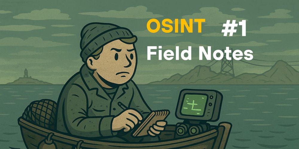
OSINT Field Notes #1 - DIY Power Grid Map, Great Firewall Leak & Birds Eye View Tool
Technical teardown on how to make a custom KML for power grids. Plus: tracking tiny ships, detailed aerial views and a case file on the Geedge leaks. Read time: 8 min.
osintfieldnotes.substack.com
October 28, 2025 at 7:11 PM
For y’all interested in getting your own views into things like boat / naval activity in the Caribbean etc, this one’s for you.