


California Landscapes
@calandscapebot.bsky.social
a real time portrait of California brought to you by the alertca.live network. maintained by @obtusatum.bsky.social.
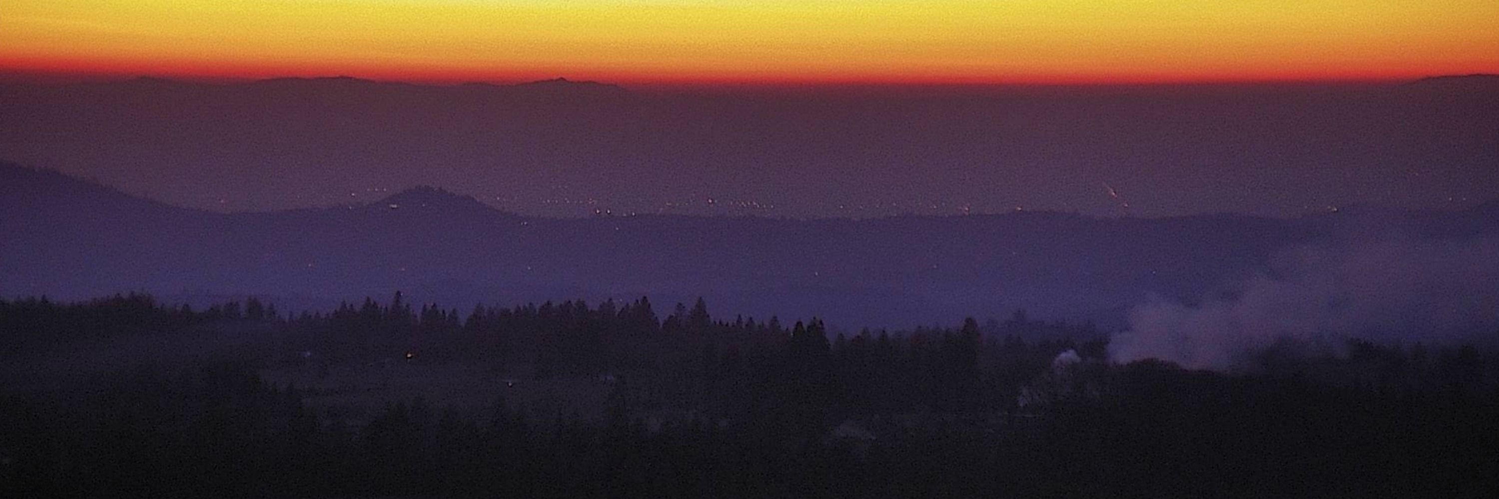
Mebane 1, Kern County, CA
🗺35.5161, -118.7176 🧭78° ⛰4462 ft
https://ops.alertcalifornia.org/cam-console/2113
🗺35.5161, -118.7176 🧭78° ⛰4462 ft
https://ops.alertcalifornia.org/cam-console/2113

January 19, 2026 at 7:36 PM
Mebane 1, Kern County, CA
🗺35.5161, -118.7176 🧭78° ⛰4462 ft
https://ops.alertcalifornia.org/cam-console/2113
🗺35.5161, -118.7176 🧭78° ⛰4462 ft
https://ops.alertcalifornia.org/cam-console/2113
Sage Hen, Nevada County, CA
🗺39.4264, -120.3119 🧭26° ⛰8307 ft
https://ops.alertcalifornia.org/cam-console/2340
🗺39.4264, -120.3119 🧭26° ⛰8307 ft
https://ops.alertcalifornia.org/cam-console/2340
January 19, 2026 at 7:07 PM
Sage Hen, Nevada County, CA
🗺39.4264, -120.3119 🧭26° ⛰8307 ft
https://ops.alertcalifornia.org/cam-console/2340
🗺39.4264, -120.3119 🧭26° ⛰8307 ft
https://ops.alertcalifornia.org/cam-console/2340
Round Mtn Modoc 2, Siskiyou County, CA
🗺41.4273, -121.4624 🧭353° ⛰5233 ft
https://ops.alertcalifornia.org/cam-console/4715
🗺41.4273, -121.4624 🧭353° ⛰5233 ft
https://ops.alertcalifornia.org/cam-console/4715

January 19, 2026 at 6:36 PM
Round Mtn Modoc 2, Siskiyou County, CA
🗺41.4273, -121.4624 🧭353° ⛰5233 ft
https://ops.alertcalifornia.org/cam-console/4715
🗺41.4273, -121.4624 🧭353° ⛰5233 ft
https://ops.alertcalifornia.org/cam-console/4715
Gypsum Canyon South 1, Orange County, CA
🗺33.8564, -117.7200 🧭55° ⛰719 ft
https://ops.alertcalifornia.org/cam-console/11091
🗺33.8564, -117.7200 🧭55° ⛰719 ft
https://ops.alertcalifornia.org/cam-console/11091
January 19, 2026 at 6:06 PM
Gypsum Canyon South 1, Orange County, CA
🗺33.8564, -117.7200 🧭55° ⛰719 ft
https://ops.alertcalifornia.org/cam-console/11091
🗺33.8564, -117.7200 🧭55° ⛰719 ft
https://ops.alertcalifornia.org/cam-console/11091
Osborn Preserve 2, Sonoma County, CA
🗺38.3536, -122.5910 🧭60° ⛰2146 ft
https://ops.alertcalifornia.org/cam-console/11023
🗺38.3536, -122.5910 🧭60° ⛰2146 ft
https://ops.alertcalifornia.org/cam-console/11023

January 19, 2026 at 5:36 PM
Osborn Preserve 2, Sonoma County, CA
🗺38.3536, -122.5910 🧭60° ⛰2146 ft
https://ops.alertcalifornia.org/cam-console/11023
🗺38.3536, -122.5910 🧭60° ⛰2146 ft
https://ops.alertcalifornia.org/cam-console/11023
Shirley Peak 1, Kern County, CA
🗺35.7057, -118.5595 🧭26° ⛰6995 ft
https://ops.alertcalifornia.org/cam-console/2378
🗺35.7057, -118.5595 🧭26° ⛰6995 ft
https://ops.alertcalifornia.org/cam-console/2378
January 19, 2026 at 5:07 PM
Shirley Peak 1, Kern County, CA
🗺35.7057, -118.5595 🧭26° ⛰6995 ft
https://ops.alertcalifornia.org/cam-console/2378
🗺35.7057, -118.5595 🧭26° ⛰6995 ft
https://ops.alertcalifornia.org/cam-console/2378
Escabroso 2, SanLuisObispo County, CA
🗺35.4685, -120.7305 🧭240° ⛰1814 ft
https://ops.alertcalifornia.org/cam-console/1962
🗺35.4685, -120.7305 🧭240° ⛰1814 ft
https://ops.alertcalifornia.org/cam-console/1962

January 19, 2026 at 4:36 PM
Escabroso 2, SanLuisObispo County, CA
🗺35.4685, -120.7305 🧭240° ⛰1814 ft
https://ops.alertcalifornia.org/cam-console/1962
🗺35.4685, -120.7305 🧭240° ⛰1814 ft
https://ops.alertcalifornia.org/cam-console/1962
Carbon Canyon 2, Orange County, CA
🗺33.9424, -117.7978 🧭201° ⛰1345 ft
https://ops.alertcalifornia.org/cam-console/1880
🗺33.9424, -117.7978 🧭201° ⛰1345 ft
https://ops.alertcalifornia.org/cam-console/1880
January 19, 2026 at 4:06 PM
Carbon Canyon 2, Orange County, CA
🗺33.9424, -117.7978 🧭201° ⛰1345 ft
https://ops.alertcalifornia.org/cam-console/1880
🗺33.9424, -117.7978 🧭201° ⛰1345 ft
https://ops.alertcalifornia.org/cam-console/1880
Olancha 2, Inyo County, CA
🗺36.2725, -118.0073 🧭261° ⛰3661 ft
https://ops.alertcalifornia.org/cam-console/2222
🗺36.2725, -118.0073 🧭261° ⛰3661 ft
https://ops.alertcalifornia.org/cam-console/2222

January 19, 2026 at 3:36 PM
Olancha 2, Inyo County, CA
🗺36.2725, -118.0073 🧭261° ⛰3661 ft
https://ops.alertcalifornia.org/cam-console/2222
🗺36.2725, -118.0073 🧭261° ⛰3661 ft
https://ops.alertcalifornia.org/cam-console/2222
Buffalo Bump North, SanDiego County, CA
🗺33.4284, -117.3825 🧭16° ⛰2854 ft
https://ops.alertcalifornia.org/cam-console/2539
🗺33.4284, -117.3825 🧭16° ⛰2854 ft
https://ops.alertcalifornia.org/cam-console/2539
January 19, 2026 at 3:07 PM
Buffalo Bump North, SanDiego County, CA
🗺33.4284, -117.3825 🧭16° ⛰2854 ft
https://ops.alertcalifornia.org/cam-console/2539
🗺33.4284, -117.3825 🧭16° ⛰2854 ft
https://ops.alertcalifornia.org/cam-console/2539
King George Ridge 1, Tulare County, CA
🗺35.8735, -118.7450 🧭336° ⛰4147 ft
https://ops.alertcalifornia.org/cam-console/2051
🗺35.8735, -118.7450 🧭336° ⛰4147 ft
https://ops.alertcalifornia.org/cam-console/2051

January 19, 2026 at 2:36 PM
King George Ridge 1, Tulare County, CA
🗺35.8735, -118.7450 🧭336° ⛰4147 ft
https://ops.alertcalifornia.org/cam-console/2051
🗺35.8735, -118.7450 🧭336° ⛰4147 ft
https://ops.alertcalifornia.org/cam-console/2051
Georgetown 1, eldorado County, CA
🗺38.9081, -120.8697 🧭235° ⛰2756 ft
https://ops.alertcalifornia.org/cam-console/13471
🗺38.9081, -120.8697 🧭235° ⛰2756 ft
https://ops.alertcalifornia.org/cam-console/13471
January 19, 2026 at 2:06 PM
Georgetown 1, eldorado County, CA
🗺38.9081, -120.8697 🧭235° ⛰2756 ft
https://ops.alertcalifornia.org/cam-console/13471
🗺38.9081, -120.8697 🧭235° ⛰2756 ft
https://ops.alertcalifornia.org/cam-console/13471
Duckwall 2, Tuolumne County, CA
🗺37.9687, -120.1198 🧭302° ⛰5823 ft
https://ops.alertcalifornia.org/cam-console/1946
🗺37.9687, -120.1198 🧭302° ⛰5823 ft
https://ops.alertcalifornia.org/cam-console/1946

January 19, 2026 at 1:36 PM
Duckwall 2, Tuolumne County, CA
🗺37.9687, -120.1198 🧭302° ⛰5823 ft
https://ops.alertcalifornia.org/cam-console/1946
🗺37.9687, -120.1198 🧭302° ⛰5823 ft
https://ops.alertcalifornia.org/cam-console/1946
Castro Peak 1, LosAngeles County, CA
🗺34.0858, -118.7857 🧭321° ⛰2792 ft
https://ops.alertcalifornia.org/cam-console/1886
🗺34.0858, -118.7857 🧭321° ⛰2792 ft
https://ops.alertcalifornia.org/cam-console/1886
January 19, 2026 at 1:06 PM
Castro Peak 1, LosAngeles County, CA
🗺34.0858, -118.7857 🧭321° ⛰2792 ft
https://ops.alertcalifornia.org/cam-console/1886
🗺34.0858, -118.7857 🧭321° ⛰2792 ft
https://ops.alertcalifornia.org/cam-console/1886
San Sevaine Lookout 1, SanBernardino County, CA
🗺34.2135, -117.5009 🧭24° ⛰5640 ft
https://ops.alertcalifornia.org/cam-console/2355
🗺34.2135, -117.5009 🧭24° ⛰5640 ft
https://ops.alertcalifornia.org/cam-console/2355

January 19, 2026 at 12:36 PM
San Sevaine Lookout 1, SanBernardino County, CA
🗺34.2135, -117.5009 🧭24° ⛰5640 ft
https://ops.alertcalifornia.org/cam-console/2355
🗺34.2135, -117.5009 🧭24° ⛰5640 ft
https://ops.alertcalifornia.org/cam-console/2355
UCSD TDLLN 1, SanDiego County, CA
🗺32.8727, -117.2421 🧭27° ⛰400 ft
https://ops.alertcalifornia.org/cam-console/13500
🗺32.8727, -117.2421 🧭27° ⛰400 ft
https://ops.alertcalifornia.org/cam-console/13500
January 19, 2026 at 12:06 PM
UCSD TDLLN 1, SanDiego County, CA
🗺32.8727, -117.2421 🧭27° ⛰400 ft
https://ops.alertcalifornia.org/cam-console/13500
🗺32.8727, -117.2421 🧭27° ⛰400 ft
https://ops.alertcalifornia.org/cam-console/13500
HWY 101 Blueberry 2, SantaBarbara County, CA
🗺34.5574, -120.1862 🧭60° ⛰1004 ft
https://ops.alertcalifornia.org/cam-console/2034
🗺34.5574, -120.1862 🧭60° ⛰1004 ft
https://ops.alertcalifornia.org/cam-console/2034

January 19, 2026 at 11:36 AM
HWY 101 Blueberry 2, SantaBarbara County, CA
🗺34.5574, -120.1862 🧭60° ⛰1004 ft
https://ops.alertcalifornia.org/cam-console/2034
🗺34.5574, -120.1862 🧭60° ⛰1004 ft
https://ops.alertcalifornia.org/cam-console/2034
Templeton 1, SanLuisObispo County, CA
🗺35.5669, -120.8193 🧭300° ⛰1939 ft
https://ops.alertcalifornia.org/cam-console/2448
🗺35.5669, -120.8193 🧭300° ⛰1939 ft
https://ops.alertcalifornia.org/cam-console/2448
January 19, 2026 at 11:07 AM
Templeton 1, SanLuisObispo County, CA
🗺35.5669, -120.8193 🧭300° ⛰1939 ft
https://ops.alertcalifornia.org/cam-console/2448
🗺35.5669, -120.8193 🧭300° ⛰1939 ft
https://ops.alertcalifornia.org/cam-console/2448
Hammond Ranch 2, Siskiyou County, CA
🗺41.3734, -122.4514 🧭0° ⛰5712 ft
https://ops.alertcalifornia.org/cam-console/2529
🗺41.3734, -122.4514 🧭0° ⛰5712 ft
https://ops.alertcalifornia.org/cam-console/2529

January 19, 2026 at 10:36 AM
Hammond Ranch 2, Siskiyou County, CA
🗺41.3734, -122.4514 🧭0° ⛰5712 ft
https://ops.alertcalifornia.org/cam-console/2529
🗺41.3734, -122.4514 🧭0° ⛰5712 ft
https://ops.alertcalifornia.org/cam-console/2529
El Paso 1, Kern County, CA
🗺35.4773, -117.7004 🧭294° ⛰4357 ft
https://ops.alertcalifornia.org/cam-console/1955
🗺35.4773, -117.7004 🧭294° ⛰4357 ft
https://ops.alertcalifornia.org/cam-console/1955
January 19, 2026 at 10:07 AM
El Paso 1, Kern County, CA
🗺35.4773, -117.7004 🧭294° ⛰4357 ft
https://ops.alertcalifornia.org/cam-console/1955
🗺35.4773, -117.7004 🧭294° ⛰4357 ft
https://ops.alertcalifornia.org/cam-console/1955
Santiago Peak CalOES S, Riverside County, CA
🗺33.7112, -117.5341 🧭145° ⛰5646 ft
https://ops.alertcalifornia.org/cam-console/2370
🗺33.7112, -117.5341 🧭145° ⛰5646 ft
https://ops.alertcalifornia.org/cam-console/2370

January 19, 2026 at 9:36 AM
Santiago Peak CalOES S, Riverside County, CA
🗺33.7112, -117.5341 🧭145° ⛰5646 ft
https://ops.alertcalifornia.org/cam-console/2370
🗺33.7112, -117.5341 🧭145° ⛰5646 ft
https://ops.alertcalifornia.org/cam-console/2370
Sedgwick Reserve Fire Lookout N, SantaBarbara County, CA
🗺34.7086, -120.0487 🧭307° ⛰1608 ft
https://ops.alertcalifornia.org/cam-console/16023
🗺34.7086, -120.0487 🧭307° ⛰1608 ft
https://ops.alertcalifornia.org/cam-console/16023
January 19, 2026 at 9:07 AM
Sedgwick Reserve Fire Lookout N, SantaBarbara County, CA
🗺34.7086, -120.0487 🧭307° ⛰1608 ft
https://ops.alertcalifornia.org/cam-console/16023
🗺34.7086, -120.0487 🧭307° ⛰1608 ft
https://ops.alertcalifornia.org/cam-console/16023
Mt Bradley 2, Siskiyou County, CA
🗺41.2219, -122.3087 🧭180° ⛰5512 ft
https://ops.alertcalifornia.org/cam-console/1687
🗺41.2219, -122.3087 🧭180° ⛰5512 ft
https://ops.alertcalifornia.org/cam-console/1687

January 19, 2026 at 8:36 AM
Mt Bradley 2, Siskiyou County, CA
🗺41.2219, -122.3087 🧭180° ⛰5512 ft
https://ops.alertcalifornia.org/cam-console/1687
🗺41.2219, -122.3087 🧭180° ⛰5512 ft
https://ops.alertcalifornia.org/cam-console/1687
Star Mtn 1, LosAngeles County, CA
🗺34.1189, -118.3925 🧭100° ⛰1486 ft
https://ops.alertcalifornia.org/cam-console/2415
🗺34.1189, -118.3925 🧭100° ⛰1486 ft
https://ops.alertcalifornia.org/cam-console/2415
January 19, 2026 at 8:07 AM
Star Mtn 1, LosAngeles County, CA
🗺34.1189, -118.3925 🧭100° ⛰1486 ft
https://ops.alertcalifornia.org/cam-console/2415
🗺34.1189, -118.3925 🧭100° ⛰1486 ft
https://ops.alertcalifornia.org/cam-console/2415
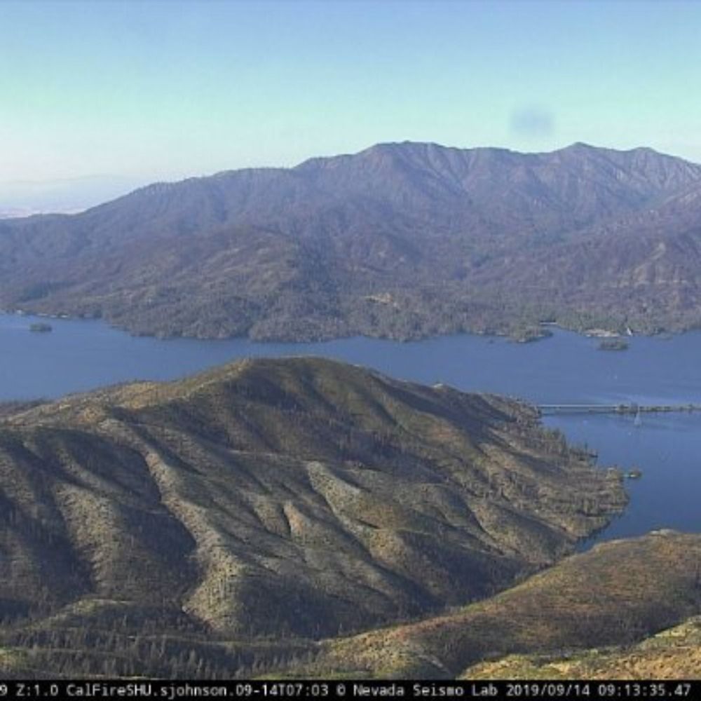
Mt Bullion 2, Mariposa County, CA
🗺37.5331, -120.0280 🧭300° ⛰4088 ft
https://ops.alertcalifornia.org/cam-console/2152
🗺37.5331, -120.0280 🧭300° ⛰4088 ft
https://ops.alertcalifornia.org/cam-console/2152

January 19, 2026 at 7:36 AM
Mt Bullion 2, Mariposa County, CA
🗺37.5331, -120.0280 🧭300° ⛰4088 ft
https://ops.alertcalifornia.org/cam-console/2152
🗺37.5331, -120.0280 🧭300° ⛰4088 ft
https://ops.alertcalifornia.org/cam-console/2152