Benjamin Hennig
@geoviews.bsky.social
1.8K followers 92 following 110 posts

Geographer + accidental cartographer. Posting about geography, maps & more. https://geoviews.net/

Political science 44%
Agriculture 12%
Posts Media Videos Starter Packs

Reposted by Benjamin D. Hennig

geovislab.bsky.social
Who Feeds the World? Find out at BragaGarour, the Icelandic Slow Food Festival this weekend at Grasagaröinum. Among the displays will be our FoodMapper Quiz, checking your knowledge of the world of food with over 200 maps! slowfood.is/bragdagardur...
Who Feeds The World?

geoviews.bsky.social
Broken News: The Global State of Press Freedom journals.sagepub.com/doi/full/10....

geoviews.bsky.social
Stateless and Scattered: Mapping the Palestinian Diaspora journals.sagepub.com/doi/full/10....

geoviews.bsky.social
Collapse of critical Atlantic current is no longer low-likelihood, study finds www.theguardian.com/environment/...

Reposted by Benjamin D. Hennig

davidleather.bsky.social
#30DayMapChallenge Day 27: Micromapping

I will reiterate again that I love map in a circle so here is another one. A map of Low Bradfield village in Sheffield where I have had many a family walk and more recently attempted to take up tennis.

Reposted by Benjamin D. Hennig

Reposted by Benjamin D. Hennig

alexselbyb.bsky.social
Day 18 #30DayMapChallenge
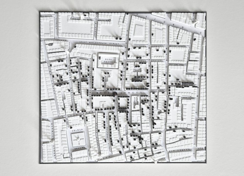
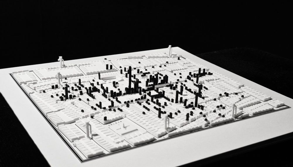
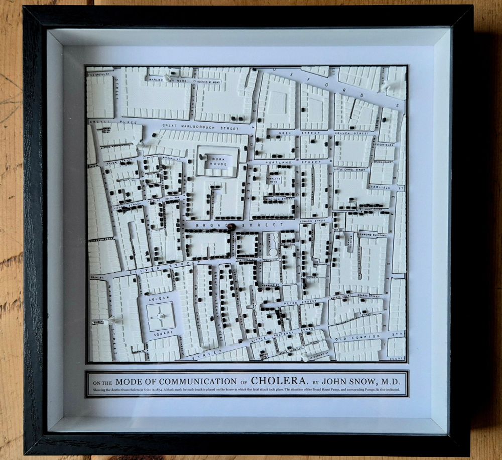
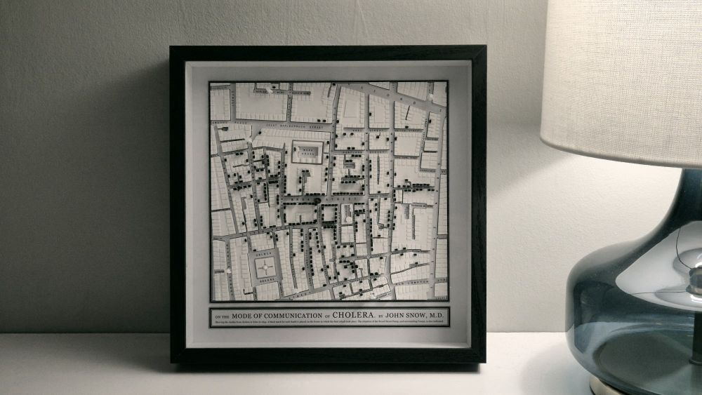
I 3D-printed John Snow's 1854 cholera map of Soho. It took ages.
3D-printed map of Soho in 1854. Black marks on top of the buildings represent deaths from cholera caused by infected water from the Broad Street Pump (note the missing handle!). Top-down view. 3D-printed map of Soho in 1854. Black marks on top of the buildings represent deaths from cholera caused by infected water from the Broad Street Pump (note the missing handle!). Side view. 3D-printed map of Soho in 1854. Black marks on top of the buildings represent deaths from cholera caused by infected water from the Broad Street Pump (note the missing handle!). Framed, close-up. 3D-printed map of Soho in 1854. Black marks on top of the buildings represent deaths from cholera caused by infected water from the Broad Street Pump (note the missing handle!). Frame, "artful" shot.

Reposted by Benjamin D. Hennig

islandsmaster.bsky.social
ISLANDS students Aisling, Aya & Jaqueline have won the Icelandic Copernicus Hackathon. They developed an AI-powered Kelp farming site selection tool. A great achievement to celebrate @ today's International Day of Women & Girls in Science! copernicus.gis.is/homepage/ind... #WomenInScience #IDWGS2025

Reposted by Benjamin D. Hennig

worldmapper.bsky.social
Map of the Week: German General Election / Bundestagswahl 2025 - find out more at wrld.at/motw360 #maps #cartograms #cartography #worldmapper

geoviews.bsky.social
Basemap World: a sleek, vector-based web map service with global and German data - interactive, customisable, and quite up-to-date basemap.de/produkte-und...

geoviews.bsky.social
Lunchtime update by the MetOffice: 'Latest observations show that the eruption is no longer confined to a single fissure. The larger fissure at the Sundhnúka crater row is estimated to be about 2.4 km long. A smaller fissure has also opened west of Fagradalsfjall [estimated] about 500 meters long.'

geoviews.bsky.social
The RUV webcams also provide live views of the eruption for all those who can’t be here youtu.be/kXD4A9uFHcg
Grindavik - Mosaic
YouTube video by RÚV
youtu.be

geoviews.bsky.social
Gas pollution cam be expected locally although the capital region is currently not in the path of gas dispersion from the eruption en.vedur.is/volcanoes/fa...

geoviews.bsky.social
The road to Grindavík has been closed by the authorities, but visitors should be able to get a glimpse of the eruption from Reykjanesbraut, the main road connecting the international airport of Keflavík with the capital Reykjavík umferdin.is/en

geoviews.bsky.social
The eruption was preceded by a series of earthquake tremors since midnight that indicated an increased activity close to the surface en.vedur.is/earthquakes-...

geoviews.bsky.social
Tourist eruption? The Reykjanes Peninsula has finally decided again to continue its eruption series at the height of the tourist season, The latest eruption in Iceland started at 3.57am last night en.vedur.is/about-imo/ne...

geoviews.bsky.social
Big thanks to an incredible global crew 🌍🌎🌏 (🇦🇼 🇨🇦 🇩🇰 🇩🇪 🇪🇨 🇪🇸 🇪🇺 🇮🇪 🇬🇧 🇮🇹 🇳🇱 🇷🇸 🇸🇪 🇹🇼 🇺🇸), local experts, guest speakers and partners who made this such a memorable experience 🙌

geoviews.bsky.social
ISLAS 2025 🏝️ Westfjords Edition 🏔️
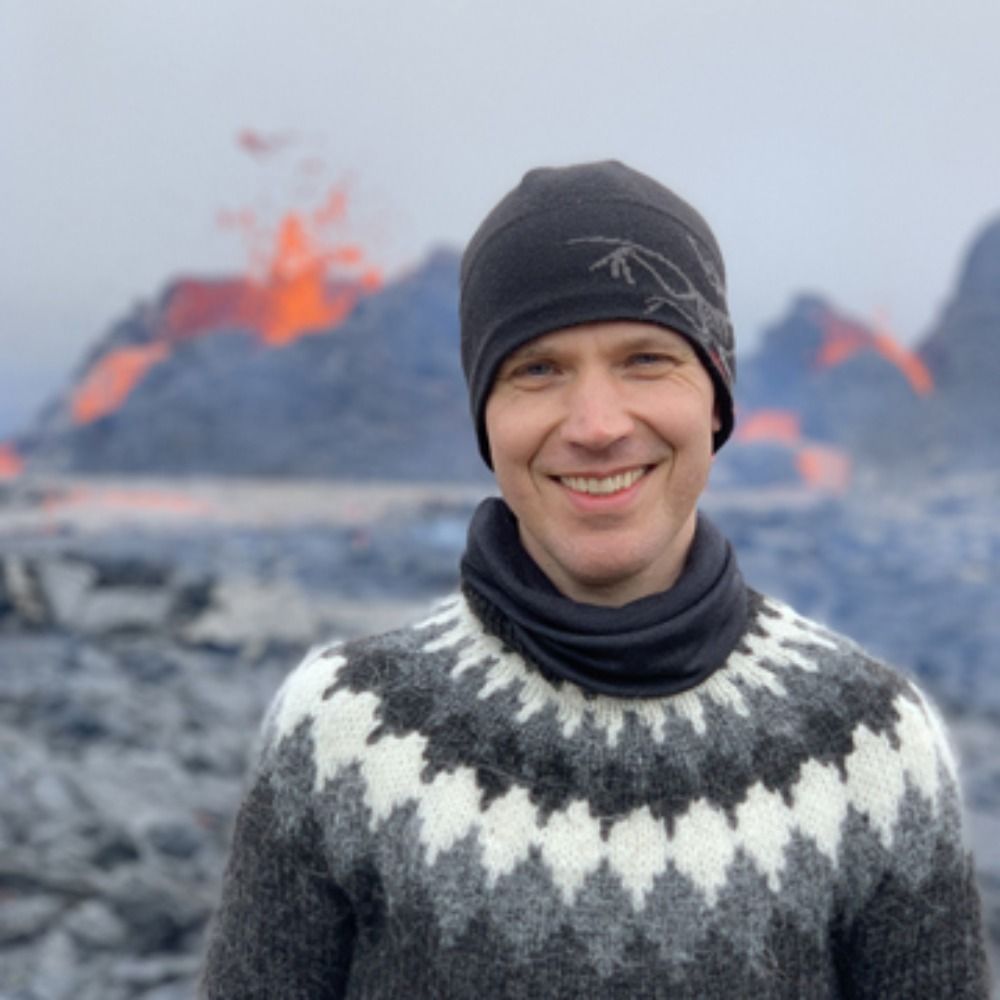
Our Islands as Laboratories for Sustainability summer school finally made it to Iceland! 🇮🇸 It was an inspiring week exploring Remote Communities in Transition @haskoliislands.bsky.social / @islandsmaster.bsky.social
#ISLAS2025

geoviews.bsky.social
Climate change drives record-breaking heat in Iceland and Greenland challenging cold adapted ecosystems and societies www.worldweatherattribution.org/climate-chan...

geoviews.bsky.social
UK Travel Visualiser - a neat little mapping project smstone0.github.io#/uk-map