


Jeremy DeHart
@jeremydehartwx.bsky.social
Meteorologist & 53 WRS Air Force Reserve Hurricane Hunter. Alum of Naval Postgraduate School (M.S.) & NC State (B.S.) | Views do not represent those of the Air Force or DoD.
Reposted by Jeremy DeHart

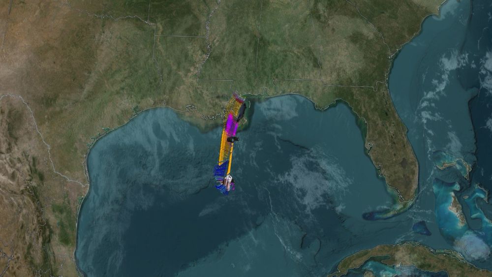
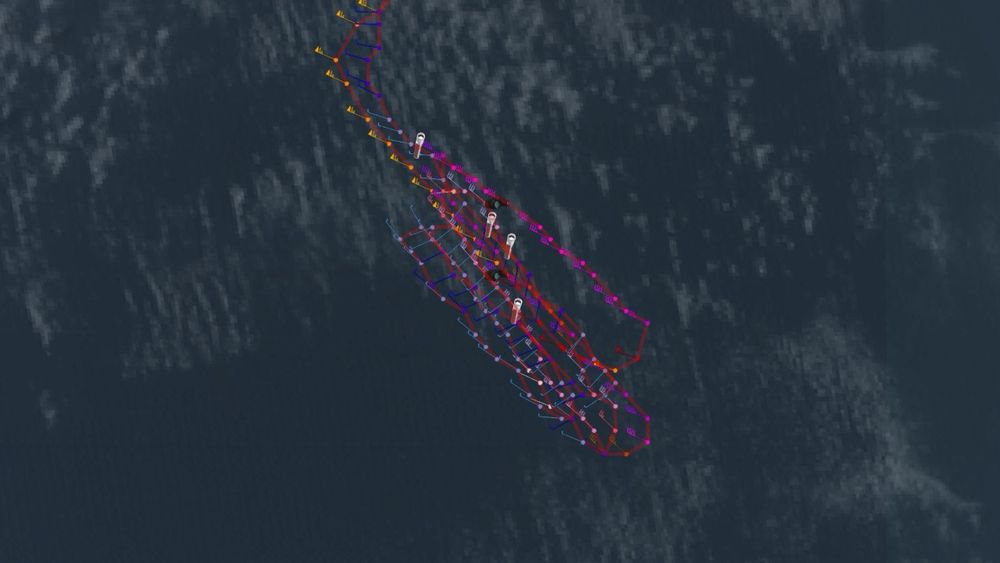
Multi-panel view of the last few days of Hurricane Melissa:
↖️ GOES-19 infrared brightness temp
↗️ GOES-19 visible satellite
↙️ Hurricane hunter planes & flight paths
↘️ Recon-derived flight level wind swath
⬇️ Estimated minimum pressure from recon dropsondes
↖️ GOES-19 infrared brightness temp
↗️ GOES-19 visible satellite
↙️ Hurricane hunter planes & flight paths
↘️ Recon-derived flight level wind swath
⬇️ Estimated minimum pressure from recon dropsondes
October 29, 2025 at 10:14 PM
Multi-panel view of the last few days of Hurricane Melissa:
↖️ GOES-19 infrared brightness temp
↗️ GOES-19 visible satellite
↙️ Hurricane hunter planes & flight paths
↘️ Recon-derived flight level wind swath
⬇️ Estimated minimum pressure from recon dropsondes
↖️ GOES-19 infrared brightness temp
↗️ GOES-19 visible satellite
↙️ Hurricane hunter planes & flight paths
↘️ Recon-derived flight level wind swath
⬇️ Estimated minimum pressure from recon dropsondes
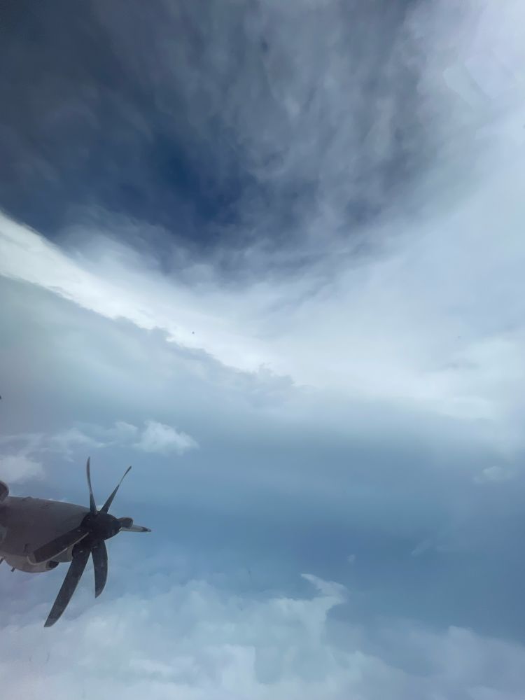
I was worried for my crew mates when I saw them circling in the eye for over 20 mins. Looks like the very rough ride was confirmed. Plane had to leave early. They reported svr turb and a "sawtooth" eye. Looks like they moved 600-700ft up & down during this stretch in ~1 min.


October 28, 2025 at 4:23 PM
I was worried for my crew mates when I saw them circling in the eye for over 20 mins. Looks like the very rough ride was confirmed. Plane had to leave early. They reported svr turb and a "sawtooth" eye. Looks like they moved 600-700ft up & down during this stretch in ~1 min.
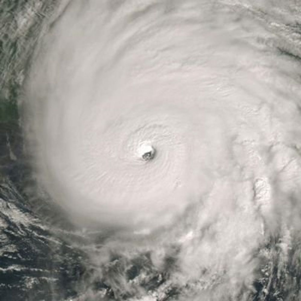
From a crewmember on yesterday's Teal 74 mission into now-Category 5 Hurricane #Melissa. As clear of an eye as you will see in the Atlantic basin.
October 27, 2025 at 4:11 PM
From a crewmember on yesterday's Teal 74 mission into now-Category 5 Hurricane #Melissa. As clear of an eye as you will see in the Atlantic basin.
From Hurricane #Imelda today. Strong winds create a streaking effect on the ocean surface. Was about 65 kts here so this is hurricane force. Eventually upgraded to Cat 2 during the mission. Should pack a decent punch to Bermuda tonight.
October 1, 2025 at 8:23 PM
From Hurricane #Imelda today. Strong winds create a streaking effect on the ocean surface. Was about 65 kts here so this is hurricane force. Eventually upgraded to Cat 2 during the mission. Should pack a decent punch to Bermuda tonight.
The final 53 WRS mission into Erin is just wrapping up. This was the 24th recon mission on this storm, several of which were ~12 hrs long. Now set to begin flying on #90L into next week as it heads toward Bermuda. Hug your local hurricane hunter. 😅


August 21, 2025 at 3:49 PM
The final 53 WRS mission into Erin is just wrapping up. This was the 24th recon mission on this storm, several of which were ~12 hrs long. Now set to begin flying on #90L into next week as it heads toward Bermuda. Hug your local hurricane hunter. 😅
We were a bit heavier and slower today, so the tail behind us was able to make up 25 mins and caught up to us

August 13, 2025 at 10:45 PM
We were a bit heavier and slower today, so the tail behind us was able to make up 25 mins and caught up to us
Just returned home. Good explainer on why #Chantal threw us a curve on the 2nd fix. Was expecting it to be NNW of the 1st fix, but got an abrupt wind flip to the NE, so had to circle and reattack from the south. Maybe this means track toward the right side of the cone? Tricky storm!


July 5, 2025 at 7:28 PM
Just returned home. Good explainer on why #Chantal threw us a curve on the 2nd fix. Was expecting it to be NNW of the 1st fix, but got an abrupt wind flip to the NE, so had to circle and reattack from the south. Maybe this means track toward the right side of the cone? Tricky storm!
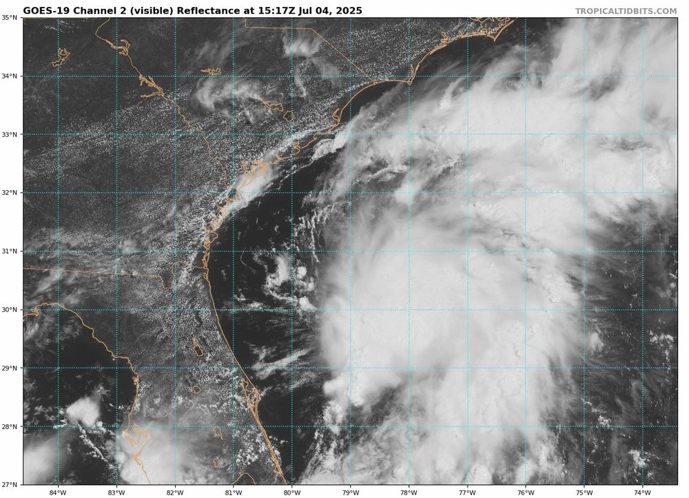
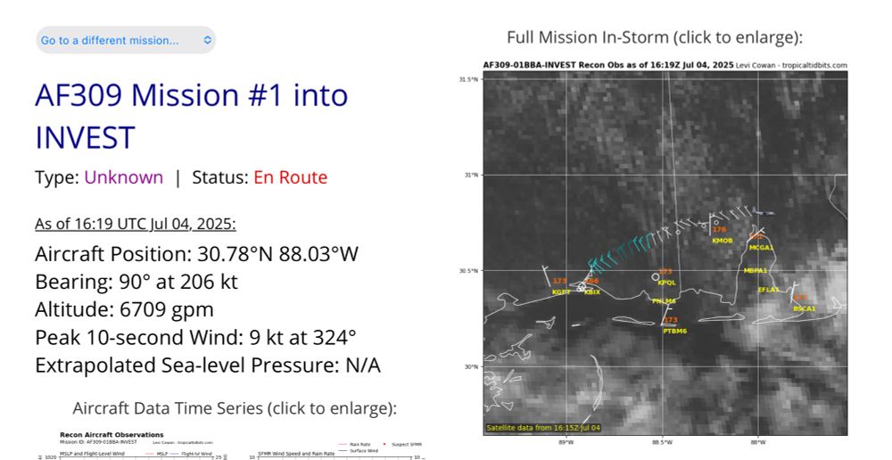
TEAL 71 is now enroute to investigate #92L. Three more @53rdWRS missions on the books through the weekend. USA airpower at work. Happy Independence Day 🇺🇸
July 4, 2025 at 5:49 PM
TEAL 71 is now enroute to investigate #92L. Three more @53rdWRS missions on the books through the weekend. USA airpower at work. Happy Independence Day 🇺🇸
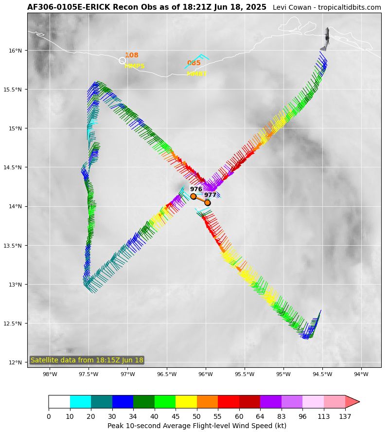
Another EPAC cyclone blowing up before landfall. Pressure in Hurricane #Erick dropped rapidly from 977mb to 972mb between passes (from center dropsondes). Closed eye was really wrapping up the second time through. Next 53 WRS mission will be in the storm this evening.

June 18, 2025 at 10:14 PM
Another EPAC cyclone blowing up before landfall. Pressure in Hurricane #Erick dropped rapidly from 977mb to 972mb between passes (from center dropsondes). Closed eye was really wrapping up the second time through. Next 53 WRS mission will be in the storm this evening.
Sure looking like this will be our first operational mission of the season. NHC has designated a "possible" in the Plan of the Day for Wed, but with current trends and expectations for this storm I'd lean toward more likely than not that we'll fly it.
#94E has a closed circulation and some convection around. It's not quite TC-grade but it's on the way to development. We'll have a better idea of the track and intensity once it's developed given the sensitivity to latitude changes. Possible recon into it Wednesday too which would help obs
June 16, 2025 at 7:19 PM
Sure looking like this will be our first operational mission of the season. NHC has designated a "possible" in the Plan of the Day for Wed, but with current trends and expectations for this storm I'd lean toward more likely than not that we'll fly it.
Last night we wore out this spot in the Gulf as we began our annual SFMR calibration missions this week. Flew a 1+ hr racetrack spiraling down from 25K ft to near the surface. Had the added benefit of feeding a few dropsondes into the models ahead of this weekend's severe wx.

March 14, 2025 at 11:25 PM
Last night we wore out this spot in the Gulf as we began our annual SFMR calibration missions this week. Flew a 1+ hr racetrack spiraling down from 25K ft to near the surface. Had the added benefit of feeding a few dropsondes into the models ahead of this weekend's severe wx.
Look for potential swings in 00Z model output this evening with a 53 WRS mission in progress over the Gulf. A second mission is also planned for 12Z.
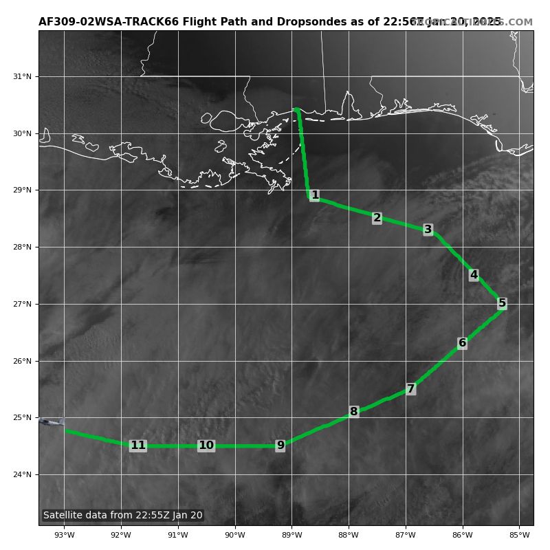
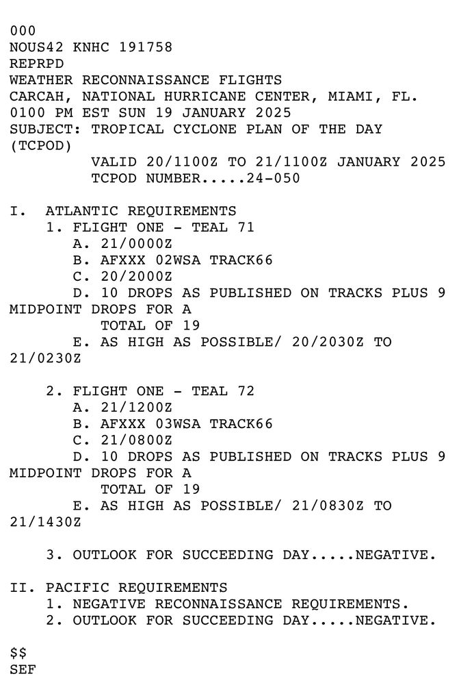
January 20, 2025 at 11:34 PM
Look for potential swings in 00Z model output this evening with a 53 WRS mission in progress over the Gulf. A second mission is also planned for 12Z.
Thank you for your service Mr. President. It will be my honor to continue serving our country under the next Commander in Chief, providing critical weather reconnaissance data to the American public 🇺🇸

January 17, 2025 at 2:02 AM
Thank you for your service Mr. President. It will be my honor to continue serving our country under the next Commander in Chief, providing critical weather reconnaissance data to the American public 🇺🇸
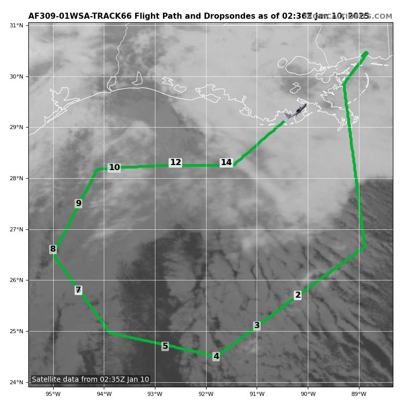
First winter storm flight of the season complete! These dropsondes will help the models resolve the thermodynamic details of this sloppy mess over the next few days
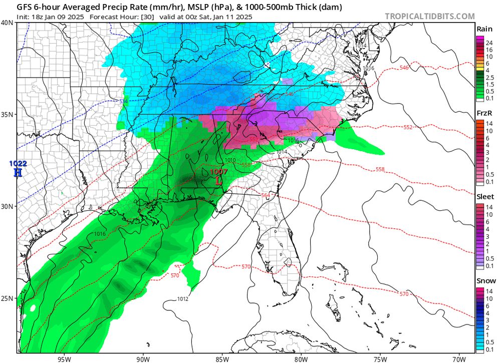
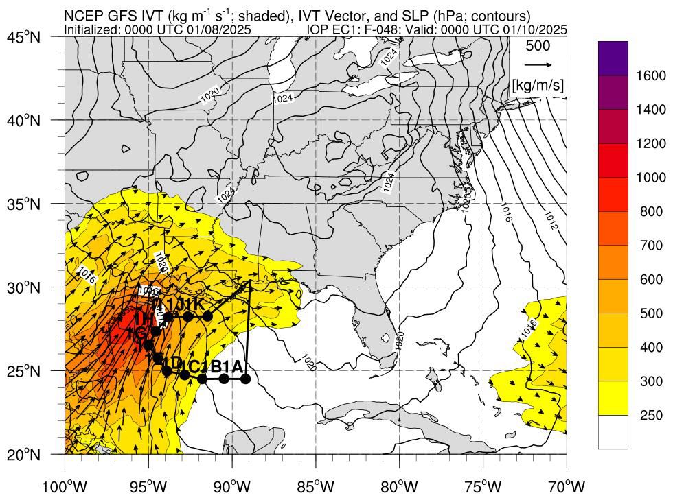
January 10, 2025 at 4:08 AM
First winter storm flight of the season complete! These dropsondes will help the models resolve the thermodynamic details of this sloppy mess over the next few days
Reposted by Jeremy DeHart

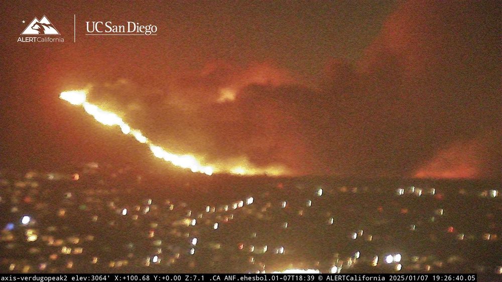
From camera videos, the speed of fire spread is breathtaking. Also, the smoke is indicative of a mountain wave typical of severe downslope windstorms, as the smoke appears to also be blowing down the slope at times.
January 8, 2025 at 3:40 AM
From camera videos, the speed of fire spread is breathtaking. Also, the smoke is indicative of a mountain wave typical of severe downslope windstorms, as the smoke appears to also be blowing down the slope at times.
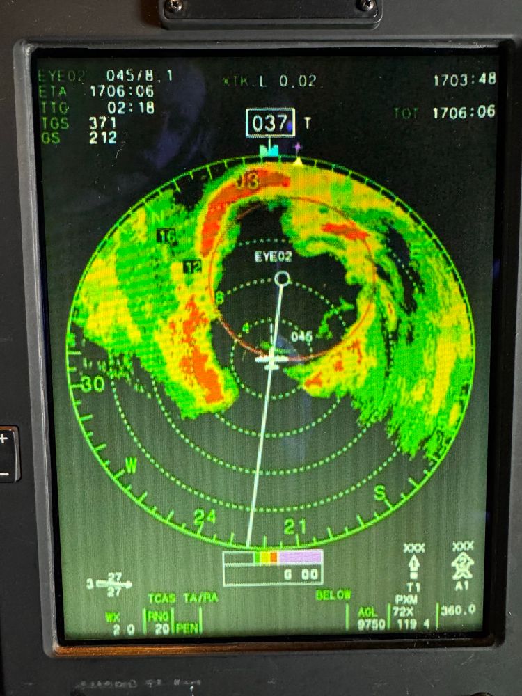
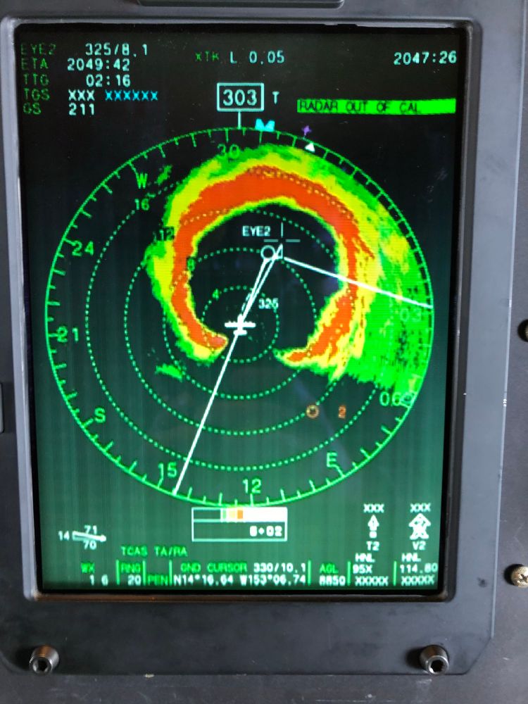
Thought this place needed a little hurricane hunter content. Radar from Cat 5 Hurricane Lane (August 21, 2018) and eye of Hurricane Sam (September 29, 2021)
January 4, 2025 at 5:26 PM
Thought this place needed a little hurricane hunter content. Radar from Cat 5 Hurricane Lane (August 21, 2018) and eye of Hurricane Sam (September 29, 2021)