


Jason Nicholls
@jnmet.bsky.social
Lead International Forecaster/Senior Meteorologist/International forecasting manager @AccuWeather. Long range/global forecaster. NVU-Lyndon grad; proud dad


A moist flow across the Aegean Sea will result in pockets of heavy rain in southeast #Turkey & portions of #Greece through Friday. The heaviest rain looks to be around the Thermaic Gulf, including near #Thessaloniki.

December 4, 2025 at 12:18 PM
A moist flow across the Aegean Sea will result in pockets of heavy rain in southeast #Turkey & portions of #Greece through Friday. The heaviest rain looks to be around the Thermaic Gulf, including near #Thessaloniki.
Scattered rains will continue in #AndhraPradesh, #TamilNadu, #Puducherry, #Karnataka, #Goa, #Kerala & #SriLanka through Friday. Rainfall lighter & spottier this weekend. A WD will bring some rain to N #Pakistan & NW #India Thursday night & Friday with additional showers this weekend.

December 4, 2025 at 10:15 AM
Scattered rains will continue in #AndhraPradesh, #TamilNadu, #Puducherry, #Karnataka, #Goa, #Kerala & #SriLanka through Friday. Rainfall lighter & spottier this weekend. A WD will bring some rain to N #Pakistan & NW #India Thursday night & Friday with additional showers this weekend.
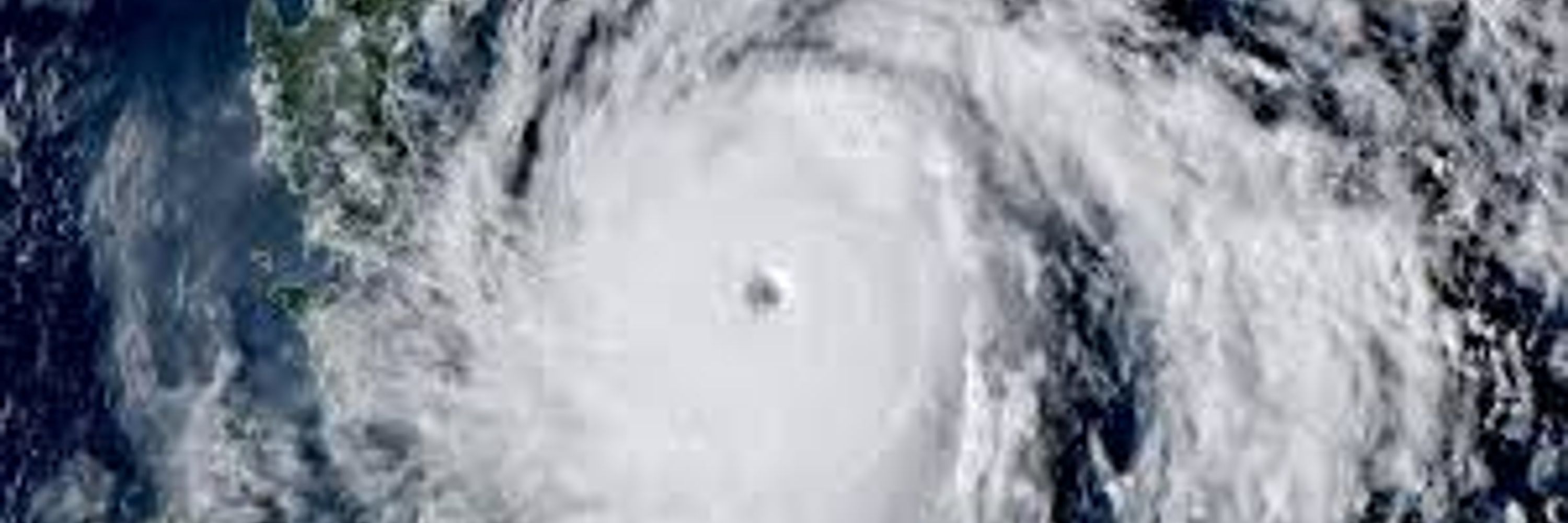
We now have Tropical Depression #Wilma, according to PAGASA. Wilma will bring areas of heavy rain to portions of the #Philippines Friday through Monday, local time.

December 4, 2025 at 8:20 AM
We now have Tropical Depression #Wilma, according to PAGASA. Wilma will bring areas of heavy rain to portions of the #Philippines Friday through Monday, local time.
Scattered rains, locally heavy, will continue in #AndhraPradesh, #TamilNadu, #Puducherry, #Karnataka, #Goa, #Kerala & #SriLanka through Friday. Rainfall will become lighter & spottier this weekend. A WD will bring some rain to N #Pakistan & NW #India Thursday night & Friday.

December 3, 2025 at 1:26 PM
Scattered rains, locally heavy, will continue in #AndhraPradesh, #TamilNadu, #Puducherry, #Karnataka, #Goa, #Kerala & #SriLanka through Friday. Rainfall will become lighter & spottier this weekend. A WD will bring some rain to N #Pakistan & NW #India Thursday night & Friday.
Risk for tropical development off northwest #Australia & the Solomon Sea next week. Also, watch for a tropical system to form in the vicinity of #DiegoGarcia around mid-month.

December 3, 2025 at 11:37 AM
Risk for tropical development off northwest #Australia & the Solomon Sea next week. Also, watch for a tropical system to form in the vicinity of #DiegoGarcia around mid-month.
A storm near #NewFoundland will bring strong winds to portions of #Ireland, southwest #England, #Wales & western #Scotland Friday into Saturday. Exposed areas can have wind gusts to hurricane force (119 km/h or 74 mph).

December 3, 2025 at 10:41 AM
A storm near #NewFoundland will bring strong winds to portions of #Ireland, southwest #England, #Wales & western #Scotland Friday into Saturday. Exposed areas can have wind gusts to hurricane force (119 km/h or 74 mph).
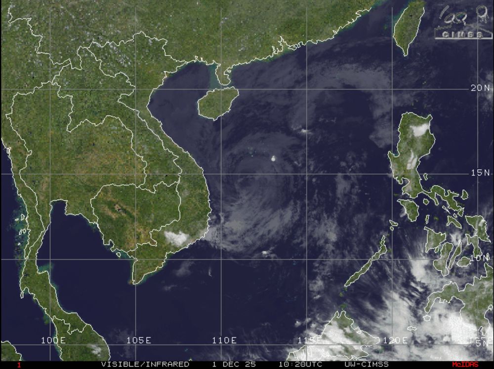
Area of low pressure over the Philippine Sea can strengthen to a depression before reaching the #Philippines this weekend.

December 3, 2025 at 8:16 AM
Area of low pressure over the Philippine Sea can strengthen to a depression before reaching the #Philippines this weekend.
Happy Union Day to those in and from the United Arab Emirates!

December 2, 2025 at 3:14 PM
Happy Union Day to those in and from the United Arab Emirates!
The ridge east of the Mariana Islands will expand westward which should steer the developing cyclone in the Philippine Sea westward toward the #Philippines this week. The cyclone will be steered westward across the South China Sea toward #Vietnam next week.

December 2, 2025 at 2:48 PM
The ridge east of the Mariana Islands will expand westward which should steer the developing cyclone in the Philippine Sea westward toward the #Philippines this week. The cyclone will be steered westward across the South China Sea toward #Vietnam next week.
It's beginning to look a lot like Christmas at the homestead.


December 2, 2025 at 1:50 PM
It's beginning to look a lot like Christmas at the homestead.
Conditions should become conducive for tropical development off northern #Australia & around the Sulu Sea next week. Also, watch for tropical development in the vicinity of #DiegoGarcia around mid-month.

December 2, 2025 at 12:33 PM
Conditions should become conducive for tropical development off northern #Australia & around the Sulu Sea next week. Also, watch for tropical development in the vicinity of #DiegoGarcia around mid-month.
Scattered rains, locally heavy, will continue in #AndhraPradesh, #TamilNadu, #Puducherry, #Karnataka, #Goa, #Kerala & #SriLanka through Friday. Rainfall will become lighter & spottier this weekend. A WD will bring some rain to N #Pakistan & NW #India late this week.

December 2, 2025 at 10:51 AM
Scattered rains, locally heavy, will continue in #AndhraPradesh, #TamilNadu, #Puducherry, #Karnataka, #Goa, #Kerala & #SriLanka through Friday. Rainfall will become lighter & spottier this weekend. A WD will bring some rain to N #Pakistan & NW #India late this week.
A developing low over the Philippine Sea can strengthen as it moves westward. This low can become a depression or storm before reaching the #Philippines this weekend.

December 2, 2025 at 8:41 AM
A developing low over the Philippine Sea can strengthen as it moves westward. This low can become a depression or storm before reaching the #Philippines this weekend.
Risk of tropical development off northern or northwestern #Australia next week. Also watch for tropical development in the vicinity of #DiegoGarcia around mid-month.

December 1, 2025 at 9:49 PM
Risk of tropical development off northern or northwestern #Australia next week. Also watch for tropical development in the vicinity of #DiegoGarcia around mid-month.
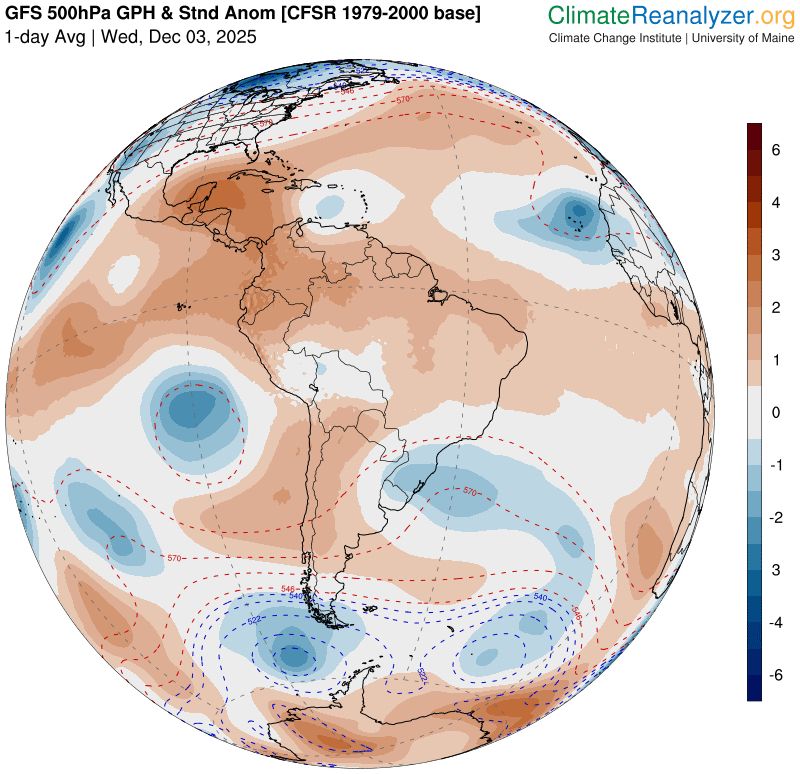
The latest weekly IOD Index is near the -IOD threshold of -0.4°C. A neutral IOD is expected to return in early December.

December 1, 2025 at 12:08 PM
The latest weekly IOD Index is near the -IOD threshold of -0.4°C. A neutral IOD is expected to return in early December.
#Koto has mostly faded over the South China Sea, but there's a good chance a new tropical system could form in the Philippine Sea later this week. Any system might impact the #Philippines by the weekend.
December 1, 2025 at 11:52 AM
#Koto has mostly faded over the South China Sea, but there's a good chance a new tropical system could form in the Philippine Sea later this week. Any system might impact the #Philippines by the weekend.
#Ditwah has weakened to a deep depression & will continue to weaken over the next 12-24 hours. However, rain, some heavy, is possible in northeast #TamilNadu & coastal #AndhraPradesh into Wednesday.

November 30, 2025 at 11:34 PM
#Ditwah has weakened to a deep depression & will continue to weaken over the next 12-24 hours. However, rain, some heavy, is possible in northeast #TamilNadu & coastal #AndhraPradesh into Wednesday.

Cyclonic Storm #Ditwah will continue to produce areas of heavy rain in #TamilNadu & #AndhraPradesh into Monday.

November 29, 2025 at 10:28 PM
Cyclonic Storm #Ditwah will continue to produce areas of heavy rain in #TamilNadu & #AndhraPradesh into Monday.
Watch for tropical development off northern or northwest #Australia later the week of 8 December.

November 29, 2025 at 12:04 AM
Watch for tropical development off northern or northwest #Australia later the week of 8 December.

Very good chance for new tropical development in the Philippine Sea next week. Also, watch for tropical development off northern or northwestern #Australia later the week of 8 December.

November 28, 2025 at 12:39 PM
Very good chance for new tropical development in the Philippine Sea next week. Also, watch for tropical development off northern or northwestern #Australia later the week of 8 December.