


Alan Russell
@soxgnasher.bsky.social
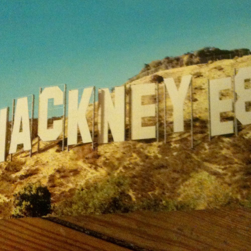
Born Homerton Hackney London local history mainly Hackney history - has es ven yox rufn eyds antisemetik
During the 1970s and first half of the 80s photographer Neil Martinson recorded the lives of those who lived and worked in Hackney, east London. Neil Martinson photographed Chatsworth Road Market Clapton Hackney in 1976

February 1, 2026 at 10:11 PM
During the 1970s and first half of the 80s photographer Neil Martinson recorded the lives of those who lived and worked in Hackney, east London. Neil Martinson photographed Chatsworth Road Market Clapton Hackney in 1976
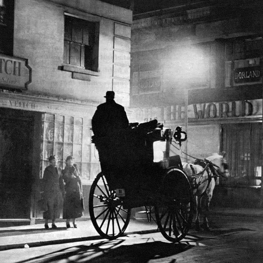
The Two Horse LCC Tram from the Swan Clapton Common to Aldersgate approaching Leabridge road junction Upper Clapton Hackney.

February 1, 2026 at 8:59 PM
The Two Horse LCC Tram from the Swan Clapton Common to Aldersgate approaching Leabridge road junction Upper Clapton Hackney.
Millfields road went down to Hackney Marshes. It was an old country lane which crossed the River Lea to Essex (crossing the marshes)at Cow Bridge. Originally called Marsh Lane by 1831 it was called Pond Lane and from 1887 Millfields Road.


February 1, 2026 at 8:27 PM
Millfields road went down to Hackney Marshes. It was an old country lane which crossed the River Lea to Essex (crossing the marshes)at Cow Bridge. Originally called Marsh Lane by 1831 it was called Pond Lane and from 1887 Millfields Road.
Fulham Place, Prout Road now Casimir road east side of old Clapton Tram sheds. Upper Clapton Hackney 1930


February 1, 2026 at 8:09 PM
Fulham Place, Prout Road now Casimir road east side of old Clapton Tram sheds. Upper Clapton Hackney 1930
The Old Clapton Tram Depot, located at 38-40 Upper Clapton Road Hackney London is a rare surviving 19th-century Victorian horse-drawn tram shed, opened on July 12, 1873, by the North Metropolitan Tramways Company.

February 1, 2026 at 5:08 PM
The Old Clapton Tram Depot, located at 38-40 Upper Clapton Road Hackney London is a rare surviving 19th-century Victorian horse-drawn tram shed, opened on July 12, 1873, by the North Metropolitan Tramways Company.
Clapton Pond, Lower Clapton, Hackney, originated in the 17th century 1600s and served as a water source and later a reservoir for the local area. It was not a natural water body but was used to store water pumped from the River Lea in the 18th century, with significant landscaping occurring in 1898

February 1, 2026 at 1:00 PM
Clapton Pond, Lower Clapton, Hackney, originated in the 17th century 1600s and served as a water source and later a reservoir for the local area. It was not a natural water body but was used to store water pumped from the River Lea in the 18th century, with significant landscaping occurring in 1898
Reposted by Alan Russell
I have vivid memories of the two-'bus- journey from Chingford to Old Ford E3 with my Mother to visit my Grandmother. I was pre-school. We changed 'buses at Clapton Pond. On Lea Bridge Road was the Clapton Jewish Day School and the splendid Synagogue. Now all gone.
January 31, 2026 at 10:12 AM
I have vivid memories of the two-'bus- journey from Chingford to Old Ford E3 with my Mother to visit my Grandmother. I was pre-school. We changed 'buses at Clapton Pond. On Lea Bridge Road was the Clapton Jewish Day School and the splendid Synagogue. Now all gone.
The Clapton tollgate, located on Lea Bridge Road, Hackney, was a 18th-century turnpike checkpoint on the Clapton side of the River Lea. Established to manage traffic crossing Leyton marshes,

January 30, 2026 at 6:32 PM
The Clapton tollgate, located on Lea Bridge Road, Hackney, was a 18th-century turnpike checkpoint on the Clapton side of the River Lea. Established to manage traffic crossing Leyton marshes,
SHOREDITCH HIGH STREET, 1810 Entrance to London at Shoreditch Church. Junction of Kingsland Road and Shoreditch High Street, looking south. Shows St. Leonard's Church and the Charity School.

January 30, 2026 at 4:30 PM
SHOREDITCH HIGH STREET, 1810 Entrance to London at Shoreditch Church. Junction of Kingsland Road and Shoreditch High Street, looking south. Shows St. Leonard's Church and the Charity School.
HARMAN STREET. SHOREDITCH, North side.Nos.1-15. 1964 Terraced houses demolished shows St.Leonard's Hospital at rear. Hare Walk CPO.

January 30, 2026 at 3:41 PM
HARMAN STREET. SHOREDITCH, North side.Nos.1-15. 1964 Terraced houses demolished shows St.Leonard's Hospital at rear. Hare Walk CPO.
CARLESS CAPEL & LEONARD.1934 First delivery of coal petrol to RAF, Biggen Hill.Carless, Capel & Leonard, Pioneers in Petrol – Hackney Wick Eugene Carless founded a distilling and refining business in 1859 at Hackney Wick – the Hope Chemical Works –

January 30, 2026 at 3:28 PM
CARLESS CAPEL & LEONARD.1934 First delivery of coal petrol to RAF, Biggen Hill.Carless, Capel & Leonard, Pioneers in Petrol – Hackney Wick Eugene Carless founded a distilling and refining business in 1859 at Hackney Wick – the Hope Chemical Works –
CAESAR STREET. SHOREDITCH, East side.Nos.15-35. 1972

January 30, 2026 at 3:19 PM
CAESAR STREET. SHOREDITCH, East side.Nos.15-35. 1972
FINSBURY AVENUE SHOREDITCH, West side. 1971 The Crispin pub was situated at 18 Finsbury Avenue. This street has since been demolished and redeveloped. A new Crispin was built as part of the Broadgate Development.


January 30, 2026 at 3:13 PM
FINSBURY AVENUE SHOREDITCH, West side. 1971 The Crispin pub was situated at 18 Finsbury Avenue. This street has since been demolished and redeveloped. A new Crispin was built as part of the Broadgate Development.
CURTAIN ROAD. Hoxton Shoreditch. Nos.86-94 1969 A Oakden & Sons, hardware factors became the second biggest supplier of locks and keys in the UK.

January 30, 2026 at 3:12 PM
CURTAIN ROAD. Hoxton Shoreditch. Nos.86-94 1969 A Oakden & Sons, hardware factors became the second biggest supplier of locks and keys in the UK.
DEREHAM PLACE. SHOREDITCH, 1934.Dereham Place was demolished 1934


January 30, 2026 at 3:00 PM
DEREHAM PLACE. SHOREDITCH, 1934.Dereham Place was demolished 1934
Children buy off-ration sweets in Hackney on 5 February 1953. Children busy tasting their first ration-free sweets outside a sweetshop in Mare Street in Hackney, London.

January 29, 2026 at 6:11 PM
Children buy off-ration sweets in Hackney on 5 February 1953. Children busy tasting their first ration-free sweets outside a sweetshop in Mare Street in Hackney, London.
Funeral of General Booth, 1912 A snapshot photograph of the funeral procession for William Booth (1829-1912) entering Abney Park Cemetery, Stoke Newington, taken by an unknown photographer in 1912. Booth's funeral was held at a vast exhibition hall, drawing a crowd of 40,000.

January 29, 2026 at 6:06 PM
Funeral of General Booth, 1912 A snapshot photograph of the funeral procession for William Booth (1829-1912) entering Abney Park Cemetery, Stoke Newington, taken by an unknown photographer in 1912. Booth's funeral was held at a vast exhibition hall, drawing a crowd of 40,000.
Railway office at 141 Mare Street, Hackney, London, 1928. where passengers went to book and purchase their tickets. Having several offices in different parts of London meant that customers did not always have to go all the way to Euston or St Pancras stations to buy their tickets or

January 29, 2026 at 5:54 PM
Railway office at 141 Mare Street, Hackney, London, 1928. where passengers went to book and purchase their tickets. Having several offices in different parts of London meant that customers did not always have to go all the way to Euston or St Pancras stations to buy their tickets or
Roe triplane at Walthamstow Marshes by the river Lea, May 1909.Sir Edwin Alliott Verdon Roe (1877-1958), seen here at the controls, was the first Briton to fly an all-British aeroplane, the Roe I, on 13 July 1909 at Walthamstow Marshes, London.


January 29, 2026 at 5:49 PM
Roe triplane at Walthamstow Marshes by the river Lea, May 1909.Sir Edwin Alliott Verdon Roe (1877-1958), seen here at the controls, was the first Briton to fly an all-British aeroplane, the Roe I, on 13 July 1909 at Walthamstow Marshes, London.
Striking female factory workers dancing outside Hackney Wick's Rubber Works, London, taken by a Planet news Ltd photographer on 8 September 1936 and used by the Daily Herald newspaper science&society

January 29, 2026 at 5:29 PM
Striking female factory workers dancing outside Hackney Wick's Rubber Works, London, taken by a Planet news Ltd photographer on 8 September 1936 and used by the Daily Herald newspaper science&society
A rural scene in the depths of Islington as pigs were driven to Caledonian Market. The pigs, among which were some weighty specimens, refused to keep to the road and invaded the pavement, to the disconfiture of some passers by who were better accustomed to dodging motor buses.

January 29, 2026 at 5:20 PM
A rural scene in the depths of Islington as pigs were driven to Caledonian Market. The pigs, among which were some weighty specimens, refused to keep to the road and invaded the pavement, to the disconfiture of some passers by who were better accustomed to dodging motor buses.
1898 Broad Street station This station was on the North London Railway. It opened in 1865 and was the NLR's terminus. By 1900 this station dealt with an average of 85,000 passengers every day, more than Euston and Paddington combined. Science&Society


January 29, 2026 at 5:15 PM
1898 Broad Street station This station was on the North London Railway. It opened in 1865 and was the NLR's terminus. By 1900 this station dealt with an average of 85,000 passengers every day, more than Euston and Paddington combined. Science&Society
Herbert Morrison with his supporters, London 10 October 1931. Herbert Morrison (1888-1965) Labour candidate for Hackney South, trying to gain support before the general election on 27 October 1931.

January 29, 2026 at 5:11 PM
Herbert Morrison with his supporters, London 10 October 1931. Herbert Morrison (1888-1965) Labour candidate for Hackney South, trying to gain support before the general election on 27 October 1931.
NORTON FOLGATE SHOREDITCH, 1909

January 29, 2026 at 3:18 PM
NORTON FOLGATE SHOREDITCH, 1909
Norton Folgate west side, looking north from Bishopsgate. Elevation to front of nos. 39-40 in 1912

January 29, 2026 at 3:17 PM
Norton Folgate west side, looking north from Bishopsgate. Elevation to front of nos. 39-40 in 1912