


Theron Finley
@theronfinley.bsky.social
PhD in Earth Sciences at UVic SEOS 🍁 | Active tectonics, structural geology, remote sensing, geothermal energy | he/him 🏳️🌈
This is fantastic news!
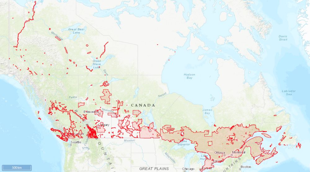
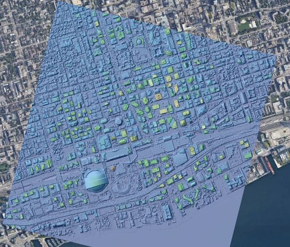
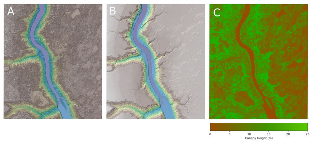
OpenTopography is excited to announce a major expansion to its international data catalog with the addition of the High Resolution Digital Elevation Model from Natural Resources Canada. This 1-meter resolution dataset is ideal for a wide range of applications.
opentopography.org/news/opentop...
opentopography.org/news/opentop...
July 23, 2025 at 6:58 PM
This is fantastic news!
Reposted by Theron Finley
OpenTopography is excited to announce a major expansion to its international data catalog with the addition of the High Resolution Digital Elevation Model from Natural Resources Canada. This 1-meter resolution dataset is ideal for a wide range of applications.
opentopography.org/news/opentop...
opentopography.org/news/opentop...
July 23, 2025 at 2:35 PM
OpenTopography is excited to announce a major expansion to its international data catalog with the addition of the High Resolution Digital Elevation Model from Natural Resources Canada. This 1-meter resolution dataset is ideal for a wide range of applications.
opentopography.org/news/opentop...
opentopography.org/news/opentop...
A thread on this paper! 🧪⚒️
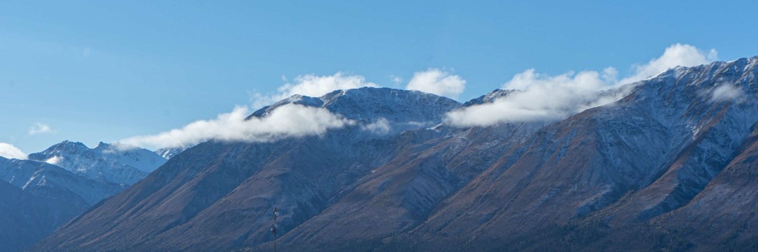
The Tintina fault is a major right-lateral fault, stretching ~1000 km across the Yukon, and having slipped a total of ~430 km in its lifetime. It's generally thought to have been inactive since the Eocene.
The Tintina fault is a major right-lateral fault, stretching ~1000 km across the Yukon, and having slipped a total of ~430 km in its lifetime. It's generally thought to have been inactive since the Eocene.

July 17, 2025 at 5:10 PM
A thread on this paper! 🧪⚒️
The Tintina fault is a major right-lateral fault, stretching ~1000 km across the Yukon, and having slipped a total of ~430 km in its lifetime. It's generally thought to have been inactive since the Eocene.
The Tintina fault is a major right-lateral fault, stretching ~1000 km across the Yukon, and having slipped a total of ~430 km in its lifetime. It's generally thought to have been inactive since the Eocene.
Really pleased to share our new paper in GRL, documenting evidence of multiple Quaternary surface-rupturing earthquakes on the Tintina fault in the Yukon.
doi.org/10.1029/2025...
@faultydata.bsky.social @earthquakeguy.bsky.social @thatfaultguy.bsky.social @tephrafan.bsky.social
doi.org/10.1029/2025...
@faultydata.bsky.social @earthquakeguy.bsky.social @thatfaultguy.bsky.social @tephrafan.bsky.social
Large Surface‐Rupturing Earthquakes and a >12 kyr, Open Interseismic Interval on the Tintina Fault, Yukon
We provide the first conclusive evidence of numerous large (>Mw 7.5) surface-rupturing earthquakes in the Quaternary on the Tintina fault
Offsets to Early and Middle Pleistocene glaciofluvial ter...
doi.org
July 16, 2025 at 9:55 PM
Really pleased to share our new paper in GRL, documenting evidence of multiple Quaternary surface-rupturing earthquakes on the Tintina fault in the Yukon.
doi.org/10.1029/2025...
@faultydata.bsky.social @earthquakeguy.bsky.social @thatfaultguy.bsky.social @tephrafan.bsky.social
doi.org/10.1029/2025...
@faultydata.bsky.social @earthquakeguy.bsky.social @thatfaultguy.bsky.social @tephrafan.bsky.social
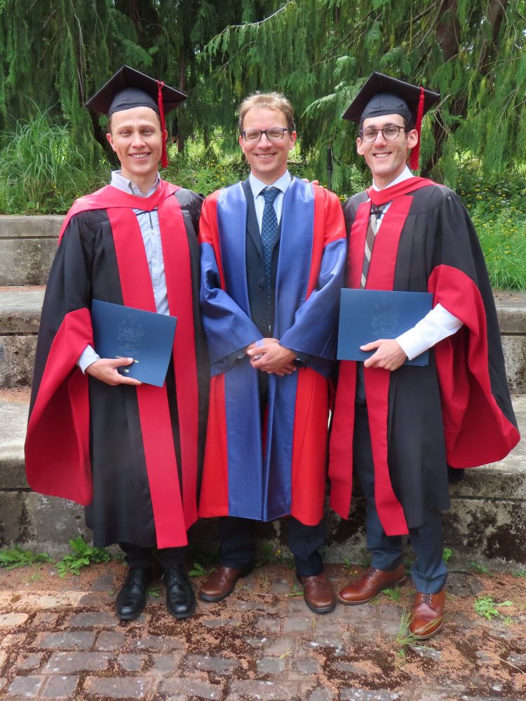
Life update: got my PhD! What a journey. I'm especially grateful to my supervisors @faultydata.bsky.social and @earthquakeguy.bsky.social for their support and mentorship along the way. Also huge congrats to @thatfaultguy.bsky.social for graduating as well!
June 12, 2025 at 4:36 PM
Life update: got my PhD! What a journey. I'm especially grateful to my supervisors @faultydata.bsky.social and @earthquakeguy.bsky.social for their support and mentorship along the way. Also huge congrats to @thatfaultguy.bsky.social for graduating as well!
Felt that one clearly at UVic, in the midst of typing the final few sentences of my thesis on mapping active faults in western Canada.
Ironically it’s the first I’ve felt around here since Nisqually 2001, when I was in grade 1. An education book-ended by earthquakes!
Ironically it’s the first I’ve felt around here since Nisqually 2001, when I was in grade 1. An education book-ended by earthquakes!
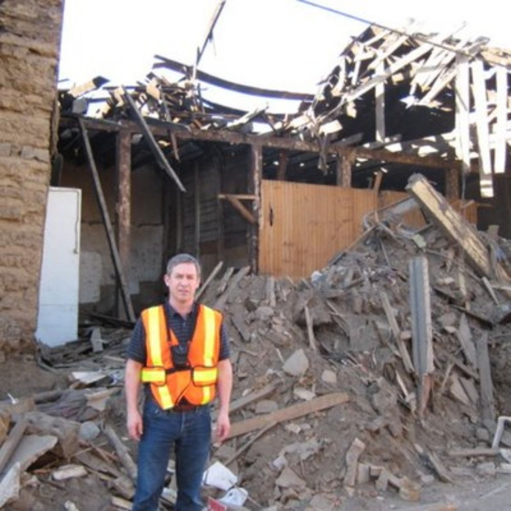
That was a shallow M5.1 earthquake, 24 km NNE of Sechelt and 60 km NW of Vancouver at 1:26 p.m. PT. Shaking was felt by 1000's across southwest British Columbia.
Details/report shaking:
www.earthquakescanada.nrcan.gc.ca/recent/2025/...
⚒️🧪
Details/report shaking:
www.earthquakescanada.nrcan.gc.ca/recent/2025/...
⚒️🧪


February 22, 2025 at 2:26 AM
Felt that one clearly at UVic, in the midst of typing the final few sentences of my thesis on mapping active faults in western Canada.
Ironically it’s the first I’ve felt around here since Nisqually 2001, when I was in grade 1. An education book-ended by earthquakes!
Ironically it’s the first I’ve felt around here since Nisqually 2001, when I was in grade 1. An education book-ended by earthquakes!
SSA abstract submission deadline has been extended until Tuesday the 14th! If you work in the Alaskan and Canadian Cordillera, please consider submitting to our session:
Attending the #SSA2025 meeting this year and working in the northern Cordillera and Alaska?
Consider submitting to our session (#33) "Neotectonics and Geohazards of the Interior Alaskan and Canadian Cordillera" !
meetings.seismosoc.org/wp-content/u...
Consider submitting to our session (#33) "Neotectonics and Geohazards of the Interior Alaskan and Canadian Cordillera" !
meetings.seismosoc.org/wp-content/u...
meetings.seismosoc.org
January 11, 2025 at 6:19 PM
SSA abstract submission deadline has been extended until Tuesday the 14th! If you work in the Alaskan and Canadian Cordillera, please consider submitting to our session:
Reposted by Theron Finley

Attending the #SSA2025 meeting this year and working in the northern Cordillera and Alaska?
Consider submitting to our session (#33) "Neotectonics and Geohazards of the Interior Alaskan and Canadian Cordillera" !
meetings.seismosoc.org/wp-content/u...
Consider submitting to our session (#33) "Neotectonics and Geohazards of the Interior Alaskan and Canadian Cordillera" !
meetings.seismosoc.org/wp-content/u...
meetings.seismosoc.org
December 30, 2024 at 7:19 PM
Attending the #SSA2025 meeting this year and working in the northern Cordillera and Alaska?
Consider submitting to our session (#33) "Neotectonics and Geohazards of the Interior Alaskan and Canadian Cordillera" !
meetings.seismosoc.org/wp-content/u...
Consider submitting to our session (#33) "Neotectonics and Geohazards of the Interior Alaskan and Canadian Cordillera" !
meetings.seismosoc.org/wp-content/u...
If you work on active faults that are challenging to study due to low strain rates and/or environmental factors such as recently glaciated landscapes or dense vegetation, please consider participating in our session at SSA 2024, April 29-May 3, in Anchorage!

November 14, 2023 at 7:32 PM
If you work on active faults that are challenging to study due to low strain rates and/or environmental factors such as recently glaciated landscapes or dense vegetation, please consider participating in our session at SSA 2024, April 29-May 3, in Anchorage!
Just getting my land legs back after a few weeks at sea deploying OBS instruments and hunting for evidence of paleoseismic events on BC's coast. I think I could get used to ship-based research!

November 4, 2023 at 2:09 AM
Just getting my land legs back after a few weeks at sea deploying OBS instruments and hunting for evidence of paleoseismic events on BC's coast. I think I could get used to ship-based research!