


OpenTopography
@opentopography.org
Open access to high-resolution, Earth science-oriented topography data, and related tools & resources. US National Science Foundation supported. #lidar https://www.opentopography.org
Pinned
OpenTopography
@opentopography.org
· Mar 13

OpenTopography: Unveiling the Earth's Surface
YouTube video by OpenTopography
youtu.be
New short (3 minute) video answers the question "What is OpenTopography?":
Check out the latest datasets now available on OpenTopography, which include over a dozen new USGS 3DEP datasets, new NOAA Coastal Lidar, and data collected over the Eaton Fire in Los Angeles, California.
opentopography.org/news/decembe...
opentopography.org/news/decembe...


January 12, 2026 at 5:43 PM
Check out the latest datasets now available on OpenTopography, which include over a dozen new USGS 3DEP datasets, new NOAA Coastal Lidar, and data collected over the Eaton Fire in Los Angeles, California.
opentopography.org/news/decembe...
opentopography.org/news/decembe...
Please join OpenTopo's Chelsea Scott & Cassandra Brigham for a WHPC@SDSC Professional Speaker Series talk.
Topographic change with OpenTopography: Adventures in cloud computing, spatial uncertainty, and impactful applications
Feb. 25, 2026 at 1–2 pm PT
Register: www.sdsc.edu/events/20260...
Topographic change with OpenTopography: Adventures in cloud computing, spatial uncertainty, and impactful applications
Feb. 25, 2026 at 1–2 pm PT
Register: www.sdsc.edu/events/20260...

January 7, 2026 at 8:06 PM
Please join OpenTopo's Chelsea Scott & Cassandra Brigham for a WHPC@SDSC Professional Speaker Series talk.
Topographic change with OpenTopography: Adventures in cloud computing, spatial uncertainty, and impactful applications
Feb. 25, 2026 at 1–2 pm PT
Register: www.sdsc.edu/events/20260...
Topographic change with OpenTopography: Adventures in cloud computing, spatial uncertainty, and impactful applications
Feb. 25, 2026 at 1–2 pm PT
Register: www.sdsc.edu/events/20260...
Reposted by OpenTopography

The NSF National Geophysical Facility will be expanding support for near-surface geophysics. Your input can help shape future efforts for research and teaching with near-surface geophysics!
Please take a few minutes to complete this survey ➡️ https://loom.ly/tVEZXlE
Please take a few minutes to complete this survey ➡️ https://loom.ly/tVEZXlE

January 7, 2026 at 7:20 PM
The NSF National Geophysical Facility will be expanding support for near-surface geophysics. Your input can help shape future efforts for research and teaching with near-surface geophysics!
Please take a few minutes to complete this survey ➡️ https://loom.ly/tVEZXlE
Please take a few minutes to complete this survey ➡️ https://loom.ly/tVEZXlE
At #AGU25? Be sure to check out these presentations by OpenTopography team members!
OT at AGU: opentopography.org/news/opentop...
OT at AGU: opentopography.org/news/opentop...


December 16, 2025 at 5:28 PM
At #AGU25? Be sure to check out these presentations by OpenTopography team members!
OT at AGU: opentopography.org/news/opentop...
OT at AGU: opentopography.org/news/opentop...
Reposted by OpenTopography

Join us at our #AGU25 poster to discover how we harnesses airborne & satellite #lidar data using advanced workflows to uncover powerful insights on forest structure, biomass, and how landscapes change over time. agu.confex.com/agu/agu25/me...
#OpenScience #WildfireRecovery #EcosystemChange #RStats
#OpenScience #WildfireRecovery #EcosystemChange #RStats

December 10, 2025 at 4:09 PM
Join us at our #AGU25 poster to discover how we harnesses airborne & satellite #lidar data using advanced workflows to uncover powerful insights on forest structure, biomass, and how landscapes change over time. agu.confex.com/agu/agu25/me...
#OpenScience #WildfireRecovery #EcosystemChange #RStats
#OpenScience #WildfireRecovery #EcosystemChange #RStats
Reposted by OpenTopography
I want to give a shout out to the good folks at @opentopography.org for making it so EASY to search for and download publicly available digital elevation models and point cloud data sets. They are a spectacular resources that I use a lot in my classes! Data citations for boxes are at listings' end.
Nearly half the boxes are sold after only an hour! Thanks everyone. Still some great ones left in the store
December 10, 2025 at 5:52 PM
I want to give a shout out to the good folks at @opentopography.org for making it so EASY to search for and download publicly available digital elevation models and point cloud data sets. They are a spectacular resources that I use a lot in my classes! Data citations for boxes are at listings' end.
November's new data releases on OpenTopography include a new Community Dataspace dataset and USGS 3DEP coverage in California, plus NOAA Coastal Lidar over Ohio.
Read more and access data: opentopography.org/news/novembe...
Read more and access data: opentopography.org/news/novembe...


December 10, 2025 at 5:02 PM
November's new data releases on OpenTopography include a new Community Dataspace dataset and USGS 3DEP coverage in California, plus NOAA Coastal Lidar over Ohio.
Read more and access data: opentopography.org/news/novembe...
Read more and access data: opentopography.org/news/novembe...
Final year for NSF-supported NCALM seed project proposals! Great opportunity for students to get free #lidar for research. Focus this year is projects in the Alaskan Arctic.
Data become open via OT. To date there are 252 NCALM datasets available on OT (red ⬇️)
Info: ncalm.cive.uh.edu/seed-proposals
Data become open via OT. To date there are 252 NCALM datasets available on OT (red ⬇️)
Info: ncalm.cive.uh.edu/seed-proposals

December 10, 2025 at 4:46 PM
Final year for NSF-supported NCALM seed project proposals! Great opportunity for students to get free #lidar for research. Focus this year is projects in the Alaskan Arctic.
Data become open via OT. To date there are 252 NCALM datasets available on OT (red ⬇️)
Info: ncalm.cive.uh.edu/seed-proposals
Data become open via OT. To date there are 252 NCALM datasets available on OT (red ⬇️)
Info: ncalm.cive.uh.edu/seed-proposals
Connect with OpenTopography at #AGU25 in New Orleans next week! Our booth (908) is staffed by the OT team and is a great chance to ask questions, provide feedback, or to discuss lidar, high resolution topography, and cyberinfrastructure.
opentopography.org/news/opentop...
opentopography.org/news/opentop...

December 9, 2025 at 3:02 PM
Connect with OpenTopography at #AGU25 in New Orleans next week! Our booth (908) is staffed by the OT team and is a great chance to ask questions, provide feedback, or to discuss lidar, high resolution topography, and cyberinfrastructure.
opentopography.org/news/opentop...
opentopography.org/news/opentop...
Reposted by OpenTopography
Discover how #lidar reveals wildfire impacts & landscape recovery. Case studies in Arizona & Los Angeles show how 3D data helps us quantify canopy loss, hazards, & restoration after major fires. #LAfires #Kaibab
Watch the new #wildfire science video: www.youtube.com/watch?v=7Joz...
Watch the new #wildfire science video: www.youtube.com/watch?v=7Joz...

Measuring Wildfire Impact: Lidar Analysis of Arizona and California Fires
YouTube video by OpenForest4D
www.youtube.com
December 4, 2025 at 3:28 PM
Discover how #lidar reveals wildfire impacts & landscape recovery. Case studies in Arizona & Los Angeles show how 3D data helps us quantify canopy loss, hazards, & restoration after major fires. #LAfires #Kaibab
Watch the new #wildfire science video: www.youtube.com/watch?v=7Joz...
Watch the new #wildfire science video: www.youtube.com/watch?v=7Joz...
Reposted by OpenTopography
Generate #forestry products from #lidar topography data with lidR! Reproducible R notebook guides users through #pointcloud filtering, raster generation & forest metrics extraction to produce key outputs like canopy height models. Explore notebook: github.com/OpenForest4D...
#googlecolab #geospatial
#googlecolab #geospatial


December 1, 2025 at 7:22 PM
Generate #forestry products from #lidar topography data with lidR! Reproducible R notebook guides users through #pointcloud filtering, raster generation & forest metrics extraction to produce key outputs like canopy height models. Explore notebook: github.com/OpenForest4D...
#googlecolab #geospatial
#googlecolab #geospatial
For the last several decades, scientists have been developing a way to make our maps more reliable with point cloud data collected by lidar. Lidar is an accurate method that helps scientists to map cities, landscapes, and places that were previously difficult or dangerous to access.
November 10, 2025 at 5:26 PM
For the last several decades, scientists have been developing a way to make our maps more reliable with point cloud data collected by lidar. Lidar is an accurate method that helps scientists to map cities, landscapes, and places that were previously difficult or dangerous to access.
New for educators! Lab Exercise: Using lidar to track Lake Michigan bluff retreat and inform local communities
Designed for community college and intro-level geomorph, enviro sci, and GIS courses, students use lidar data to learn about dynamic coastal erosion.
opentopography.org/learn/WI_blu...
Designed for community college and intro-level geomorph, enviro sci, and GIS courses, students use lidar data to learn about dynamic coastal erosion.
opentopography.org/learn/WI_blu...

November 3, 2025 at 10:22 PM
New for educators! Lab Exercise: Using lidar to track Lake Michigan bluff retreat and inform local communities
Designed for community college and intro-level geomorph, enviro sci, and GIS courses, students use lidar data to learn about dynamic coastal erosion.
opentopography.org/learn/WI_blu...
Designed for community college and intro-level geomorph, enviro sci, and GIS courses, students use lidar data to learn about dynamic coastal erosion.
opentopography.org/learn/WI_blu...
Reposted by OpenTopography
Discover how #lidar reveals the size & location of individual Ponderosa Pines at Sunset Crater, AZ! Using advanced algorithms in lidR, we map tree height and crowns in stunning detail, informing forest ecology and management.
openforest4d.org/tree-identif...
#Forestry
#RemoteSensing
#RStats
openforest4d.org/tree-identif...
#Forestry
#RemoteSensing
#RStats

October 30, 2025 at 3:41 PM
Discover how #lidar reveals the size & location of individual Ponderosa Pines at Sunset Crater, AZ! Using advanced algorithms in lidR, we map tree height and crowns in stunning detail, informing forest ecology and management.
openforest4d.org/tree-identif...
#Forestry
#RemoteSensing
#RStats
openforest4d.org/tree-identif...
#Forestry
#RemoteSensing
#RStats
The new NSF-funded Center for Land Surface Hazards (CLaSH) at U. Michigan is seeking an Assistant Director to help lead an ambitious, interdisciplinary effort to transform the science of and advance community resilience for hazards like landslides and flooding:
careers.umich.edu/job_detail/2...
careers.umich.edu/job_detail/2...
Center Assistant Director | U-M Careers
careers.umich.edu
October 27, 2025 at 7:42 PM
The new NSF-funded Center for Land Surface Hazards (CLaSH) at U. Michigan is seeking an Assistant Director to help lead an ambitious, interdisciplinary effort to transform the science of and advance community resilience for hazards like landslides and flooding:
careers.umich.edu/job_detail/2...
careers.umich.edu/job_detail/2...
Reposted by OpenTopography
Ever wondered what #lidar point clouds reveal about forests? OpenForest4D’s new guide breaks down how elevation, return number, intensity, and classification describe forest structure.
openforest4d.org/lidar-point-...
#pointcloud #laserscanning #forestry #geospatial
openforest4d.org/lidar-point-...
#pointcloud #laserscanning #forestry #geospatial

October 27, 2025 at 4:33 PM
Ever wondered what #lidar point clouds reveal about forests? OpenForest4D’s new guide breaks down how elevation, return number, intensity, and classification describe forest structure.
openforest4d.org/lidar-point-...
#pointcloud #laserscanning #forestry #geospatial
openforest4d.org/lidar-point-...
#pointcloud #laserscanning #forestry #geospatial
Reposted by OpenTopography
Fan in the Fall River valley produced by the 1982 Lawn Lake Flood, caused by failure of an old dam in Rocky Mtn. NP. I was scanning photos of the bouldery fan taken by Jim Knox, and decided to try a 3D view with lidar data and #rayshader. 0.5 m DEM from USGS point cloud via @opentopography.org

October 19, 2025 at 2:00 AM
Fan in the Fall River valley produced by the 1982 Lawn Lake Flood, caused by failure of an old dam in Rocky Mtn. NP. I was scanning photos of the bouldery fan taken by Jim Knox, and decided to try a 3D view with lidar data and #rayshader. 0.5 m DEM from USGS point cloud via @opentopography.org
OT will be at GSA Connects 2025 in San Antonio, TX, Oct 19–22. Visit us at booth 809 to talk lidar, topography, and grab an "I ❤️ LIDAR" sticker. OT is honored to receive the 2025 GSA President’s Medal. Join us for the President’s Medal Lecture on Mon Oct. 20.
opentopography.org/news/opentop...
opentopography.org/news/opentop...

October 15, 2025 at 3:32 PM
OT will be at GSA Connects 2025 in San Antonio, TX, Oct 19–22. Visit us at booth 809 to talk lidar, topography, and grab an "I ❤️ LIDAR" sticker. OT is honored to receive the 2025 GSA President’s Medal. Join us for the President’s Medal Lecture on Mon Oct. 20.
opentopography.org/news/opentop...
opentopography.org/news/opentop...
OpenTopography services may be intermittently unavailable from 11 AM to 12 PM PDT on Tuesday, October 14, 2025 during system updates. Thank you for your patience.
October 10, 2025 at 5:19 PM
OpenTopography services may be intermittently unavailable from 11 AM to 12 PM PDT on Tuesday, October 14, 2025 during system updates. Thank you for your patience.
New September 2025 data releases on OpenTopography include Land Information New Zealand (LINZ) lidar over the North Island of New Zealand, SfM topography over the 2019 Ridgecrest rupture, NOAA coastal lidar additions, and additional USGS 3DEP data.
opentopography.org/news/septemb...
opentopography.org/news/septemb...


October 2, 2025 at 5:44 PM
New September 2025 data releases on OpenTopography include Land Information New Zealand (LINZ) lidar over the North Island of New Zealand, SfM topography over the 2019 Ridgecrest rupture, NOAA coastal lidar additions, and additional USGS 3DEP data.
opentopography.org/news/septemb...
opentopography.org/news/septemb...
Reposted by OpenTopography
🌲 Join us at ForestSAT 2026! 🌍
📅 May 4–8, 2026 | Hybrid – Attend in-person or online
📧 Questions? Reach out at [email protected]
Discover the benefits of attending: carlos-alberto-silva.github.io/silvalab/For...
📅 May 4–8, 2026 | Hybrid – Attend in-person or online
📧 Questions? Reach out at [email protected]
Discover the benefits of attending: carlos-alberto-silva.github.io/silvalab/For...


September 29, 2025 at 7:30 PM
🌲 Join us at ForestSAT 2026! 🌍
📅 May 4–8, 2026 | Hybrid – Attend in-person or online
📧 Questions? Reach out at [email protected]
Discover the benefits of attending: carlos-alberto-silva.github.io/silvalab/For...
📅 May 4–8, 2026 | Hybrid – Attend in-person or online
📧 Questions? Reach out at [email protected]
Discover the benefits of attending: carlos-alberto-silva.github.io/silvalab/For...
Coastlines in Crisis
Coastal areas like the Outer Banks of North Carolina are shrinking. What can we learn and see from lidar data?
Coastal areas like the Outer Banks of North Carolina are shrinking. What can we learn and see from lidar data?
October 1, 2025 at 5:19 PM
Coastlines in Crisis
Coastal areas like the Outer Banks of North Carolina are shrinking. What can we learn and see from lidar data?
Coastal areas like the Outer Banks of North Carolina are shrinking. What can we learn and see from lidar data?
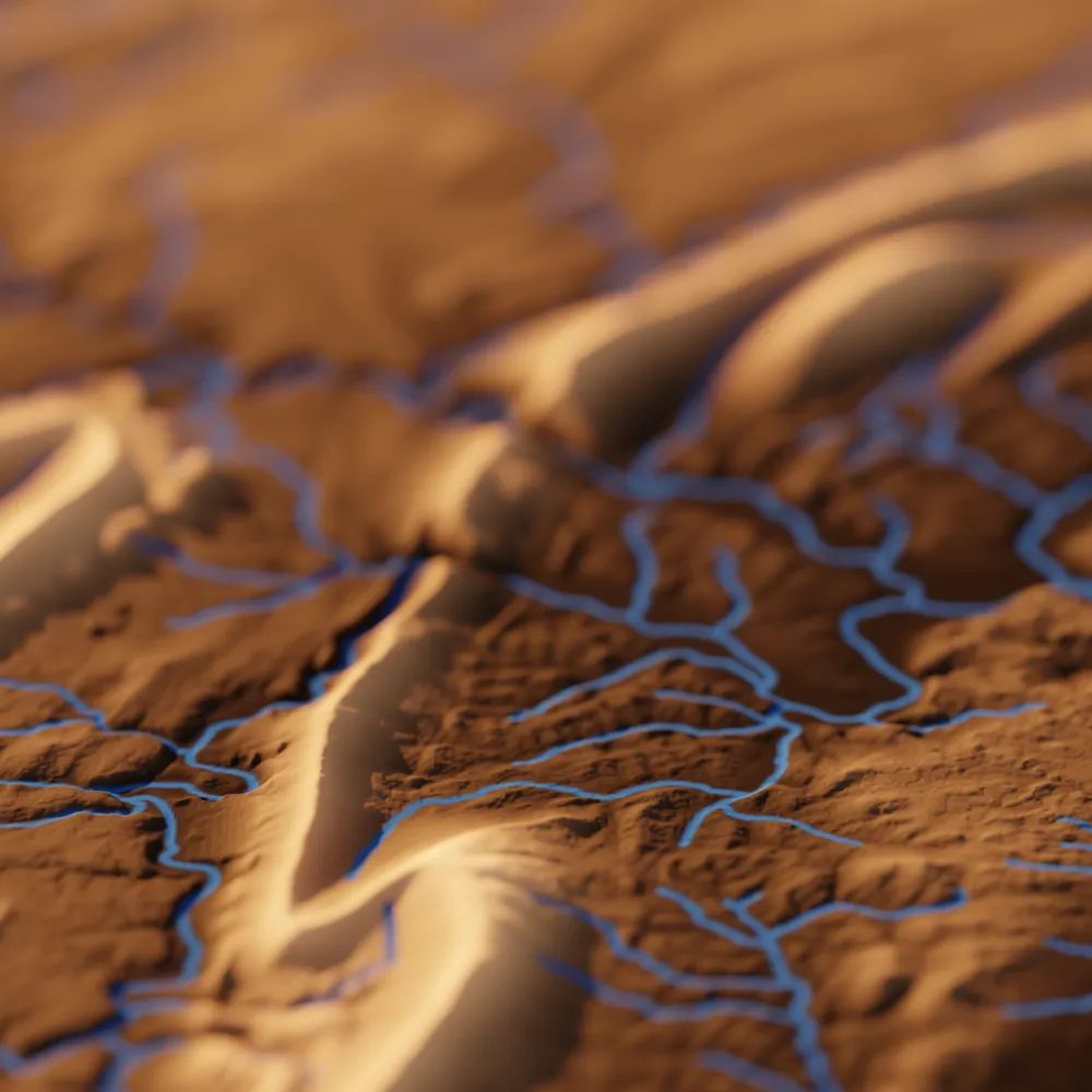
Check out TopoRivBlender, a new tool to create custom 3D images of topography and hydrography. Uses Blender and the OpenTopography API to produce 3D visualizations for data around the world.
More info:
waterdata.usgs.gov/blog/topo-ri...
github.com/DOI-USGS/top...
More info:
waterdata.usgs.gov/blog/topo-ri...
github.com/DOI-USGS/top...


September 29, 2025 at 5:54 PM
Check out TopoRivBlender, a new tool to create custom 3D images of topography and hydrography. Uses Blender and the OpenTopography API to produce 3D visualizations for data around the world.
More info:
waterdata.usgs.gov/blog/topo-ri...
github.com/DOI-USGS/top...
More info:
waterdata.usgs.gov/blog/topo-ri...
github.com/DOI-USGS/top...
Learn more about the 1m resolution Canadian HRDEM and access via OpenTopography here: opentopography.org/news/opentop...
September 26, 2025 at 2:46 PM
Learn more about the 1m resolution Canadian HRDEM and access via OpenTopography here: opentopography.org/news/opentop...
Missed last week's AGU EPSP Connects Virtual Science Talk by OpenTopography's Chelsea Scott and Cassandra Brigham? Check out the recording!
⬇️
www.youtube.com/live/WJHPdyv...
Topographic change with OpenTopography: Adventures in cloud computing, spatial uncertainty, and impactful applications
⬇️
www.youtube.com/live/WJHPdyv...
Topographic change with OpenTopography: Adventures in cloud computing, spatial uncertainty, and impactful applications

AGU EPSP Connects - September 2025
Topographic change with OpenTopography: Adventures in cloud computing, spatial uncertainty, and impactful applications
www.youtube.com
September 23, 2025 at 6:43 PM
Missed last week's AGU EPSP Connects Virtual Science Talk by OpenTopography's Chelsea Scott and Cassandra Brigham? Check out the recording!
⬇️
www.youtube.com/live/WJHPdyv...
Topographic change with OpenTopography: Adventures in cloud computing, spatial uncertainty, and impactful applications
⬇️
www.youtube.com/live/WJHPdyv...
Topographic change with OpenTopography: Adventures in cloud computing, spatial uncertainty, and impactful applications