Adam Voiland
@avoiland.bsky.social
150 followers 60 following 79 posts
Earth science writer interested in the mantle, stratosphere, and most things in between.
Posts Media Videos Starter Packs
avoiland.bsky.social
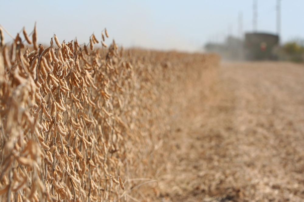
China normally buys billions of dollars’ worth of U.S. soybeans, but not this year. Here’s where farmers are feeling the pinch. Map based on the Cropland Data Layer. earthobservatory.nasa.gov/images/15441...
avoiland.bsky.social
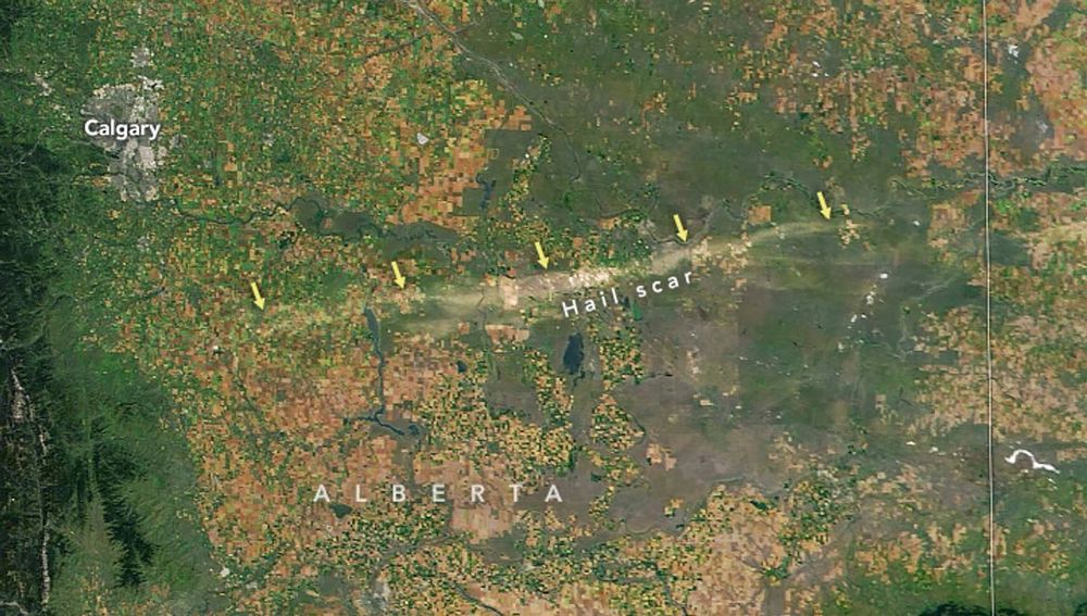
September puzzler below. Your challenge is to use the comments section to tell us where it is, what we are looking at, and why this area is interesting. Answer will be posted next week. earthobservatory.nasa.gov/blogs/earthm...
avoiland.bsky.social
Very true! I should have worded that post differently. Thanks for flagging that.
avoiland.bsky.social
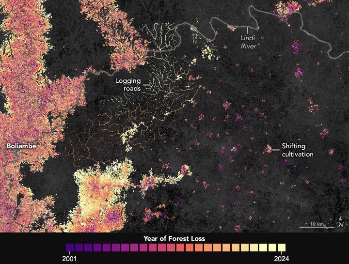
Satellite data show decades of gradual but persistent change in forests around Kisangani, one of the Democratic Republic of the Congo’s largest cities. earthobservatory.nasa.gov/images/15481... 🛰️
avoiland.bsky.social
It’s been a quiet year in the Northwest Pacific for typhoons but #Ragasa seems determined to change that. earthobservatory.nasa.gov/images/15482...
avoiland.bsky.social
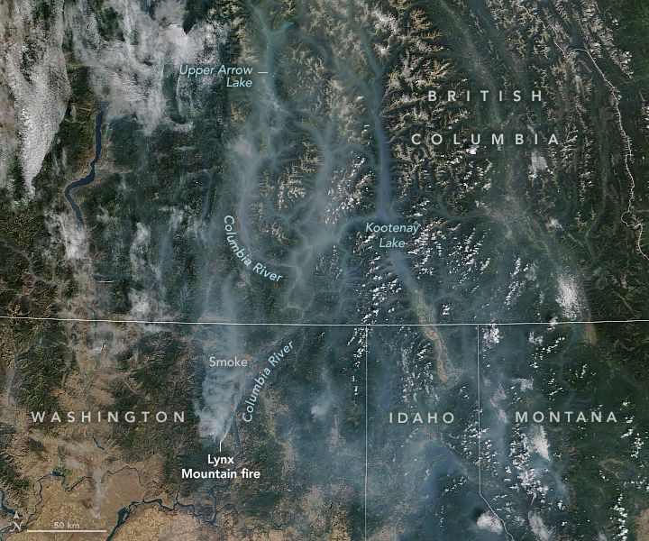
Wildfires affect not just the air we breathe, but the water we drink. earthobservatory.nasa.gov/images/15479...
avoiland.bsky.social
Geologists have an amazing new superpower. With InSAR satellites, it’s possible to measure how much earthquakes move the land surface and even spot the earliest stirrings of volcanic eruptions from space. 🌍📡🌋 earthobservatory.nasa.gov/images/15477...
Reposted by Adam Voiland
ptfretwell.bsky.social
Each year as the sun starts to reappear over Antarctica I start the process of going through Sentinel2 imagery to find the locations of the 66 known emperor penguin colonies. Here is this year's first image, of Snow Hill, the most northerly colony. Can you spot the penguins?
avoiland.bsky.social
New York City’s Manhattan Island was the site of the nation’s first Labor Day parade on September 5, 1882. earthobservatory.nasa.gov/images/15473...
avoiland.bsky.social
An asteroid that struck the rainforest in Africa around 1 million years ago created Ghana’s only natural lake. Now artisanal gold mining and urbanization are eating away at the forest around Lake Bosumtwi. Landsat images 2015 (left) and 2024 (right). ⬇️ earthobservatory.nasa.gov/images/15473...
avoiland.bsky.social
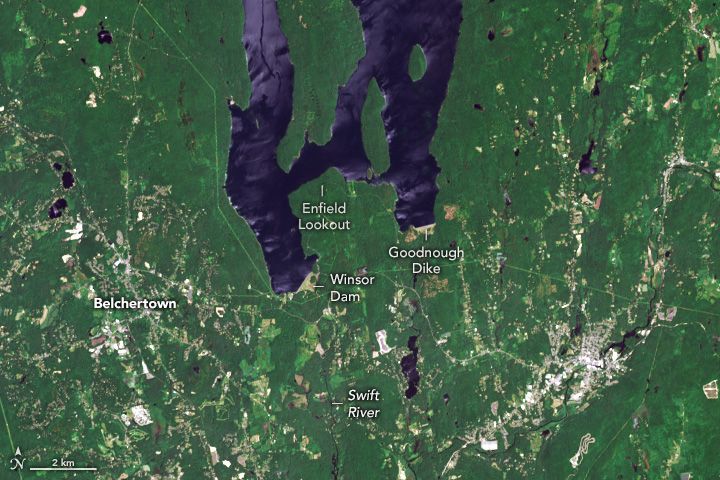
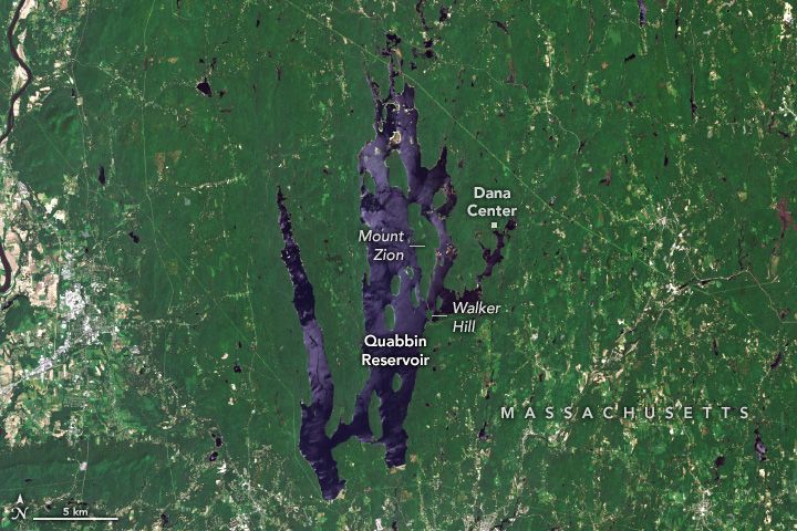
Forests play a key role in filtering the waters of the Quabbin Reservoir in central Massachusetts. The reservoir provides water to Boston and is home to submerged towns and nesting bald eagles but NOT endangered timber rattlesnakes. earthobservatory.nasa.gov/images/15460... #Quabbin 🐍
avoiland.bsky.social
It’s fine to dredge up old content but why not acknowledge it? Here is the original source visibleearth.nasa.gov/images/15201... www.naturalhazards.nasa.gov/images/15201...
avoiland.bsky.social
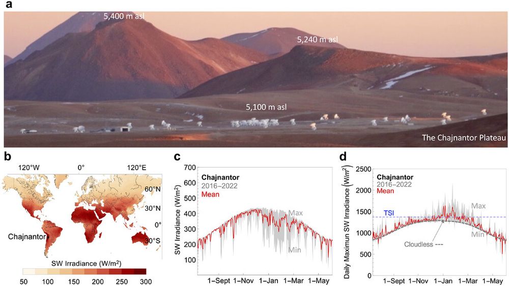
More on the extreme surface irradiance in this area here. journals.ametsoc.org/view/journal...
avoiland.bsky.social
The plateau is home to several observatories, including the Atacama Large Millimeter Array (ALMA). Look closely for signs of the array (roads) in this Landsat image. The photo is a screenshot from the live view www.almaobservatory.org/en/live-from... eoimages.gsfc.nasa.gov/images/image...
avoiland.bsky.social
When snow falls on the Chajnantor Plateau in the Atacama Desert, it doesn’t typically last for long. The plateau faces some of the most intense surface irradiance on the planet. earthobservatory.nasa.gov/images/15456... #chile
avoiland.bsky.social
On June 30, 1908, an incoming fireball exploded kilometers above Earth’s surface, scorching and toppling large numbers of trees. earthobservatory.nasa.gov/images/15448... #tunguska
Reposted by Adam Voiland
rsimmon.bsky.social
Drop-dead gorgeous figures showing Hadley circulation patterns & cloud trends by Michala Garrison, NASA Earth Observatory.

earthobservatory.nasa.gov/images/15444...

#dataviz 📊🗺️
Diagram of the Hadley circulation with a Western Hemisphere view of cloud cover in 2015. Hadley cells are large-scale circulation patterns that start with rising air on either side of the Equator, falling air at about 30˚ north and south, and then mid-latitude and polar cells from about 30˚-60˚ and 60˚–90˚, respectively. Plot cloud cover from 90˚ south to 90˚ north on the vertical axis and from 1984 to 2018 on the horizontal axis. Cloud cover is shown in shades of blue to light gray. Over time the clouds bands have narrowed and moved towards the poles.
avoiland.bsky.social
“The people of Texas are informed that, in accordance with a proclamation from the Executive of the United States, all slaves are free,” the order stated.
avoiland.bsky.social
On June 19, 1865, Major General Gordon Granger issued General Order No. 3. Union troops marched through Galveston and read the order aloud at several locations, including Union Army headquarters at the Osterman building. www.naturalhazards.nasa.gov/images/14845... #Juneteenth
Reposted by Adam Voiland
aedwardslevy.bsky.social
This is not actually a subtweet of anything specific right now, but I do want to make a plea to everyone to a) attribute and link to the source of any information you're sharing b) only share posts that do so.

This isn't (just) about credit, it's about creating a chain of custody for information.