Bill Greer
@billfgreer.bsky.social
790 followers
380 following
37 posts
Building a dedicated satellite for humanitarian aid and disaster planning, mitigation, response, and recovery. Open data, GIS, Remote Sensing, and creating the best possible future.
Posts
Media
Videos
Starter Packs


Reposted by Bill Greer

Common Space
@commonspace.bsky.social
· Aug 15

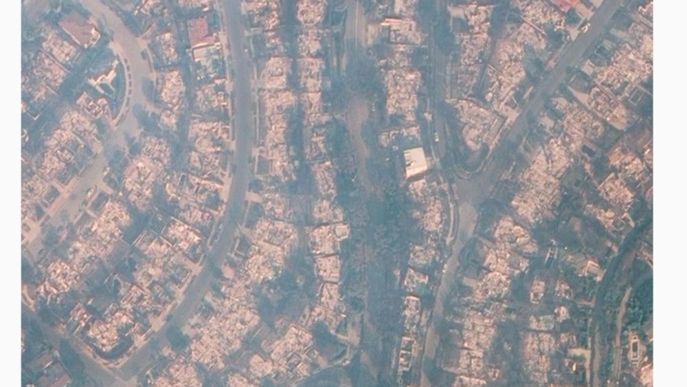
A Moral Case for a Humanitarian Satellite:
At what point does inaction become unconscionable?
What does it say about our world when we spend over $54 billion a year on defense and intelligence satellites to spy on each other - yet cannot dedicate even one satellite to saving lives? We take pic...
www.linkedin.com

Bill Greer
@billfgreer.bsky.social
· Aug 15

A Moral Case for a Humanitarian Satellite:
At what point does inaction become unconscionable?
What does it say about our world when we spend over $54 billion a year on defense and intelligence satellites to spy on each other - yet cannot dedicate even one satellite to saving lives? We take pic...
www.linkedin.com
Bill Greer
@billfgreer.bsky.social
· May 19

A satellite for the people // demand assessment
Welcome! We're with Common Space, a nonprofit dedicated to catalyzing an independent, people-focused satellite mission. Read more about our thinking here > www.commonspace.world
Thanks for taking the ...
docs.google.com


Reposted by Bill Greer

Bill McKay
@mckay4senate.bsky.social
· Mar 15


Bill Greer
@billfgreer.bsky.social
· Mar 16
Reposted by Bill Greer

Bill Greer
@billfgreer.bsky.social
· Mar 11

Bill Greer
@billfgreer.bsky.social
· Mar 10
Bill Greer
@billfgreer.bsky.social
· Mar 7
Bill Greer
@billfgreer.bsky.social
· Mar 7
Bill Greer
@billfgreer.bsky.social
· Mar 7
Bill Greer
@billfgreer.bsky.social
· Mar 7
Bill Greer
@billfgreer.bsky.social
· Mar 7

Maxar Technologies reportedly restricts Ukraine's access to satellite imagery
Kyiv has relied on high-resolution satellite images for defense and strategic planning, tracking Russian troop movements, assessing battlefield conditions, and monitoring Russian infrastructure damage...
kyivindependent.com

Bill Greer
@billfgreer.bsky.social
· Feb 27
Bill Greer
@billfgreer.bsky.social
· Feb 24
Bill Greer
@billfgreer.bsky.social
· Feb 16