
Dr. Brianna R. Pagán
@briannaritapagan.bsky.social
1.5K followers
340 following
33 posts
Tech Lead @developmentseed
Formerly @NASA
Lecturer @ Loyola Marymount University
Founding Editorial Board Member @ Cloud-Native Geospatial
Steering Council Member @ Pangeo
open source enthusiast, ultra runner
Posts
Media
Videos
Starter Packs
Reposted by Dr. Brianna R. Pagán


Reposted by Dr. Brianna R. Pagán

aimeeb
@yayyyimee.bsky.social
· Apr 4
Reposted by Dr. Brianna R. Pagán


Reposted by Dr. Brianna R. Pagán


Reposted by Dr. Brianna R. Pagán


Reposted by Dr. Brianna R. Pagán

Kurt Schwehr
@kurtschwehr.bsky.social
· Jan 29
Reposted by Dr. Brianna R. Pagán
Reposted by Dr. Brianna R. Pagán

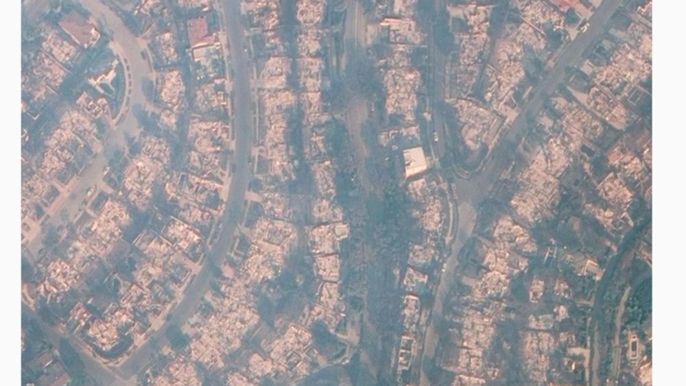
Daniel Swain
@weatherwest.bsky.social
· Jan 17


Reposted by Dr. Brianna R. Pagán