Kiri Carini
@kiricarini.com
2.9K followers 630 following 350 posts
Geospatial Communicator. Data + Stories for @developmentseed.org @osmus.bsky.social Board Member Hiking shenanigans. Desert dweller.
Posts Media Videos Starter Packs
Pinned
kiricarini.com
I didn't see this already, so I went through my follow list and made a Starter Pack for Women+ in geo & EO - very broadly.

I'm reminded how lopsided the gender divide is still in our field when I get 1 woman follower for every 10 men. It's particularly noticeable right now.

go.bsky.app/Ay1iTTe
Reposted by Kiri Carini
developmentseed.org
DevSeed intern Beatriz Peres used ESA’s new Sentinel-1 Zarr to analyze the 2024 Valencia floods with lightweight, time-series workflows.

Her blog shows how Zarr + xarray make flood monitoring faster & more flexible: developmentseed.org/blog/2025-09...

#BiDS25 @thrivegeo.bsky.social
kiricarini.com
Did anyone catch the livestream?? 👀
developmentseed.org
@worldresources.bsky.social call to move past the hype and use AI responsibly for public good resonates with how we've approached AI in our work. This is the conversation to pay attention to — don’t miss the livestream this week.

Sign up: landcarbonlab.org/events/ai-me...
Reposted by Kiri Carini
developmentseed.org
@worldresources.bsky.social call to move past the hype and use AI responsibly for public good resonates with how we've approached AI in our work. This is the conversation to pay attention to — don’t miss the livestream this week.

Sign up: landcarbonlab.org/events/ai-me...
Reposted by Kiri Carini
osmus.bsky.social
Register for #MappyHour with special guest Jason Boone, who will guide you through his process of creating map animations using #OpenStreetMap data with Adobe After Effects and Geolayers, plus time for Q&A.

Join us at noon ET on Wednesday, September 17th. Register: bit.ly/MappyHour-ma...
Reposted by Kiri Carini
developmentseed.org
We built stac-map, a lightweight, map-first prototype for exploring STAC GeoParquet in your browser. Built w/ DuckDB, geoarrow, & semantic STAC search, explore STAC GeoParquet files directly in the browser.

Try it: developmentseed.org/stac-map/

Blog: ds.io/stac-map

@gadom.ski @indraneel.org
kiricarini.com
Cool “before the rain” skies in Southern Arizona last night.
kiricarini.com
Glad you like it! I hope it catches the eyes of some of the geo-nerds that visit you.
kiricarini.com
The Mexican free-tailed bats are still cleaning out my feeders every night.
kiricarini.com
It’s a two for one video!
kiricarini.com
I really don’t feel like posting anything except hummingbirds. Sorrynotsorry.
kiricarini.com
Today is one of those days to put the whole "If you don't have anything nice to say, don't say anything" into practice. 🤐
kiricarini.com
Beautifully done!
Reposted by Kiri Carini
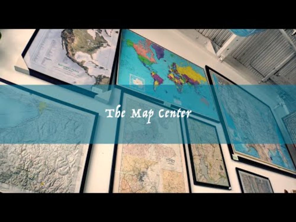
mapcenter.com
One of my customers had so much fun visiting the Map Center that he came back a few days later with a camera. He made this magnificent short documentary about my store, about me, and why I bother to do any of it at all.

It's really lovely and I hope you watch it!
youtu.be/Dj9uKpk3Idk?...
The Map Center
YouTube video by You Are Here
youtu.be
kiricarini.com
That's not a hummingbird...
kiricarini.com
It’s Friday and I’m in car line at my kids school. It’s only 98 degrees today.

I’ll share this from the DevSeed account next week but @zacdezgeo.github.io & I just wrapped the blog on building QGIS plugins and what we learned from updating the GEE-QGIS plugin.

developmentseed.org/blog/2025-08...
Better QGIS Plugins — Development Seed
Build better QGIS plugins with custom dialogs and the Processing framework.
developmentseed.org
kiricarini.com
I love when we have a project that is soooo cool that we have to give it a codename while it's under development. 🕵️
kiricarini.com
Played a game with my 8 year old last night. He loves this little comic from @theoatmeal.bsky.social.
Adding it to my zine inspiration collection.
Maybe we need data stories told from the perspective of the creatures we’re helping @gusbusdraws.bsky.social
kiricarini.com
I saw your name on a few of the blog posts! What a time!
kiricarini.com
Hard to read the small print, but that's 2012, btw. Who remembers this era of geospatial??
kiricarini.com
Every so often, I find myself in the archives of the @developmentseed.org blog. I love getting insight into what life was like before my time at DevSeed. Here's a good one. Remember that cool new tool called MapBox (lol). It got to be such a big deal that we gave it its own blog & Twitter account.
kiricarini.com
The amazing creative talent who brought my zine idea to life.

Give Gus a follow!
gusbecker.bsky.social
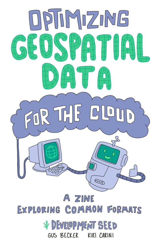
Zines are a great tool for science communication. Earlier this year, I put one together with @kiricarini.com of @developmentseed.org.

The zine provides a visually interesting jumping off point for folks learning cloud-native geospatial data!
"Optimizing Geospatial Data for the Cloud"
"A zine exploring common formats"
"Development Seed"
"Gus Becker Kiri Carini"
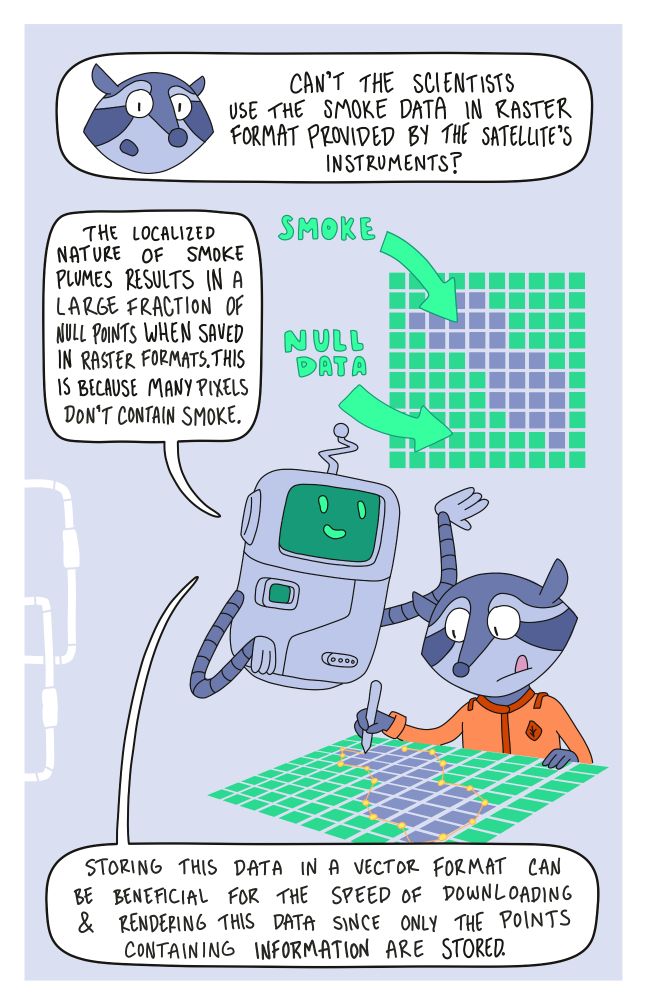
A floating robot  with one hand on a keyboard to a computer that has a glove on the screen. The other hand is giving a thumbs up. A raccoon character asking about smoke data, and a floating robot describes how vector format may be more efficient than raster in some cases.
kiricarini.com
Nope. 👎🏻
Reposted by Kiri Carini
openaq.org
OpenAQ @openaq.org · Aug 5
Project Phoenix is a community science monitoring project to study the effects of smoke on birds in neighborhoods across California, Oregon, and Washington. Live on the U.S. West Coast? You can join the effort. www.project-phoenix-investigating-bird-responses-to-smoke.org
Project Phoenix
www.project-phoenix-investigating-bird-responses-to-smoke.org