


Enrique Fuster
@enriquefuster.bsky.social
Crafting visuals with stop motion, 3D, art and data science.
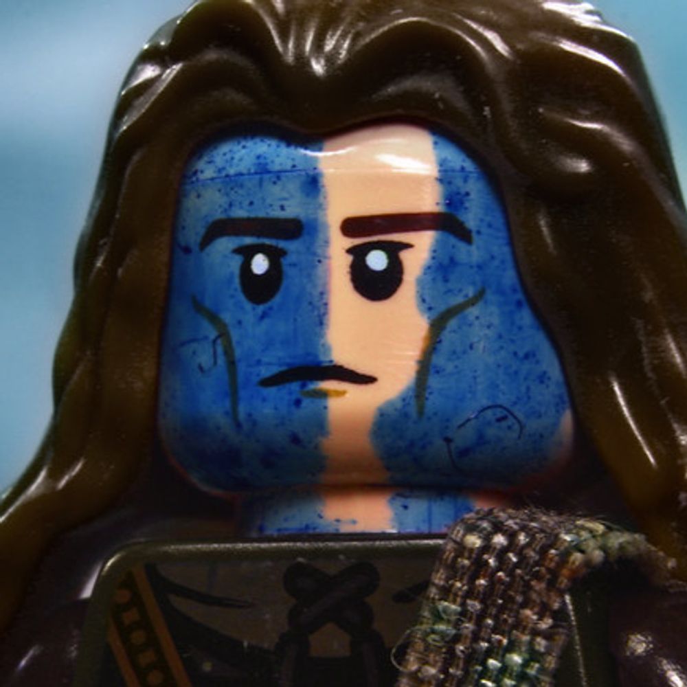
The goal: recreate real landscapes in LEGO for a few wide shots in my upcoming brickfilm.
Instancing bricks is too heavy at scale, so I use simple textured geometry for terrain—building on techniques from my last animation, still experimenting with Geometry Nodes.
#b3d #blender
Instancing bricks is too heavy at scale, so I use simple textured geometry for terrain—building on techniques from my last animation, still experimenting with Geometry Nodes.
#b3d #blender
November 8, 2025 at 12:25 PM
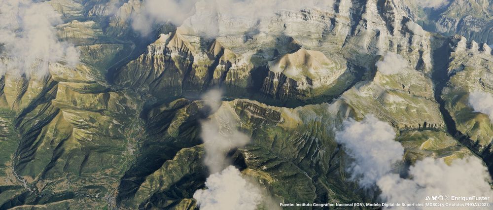
More renders from different locations. Tested national remote sensing data have a resolution of 0.5–2 m per pixel, enough for intermediate-scale visualizations (an alternative to Google Map Tiles).
#b3d #30DayMapChallenge Day 8 – Urban
#b3d #30DayMapChallenge Day 8 – Urban


November 8, 2025 at 12:24 PM
More renders from different locations. Tested national remote sensing data have a resolution of 0.5–2 m per pixel, enough for intermediate-scale visualizations (an alternative to Google Map Tiles).
#b3d #30DayMapChallenge Day 8 – Urban
#b3d #30DayMapChallenge Day 8 – Urban
During preproduction of my next animation, I explored integrating real environments with open satellite & DSM data.
Massive files led me to create a Python workflow, splitting the data into chunks to load into Blender: github.com/EnriqueFuste...
#b3d #30DayMapChallenge Day 8 – Urban
Massive files led me to create a Python workflow, splitting the data into chunks to load into Blender: github.com/EnriqueFuste...
#b3d #30DayMapChallenge Day 8 – Urban


November 8, 2025 at 12:22 PM
During preproduction of my next animation, I explored integrating real environments with open satellite & DSM data.
Massive files led me to create a Python workflow, splitting the data into chunks to load into Blender: github.com/EnriqueFuste...
#b3d #30DayMapChallenge Day 8 – Urban
Massive files led me to create a Python workflow, splitting the data into chunks to load into Blender: github.com/EnriqueFuste...
#b3d #30DayMapChallenge Day 8 – Urban
A few years ago I ran a small print-on-demand map shop.
Made a few sales and hundreds of maps—first by hand (Photoshop), then with #Mapbox + #Python (OpenCV & Pillow).
Focused more on craft than marketing, but learned a lot.
Yesterday felt like redemption: #30DayMapChallenge Day 3 – Polygons.
Made a few sales and hundreds of maps—first by hand (Photoshop), then with #Mapbox + #Python (OpenCV & Pillow).
Focused more on craft than marketing, but learned a lot.
Yesterday felt like redemption: #30DayMapChallenge Day 3 – Polygons.
November 4, 2025 at 10:08 PM
A few years ago I ran a small print-on-demand map shop.
Made a few sales and hundreds of maps—first by hand (Photoshop), then with #Mapbox + #Python (OpenCV & Pillow).
Focused more on craft than marketing, but learned a lot.
Yesterday felt like redemption: #30DayMapChallenge Day 3 – Polygons.
Made a few sales and hundreds of maps—first by hand (Photoshop), then with #Mapbox + #Python (OpenCV & Pillow).
Focused more on craft than marketing, but learned a lot.
Yesterday felt like redemption: #30DayMapChallenge Day 3 – Polygons.