Harold Tobin
@haroldtobin.bsky.social
3.7K followers
250 following
160 posts
UW prof and director of the Pacific Northwest Seismic Network. WA State Seismologist. All about subduction zones and very messed up rocks.
Posts
Media
Videos
Starter Packs


Harold Tobin
@haroldtobin.bsky.social
· Aug 3
Harold Tobin
@haroldtobin.bsky.social
· Aug 3
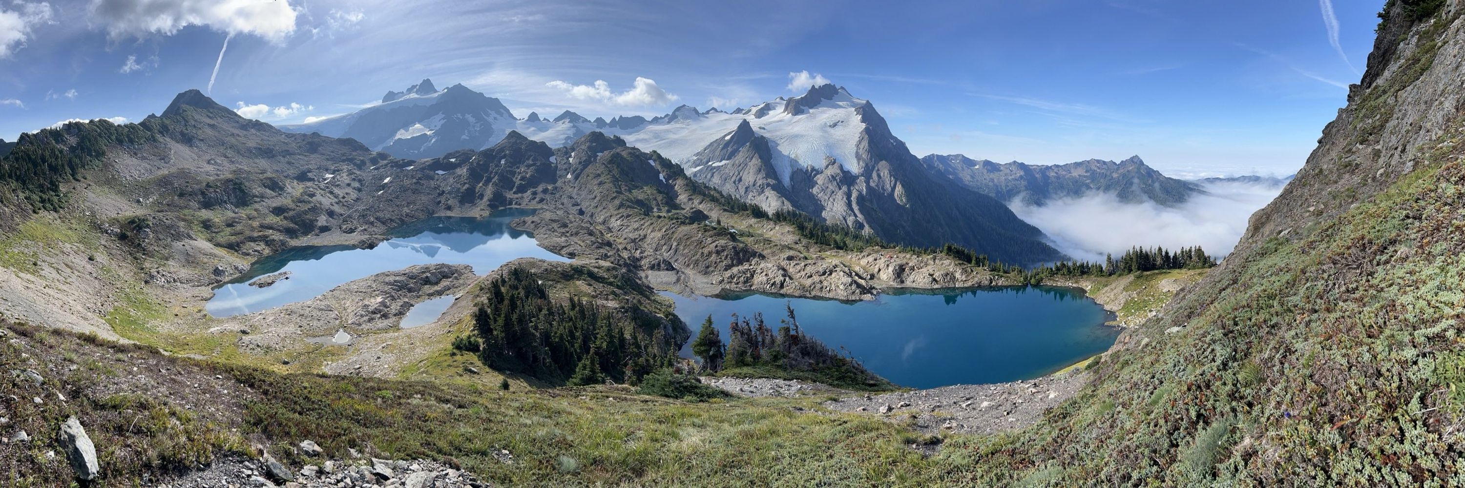
Harold Tobin
@haroldtobin.bsky.social
· Aug 2
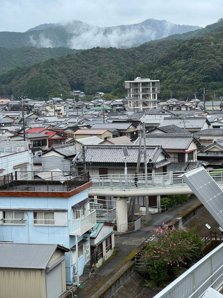
Harold Tobin
@haroldtobin.bsky.social
· Aug 1
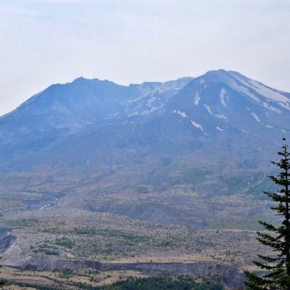
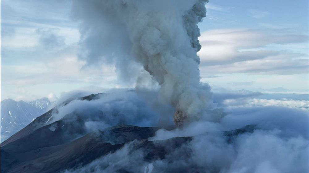
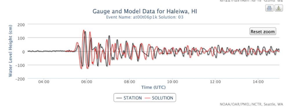
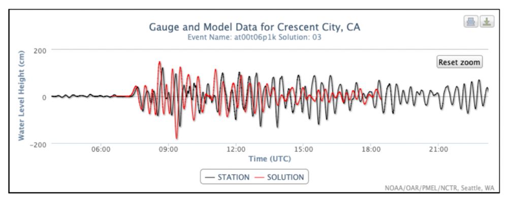
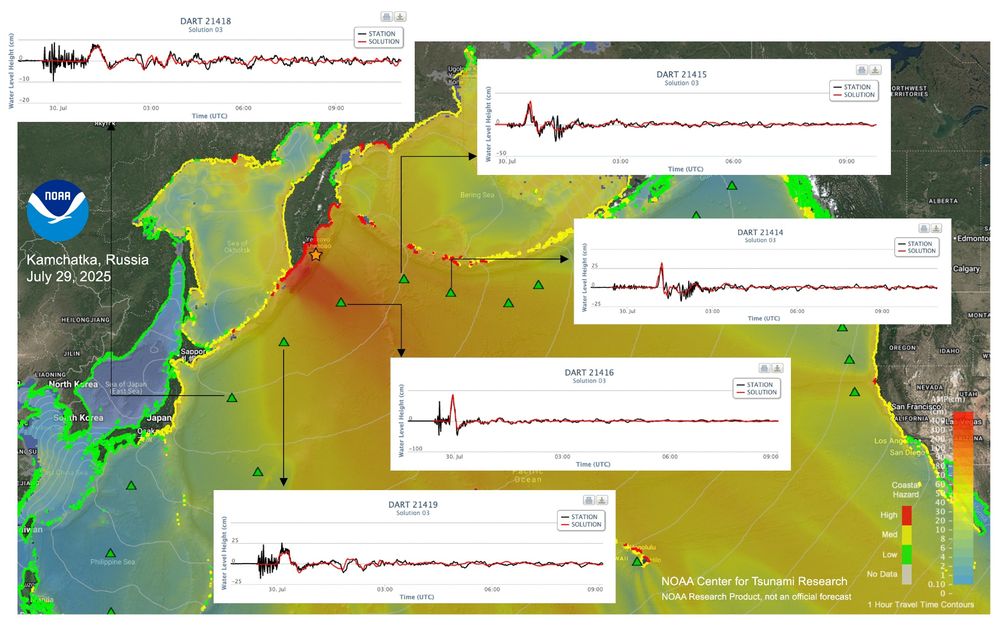
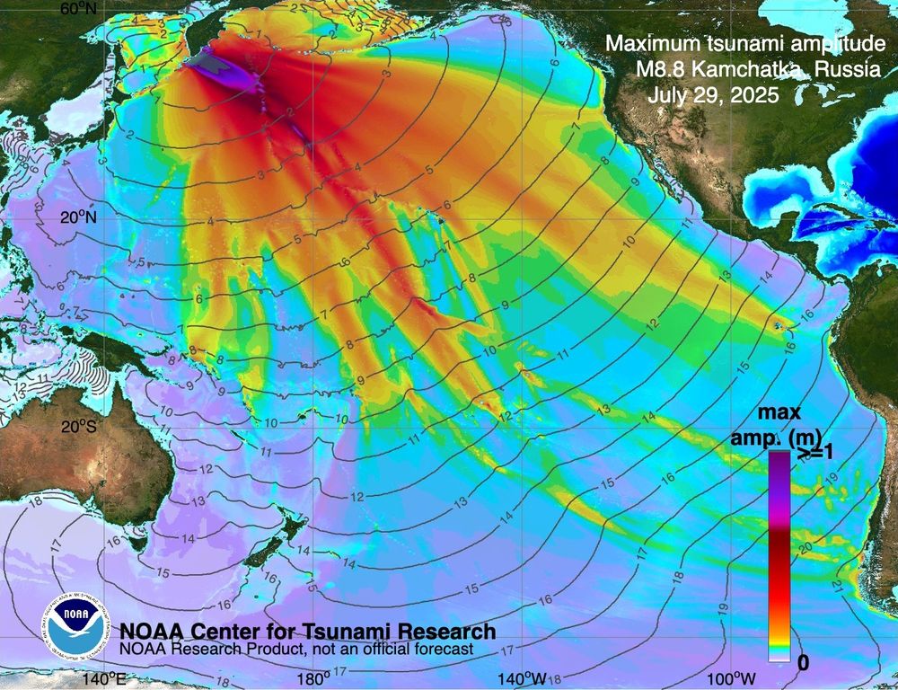
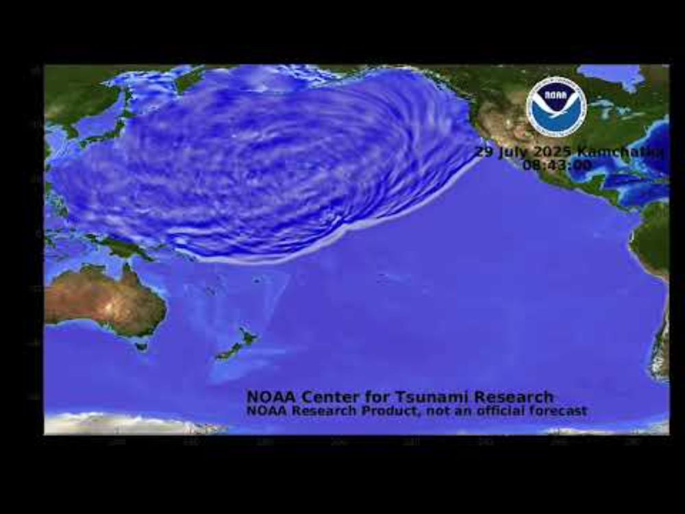
Why a recent earthquake didn't wreak havoc, despite its power
After an 8.8 magnitude earthquake off Russia's coast triggered tsunami alerts as far as the U.S., experts like seismologist Harold Tobin explain why the impact was far less devastating than expected.
www.cbsnews.com
Harold Tobin
@haroldtobin.bsky.social
· Aug 1
Harold Tobin
@haroldtobin.bsky.social
· Jul 31
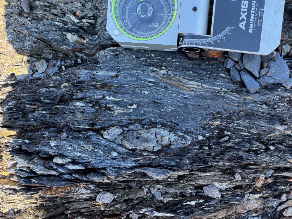
Harold Tobin
@haroldtobin.bsky.social
· Jul 31
Harold Tobin
@haroldtobin.bsky.social
· Jul 31