Mica Jorgenson
@micaamy.bsky.social
580 followers 610 following 160 posts
🔥 professional fire nerd🔥| Dr. of #envhist | recovering academic | 53.9171° N | loves maps | fun stuff advocate | personal account
Posts Media Videos Starter Packs
micaamy.bsky.social
Delighted that this work continues to find new audiences, and (although purely coincidental) feels very appropriate coming out on the last day of my last fire season deployment. Thank you for hosting me, and for the work of your wonderful editorial team @envhistnow.bsky.social !
micaamy.bsky.social
Sentinel 2 images from the confluence of the Mackenzie and the Liard. Left: Some serious fire behaviour from sept 9. Right: Autumn colours on the boreal from Sept 10 -- and an orange retardant line from a small lake (centre of the image).
micaamy.bsky.social
I can't take my eyes off these fires in the west of the Cariboo region. Its the summer that won't end out there, despite COLD overnight temperatures and shortening days. Look at this one chugging through a cutblock -- open flame visible from satellite (sept 7).
micaamy.bsky.social
I haven't had much cause to bust out my corsi-rosenthal box yet this summer, but today its making short work of the 160 AQI outside (currently 15 in my office).
micaamy.bsky.social
definitely not, since its in northern BC, Canada.
micaamy.bsky.social
The thing that always blows my mind with the satellite imagery is that we can't even see the head of the fire, since its usually concealed by smoke. Copernicus' false colour (urban) shows that, as impressive as the previous image may be, the head of the fire is burning even hotter and faster.
micaamy.bsky.social
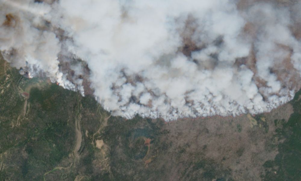
Sentinel 2 captured some truly unhinged fire behaviour yesterday. When you can see an organized flame front from space, its safe to say that our fire behaviour is "aggressive."
micaamy.bsky.social
Also from August 30 -- Sentinel captured the plume coming up from SS104 burning near Fort Provenance, NWT, as it punched up into the atmosphere.
micaamy.bsky.social
Watching smoke from space is one thing -- watching fire is another. This is a capture from Aug 30, and is of the fire burning north of Tsacha Lake in BC. Flames are visible from Sentinel's passover -- you can see them burning in the patch of green in the top left.
micaamy.bsky.social
A recovering academic moment of realization today: I'm developing a new course for my organization and not only am I getting paid to write the content but I have access to a team of 3 subject matter experts and am working directly with an adult learning professional. Academia, take notes.
micaamy.bsky.social
Yes, I did post this same picture a few minutes ago with the wrong ID 🫠
micaamy.bsky.social
ditnikkwun / ᑔᐪᘆᐟᐠᗒᐣ / Castilleja miniata
micaamy.bsky.social
Orange sun and ash falling on Vancouver Island last night was a disorienting experience.
micaamy.bsky.social
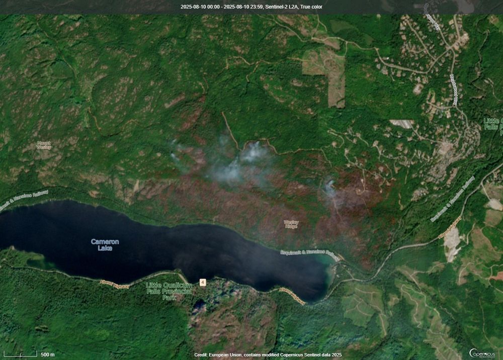
Should be taking the day off work, but then I thought: what if I could see the Wesley Ridge fire from space? Sentinel imagery from yesterday (Jul 31)
Reposted by Mica Jorgenson
nichecanada.bsky.social
You can read about the background behind this article and the research that led to it in @micaamy.bsky.social and John's post on our site, "Writing Health and History During a Global Pandemic" - niche-canada.org/2021/05/10/w...

#envhist #histmed #mininghistory
Reposted by Mica Jorgenson
tinaadcock.bsky.social
It was MINING & ENVIRONMENTAL JUSTICE week in my Canadian #envhist seminar today. Below is a short thread about what we read and watched ⛏️⚖️🧵
micaamy.bsky.social
Was looking at the satellite today and...is this just a line of retardant on the south flank of this fire? For context, that's the Mackenzie River to the east, and Fort Simpson to the North - Dencho region wildfire in NWT.