Michael Fischer
@mikefischerwx.bsky.social
2.6K followers
270 following
32 posts
Assistant Professor at the University of Miami. Usually discussing hurricanes.
Posts
Media
Videos
Starter Packs


Reposted by Michael Fischer


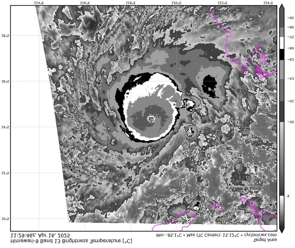


Reposted by Michael Fischer