NOAA
@noaa.gov
40K followers 4 following 89 posts
NOAA provides science, service and stewardship to protect life, property & Earth's natural resources. An agency of the Department of Commerce. Join us on Instagram & Facebook. Official NOAA account.
Posts Media Videos Starter Packs
Pinned
noaa.gov
NOAA @noaa.gov · 9d
For the latest on #Humberto and #Imelda:

-- Visit www.hurricanes.gov
-- Follow nws.noaa.gov on Bluesky
-- Follow @NHC_Atlantic
and @NWS on X

As always: Get your latest *local* forecast 24/7 at www.weather.gov by inputting your city, state or Zip Code
hurricanes.gov
Central Pacific Hurricane Center 2525 Correa Rd Suite 250 Honolulu, HI 96822 [email protected]
www.hurricanes.gov
noaa.gov
NOAA @noaa.gov · 7d
The U.S. Government is closed & this account will not be updated.

NOAA.gov websites & social media necessary to protect lives & property WILL be maintained.

For critical weather info from NWS.noaa.gov, please visit
www.weather.gov

Learn more: www.commerce.gov/news/blog/
The U.S. Government is closed & this account will not be updated. 

NOAA.gov websites & social media necessary to protect lives & property WILL be maintained.

For critical weather information from NWS.noaa.gov, please visit: 
https://www.weather.gov

Learn more: https://www.commerce.gov/news/blog/
noaa.gov
NOAA @noaa.gov · 9d
For the latest on #Humberto and #Imelda:

-- Visit www.hurricanes.gov
-- Follow nws.noaa.gov on Bluesky
-- Follow @NHC_Atlantic
and @NWS on X

As always: Get your latest *local* forecast 24/7 at www.weather.gov by inputting your city, state or Zip Code
hurricanes.gov
Central Pacific Hurricane Center 2525 Correa Rd Suite 250 Honolulu, HI 96822 [email protected]
www.hurricanes.gov
Reposted by NOAA
nws.noaa.gov
Swells and high surf from both Humberto and Imelda are expected to produce dangerous marine conditions and rip currents along the east coast of Florida and the Georgia coast today (Sept. 29). These conditions will spread northward along much of the East Coast early this week.
weather.gov/safety
noaa.gov
NOAA @noaa.gov · 9d
Hurricane #Humberto Advisory 20: (NOAA's National Hurricane Center):

"Humberto Expected to Produce Dangerous Surf and Rip Currents For Bermuda and Most of the U. S. East Coast This Week. Tropical Storm Conditions Possible in Bermuda On Tuesday."

See: #humbertoes.gov/#humberto" class="hover:underline text-blue-600 dark:text-sky-400" target="_blank" rel="noopener">hurricanes.gov/#humberto
hurricanes.gov
Central Pacific Hurricane Center 2525 Correa Rd Suite 250 Honolulu, HI 96822 [email protected]
hurricanes.gov
Reposted by NOAA
nws.noaa.gov
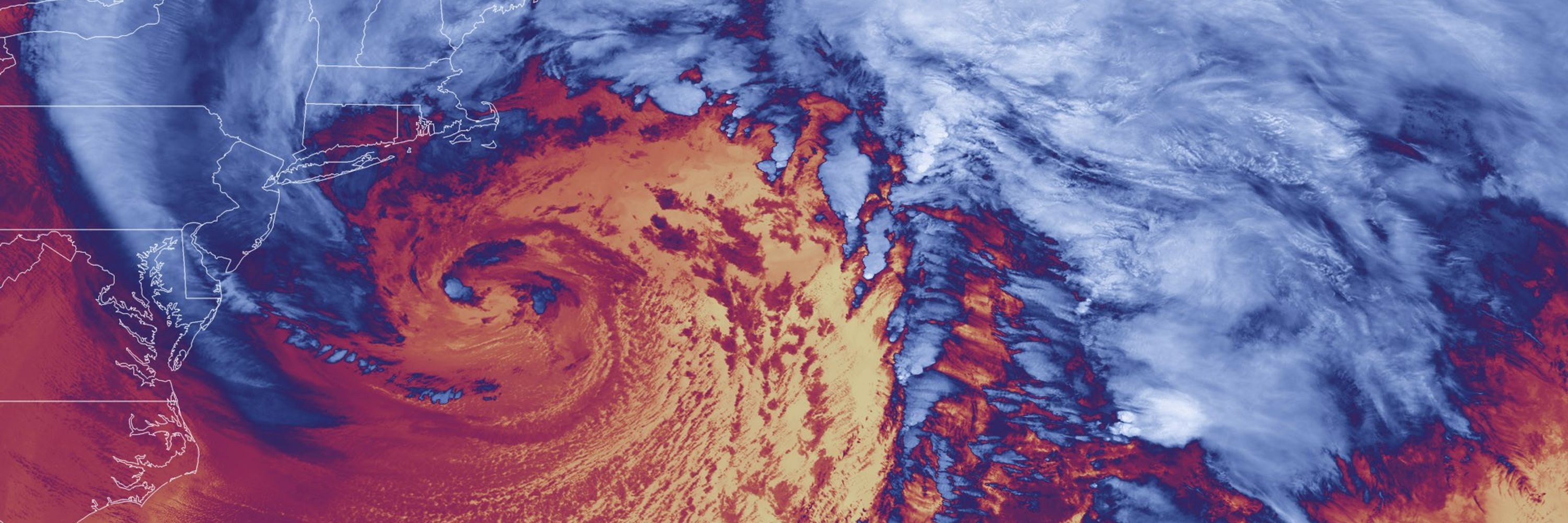
Quite a satellite image this morning! 🛰️🌀

Clouds extend 1000 miles from #Imelda's center all the way into central Pennsylvania.

#Humberto continues to churn in the Atlantic.
Visible satellite image of the East Coast and Atlantic showing the two tropical system.
noaa.gov
NOAA @noaa.gov · 15d
AND... WE HAVE LIFTOFF of NOAA’s #SWFOL1 satellite, riding along with
NASA.gov's Interstellar Mapping and Acceleration Probe (#IMAP) and Carruthers Geocorona Observatory!

More about SWFO-L1:
noaa.gov/SWFOL1

#LetsGoSWFO!
SWFO-L1 Launch
SWFO-L1 will keep a watchful eye on the sun and near-Earth environment for space weather activity, using a solar telescope to monitor the Sun's activity and a suite of instruments to make real-time me...
noaa.gov
noaa.gov
NOAA @noaa.gov · 16d
SWFO-L1 🚀LAUNCH UPDATE per NASA Kennedy:

NASA and SpaceX are now targeting 7:30 a.m. EDT, Wed Sept. 24 for the launch of IMAP, SWFO-L1, and Carruthers to allow more time for recovery assets to arrive at the landing zone. All 3 spacecraft and rocket remain healthy.

science.nasa.gov/blogs/imap/2...
NASA, SpaceX Now Targeting Sept. 24 for Space Weather Launch - NASA Science
NASA and SpaceX are now targeting 7:30 a.m. EDT, Wednesday Sept. 24 for the launch of NASA and the National Oceanic and Atmospheric Administration (NOAA)
science.nasa.gov
Reposted by NOAA
nws.noaa.gov
The Fall/Autumnal Equinox is TODAY at 2:19 PM EDT. That's the time at which our Sun is directly over the Earth's equator, signaling the start of Northern Hemisphere astronomical fall. The Earth’s northern hemisphere will continue to tilt further from the sun through the Winter Solstice on Dec 21.
Graphic showing Earth during the June solstice and September equinox. At the equinox, sunlight is evenly distributed along the equator. Text notes Fall Equinox 2025 occurs Sept 22 at 2:19 pm EDT.
noaa.gov
NOAA @noaa.gov · 19d
We're at T-minus 4 days & counting until the SWFOL1 launch! 🚀

NOAA's #SWFOL1 🛰️ will improve #SpaceWeather forecasting:

Its magnetometer will track solar plasma heading toward Earth and help forecast geomagnetic storms.

More: noaa.gov/SWFOL1

#SWFOMission #LetsGoSWFO #CountdownToLaunch
SWFO-L1 Launch
SWFO-L1 will keep a watchful eye on the sun and near-Earth environment for space weather activity, using a solar telescope to monitor the Sun's activity and a suite of instruments to make real-time me...
noaa.gov
Reposted by NOAA
nws.noaa.gov
Though temperatures will feel very beach-like, increasing northeast winds this weekend will bring a high rip current risk to local beaches in parts of Florida and Georgia. Locals and visitors, should follow beach patrol guidance & flags.
Visit weather.gov/beach for the latest forecast info.
Rip current risk outlook for Sept 19–20, 2025. High risk marked in red along parts of Florida’s east coast. Moderate risk in yellow extends along the rest of Florida, Georgia, South Carolina, and North Carolina coasts. Low or no data elsewhere. Ocean waves are shown breaking offshore with text: Don't Put Yourself at Risk: How to help someone caught in a rip current. Carefully assess the situation. Is the person unable to return to shore? Get help from a lifeguard. If there is no lifeguard, call 9-1-1. Advise the person to swim following the shoreline to escape the current. If possible, throw the person something that floats. Never enter the water without a flotation device. Many people have died trying to rescue someone caught in a rip current.
Reposted by NOAA
nws.noaa.gov
The Atlantic season's 7th named storm, Tropical Storm Gabrielle, has formed. Gabrielle is expected to slowly strengthen and may approach Bermuda as a hurricane early next week.

nhc.noaa.gov
noaa.gov
NOAA @noaa.gov · 21d
Countdown to launch: NOAA’s #SWFOL1 #Satellite #Observatory

Safeguarding society, a million miles from home ...

Scheduled for September 23, 2025, from Florida's Kennedy Space Center.

--> Bookmark: noaa.gov/SWFOL1
An artist's rendering of NOAA's SWFO-L1 satellite in space orbit next to a image of the sun producing a coronal mass ejection. Earth  is seen in the far distance. Image credit: NOAA Satellites.
Reposted by NOAA
nws.noaa.gov
Space weather is a two-sided coin: it creates beautiful auroras, but it can also jeopardize the technologies we rely on daily. See all the impacts of space weather at weather.gov/safety.
Space weather impacts: Aurora (northern lights). GPS. Satellites. Communications. Human space exploration. Aviation. Electric Power.
Reposted by NOAA
nws.noaa.gov
Here is the latest precipitation forecast through the work week (September 15-19), with a few areas of wet and unsettled weather anticipated. Umbrellas may be needed at times in the central U.S., Mid-Atlantic, southern Florida, and Southwest. ☔️
weather.gov
Map of the U.S. with the precipitation forecast this week (September 15-19). The map contours show bright shading over the Plains and Mid Atlantic states where more rain is expected.
noaa.gov
NOAA @noaa.gov · 26d
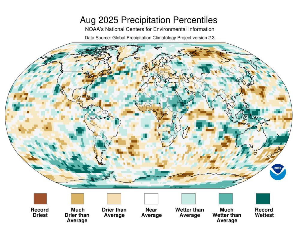
NOAA's NCEI has issued its Global #August 2025 temperature and precipitation analysis.

Summary and images for download can be accessed at: bit.ly/Global202508

via NOAA National Centers for Environmental Information
Reposted by NOAA
nws.noaa.gov
Tropical Storm Kiko will continue to pass north of the Hawaiian Islands today and Wednesday, disrupting the trade winds, producing areas of heavy rainfall, and generating large surf along east facing shores. Find more detailed info at the NWS Forecast Office Honolulu's webpage: weather.gov/hfo
Kiko is forecast to pass north of the Hawaiian Islands today
and Wednesday. Additional weakening is expected, and the threat of
direct impacts on the islands continues to diminish, though
interests should still monitor Kiko's progress and the latest
forecasts.
 
Swells generated by Kiko are gradually building from east to west
across the exposed Hawaiian waters and are forecast to peak 
today through Wednesday, potentially producing life-threatening
surf and rip currents. Refer to the latest updates and forecasts
issued from the National Weather Service in Honolulu, Hawaii.
Reposted by NOAA
nws.noaa.gov
A day at the beach won't be "a day at the beach" today. Higher than normal tides and persistant onshore winds are leading to rough surf, rip currents, and coastal flooding up and down the U.S. East Coast. Take extra precautions while enjoying the coast today.

weather.gov
noaa.gov
NOAA @noaa.gov · 29d
NOAA's NCEI just released its #August and #Summer 2025 temperature and precipitation analysis for the U.S.

Report summary & images for download can be accessed at:

bit.ly/USClimate202...
Reposted by NOAA
nws.noaa.gov
Attention Teachers and Educators!
Have the NWS visit your classroom virtually! Presentation topics include weather, climate, space weather, hydrology (rivers) & tsunamis, and are available in English and Spanish. weather.gov/education/sc... #BackToSchoolNOAA
A group of students sit on a classroom floor facing the projector screen which displays a map of the United States and the faces of meteorologists virtually speaking about the presentation. The students hold their laptops and listen intently to the presentation. Text on the photo reads: Virtual School Talks
Reposted by NOAA
nws.noaa.gov
After a fairly cool stretch of weather for portions of the U.S., temperatures will be on the rise this week. That trend will continue into mid September. The exception being eastern portions of the country with a near to below normal signal. Here's the 8-14 day temperature outlook (Sept. 15-21).👇
8-14 Day Temperature Outlook (September 15-21)
Maybe showing all 50 states with most colored orange and red - indicating better odds of seeing above normal temperatures. Near to below more likely across the eastern U.S. and northwest Alaska.
Reposted by NOAA
nws.noaa.gov
It is a chilly morning across the eastern third of the country today! In fact, as of 8 am ET, seven stations recorded a record low with with many more tied or within 3 degrees of the previous daily record.

☀️Ample sunshine will allow for a quick warmup by this afternoon.
Map of locations across the Great Lakes, Midwest and portions of the Northeast that tied or broke low temperature records this morning. Many locations are in the 30s and 40s this morning.
Reposted by NOAA
nws.noaa.gov
Unseasonably cool weather across the Plains and into the Midwest today will push even further south and east behind a cold front as we move into Saturday. Above normal readings are set to return to much those same areas by mid-week next week. Get the latest at weather.gov
U.S. map of forecast high temperatures for Sept 5, ranging from 40s in the northern Plains to 100s in Texas and California. Record cool highs marked in the Upper Midwest. U.S. map of forecast high temperatures for Sept 6, similar pattern with 40s–100s. Record cool highs marked over Michigan and nearby states.”
Reposted by NOAA
nws.noaa.gov
Did you know the NWS deploys meteorologists to wildfires? Incident Meteorologists provide forecasts to keep firefighters prepared for upcoming weather.

📸Incident meteorologists and fire officials at the Bison Ridge Fire in Idaho. NWS Photos: Robert Hyatt

www.noaa.gov/stories/imet...
Map of locations where NWS incident meteorologists are deployed (as of September 4, 2025) across California, Oregon, Washington, Idaho, Montana, Wyoming, Colorado, Utah, Idaho, and Arizona. NWS meteorologist points to a map while providing a weather briefing outside while a group of fire firefighters and fire officials stand in the foreground. Photo of NWS Incident Meteorologist in the foreground talking with two fire weather officials. Two red trucks are visible with a smokey landscape in the background. Photo of a NWS meteorologist speaking with a small group of people on-site at an incident command post.