


Peter Corman
@peterc428.bsky.social
MU'27 | MU-AMS Historian | New York Giants Fan |
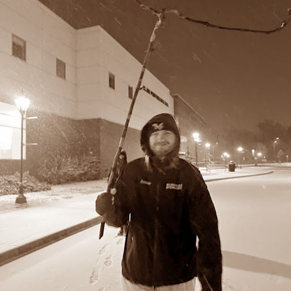
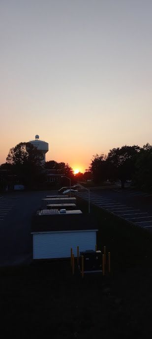
If the compression wasn't so bad on here, I'd honestly post on here more than I do (which is almost never)
May 22, 2025 at 10:11 PM
If the compression wasn't so bad on here, I'd honestly post on here more than I do (which is almost never)
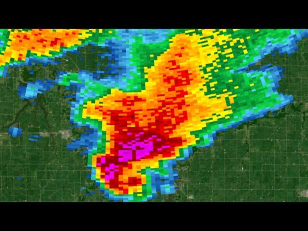
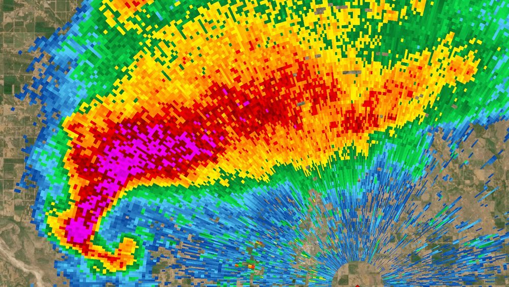
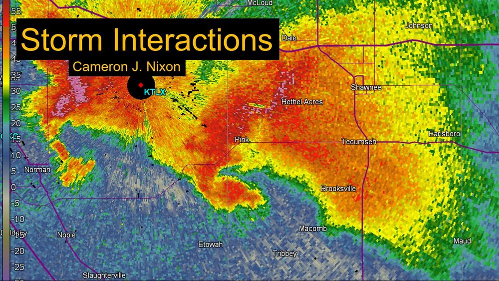
I don't know what to post on here, so here's a Radar Loop of the supercell that produced that rather intense EF3 near Hiwannee, Mississippi back on February 12th
March 10, 2025 at 4:05 PM
I don't know what to post on here, so here's a Radar Loop of the supercell that produced that rather intense EF3 near Hiwannee, Mississippi back on February 12th
Dam. Twitter is down.
March 10, 2025 at 3:42 PM
Dam. Twitter is down.
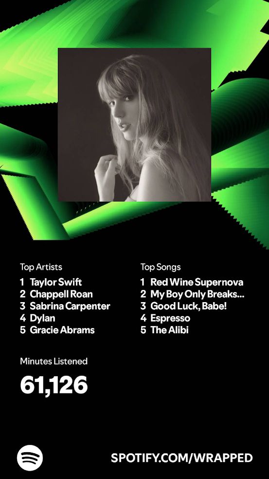
Another year of Spotify Wrapped, another year of Taylor being my #1 artist.
December 4, 2024 at 2:31 PM
Another year of Spotify Wrapped, another year of Taylor being my #1 artist.
6 years ago today, a significant tornado outbreak occured in Illinois, highlighted by two cyclic, tornadic supercells. The evolution of these supercells is linked below
Taylorville: youtu.be/5marrHgXUHA
Havana: youtu.be/ygiTMtaZR-o
Taylorville: youtu.be/5marrHgXUHA
Havana: youtu.be/ygiTMtaZR-o
2018 Taylorville, Illinois Supercell Radar Loop
YouTube video by Peter Corman
youtu.be
December 1, 2024 at 8:48 PM
6 years ago today, a significant tornado outbreak occured in Illinois, highlighted by two cyclic, tornadic supercells. The evolution of these supercells is linked below
Taylorville: youtu.be/5marrHgXUHA
Havana: youtu.be/ygiTMtaZR-o
Taylorville: youtu.be/5marrHgXUHA
Havana: youtu.be/ygiTMtaZR-o
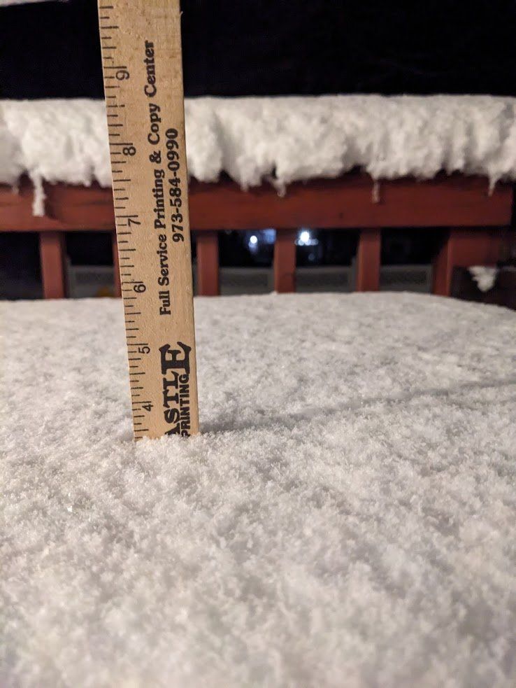
3.4 inches of snow up at my house in Liberty Township, New Jersey. Elevation ~1000 feet. Photo courtesy of my Mom.
November 23, 2024 at 2:15 AM
3.4 inches of snow up at my house in Liberty Township, New Jersey. Elevation ~1000 feet. Photo courtesy of my Mom.
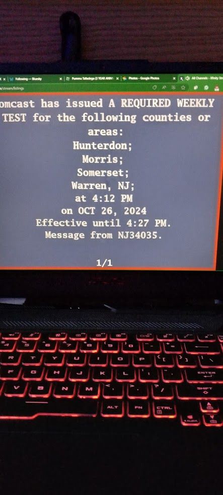
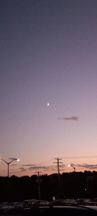
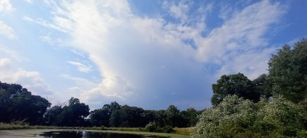
Weather or something I don't know.
November 22, 2024 at 5:53 PM
Weather or something I don't know.
Reposted by Peter Corman

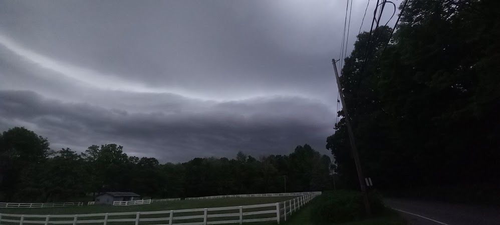
Generally as expected, the polar vortex is forecast to be near record strong going into the latter part of this month into Dec
This might be one of those intriguing cases where a strong polar vortex actually helps keep North America cold by anchoring the +TNH/-EPO pattern in place later this winter
This might be one of those intriguing cases where a strong polar vortex actually helps keep North America cold by anchoring the +TNH/-EPO pattern in place later this winter

November 20, 2024 at 12:23 PM
Generally as expected, the polar vortex is forecast to be near record strong going into the latter part of this month into Dec
This might be one of those intriguing cases where a strong polar vortex actually helps keep North America cold by anchoring the +TNH/-EPO pattern in place later this winter
This might be one of those intriguing cases where a strong polar vortex actually helps keep North America cold by anchoring the +TNH/-EPO pattern in place later this winter
13 years ago today, a long-tracked, violent, and photogenic EF4 tornado occurred in southwestern Oklahoma, impacting areas near Tipton.
Radar Loop of the supercell's evolution: youtu.be/rCvgc16COBg
Radar Loop of the supercell's evolution: youtu.be/rCvgc16COBg
November 7, 2024 at 8:08 PM
13 years ago today, a long-tracked, violent, and photogenic EF4 tornado occurred in southwestern Oklahoma, impacting areas near Tipton.
Radar Loop of the supercell's evolution: youtu.be/rCvgc16COBg
Radar Loop of the supercell's evolution: youtu.be/rCvgc16COBg
Here's a radar loop of the evolution of a tornadic supercell that produced a long-tracked, intense EF3 tornado that impacted areas near Comanche, Oklahoma during the early morning hours of November 3rd. #wxtwitter
November 6, 2024 at 11:07 PM
Here's a radar loop of the evolution of a tornadic supercell that produced a long-tracked, intense EF3 tornado that impacted areas near Comanche, Oklahoma during the early morning hours of November 3rd. #wxtwitter
Reposted by Peter Corman
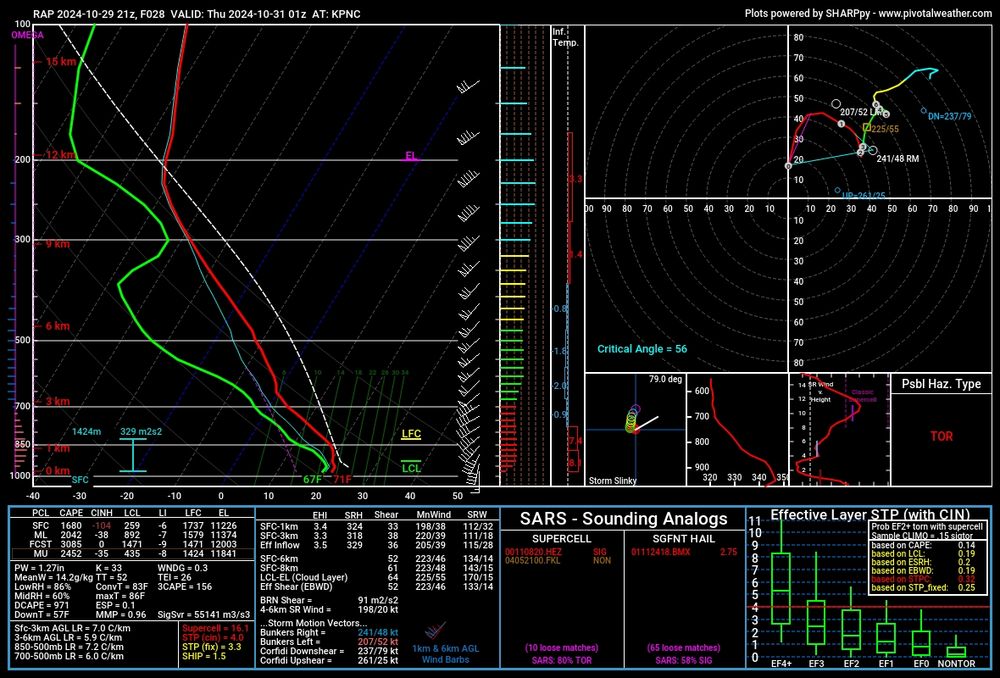
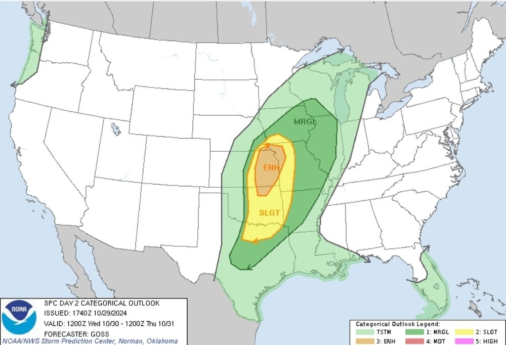
I'm becoming more concerned that a significant tornado threat could develop in eastern KS and northeast OK near or after dark tomorrrow. Very strong low level shear will be in place ahead of an unussualy warm and moist air mass for October. Supercells could continue overnight with tornadoes.
October 30, 2024 at 12:30 AM
I'm becoming more concerned that a significant tornado threat could develop in eastern KS and northeast OK near or after dark tomorrrow. Very strong low level shear will be in place ahead of an unussualy warm and moist air mass for October. Supercells could continue overnight with tornadoes.
Reposted by Peter Corman

19 years ago today, Hurricane Wilma struck Florida after a long Caribbean trek.
This loop of recon-derived flight wind speed shows its eyewall replacement cycle & transformation from a tiny but extremely powerful hurricane to a very large and fast moving storm:
This loop of recon-derived flight wind speed shows its eyewall replacement cycle & transformation from a tiny but extremely powerful hurricane to a very large and fast moving storm:
October 25, 2024 at 1:18 AM
19 years ago today, Hurricane Wilma struck Florida after a long Caribbean trek.
This loop of recon-derived flight wind speed shows its eyewall replacement cycle & transformation from a tiny but extremely powerful hurricane to a very large and fast moving storm:
This loop of recon-derived flight wind speed shows its eyewall replacement cycle & transformation from a tiny but extremely powerful hurricane to a very large and fast moving storm:
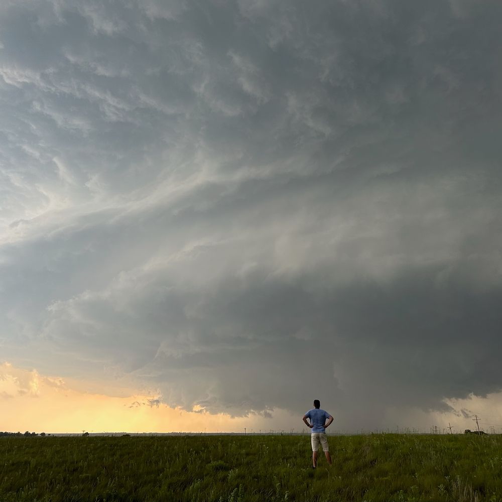
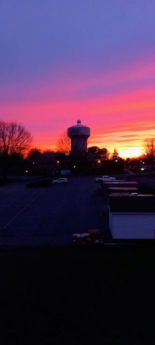
It has been a very quiet month around here. It's been great, but at the same time, I want some thunderstorms again pleasee.
October 24, 2024 at 12:20 PM
It has been a very quiet month around here. It's been great, but at the same time, I want some thunderstorms again pleasee.
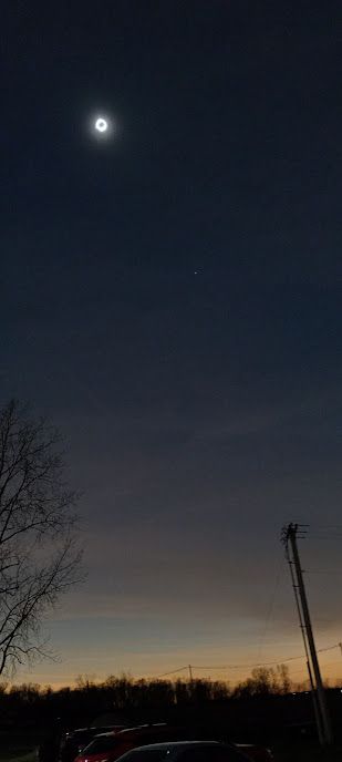
if you see this, post a weather

October 18, 2024 at 2:24 PM
if you see this, post a weather
Reposted by Peter Corman

Hey folks! About me:
I'm a severe wx research scientist in Norman, OK. I'm an advocate for new ideas and research into the forecasting of tornadoes and large hail. I love interacting with NWS, reararchers, broadcasters, students, and chasers alike. Just be prepared for a pretty picture or two ;)
I'm a severe wx research scientist in Norman, OK. I'm an advocate for new ideas and research into the forecasting of tornadoes and large hail. I love interacting with NWS, reararchers, broadcasters, students, and chasers alike. Just be prepared for a pretty picture or two ;)
October 17, 2024 at 6:17 PM
Hey folks! About me:
I'm a severe wx research scientist in Norman, OK. I'm an advocate for new ideas and research into the forecasting of tornadoes and large hail. I love interacting with NWS, reararchers, broadcasters, students, and chasers alike. Just be prepared for a pretty picture or two ;)
I'm a severe wx research scientist in Norman, OK. I'm an advocate for new ideas and research into the forecasting of tornadoes and large hail. I love interacting with NWS, reararchers, broadcasters, students, and chasers alike. Just be prepared for a pretty picture or two ;)
Hey y'all! I've seen a bunch of people on #wxtwitter move over to Bluesky, so I've decided to join for myself!
October 17, 2024 at 5:51 PM
Hey y'all! I've seen a bunch of people on #wxtwitter move over to Bluesky, so I've decided to join for myself!