
Nick Deshais
@nickdeshais.bsky.social
950 followers
650 following
110 posts
Seattle Times staff writer covering transportation.
Ferries, bikes, pedestrians, buses, trains and oh yeah cars too.
https://www.seattletimes.com/author/nicholas-deshais/
Posts
Media
Videos
Starter Packs
Reposted by Nick Deshais

The Seattle Times
@seattletimes.com
· Aug 17
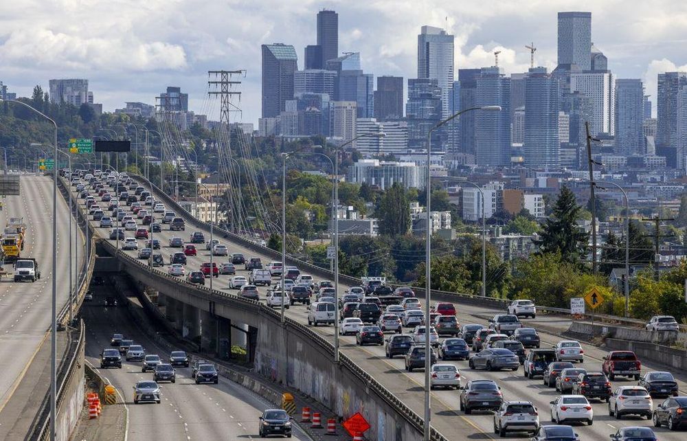
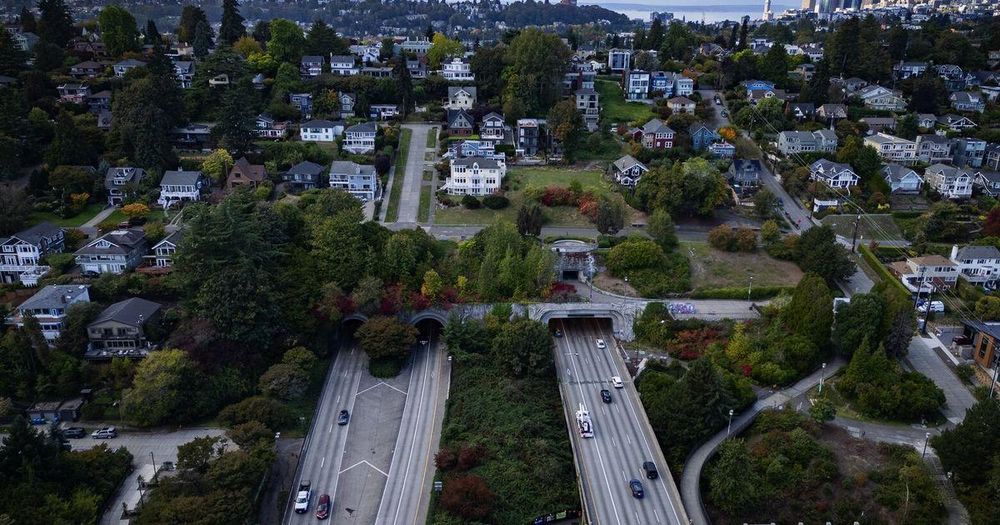
As Seattle drivers deal with I-5 closure, some say it’s time to cap it
While drivers flooded Seattle's streets to make their way around the region's closed highways, a group of people advocated for lidding Interstate 5 to hide the highway and dampen the noise.
www.seattletimes.com
Reposted by Nick Deshais


Nick Deshais
@nickdeshais.bsky.social
· Jul 18
Nick Deshais
@nickdeshais.bsky.social
· Jul 18
Reposted by Nick Deshais

Reposted by Nick Deshais

Annalee Newitz
@annaleen.bsky.social
· Jul 10
Nick Deshais
@nickdeshais.bsky.social
· Jul 9
Reposted by Nick Deshais

Reposted by Nick Deshais

Reposted by Nick Deshais

Reposted by Nick Deshais

Nick Deshais
@nickdeshais.bsky.social
· May 20
Reposted by Nick Deshais


Nick Deshais
@nickdeshais.bsky.social
· May 20


Nick Deshais
@nickdeshais.bsky.social
· May 20

Reposted by Nick Deshais

Reposted by Nick Deshais

Davina Duerr
@davina425.bsky.social
· May 15
Reposted by Nick Deshais