


HeiGIT
@heigit.org
Open-source geoinformation, methods and software for the benefit of the environment and society.
---
This is the official account of HeiGIT (Heidelberg Institute for Geoinformation Technology) at Heidelberg University.
Check us out at https://heigit.org/
---
This is the official account of HeiGIT (Heidelberg Institute for Geoinformation Technology) at Heidelberg University.
Check us out at https://heigit.org/
🌍 Let’s make International #ReducingCO2 Emissions Day a local practice.
Cities and communities are key to cutting emissions, but action needs the right tools. The Climate Action Navigator supports local #climateaction by providing data-driven insights.
👉 climate-action.heigit.org/dashboard
Cities and communities are key to cutting emissions, but action needs the right tools. The Climate Action Navigator supports local #climateaction by providing data-driven insights.
👉 climate-action.heigit.org/dashboard
January 28, 2026 at 9:02 AM
🌍 Let’s make International #ReducingCO2 Emissions Day a local practice.
Cities and communities are key to cutting emissions, but action needs the right tools. The Climate Action Navigator supports local #climateaction by providing data-driven insights.
👉 climate-action.heigit.org/dashboard
Cities and communities are key to cutting emissions, but action needs the right tools. The Climate Action Navigator supports local #climateaction by providing data-driven insights.
👉 climate-action.heigit.org/dashboard
How do you analyse #OpenStreetMap data at the pace it is produced?
The latest release of ohsome-planet introduces minutely updates, delivering continuously up-to-date, GIS-ready OSM data in GeoParquet—ready for analysis with DuckDB, GeoPandas, or QGIS.
Learn more: buff.ly/abUmuPa
#opendata #GIS
The latest release of ohsome-planet introduces minutely updates, delivering continuously up-to-date, GIS-ready OSM data in GeoParquet—ready for analysis with DuckDB, GeoPandas, or QGIS.
Learn more: buff.ly/abUmuPa
#opendata #GIS
January 22, 2026 at 8:15 AM
How do you analyse #OpenStreetMap data at the pace it is produced?
The latest release of ohsome-planet introduces minutely updates, delivering continuously up-to-date, GIS-ready OSM data in GeoParquet—ready for analysis with DuckDB, GeoPandas, or QGIS.
Learn more: buff.ly/abUmuPa
#opendata #GIS
The latest release of ohsome-planet introduces minutely updates, delivering continuously up-to-date, GIS-ready OSM data in GeoParquet—ready for analysis with DuckDB, GeoPandas, or QGIS.
Learn more: buff.ly/abUmuPa
#opendata #GIS
Heidelberg University is at the center of #OpenStreetMap research and Alexander Zipf is the most prolific author in this field, according to a study that analyzed over 15 years of OSM research.
An interesting reading for the #OSM community & all #VGI researchers: arxiv.org/pdf/2601.09338
An interesting reading for the #OSM community & all #VGI researchers: arxiv.org/pdf/2601.09338

January 21, 2026 at 9:00 AM
Heidelberg University is at the center of #OpenStreetMap research and Alexander Zipf is the most prolific author in this field, according to a study that analyzed over 15 years of OSM research.
An interesting reading for the #OSM community & all #VGI researchers: arxiv.org/pdf/2601.09338
An interesting reading for the #OSM community & all #VGI researchers: arxiv.org/pdf/2601.09338
How can we embed #innovation into our daily work? 🤔
We create space to experiment with new ideas & technologies without immediate pressure to deliver results. This mindset led to Innovation Summer, making room to explore new ideas. How do you develop new ideas?
🔍 heigit.org?p=41714
#research
We create space to experiment with new ideas & technologies without immediate pressure to deliver results. This mindset led to Innovation Summer, making room to explore new ideas. How do you develop new ideas?
🔍 heigit.org?p=41714
#research

January 20, 2026 at 8:21 AM
How can we embed #innovation into our daily work? 🤔
We create space to experiment with new ideas & technologies without immediate pressure to deliver results. This mindset led to Innovation Summer, making room to explore new ideas. How do you develop new ideas?
🔍 heigit.org?p=41714
#research
We create space to experiment with new ideas & technologies without immediate pressure to deliver results. This mindset led to Innovation Summer, making room to explore new ideas. How do you develop new ideas?
🔍 heigit.org?p=41714
#research
HGG Lecture: “The Forest After the Last Ice Age in the Landscape of Germany – Researching Forest History with the Help of Fossil Pollen”
📆 Jan 20, 7:15 pm
📍 Lecture Hall 2, KIP, HD
🗣️ Dr. Susanne Jahns
💡 Lecture in German
👉 heigit.org/events/hgg-l...
📆 Jan 20, 7:15 pm
📍 Lecture Hall 2, KIP, HD
🗣️ Dr. Susanne Jahns
💡 Lecture in German
👉 heigit.org/events/hgg-l...

January 16, 2026 at 8:15 AM
HGG Lecture: “The Forest After the Last Ice Age in the Landscape of Germany – Researching Forest History with the Help of Fossil Pollen”
📆 Jan 20, 7:15 pm
📍 Lecture Hall 2, KIP, HD
🗣️ Dr. Susanne Jahns
💡 Lecture in German
👉 heigit.org/events/hgg-l...
📆 Jan 20, 7:15 pm
📍 Lecture Hall 2, KIP, HD
🗣️ Dr. Susanne Jahns
💡 Lecture in German
👉 heigit.org/events/hgg-l...
We conducted a #GIS training for #PublicHealth with @roteskreuz.bsky.social, @croixrouge.bsky.social, the Colombian Red Cross & @rki.de.
Key lesson: if health professionals and information managers work together, they can translate complex data into high-quality results
heigit.org/gis-training...
Key lesson: if health professionals and information managers work together, they can translate complex data into high-quality results
heigit.org/gis-training...

January 15, 2026 at 8:51 AM
We conducted a #GIS training for #PublicHealth with @roteskreuz.bsky.social, @croixrouge.bsky.social, the Colombian Red Cross & @rki.de.
Key lesson: if health professionals and information managers work together, they can translate complex data into high-quality results
heigit.org/gis-training...
Key lesson: if health professionals and information managers work together, they can translate complex data into high-quality results
heigit.org/gis-training...
🚶♀️ How do you move around #Mannheim? Share your experience!
As part of the Silver Ways project, we are inviting everyone to participate in our #mobility survey and help us better understand #walking needs, barriers, and preferences in Mannheim.
👉 tinyurl.com/47yuf32w
#research #GIS #opendata
As part of the Silver Ways project, we are inviting everyone to participate in our #mobility survey and help us better understand #walking needs, barriers, and preferences in Mannheim.
👉 tinyurl.com/47yuf32w
#research #GIS #opendata

January 13, 2026 at 8:45 AM
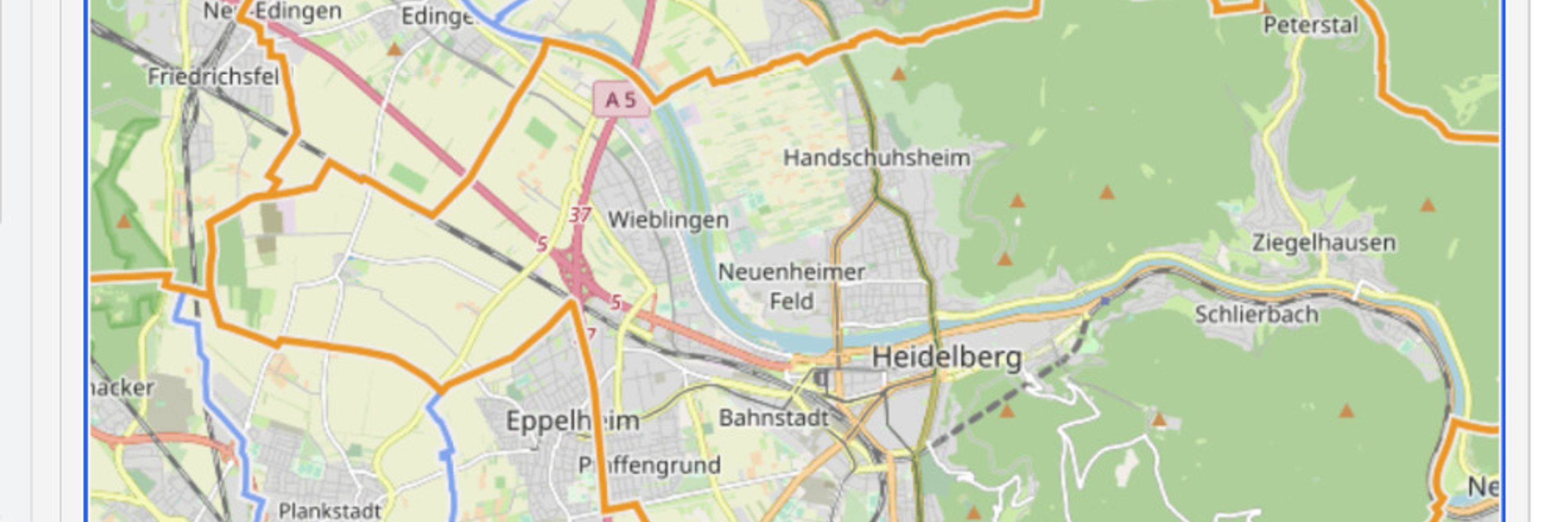
openrouteservice use-case: how equitable is access to urban green space?
A recent study used openrouteservice to analyse walking accessibility to culturally valued green spaces in Jakarta. Network-based travel times revealed clear socioeconomic inequalities.
👉 heigit.org?p=41611
A recent study used openrouteservice to analyse walking accessibility to culturally valued green spaces in Jakarta. Network-based travel times revealed clear socioeconomic inequalities.
👉 heigit.org?p=41611

January 8, 2026 at 8:45 AM
openrouteservice use-case: how equitable is access to urban green space?
A recent study used openrouteservice to analyse walking accessibility to culturally valued green spaces in Jakarta. Network-based travel times revealed clear socioeconomic inequalities.
👉 heigit.org?p=41611
A recent study used openrouteservice to analyse walking accessibility to culturally valued green spaces in Jakarta. Network-based travel times revealed clear socioeconomic inequalities.
👉 heigit.org?p=41611
We’ve updated the Climate Action Navigator to make data-driven local #climateaction easier 🌍
🔍 High-resolution data on walkability & bikeability, heating emissions, CO₂ budget, & land-use change
⚡ Faster vector-based maps
🌐 Interface now in English & German
📄 PDF reports
climate-action.heigit.org
🔍 High-resolution data on walkability & bikeability, heating emissions, CO₂ budget, & land-use change
⚡ Faster vector-based maps
🌐 Interface now in English & German
📄 PDF reports
climate-action.heigit.org
December 30, 2025 at 8:31 AM
We’ve updated the Climate Action Navigator to make data-driven local #climateaction easier 🌍
🔍 High-resolution data on walkability & bikeability, heating emissions, CO₂ budget, & land-use change
⚡ Faster vector-based maps
🌐 Interface now in English & German
📄 PDF reports
climate-action.heigit.org
🔍 High-resolution data on walkability & bikeability, heating emissions, CO₂ budget, & land-use change
⚡ Faster vector-based maps
🌐 Interface now in English & German
📄 PDF reports
climate-action.heigit.org
Happy holidays🎄
Thanks to our partners and collaborators for advancing open geoinformation technologies with us in 2025 for the benefit of society and the environment. Together, we turn geospatial data into insights for humanitarian response and climate action.
Our milestones tinyurl.com/evbycst9
Thanks to our partners and collaborators for advancing open geoinformation technologies with us in 2025 for the benefit of society and the environment. Together, we turn geospatial data into insights for humanitarian response and climate action.
Our milestones tinyurl.com/evbycst9

December 24, 2025 at 9:30 AM
Happy holidays🎄
Thanks to our partners and collaborators for advancing open geoinformation technologies with us in 2025 for the benefit of society and the environment. Together, we turn geospatial data into insights for humanitarian response and climate action.
Our milestones tinyurl.com/evbycst9
Thanks to our partners and collaborators for advancing open geoinformation technologies with us in 2025 for the benefit of society and the environment. Together, we turn geospatial data into insights for humanitarian response and climate action.
Our milestones tinyurl.com/evbycst9
We have released and deployed a new version of ohsome-dashboard & of ohsome-quality-api to production 🎉
What´s new? German translation, a new welcome screen and an extended search interface. Oqapi extended its support for currentness to all topics.
Happy Analyzing! 🙂
dashboard.ohsome.org
What´s new? German translation, a new welcome screen and an extended search interface. Oqapi extended its support for currentness to all topics.
Happy Analyzing! 🙂
dashboard.ohsome.org

December 23, 2025 at 8:32 AM
We have released and deployed a new version of ohsome-dashboard & of ohsome-quality-api to production 🎉
What´s new? German translation, a new welcome screen and an extended search interface. Oqapi extended its support for currentness to all topics.
Happy Analyzing! 🙂
dashboard.ohsome.org
What´s new? German translation, a new welcome screen and an extended search interface. Oqapi extended its support for currentness to all topics.
Happy Analyzing! 🙂
dashboard.ohsome.org
What if urban traffic speeds could be estimated using only #opendata?
Our work combines #OpenStreetMap and Street View Imagery to infer #traffic speed classes across a whole city. The focus is on long-term, typical traffic patterns and spatial completeness. Case study: Berlin
tinyurl.com/2hsdjuzw
Our work combines #OpenStreetMap and Street View Imagery to infer #traffic speed classes across a whole city. The focus is on long-term, typical traffic patterns and spatial completeness. Case study: Berlin
tinyurl.com/2hsdjuzw

December 22, 2025 at 9:07 AM
What if urban traffic speeds could be estimated using only #opendata?
Our work combines #OpenStreetMap and Street View Imagery to infer #traffic speed classes across a whole city. The focus is on long-term, typical traffic patterns and spatial completeness. Case study: Berlin
tinyurl.com/2hsdjuzw
Our work combines #OpenStreetMap and Street View Imagery to infer #traffic speed classes across a whole city. The focus is on long-term, typical traffic patterns and spatial completeness. Case study: Berlin
tinyurl.com/2hsdjuzw
How to use Earth observation data and techniques in studying different domains of disaster management? 🌍
Our contributions featured in Data-Driven Earth Observation for Disaster Management: From Theory to Practical Applications talks exactly about that!
Read more 👉 buff.ly/xqN9RHj
Our contributions featured in Data-Driven Earth Observation for Disaster Management: From Theory to Practical Applications talks exactly about that!
Read more 👉 buff.ly/xqN9RHj

December 19, 2025 at 10:15 AM
How to use Earth observation data and techniques in studying different domains of disaster management? 🌍
Our contributions featured in Data-Driven Earth Observation for Disaster Management: From Theory to Practical Applications talks exactly about that!
Read more 👉 buff.ly/xqN9RHj
Our contributions featured in Data-Driven Earth Observation for Disaster Management: From Theory to Practical Applications talks exactly about that!
Read more 👉 buff.ly/xqN9RHj
𝗧𝗵𝗲 #𝗜𝗙𝗥𝗖 𝗡𝗲𝘁𝘄𝗼𝗿𝗸 𝗚𝗜𝗦 𝗧𝗿𝗮𝗶𝗻𝗶𝗻𝗴 𝗽𝗹𝗮𝘁𝗳𝗼𝗿𝗺 𝗶𝘀 𝗻𝗼𝘄 𝗮𝘃𝗮𝗶𝗹𝗮𝗯𝗹𝗲 𝗮𝗹𝘀𝗼 𝗶𝗻 𝗦𝗽𝗮𝗻𝗶𝘀𝗵:
giscience.github.io/gis-training...
We´ve recently used the new translated version in a training with several National Red Cross Societies in Bogotá.
It´s great to see #GIS become more accessible for humanitarian work!
giscience.github.io/gis-training...
We´ve recently used the new translated version in a training with several National Red Cross Societies in Bogotá.
It´s great to see #GIS become more accessible for humanitarian work!


December 18, 2025 at 9:15 AM
𝗧𝗵𝗲 #𝗜𝗙𝗥𝗖 𝗡𝗲𝘁𝘄𝗼𝗿𝗸 𝗚𝗜𝗦 𝗧𝗿𝗮𝗶𝗻𝗶𝗻𝗴 𝗽𝗹𝗮𝘁𝗳𝗼𝗿𝗺 𝗶𝘀 𝗻𝗼𝘄 𝗮𝘃𝗮𝗶𝗹𝗮𝗯𝗹𝗲 𝗮𝗹𝘀𝗼 𝗶𝗻 𝗦𝗽𝗮𝗻𝗶𝘀𝗵:
giscience.github.io/gis-training...
We´ve recently used the new translated version in a training with several National Red Cross Societies in Bogotá.
It´s great to see #GIS become more accessible for humanitarian work!
giscience.github.io/gis-training...
We´ve recently used the new translated version in a training with several National Red Cross Societies in Bogotá.
It´s great to see #GIS become more accessible for humanitarian work!
We have two new indicators in our assessment tool for residential heating emissions: building construction year & energy carrier🏘️
Let´s test the new features by looking at Kalbach-Riedberg (#Frankfurt). Some areas seems to have no emissions: how is this possible?
🔎 heigit.org/new-indicato...
Let´s test the new features by looking at Kalbach-Riedberg (#Frankfurt). Some areas seems to have no emissions: how is this possible?
🔎 heigit.org/new-indicato...


December 17, 2025 at 9:15 AM
We have two new indicators in our assessment tool for residential heating emissions: building construction year & energy carrier🏘️
Let´s test the new features by looking at Kalbach-Riedberg (#Frankfurt). Some areas seems to have no emissions: how is this possible?
🔎 heigit.org/new-indicato...
Let´s test the new features by looking at Kalbach-Riedberg (#Frankfurt). Some areas seems to have no emissions: how is this possible?
🔎 heigit.org/new-indicato...
The latest #SketchMapTool release integrates #OpenAerialMap, allowing you to add freshly captured drone or openly licensed imagery as a base map with just an image ID. 🗺️
This makes #ParticipatoryMapping even more accessible and efficient in #humanitarian contexts and beyond!
🔗 heigit.org?p=41381
This makes #ParticipatoryMapping even more accessible and efficient in #humanitarian contexts and beyond!
🔗 heigit.org?p=41381

December 16, 2025 at 8:25 AM
The latest #SketchMapTool release integrates #OpenAerialMap, allowing you to add freshly captured drone or openly licensed imagery as a base map with just an image ID. 🗺️
This makes #ParticipatoryMapping even more accessible and efficient in #humanitarian contexts and beyond!
🔗 heigit.org?p=41381
This makes #ParticipatoryMapping even more accessible and efficient in #humanitarian contexts and beyond!
🔗 heigit.org?p=41381
What’s your take on AI-assisted mapping in #OpenStreetMap? 🤖
More map data is now generated automatically, raising questions about transparency and #dataquality. Our research shows AI-created roads are hard to detect once mixed with human edits. How will mapping change?
heigit.org?p=41526
More map data is now generated automatically, raising questions about transparency and #dataquality. Our research shows AI-created roads are hard to detect once mixed with human edits. How will mapping change?
heigit.org?p=41526

December 15, 2025 at 1:35 PM
What’s your take on AI-assisted mapping in #OpenStreetMap? 🤖
More map data is now generated automatically, raising questions about transparency and #dataquality. Our research shows AI-created roads are hard to detect once mixed with human edits. How will mapping change?
heigit.org?p=41526
More map data is now generated automatically, raising questions about transparency and #dataquality. Our research shows AI-created roads are hard to detect once mixed with human edits. How will mapping change?
heigit.org?p=41526
Happy 30th birthday @klaus-tschira-stiftung.de! 🎉
To honor this milestone, we put together a short video to show what we do for humanitarian aid, climate action, and sustainable mobility with your support: youtube.com/shorts/0yWBj...
To honor this milestone, we put together a short video to show what we do for humanitarian aid, climate action, and sustainable mobility with your support: youtube.com/shorts/0yWBj...
December 11, 2025 at 9:30 AM
Happy 30th birthday @klaus-tschira-stiftung.de! 🎉
To honor this milestone, we put together a short video to show what we do for humanitarian aid, climate action, and sustainable mobility with your support: youtube.com/shorts/0yWBj...
To honor this milestone, we put together a short video to show what we do for humanitarian aid, climate action, and sustainable mobility with your support: youtube.com/shorts/0yWBj...
We have released a new hiBike update in the Climate Action Navigator! 🚲
Now with Greenness, Detour Factors, and Extended Summaries to help analyze bikeability with even more precision.
Read more: heigit.org?p=41475
Try hiBike: climate-action.heigit.org/webapp/dashb...
@radlobby.at
Now with Greenness, Detour Factors, and Extended Summaries to help analyze bikeability with even more precision.
Read more: heigit.org?p=41475
Try hiBike: climate-action.heigit.org/webapp/dashb...
@radlobby.at

December 10, 2025 at 9:01 AM
We have released a new hiBike update in the Climate Action Navigator! 🚲
Now with Greenness, Detour Factors, and Extended Summaries to help analyze bikeability with even more precision.
Read more: heigit.org?p=41475
Try hiBike: climate-action.heigit.org/webapp/dashb...
@radlobby.at
Now with Greenness, Detour Factors, and Extended Summaries to help analyze bikeability with even more precision.
Read more: heigit.org?p=41475
Try hiBike: climate-action.heigit.org/webapp/dashb...
@radlobby.at
2025 was an exciting year for HeiGIT!
More research, new collaborations, & initiatives that make open geodata more practical for humanitarian aid, mobility, and climate resilience. There is more to come in 2026!
Thanks to the Klaus Tschira Stiftung & all partners 🎉
👉 heigit.org?p=41461
#opendata
More research, new collaborations, & initiatives that make open geodata more practical for humanitarian aid, mobility, and climate resilience. There is more to come in 2026!
Thanks to the Klaus Tschira Stiftung & all partners 🎉
👉 heigit.org?p=41461
#opendata

December 9, 2025 at 9:15 AM
2025 was an exciting year for HeiGIT!
More research, new collaborations, & initiatives that make open geodata more practical for humanitarian aid, mobility, and climate resilience. There is more to come in 2026!
Thanks to the Klaus Tschira Stiftung & all partners 🎉
👉 heigit.org?p=41461
#opendata
More research, new collaborations, & initiatives that make open geodata more practical for humanitarian aid, mobility, and climate resilience. There is more to come in 2026!
Thanks to the Klaus Tschira Stiftung & all partners 🎉
👉 heigit.org?p=41461
#opendata
Dynamic routing for humanitarian logistics
Static #routing fails when roads collapse or flood — slowing relief when every minute matters.
We’re developing dynamic routing that uses real-time, mission-specific data to help responders adapt routes on the fly and avoid delays.
🔍 buff.ly/hjk1qGt
Static #routing fails when roads collapse or flood — slowing relief when every minute matters.
We’re developing dynamic routing that uses real-time, mission-specific data to help responders adapt routes on the fly and avoid delays.
🔍 buff.ly/hjk1qGt

December 8, 2025 at 8:25 AM
Dynamic routing for humanitarian logistics
Static #routing fails when roads collapse or flood — slowing relief when every minute matters.
We’re developing dynamic routing that uses real-time, mission-specific data to help responders adapt routes on the fly and avoid delays.
🔍 buff.ly/hjk1qGt
Static #routing fails when roads collapse or flood — slowing relief when every minute matters.
We’re developing dynamic routing that uses real-time, mission-specific data to help responders adapt routes on the fly and avoid delays.
🔍 buff.ly/hjk1qGt
#NewPaper on permafrost monitoring🌐
Volunteers successfully mapped Arctic permafrost with the open-source app MapSwipe.
Results show that #CitizenScience can effectively contribute data to climate research.
👉 Blog: heigit.org/new-paper-on...
👉 Full paper: tc.copernicus.org/articles/19/...
@awi.de
Volunteers successfully mapped Arctic permafrost with the open-source app MapSwipe.
Results show that #CitizenScience can effectively contribute data to climate research.
👉 Blog: heigit.org/new-paper-on...
👉 Full paper: tc.copernicus.org/articles/19/...
@awi.de

December 5, 2025 at 9:07 AM
#NewPaper on permafrost monitoring🌐
Volunteers successfully mapped Arctic permafrost with the open-source app MapSwipe.
Results show that #CitizenScience can effectively contribute data to climate research.
👉 Blog: heigit.org/new-paper-on...
👉 Full paper: tc.copernicus.org/articles/19/...
@awi.de
Volunteers successfully mapped Arctic permafrost with the open-source app MapSwipe.
Results show that #CitizenScience can effectively contribute data to climate research.
👉 Blog: heigit.org/new-paper-on...
👉 Full paper: tc.copernicus.org/articles/19/...
@awi.de
🗺 Join our online Mapping with Communities event, co-organized with the UBDC!
Connect with global mappers to share work, learn, and collaborate.
Two sessions: 8 & 9 December
Register: heigit.org/events/mappi...
Submit your project: heigit.limequery.org/341954?lang=en
#CommunityMapping #GIS
Connect with global mappers to share work, learn, and collaborate.
Two sessions: 8 & 9 December
Register: heigit.org/events/mappi...
Submit your project: heigit.limequery.org/341954?lang=en
#CommunityMapping #GIS

December 4, 2025 at 8:32 AM
🗺 Join our online Mapping with Communities event, co-organized with the UBDC!
Connect with global mappers to share work, learn, and collaborate.
Two sessions: 8 & 9 December
Register: heigit.org/events/mappi...
Submit your project: heigit.limequery.org/341954?lang=en
#CommunityMapping #GIS
Connect with global mappers to share work, learn, and collaborate.
Two sessions: 8 & 9 December
Register: heigit.org/events/mappi...
Submit your project: heigit.limequery.org/341954?lang=en
#CommunityMapping #GIS
𝗚𝗲𝗼𝗶𝗻𝗳𝗼𝗿𝗺𝗮𝘁𝗶𝗰𝘀 𝗵𝗲𝗹𝗽𝘀 𝗮𝗱𝘃𝗮𝗻𝗰𝗲 𝗴𝗹𝗼𝗯𝗮𝗹 𝗱𝗶𝗴𝗶𝘁𝗮𝗹 𝗵𝗲𝗮𝗹𝘁𝗵.
At the 𝘎𝘭𝘰𝘣𝘢𝘭 𝘋𝘪𝘨𝘪𝘵𝘢𝘭 𝘏𝘦𝘢𝘭𝘵𝘩 𝘗𝘳𝘰𝘫𝘦𝘤𝘵 𝘞𝘦𝘦𝘬, we had the chance to discuss how #GIS can support #GlobalHealth through climate-related spatial indicators, advanced routing and accessibility analysis, & participatory mapping: heigit.org/geoinformati...
At the 𝘎𝘭𝘰𝘣𝘢𝘭 𝘋𝘪𝘨𝘪𝘵𝘢𝘭 𝘏𝘦𝘢𝘭𝘵𝘩 𝘗𝘳𝘰𝘫𝘦𝘤𝘵 𝘞𝘦𝘦𝘬, we had the chance to discuss how #GIS can support #GlobalHealth through climate-related spatial indicators, advanced routing and accessibility analysis, & participatory mapping: heigit.org/geoinformati...

December 3, 2025 at 9:00 AM
𝗚𝗲𝗼𝗶𝗻𝗳𝗼𝗿𝗺𝗮𝘁𝗶𝗰𝘀 𝗵𝗲𝗹𝗽𝘀 𝗮𝗱𝘃𝗮𝗻𝗰𝗲 𝗴𝗹𝗼𝗯𝗮𝗹 𝗱𝗶𝗴𝗶𝘁𝗮𝗹 𝗵𝗲𝗮𝗹𝘁𝗵.
At the 𝘎𝘭𝘰𝘣𝘢𝘭 𝘋𝘪𝘨𝘪𝘵𝘢𝘭 𝘏𝘦𝘢𝘭𝘵𝘩 𝘗𝘳𝘰𝘫𝘦𝘤𝘵 𝘞𝘦𝘦𝘬, we had the chance to discuss how #GIS can support #GlobalHealth through climate-related spatial indicators, advanced routing and accessibility analysis, & participatory mapping: heigit.org/geoinformati...
At the 𝘎𝘭𝘰𝘣𝘢𝘭 𝘋𝘪𝘨𝘪𝘵𝘢𝘭 𝘏𝘦𝘢𝘭𝘵𝘩 𝘗𝘳𝘰𝘫𝘦𝘤𝘵 𝘞𝘦𝘦𝘬, we had the chance to discuss how #GIS can support #GlobalHealth through climate-related spatial indicators, advanced routing and accessibility analysis, & participatory mapping: heigit.org/geoinformati...
Influence of Meteorological Variables on PM₂.₅ in Temuco
In biomass-heated Temuco, weather turns routine emissions into extreme PM₂.₅ episodes. Using data from 11 stations, the study links meteorology, spatial variability and the need to move away from polluting heating tech.
tinyurl.com/2jr7sn9n
In biomass-heated Temuco, weather turns routine emissions into extreme PM₂.₅ episodes. Using data from 11 stations, the study links meteorology, spatial variability and the need to move away from polluting heating tech.
tinyurl.com/2jr7sn9n

December 2, 2025 at 9:46 AM
Influence of Meteorological Variables on PM₂.₅ in Temuco
In biomass-heated Temuco, weather turns routine emissions into extreme PM₂.₅ episodes. Using data from 11 stations, the study links meteorology, spatial variability and the need to move away from polluting heating tech.
tinyurl.com/2jr7sn9n
In biomass-heated Temuco, weather turns routine emissions into extreme PM₂.₅ episodes. Using data from 11 stations, the study links meteorology, spatial variability and the need to move away from polluting heating tech.
tinyurl.com/2jr7sn9n