C. Jänicke
@cjaenicke.bsky.social
170 followers 260 following 19 posts
Research associate at Leibniz Institute of Agricultural Development in Transition Economies (IAMO) and PhD candidate at Humboldt Universität zu Berlin. I am studying land systems with a focus on agricultural land use and land ownership patterns.
Posts Media Videos Starter Packs
cjaenicke.bsky.social
Just published 🌱:
We dug into 16 million+ field records across Central Europe to find out what drives farmers’ crop rotation choices.
Turns out past cropping, agronomic advice, and legume prices matter a lot and legumes are likely to play a much bigger role in the future👉 doi.org/10.1016/j.ag...
Redirecting
doi.org
Reposted by C. Jänicke
maeunigoe.bsky.social
#EAAE2025 🚨: What is the role of land use/ownership concentration for land prices? Evidence for Brandenburg by @cjaenicke.bsky.social + @stefanseifert.bsky.social

Join us on Wednesday, August 27, at 5:45 pm 👉 Poster screen 3
Reposted by C. Jänicke
iamo-lsg.bsky.social
🦋 The Land System Group is now on Bluesky!
We're excited to share some interesting insights from our research group at IAMO. Keep up to date by following us.
Reposted by C. Jänicke
humboldteolab.bsky.social
Using Remote Sensing and Agro-Ecosystem Modelling 🛰️🌽📈, Esther Shupel Ibrahim analyzes impacts of climate change and diseases on smallholder agriculture in Nigeria and develops strategies to support and empower smallholder farmers.
Find out more about her PhD research in this StoryMap:
arcg.is/1bG48K
Header Image of Maize field with a picture of Esther Shupel Ibrahim and text: Research for Smallholder Farmers' Food Security in Nigeria
Reposted by C. Jänicke
danielmu11er.bsky.social
A comprehensive field- and farm-level land-use dataset from the Integrated Administration and Control System (IACS) is now available: doi.org/10.1038/s415... #OpenData #EUAgri #LandUse #SustainableFarming
Field and farm-level data on agricultural land use for the European Union - Scientific Data
Scientific Data - Field and farm-level data on agricultural land use for the European Union
doi.org
Reposted by C. Jänicke
akrotelm.bsky.social
Neue Studie zu #Glyphosat. 💥
👉 "Jeder Haushalt 🏠 trägt dazu bei, dass dieses Gift die Natur belastet."

Damit ist die These, dass die hohe Belastung in Gewässern nicht nur aus der #Landwirtschaft 🚜 stammt, sondern zu großen Anteilen aus 🏘 Haushaltsabwässern, bestätigt.
Bericht im DLF 📻
👇
Reposted by C. Jänicke
humboldtuni.bsky.social
🫧 #WirSindBUA: Die @berlinualliance.bsky.social hat wasserbezogene Risiken des Klimawandels zu einem ihrer Forschungsschwerpunkte gemacht, u. a. mit der Einstein Research Unit „CliWaC“. #HU-Prof. Dr. Tobias Krüger spricht über die bisherigen Forschungserkenntnisse 👉 www.hu-berlin.de/de/pr/wir-si...
Grafik: #WirSindBUA
Reposted by C. Jänicke
bartoszbartk.com
Really cool and informative paper by Fabian Klebl and others on farmers' preferences for where to locate hedges or wildlife strips. Highly recommended (only wrinkle for me: no German case study😕). #biodiversity #agriculture
www.sciencedirect.com/science/arti...
Screenshot of paper "Connecting habitats in European agricultural landscapes: Farmers' spatial preferences for linear wildlife corridors" by Klebl, Rhodes, Häfner and Piorr

Abstract: Habitat fragmentation in agricultural landscapes threatens biodiversity. Enhancing landscape connectivity across
cultivated areas requires a thorough understanding of farmers’ spatial considerations and their willingness to
create semi-natural habitats. We therefore conducted a spatial choice experiment with farmers from ten European
countries to assess their preferences for placing linear wildlife habitats (hedgerows and wildflower strips) at
the field scale under different scenarios, as well as the role of farm and personal factors. A total of 471 responses
were analysed using multinomial logistic regression and generalised linear mixed models. The results indicate
that landscape conditions, including field shape, slope, soil quality, and pre-existing landscape features, exert a
significant influence on farmers’ decisions, as do the size of machinery, cultural regions, attitudes towards
biodiversity, and type of intervention. On the other hand, no statistical significance was found for other variables.
In general, farmers’ choices were driven by a desire to minimise disturbance to field work, optimise
productivity, increase biodiversity, and address specific environmental challenges. The insights into farmers’
decision-making from this study can inform ecological network planning to reduce transaction costs by preselecting
likely adopters, and to mitigate resistance and lower financial compensation by identifying best-fit
options aligned with farmers’ practices. Integrating these findings into geospatial models could improve predictions
of the impact of spatially targeted biodiversity conservation strategies on landscape composition and
future biodiversity trends in agricultural areas.
Reposted by C. Jänicke
philrufin.bsky.social
Return of the good times: the Earth Observation Lab of @humboldtuni.bsky.social has joined Bluesky: Follow @humboldteolab.bsky.social for all things terrestrial remote sensing and geospatial at large!
Logo of the Earth Observation Lab of Humboldt University Berlin on background false-color satellite image showing contrasting agricultural systems at the Turkish-Syrian border.
cjaenicke.bsky.social

It's already version 1.1, we are basically flying :D! (irony off)
Unfortunately, we discovered some major flaws in the first version that needed to be fixed.

Please spread the word about this great database. It was a lot of work :).
cjaenicke.bsky.social
In addition to the crop codes, we also collected farm identifiers, which we are allowed to share for 6 countries, and organic vs. conventional management information, which we can share for 4 countries.
cjaenicke.bsky.social
We collected, with the help of all our project partners, as many as possible available IACS/GSA data. Building on the work of the EuroCrops project (eurocrops.tum.de/), we harmonized the land-use information, i.e., the crop codes, as well as the data structure.
eurocrops.tum.de
cjaenicke.bsky.social
Our project released one of our milestones; a harmonized database of field-level land use data for almost all countries of the EU with a temporal coverage of up to 20 years. You can find it here: zenodo.org/records/1423...
LinkedIn
This link will take you to a page that’s not on LinkedIn
lnkd.in
Reposted by C. Jänicke
mattbetts42.bsky.social
My daughter sent me this and I think it’s kind of funny/true
cjaenicke.bsky.social
Wir zeigen auf, dass es einer differenzierten Betrachtung von Eigentums- und Nutzungsstrukturen bedarf, und plädieren für eine ehröhte Transparenz des Bodenmarkts um politische Entscheidungen besser zu fundieren und die Ausgangsbedingungen für alle Marktteilnehmer zu verbessern. lnkd.in/eQ8_My-i
LinkedIn
This link will take you to a page that’s not on LinkedIn
lnkd.in
cjaenicke.bsky.social
🚜 Wem gehört das Land? 🌾 (1/2)
In unserem neuesten Policy Brief werfen Alfons Balmann, Daniel Müller und ich einen genaueren Blick auf das landwirtschaftliche Bodeneigentum in Brandenburg. Unsere Analyse zeigt: Der Boden gehört vielen – eine breite Streuung des Eigentums ist zu beobachten.
cjaenicke.bsky.social
6) On the local market, the ownership concentration rarely exceeds common thresholds of market concentration that indicate potential market power (Figure 2 below). When these thresholds are exceeded, public institutions are often the largest owners.
cjaenicke.bsky.social
5)
We find examples of non-agricultural investors owning larger areas, but identifying them was difficult. Also, successor companies to the agriculture productive companies own larger areas. These companies constitute an entry point for investors to quickly take control of large areas.
cjaenicke.bsky.social
4)
The largest owners are diverse. We identified public institutions, agricultural company networks, and non-profit organizations among the largest individual owners.
cjaenicke.bsky.social
3)
Land ownership is fragmented, more than the actual land use. There are much more landowners (~185,000) than farmers (5,000), and parcels are much smaller than the fields.

More than half of the land is owned by private persons who are not active in agriculture but only own a few ha.
cjaenicke.bsky.social
2) We used all available cadastral data on agricultural land in 2020 and combined it with information on company networks.
We categorized all landowners and researched the largest 15 owners in detail.
We calculated concentration measures for the local market to investigate potential market power.
cjaenicke.bsky.social
Who owns the agricultural land, and how concentrated is land ownership? Knowledge about this is minimal, although being at the center of heated debates. This motivated us to examine land ownership structures for Brandenburg in detail. Read up on our results here: doi.org/10.1007/s104...
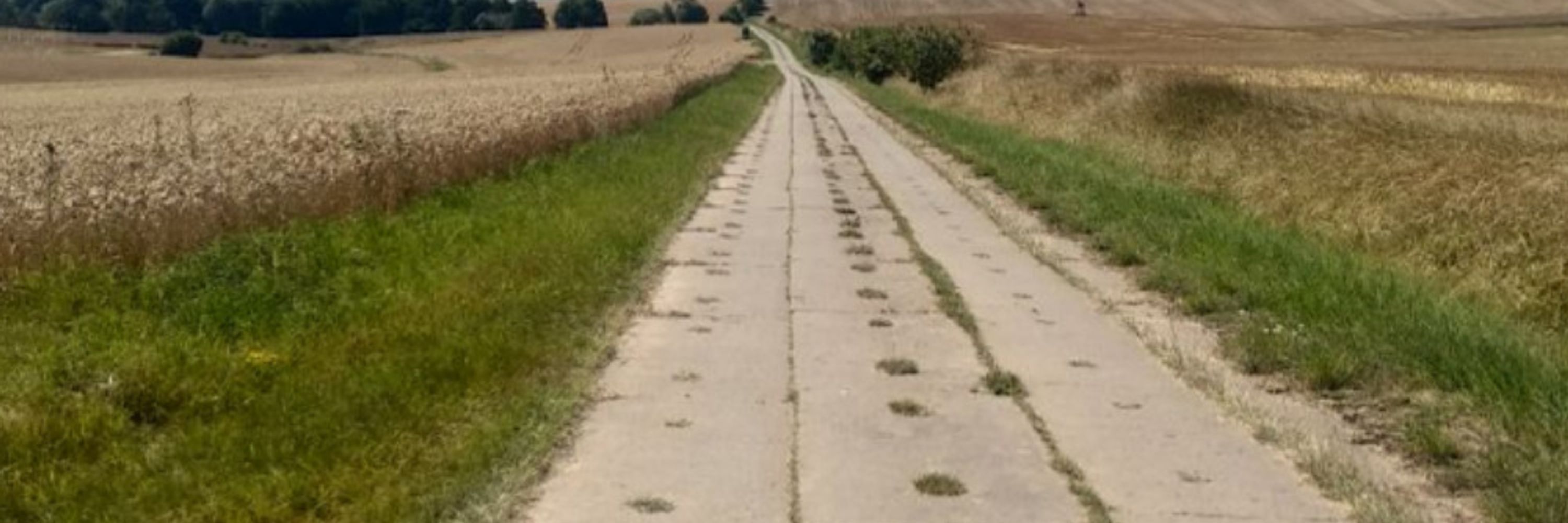
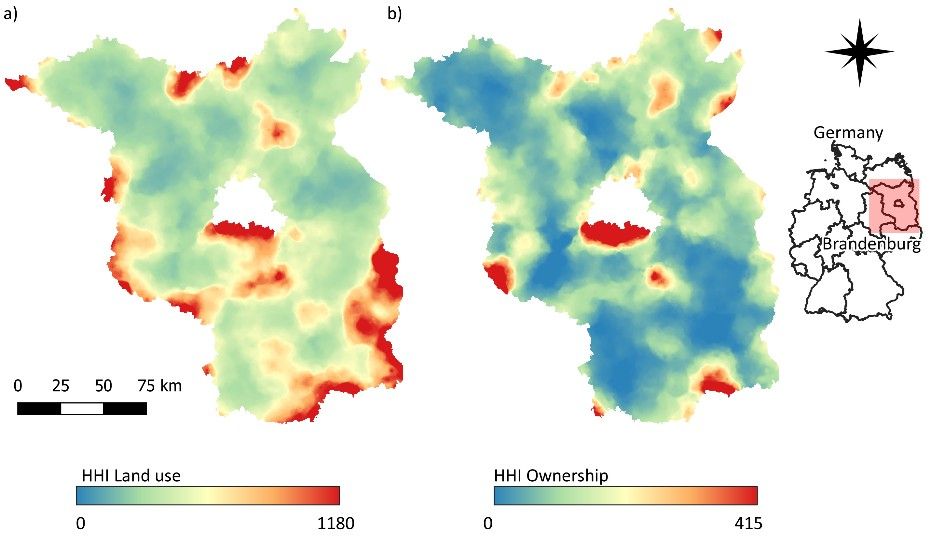
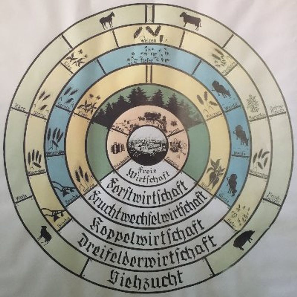
Revealing agricultural land ownership concentration with cadastral and company network data - Agriculture and Human Values
In many high-income countries, agricultural land is highly concentrated in a few hands, but detailed knowledge of ownership structures is limited. We examined land ownership structures and agricultura...
doi.org
Reposted by C. Jänicke
ploeg.bsky.social
Africa's population centers are relatively regional and dense, and will likely continue to be so. Whatever infrastructure issues they will have in the future will almost certainly be the same ones they have had for decades, only more so. (Map shows projected population centers in 2050.)
Estimated population density by 2050, with five centers called out: Coastal West Africa, 287 million, Great Lakes Region, 132 million, Nile Delta, 85 million, Ethiopian Highlands, 70 million, Mediterranean Coast, 63 million
cjaenicke.bsky.social
It's a great collaborative effort with great colleagues (e.g. @danielmu11er.bsky.social and others not yet here on bsky).

Btw, Maximillian Wesemeyer and I share the main authorship, my name only appears first alphabetically.